canton of Châtillon-Coligny (canton de Châtillon-Coligny)
- canton of France (until March 2015)
- Country:

- Capital: Châtillon-Coligny
- Coordinates: 47° 50' 39" N, 2° 50' 43" E


- GPS tracks (wikiloc): [Link]
- Wikidata storage: Wikidata: Q677092
- VIAF ID: Alt: [138723007]
- Library of Congress authority ID: Alt: [no2004024722]
- INSEE canton code: [4508]
Includes regions:
Le Charme
- commune in Loiret, France
- Country:
- Postal Code: 45230
- Coordinates: 47° 47' 59" N, 2° 59' 41" E
- GPS tracks (wikiloc): [Link]
- Area: 13.82 sq km
- Population: 146


La Chapelle-sur-Aveyron
- commune in Loiret, France
- Country:
- Postal Code: 45230
- Coordinates: 47° 52' 0" N, 2° 51' 44" E
- GPS tracks (wikiloc): [Link]
- Area: 19.03 sq km
- Population: 661

Dammarie-sur-Loing
- commune in Loiret, France
- Country:
- Postal Code: 45230
- Coordinates: 47° 47' 2" N, 2° 52' 50" E
- GPS tracks (wikiloc): [Link]
- Area: 20.94 sq km
- Population: 503


Pressigny-les-Pins
- commune in Loiret, France
- Country:
- Postal Code: 45290
- Coordinates: 47° 52' 52" N, 2° 45' 4" E
- GPS tracks (wikiloc): [Link]
- Area: 11.91 sq km
- Population: 498
- Web site: [Link]


Nogent-sur-Vernisson
- commune in Loiret, France
- Country:
- Postal Code: 45290
- Coordinates: 47° 50' 47" N, 2° 44' 32" E
- GPS tracks (wikiloc): [Link]
- Area: 33.27 sq km
- Population: 2551
- Web site: [Link]
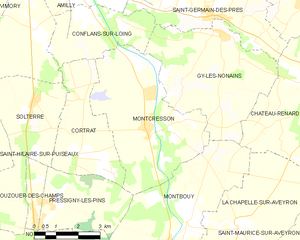
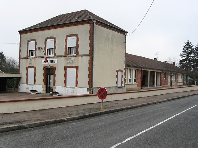
Montcresson
- commune in Loiret, France
- Country:
- Postal Code: 45700
- Coordinates: 47° 54' 21" N, 2° 48' 25" E
- GPS tracks (wikiloc): [Link]
- Area: 21 sq km
- Population: 1290
- Web site: [Link]


Montbouy
- commune in Loiret, France
- Country:
- Postal Code: 45230
- Coordinates: 47° 51' 41" N, 2° 49' 12" E
- GPS tracks (wikiloc): [Link]
- Area: 26.73 sq km
- Population: 745
- Web site: [Link]

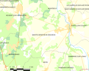
Sainte-Geneviève-des-Bois
- commune in Loiret, France
- Country:
- Postal Code: 45230
- Coordinates: 47° 49' 5" N, 2° 49' 6" E
- GPS tracks (wikiloc): [Link]
- Area: 40.74 sq km
- Population: 1083
- Web site: [Link]


Aillant-sur-Milleron
- commune in Loiret, France
- Country:
- Postal Code: 45230
- Coordinates: 47° 47' 34" N, 2° 55' 47" E
- GPS tracks (wikiloc): [Link]
- Area: 26.93 sq km
- Population: 404
- Web site: [Link]
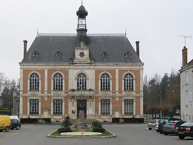

Châtillon-Coligny
- commune in Loiret, France
- Country:
- Postal Code: 45230
- Coordinates: 47° 49' 22" N, 2° 50' 47" E
- GPS tracks (wikiloc): [Link]
- Area: 25.53 sq km
- Population: 1911
- Web site: [Link]


Saint-Maurice-sur-Aveyron
- commune in Loiret, France
- Country:
- Postal Code: 45230
- Coordinates: 47° 51' 4" N, 2° 55' 38" E
- GPS tracks (wikiloc): [Link]
- Area: 53.76 sq km
- Population: 859
- Web site: [Link]

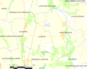
Cortrat
- commune in Loiret, France
- Country:
- Postal Code: 45700
- Coordinates: 47° 53' 48" N, 2° 45' 54" E
- GPS tracks (wikiloc): [Link]
- Area: 11.03 sq km
- Population: 82