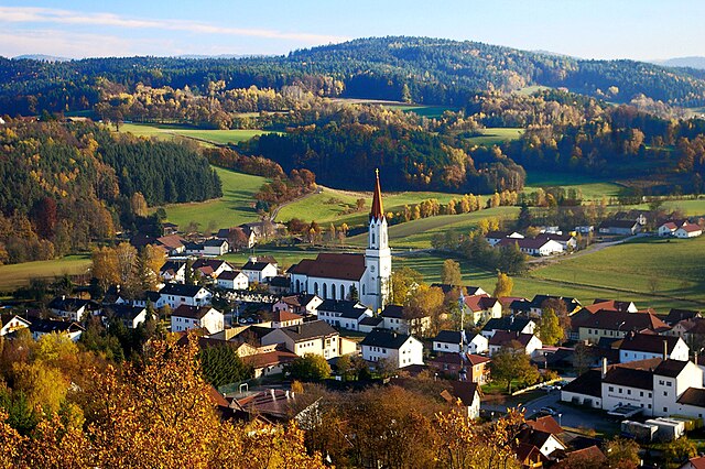
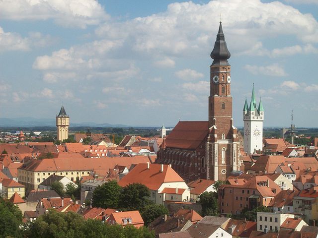
Cham (Landkreis Cham)

- district of Bavaria, Germany
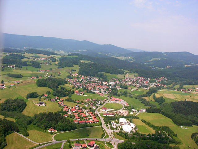
 Hiking in Cham
Cham District, located in the state of Bavaria, Germany, offers a variety of hiking opportunities amid beautiful landscapes, including forests, meadows, and rolling hills. Here are some highlights and tips for hiking in this area:
Scenic Trails
-
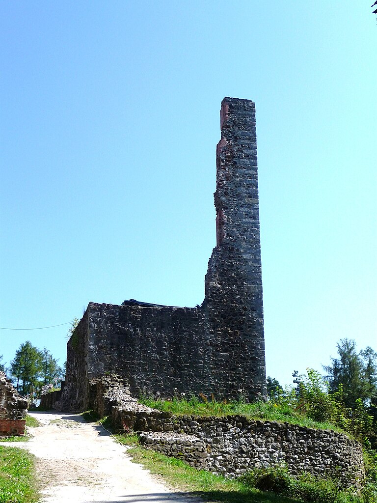
Arber Region: The nearby Arber mountain (the highest peak in the Bavarian Forest) provides numerous trails ranging in difficulty. Hikers can enjoy breathtaking views from the summit and explore the surrounding national park.
-
Bavarian Forest National Park: This large park is a haven for hikers. With marked trails of varying lengths and difficulties, you'll find well-maintained paths through ancient forests, plenty of wildlife, and serene lakes.
-
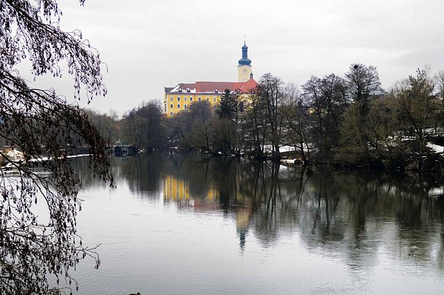
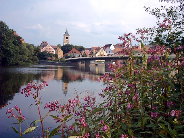
Cham Area Trails: There are several local trails around Cham that allow you to explore the picturesque countryside. These trails often lead you through charming villages, tranquil rivers, and scenic lookout points.
Hiking Tips
-
Trail Maps: Before heading out, pick up a map or use a hiking app to navigate. Many trails are well-marked, but it's always good to have a backup.
-
Weather: The weather can change quickly, especially in higher elevations, so check forecasts and dress in layers. Bring a waterproof jacket in cooler months.
-
Safety: Always let someone know your plans and estimated return time, especially if hiking alone.
-
Hydration and Snacks: Carry enough water and snacks to keep your energy levels up. There may be limited access to facilities on longer trails.
-
Respect Nature: Stay on marked trails, dispose of waste properly, and be mindful of wildlife.
Accessibility
Cham’s trails are accessible to a wide range of hikers, from families looking for leisurely walks to seasoned trekkers seeking a challenge. The region is also well-connected by public transport, making it easy to reach various trailheads.
Conclusion
Hiking in Cham District provides a fantastic way to experience Bavaria's natural beauty. Whether you’re planning a day hike or a more extended backpacking trip, the region's diverse landscapes and trails offer something for everyone. Always remember to tread lightly and enjoy the stunning scenery that this beautiful area has to offer!
- Country:

- Capital: Cham
- Licence Plate Code: WÜM; ROD; KÖZ; CHA
- Coordinates: 49° 15' 0" N, 12° 40' 12" E


- GPS tracks (wikiloc): [Link]
- AboveSeaLevel: 469 м m
- Area: 1510.00 sq km
- Population: 121401
- Web site: http://www.landkreis-cham.de
- Wikipedia en: wiki(en)
- Wikipedia: wiki(de)
- Wikidata storage: Wikidata: Q10424
- Wikipedia Commons Category: [Link]
- Freebase ID: [/m/01jy3j]
- GeoNames ID: Alt: [2940202]
- VIAF ID: Alt: [235891742]
- OSM relation ID: [62548]
- GND ID: Alt: [4009719-5]
- archINFORM location ID: [8265]
- Quora topic ID: [Cham-4]
- TGN ID: [7205735]
- Historical Gazetteer (GOV) ID: [adm_139372]
- Bavarikon ID: [ODB_A00001730]
- ISNI: Alt: [0000 0004 0415 7603]
- NKCR AUT ID: [ge685480]
- NUTS code: [DE235]
- Ringgold ID: [169357]
- BabelNet ID: [01744547n]
- German district key: 09372
Includes regions:


Zandt
- municipality of Germany
Hiking in Zandt
Zandt is a small village located in Germany, particularly known for its picturesque landscapes and tranquil natural surroundings. While Zandt itself may not be a well-known hiking destination compared to major national parks or mountain ranges, it can still serve as a great starting point for hiking in the wider region of Bavaria....
- Country:
- Postal Code: 93499
- Local Dialing Code: 09944
- Licence Plate Code: CHA
- Coordinates: 49° 9' 0" N, 12° 44' 0" E
- GPS tracks (wikiloc): [Link]
- AboveSeaLevel: 472 м m
- Area: 21.61 sq km
- Population: 1578
- Web site: [Link]

Zell
- municipality of Germany
Hiking in Zell
Zell, located in the Upper Palatinate region of Bavaria, Germany, offers a range of beautiful hiking opportunities amidst its scenic landscapes. The region is characterized by rolling hills, forests, and charming villages, making it a great destination for nature lovers and outdoor enthusiasts....
- Country:
- Postal Code: 93199
- Local Dialing Code: 09468
- Licence Plate Code: CHA
- Coordinates: 49° 8' 40" N, 12° 24' 41" E
- GPS tracks (wikiloc): [Link]
- AboveSeaLevel: 486 м m
- Area: 32.95 sq km
- Population: 1554
- Web site: [Link]

Cham
- municipality in Oberpfalz, Germany
Hiking in Cham
Cham, located in Bavaria, Germany, is a beautiful area known for its natural landscapes, making it a great destination for hiking enthusiasts. The region is characterized by rolling hills, dense forests, rivers, and scenic views, providing a variety of trails suitable for different skill levels....
- Country:
- Postal Code: 93413
- Local Dialing Code: 0 99 71
- Licence Plate Code: CHA
- Coordinates: 49° 13' 0" N, 12° 39' 0" E
- GPS tracks (wikiloc): [Link]
- AboveSeaLevel: 364 м m
- Area: 80.67 sq km
- Population: 16692
- Web site: [Link]


Reichenbach am Regen
- municipality of Germany
Hiking in Reichenbach am Regen
Reichenbach am Regen is a charming village located in Bavaria, Germany, and it offers a variety of hiking opportunities amidst beautiful natural scenery. Here are some details about hiking in that region:...
- Country:
- Postal Code: 93189
- Local Dialing Code: 09464
- Coordinates: 49° 11' 0" N, 12° 21' 0" E
- GPS tracks (wikiloc): [Link]
- AboveSeaLevel: 386 м m
- Area: 10.53 sq km
- Population: 1052
- Web site: [Link]


Roding
- municipality of Germany
Hiking in Roding
Roding, a charming town located in Bavaria, Germany, is surrounded by natural beauty and offers an array of hiking opportunities for outdoor enthusiasts. Here are some key points about hiking in and around Roding:...
- Country:
- Postal Code: 93426
- Local Dialing Code: 09461
- Coordinates: 49° 12' 0" N, 12° 31' 0" E
- GPS tracks (wikiloc): [Link]
- AboveSeaLevel: 369 м m
- Area: 119.63 sq km
- Population: 11706
- Web site: [Link]


Lam
- Bavaria
Hiking in Lam
Hiking in Lam, Bavaria, offers a wonderful opportunity to explore the beautiful landscapes of the Bavarian Forest, one of Germany's oldest national parks. Here are some key highlights for hiking in the area:...
- Country:
- Postal Code: 93462
- Local Dialing Code: 09943
- Licence Plate Code: CHA
- Coordinates: 49° 11' 48" N, 13° 3' 2" E
- GPS tracks (wikiloc): [Link]
- AboveSeaLevel: 574 м m
- Area: 33.38 sq km
- Population: 3140
- Web site: [Link]


Hohenwarth
- municipality of Germany
Hiking in Hohenwarth
Hohenwarth is a picturesque area located in the Bavarian Forest region of Germany, offering various hiking opportunities for both beginners and experienced hikers. The natural landscape is characterized by dense forests, rolling hills, and stunning views of the surrounding countryside, making it a great destination for outdoor activities....
- Country:
- Postal Code: 93480
- Local Dialing Code: 09946
- Licence Plate Code: CHA
- Coordinates: 49° 12' 0" N, 12° 56' 0" E
- GPS tracks (wikiloc): [Link]
- AboveSeaLevel: 507 м m
- Area: 24.22 sq km
- Population: 2129
- Web site: [Link]


Michelsneukirchen
- community in Bavaria, Germany
Hiking in Michelsneukirchen
Michelsneukirchen, a quaint village in Bavaria, Germany, offers beautiful hiking opportunities amidst picturesque landscapes. The surrounding area features rolling hills, lush forests, and scenic views characteristic of the Bavarian countryside. Here are some highlights for hiking in and around Michelsneukirchen:...
- Country:
- Postal Code: 93185
- Local Dialing Code: 09467
- Licence Plate Code: CHA
- Coordinates: 49° 7' 27" N, 12° 33' 9" E
- GPS tracks (wikiloc): [Link]
- AboveSeaLevel: 569 м m
- Area: 32.84 sq km
- Population: 1453
- Web site: [Link]


Stamsried
- municipality of Germany
Hiking in Stamsried
Stamsried is a charming municipality in Bavaria, Germany, known for its beautiful landscapes, lush forests, and scenic hiking trails. Here’s an overview of what you can expect when hiking in the Stamsried area:...
- Country:
- Postal Code: 93491
- Local Dialing Code: 09466
- Licence Plate Code: CHA
- Coordinates: 49° 16' 0" N, 12° 32' 0" E
- GPS tracks (wikiloc): [Link]
- AboveSeaLevel: 453 м m
- Area: 43.42 sq km
- Population: 1908
- Web site: [Link]


Furth im Wald
- municipality of Germany
Hiking in Furth im Wald
Furth im Wald is a picturesque town located in Bavaria, Germany, near the Czech border. It's well-known for its stunning natural landscapes and outdoor activities, making it an excellent destination for hiking enthusiasts. Here are some highlights about hiking in and around Furth im Wald:...
- Country:
- Postal Code: 93437
- Local Dialing Code: 09973
- Licence Plate Code: CHA
- Coordinates: 49° 18' 35" N, 12° 50' 24" E
- GPS tracks (wikiloc): [Link]
- AboveSeaLevel: 407 м m
- Area: 67.06 sq km
- Population: 9437
- Web site: [Link]


Waldmünchen
- municipality of Germany
Hiking in Waldmünchen
Waldmünchen, located in the Bavarian Forest region of Germany, offers a wonderful setting for hiking enthusiasts. The area is characterized by its lush landscapes, rolling hills, and dense forests, making it an excellent destination for both casual walkers and seasoned hikers....
- Country:
- Postal Code: 93449
- Local Dialing Code: 09972
- Coordinates: 49° 22' 0" N, 12° 42' 0" E
- GPS tracks (wikiloc): [Link]
- AboveSeaLevel: 514 м m
- Area: 101.17 sq km
- Population: 7274
- Web site: [Link]

Pösing
- municipality of Germany
Hiking in Pösing
Pösing, a small community in Bavaria, Germany, is situated near the picturesque surroundings of the Bavarian Forest and the hills of the surrounding countryside. While it may not be one of the most famous hiking destinations, it offers several opportunities for outdoor enthusiasts to explore beautiful landscapes, quaint villages, and a variety of natural features....
- Country:
- Postal Code: 93483
- Local Dialing Code: 09461
- Licence Plate Code: CHA
- Coordinates: 49° 14' 0" N, 12° 33' 0" E
- GPS tracks (wikiloc): [Link]
- AboveSeaLevel: 364 м m
- Area: 9.13 sq km
- Population: 870
- Web site: [Link]


Pemfling
- municipality of Germany
Hiking in Pemfling
Pemfling is a small village located in the Bavarian Forest region of Germany, known for its picturesque landscapes, dense forests, and hiking opportunities. Here are some key points about hiking in and around Pemfling:...
- Country:
- Postal Code: 93482
- Local Dialing Code: 09971
- Licence Plate Code: CHA
- Coordinates: 49° 16' 0" N, 12° 37' 0" E
- GPS tracks (wikiloc): [Link]
- AboveSeaLevel: 431 м m
- Area: 44.54 sq km
- Population: 2083
- Web site: [Link]


Traitsching
- municipality of Germany
Hiking in Traitsching
Traitsching is a charming area in Bavaria, Germany, known for its scenic landscapes and outdoor recreational opportunities. Hiking in this region can offer a wonderful experience, thanks to its diverse terrain and the surrounding natural beauty....
- Country:
- Postal Code: 93455
- Local Dialing Code: 0 99 74
- Licence Plate Code: CHA
- Coordinates: 49° 9' 0" N, 12° 39' 0" E
- GPS tracks (wikiloc): [Link]
- AboveSeaLevel: 416 м m
- Area: 45.4 sq km
- Population: 3666
- Web site: [Link]


Chamerau
- municipality of Germany
Hiking in Chamerau
Chamerau, located in Bavaria, Germany, offers a variety of hiking opportunities set against a backdrop of lush landscapes, rolling hills, and scenic forests. Here are some highlights and tips for hiking in this beautiful region:...
- Country:
- Postal Code: 93466
- Local Dialing Code: 09944
- Licence Plate Code: CHA
- Coordinates: 49° 12' 0" N, 12° 45' 0" E
- GPS tracks (wikiloc): [Link]
- AboveSeaLevel: 375 м m
- Area: 23.4 sq km
- Population: 2401
- Web site: [Link]


Miltach
- municipality of Germany
Hiking in Miltach
Miltach, located in Bavaria, Germany, is a great destination for hiking enthusiasts due to its picturesque landscapes and well-marked trails. Nestled in the scenic surroundings of the Bavarian Forest, Miltach offers a range of hiking opportunities suitable for various skill levels....
- Country:
- Postal Code: 93468
- Local Dialing Code: 09944
- Licence Plate Code: CHA
- Coordinates: 49° 9' 0" N, 12° 46' 0" E
- GPS tracks (wikiloc): [Link]
- AboveSeaLevel: 382 м m
- Area: 25.23 sq km
- Population: 2211
- Web site: [Link]


Eschlkam
- municipality of Germany
Hiking in Eschlkam
Eschlkam is a picturesque village located in the Bavarian Forest region of Germany, near the Czech border. It’s an excellent destination for hiking enthusiasts, offering a combination of beautiful landscapes, rich nature, and charming local culture. Here are some highlights for hiking in Eschlkam:...
- Country:
- Postal Code: 93458
- Local Dialing Code: 09948; 09947
- Licence Plate Code: CHA
- Coordinates: 49° 17' 0" N, 12° 55' 0" E
- GPS tracks (wikiloc): [Link]
- AboveSeaLevel: 460 м m
- Area: 60.46 sq km
- Population: 3458
- Web site: [Link]


Rötz
- municipality of Germany
Hiking in Rötz
Rötz is a charming town located in Bavaria, Germany, surrounded by the picturesque landscapes of the Upper Palatinate Forest. Hiking in this region offers a variety of trails that cater to different skill levels, from leisurely walks to more challenging hikes....
- Country:
- Postal Code: 92444
- Local Dialing Code: 09976
- Licence Plate Code: CHA
- Coordinates: 49° 20' 31" N, 12° 31' 40" E
- GPS tracks (wikiloc): [Link]
- AboveSeaLevel: 453 м m
- Area: 66.68 sq km
- Population: 3426
- Web site: [Link]

Lohberg
- municipality of Germany
Hiking in Lohberg
Lohberg is a beautiful area located in Bavaria, Germany, known for its stunning natural landscapes and outdoor recreational opportunities, including hiking. Nestled in the foothills of the Bavarian Forest, Lohberg offers a variety of trails suitable for different skill levels and preferences. Here are some highlights for hiking in the area:...
- Country:
- Postal Code: 93470
- Local Dialing Code: 09943
- Licence Plate Code: CHA
- Coordinates: 49° 11' 0" N, 13° 6' 0" E
- GPS tracks (wikiloc): [Link]
- AboveSeaLevel: 636 м m
- Area: 59.25 sq km
- Population: 2051
- Web site: [Link]


Blaibach
- municipality of Germany
Hiking in Blaibach
Blaibach, located in Bavaria, Germany, is known for its scenic landscapes and beautiful hiking trails. The region is characterized by its rolling hills, lush forests, and tranquil rivers, making it ideal for outdoor enthusiasts. Here are some key points about hiking in Blaibach:...
- Country:
- Postal Code: 93476
- Local Dialing Code: 0 99 41
- Licence Plate Code: CHA
- Coordinates: 49° 10' 0" N, 12° 49' 0" E
- GPS tracks (wikiloc): [Link]
- AboveSeaLevel: 394 м m
- Area: 17.02 sq km
- Population: 1913
- Web site: [Link]


Willmering
- municipality of Germany
Hiking in Willmering
It seems there might be some confusion, as there is no widely recognized hiking destination known as "Willmering." However, if you are referring to a specific area, or if "Willmering" is a local or lesser-known location, I would need more details to provide accurate information....
- Country:
- Postal Code: 93497
- Local Dialing Code: 09971
- Licence Plate Code: CHA
- Coordinates: 49° 15' 0" N, 12° 40' 0" E
- GPS tracks (wikiloc): [Link]
- AboveSeaLevel: 375 м m
- Area: 10.3 sq km
- Population: 1516
- Web site: [Link]

Treffelstein
- municipality of Germany
Hiking in Treffelstein
Treffelstein, located in Bavaria, Germany, offers a charming hiking experience amidst lush landscapes and scenic views. Here are some highlights for hiking in the area:...
- Country:
- Postal Code: 93492
- Local Dialing Code: 09673
- Licence Plate Code: CHA
- Coordinates: 49° 25' 0" N, 12° 37' 0" E
- GPS tracks (wikiloc): [Link]
- AboveSeaLevel: 524 м m
- Area: 20.86 sq km
- Population: 1023
- Web site: [Link]


Grafenwiesen
- municipality of Germany
Hiking in Grafenwiesen
Grafenwiesen is a picturesque region located in Bavaria, Germany, known for its stunning natural landscapes and a variety of outdoor activities, including hiking. The area boasts beautiful trails that crisscross through forests, meadows, and along streams, providing hikers with opportunities to experience the region's diverse flora and fauna....
- Country:
- Postal Code: 93479
- Local Dialing Code: 09941
- Licence Plate Code: CHA
- Coordinates: 49° 12' 0" N, 12° 52' 0" E
- GPS tracks (wikiloc): [Link]
- AboveSeaLevel: 439 м m
- Area: 10.19 sq km
- Population: 1525
- Web site: [Link]


Neukirchen beim Heiligen Blut
- municipality of Germany
Hiking in Neukirchen beim Heiligen Blut
Neukirchen beim Heiligen Blut, located in the Bavarian Forest of Germany, is a beautiful destination for hiking enthusiasts, offering a range of trails with varying levels of difficulty. The area is not only known for its scenic landscapes but also for its rich natural and cultural heritage....
- Country:
- Postal Code: 93453
- Local Dialing Code: 09947
- Licence Plate Code: CHA
- Coordinates: 49° 15' 33" N, 12° 58' 13" E
- GPS tracks (wikiloc): [Link]
- AboveSeaLevel: 485 м m
- Area: 59.86 sq km
- Population: 4176
- Web site: [Link]

Runding
- municipality of Germany
Hiking in Runding
Runding is a small village located in Bavaria, Germany, known for its serene landscapes and proximity to various hiking trails. Here are some highlights and tips for hiking in and around Runding:...
- Country:
- Postal Code: 93486
- Local Dialing Code: 0 99 71
- Licence Plate Code: CHA
- Coordinates: 49° 13' 0" N, 12° 46' 0" E
- GPS tracks (wikiloc): [Link]
- AboveSeaLevel: 484 м m
- Area: 20.94 sq km
- Population: 2121
- Web site: [Link]


Falkenstein
- municipality of Bavaria, Germany
Hiking in Falkenstein
Falkenstein, located in Bavaria, Germany, is a fantastic destination for hiking enthusiasts. Nestled in the picturesque landscape of the Bavarian Forest, it offers a variety of trails that cater to different skill levels, from leisurely walks to more challenging hikes....
- Country:
- Postal Code: 93167
- Local Dialing Code: 09462
- Licence Plate Code: CHA
- Coordinates: 49° 5' 52" N, 12° 29' 11" E
- GPS tracks (wikiloc): [Link]
- AboveSeaLevel: 573 м m
- Area: 45.46 sq km
- Population: 3252
- Web site: [Link]


Arnschwang
- municipality of Germany
Hiking in Arnschwang
Arnschwang, located in Bavaria, Germany, offers a range of hiking opportunities for outdoor enthusiasts. The region is characterized by its picturesque landscapes, rolling hills, forests, and the scenic charm of the Bavarian countryside. Here are some key points to consider when hiking in Arnschwang:...
- Country:
- Postal Code: 93473
- Local Dialing Code: 0 99 77
- Licence Plate Code: CHA
- Coordinates: 49° 16' 0" N, 12° 49' 0" E
- GPS tracks (wikiloc): [Link]
- AboveSeaLevel: 390 м m
- Area: 28.32 sq km
- Population: 1775
- Web site: [Link]


Waffenbrunn
- municipality of Germany
Hiking in Waffenbrunn
Waffenbrunn is a small village located in Bavaria, Germany, known for its picturesque landscape and proximity to nature. For hiking enthusiasts, the area offers a variety of trails that showcase the stunning natural beauty and quaint Bavarian countryside....
- Country:
- Postal Code: 93494
- Local Dialing Code: 09971
- Licence Plate Code: CHA
- Coordinates: 49° 16' 0" N, 12° 40' 0" E
- GPS tracks (wikiloc): [Link]
- AboveSeaLevel: 396 м m
- Area: 25.17 sq km
- Population: 1792
- Web site: [Link]

Walderbach
- municipality of Germany
Hiking in Walderbach
Walderbach is a small municipality in Bavaria, Germany, known for its picturesque landscapes and natural beauty. While it may not be as widely recognized as some major hiking destinations, it offers several hiking opportunities that are perfect for outdoor enthusiasts looking to explore the Bavarian countryside....
- Country:
- Postal Code: 93194
- Local Dialing Code: 09464
- Licence Plate Code: CHA
- Coordinates: 49° 11' 0" N, 12° 23' 0" E
- GPS tracks (wikiloc): [Link]
- AboveSeaLevel: 369 м m
- Area: 34.91 sq km
- Population: 1731
- Web site: [Link]


Gleißenberg
- municipality of Germany
Hiking in Gleißenberg
Gleißenberg is a picturesque village located in Bavaria, Germany, nestled in the rolling hills of the Upper Palatinate region. The surrounding landscape offers beautiful hiking opportunities, characterized by lush forests, meadows, and panoramic views. Here’s what you can expect when hiking in and around Gleißenberg:...
- Country:
- Postal Code: 93477
- Local Dialing Code: 09975
- Licence Plate Code: CHA
- Coordinates: 49° 19' 0" N, 12° 44' 0" E
- GPS tracks (wikiloc): [Link]
- AboveSeaLevel: 419 м m
- Area: 15.38 sq km
- Population: 834
- Web site: [Link]


Arrach
- municipality of Germany
Hiking in Arrach
Arrach is a charming village located in the Bavarian Forest region of Germany, known for its scenic landscapes and outdoor activities, including hiking. The area offers a variety of trails suitable for different skill levels, ranging from easy walks to more challenging hikes. Here are some highlights:...
- Country:
- Postal Code: 93474
- Local Dialing Code: 09943
- Licence Plate Code: CHA
- Coordinates: 49° 11' 29" N, 12° 59' 38" E
- GPS tracks (wikiloc): [Link]
- AboveSeaLevel: 549 м m
- Area: 28.81 sq km
- Population: 2571
- Web site: [Link]


Schönthal
- municipality of Germany
Hiking in Schönthal
Schönthal is a picturesque area that offers a variety of hiking opportunities, characterized by its beautiful landscapes, lush forests, and charming villages. Whether you're an experienced hiker or a beginner looking for a scenic stroll, Schönthal has something to offer. Here are some notable aspects to consider when hiking in Schönthal:...
- Country:
- Postal Code: 93488
- Local Dialing Code: 09978
- Coordinates: 49° 21' 0" N, 12° 36' 0" E
- GPS tracks (wikiloc): [Link]
- AboveSeaLevel: 453 м m
- Area: 43.7 sq km
- Population: 1894
- Web site: [Link]


Schorndorf
- municipality of Germany
Hiking in Schorndorf
Schorndorf, Bavaria, is a picturesque town located in southern Germany, known for its beautiful landscapes, charming architecture, and outdoor activities, including hiking. Here are some highlights about hiking in and around Schorndorf:...
- Country:
- Postal Code: 93489
- Local Dialing Code: 0 94 67
- Licence Plate Code: CHA
- Coordinates: 49° 10' 0" N, 12° 36' 0" E
- GPS tracks (wikiloc): [Link]
- AboveSeaLevel: 419 м m
- Area: 38.54 sq km
- Population: 1908
- Web site: [Link]


Wald
- municipality in Upper Palatinate, Germany
Hiking in Wald
Wald, located in the Upper Palatinate region of Bavaria, Germany, offers a range of hiking opportunities for outdoor enthusiasts. The picturesque landscapes, dense forests, and rolling hills create a beautiful backdrop for hiking adventures. Here are some key aspects of hiking in Wald and the surrounding areas:...
- Country:
- Postal Code: 93192
- Local Dialing Code: 09463
- Licence Plate Code: CHA
- Coordinates: 49° 9' 0" N, 12° 21' 0" E
- GPS tracks (wikiloc): [Link]
- AboveSeaLevel: 543 м m
- Area: 37.79 sq km
- Population: 2339
- Web site: [Link]


Rettenbach
- human settlement in Germany
Hiking in Rettenbach
Rettenbach is a picturesque village located in the Upper Palatinate region of Bavaria, Germany. This area is known for its stunning natural landscapes, hiking trails, and outdoor activities. When planning to hike in Rettenbach, here are some key details to consider:...
- Country:
- Postal Code: 93191
- Local Dialing Code: 0 94 62
- Licence Plate Code: CHA
- Coordinates: 49° 4' 13" N, 12° 27' 24" E
- GPS tracks (wikiloc): [Link]
- AboveSeaLevel: 576 м m
- Area: 27.11 sq km
- Population: 1493
- Web site: [Link]


Rimbach
- municipality in the district of Cham (district) in the Upper Palatinate in Bavaria in Germany
Hiking in Rimbach
Rimbach, located in the Upper Palatinate region of Bavaria, Germany, offers a variety of hiking opportunities amidst its stunning natural beauty. The region is characterized by rolling hills, dense forests, and picturesque landscapes, making it ideal for outdoor enthusiasts. Here are some key points about hiking in Rimbach and the surrounding area:...
- Country:
- Postal Code: 93485
- Local Dialing Code: 09941
- Licence Plate Code: CHA
- Coordinates: 49° 13' 51" N, 12° 52' 46" E
- GPS tracks (wikiloc): [Link]
- AboveSeaLevel: 488 м m
- Area: 24.73 sq km
- Population: 1881
- Web site: [Link]


Bad Kötzting
- municipality of Germany
Hiking in Bad Kötzting
Bad Kötzting, located in the Bavarian Forest in Germany, is a great destination for hiking enthusiasts. This picturesque town offers access to a variety of trails that cater to different skill levels, making it an appealing spot for both beginners and experienced hikers....
- Country:
- Postal Code: 93444
- Local Dialing Code: 0 99 41
- Coordinates: 49° 10' 37" N, 12° 51' 18" E
- GPS tracks (wikiloc): [Link]
- AboveSeaLevel: 409 м m
- Area: 62.15 sq km
- Population: 6805
- Web site: [Link]
Weiding
- municipality in the Cham district in Bavaria, Germany
Hiking in Weiding
Weiding is a charming area in Bavaria, Germany, known for its picturesque landscapes and scenic hiking trails. As a hiking instructor, I can share some highlights of hiking in and around Weiding:...
- Country:
- Postal Code: 93495
- Local Dialing Code: 09977
- Licence Plate Code: CHA
- Coordinates: 49° 16' 0" N, 12° 46' 0" E
- GPS tracks (wikiloc): [Link]
- AboveSeaLevel: 380 м m
- Area: 28.16 sq km
- Population: 2060
- Web site: [Link]


Tiefenbach
- place in Bavaria, Germany
Hiking in Tiefenbach
Tiefenbach, located in the Upper Palatinate region of Bavaria, Germany, offers a tranquil escape into nature, making it a lovely destination for hiking enthusiasts. The area is characterized by its rolling hills, lush forests, and picturesque landscapes, providing a variety of trails suited for different skill levels....
- Country:
- Postal Code: 93464
- Local Dialing Code: 09673
- Licence Plate Code: CHA
- Coordinates: 49° 26' 0" N, 12° 35' 0" E
- GPS tracks (wikiloc): [Link]
- AboveSeaLevel: 527 м m
- Area: 45.84 sq km
- Population: 2228
- Web site: [Link]
Shares border with regions:

Schwandorf
- district of Bavaria, Germany
Hiking in Schwandorf
Schwandorf district, located in Bavaria, Germany, is a great area for hiking enthusiasts looking for scenic routes and beautiful landscapes. The region is characterized by rolling hills, forests, and rivers, providing a mix of terrain that caters to various hiking levels....
- Country:
- Capital: Schwandorf
- Licence Plate Code: SAD; ROD; OVI; NEN; NAB; BUL
- Coordinates: 49° 22' 12" N, 12° 15' 0" E
- GPS tracks (wikiloc): [Link]
- AboveSeaLevel: 465 м m
- Area: 1472.88 sq km
- Population: 131260
- Web site: [Link]

Regensburg
- district of Bavaria, Germany
Hiking in Regensburg
Regensburg is located in the state of Bavaria, Germany, and it offers a variety of hiking opportunities that showcase the region's natural beauty and historical significance. Here's what you can expect when hiking in and around the Regensburg district:...
- Country:
- Capital: Regensburg
- Licence Plate Code: R
- Coordinates: 49° 4' 48" N, 12° 10' 12" E
- GPS tracks (wikiloc): [Link]
- AboveSeaLevel: 390 м m
- Area: 1396.00 sq km
- Population: 144278
- Web site: [Link]
Straubing-Bogen
- district of Bavaria, Germany
Hiking in Straubing-Bogen
Straubing-Bogen is a beautiful district located in Bavaria, Germany, known for its picturesque landscapes and varied terrain, making it a great destination for hiking enthusiasts. Here are some highlights and tips for hiking in the region:...
- Country:
- Capital: Straubing
- Licence Plate Code: MAL; BOG; SR
- Coordinates: 48° 55' 12" N, 12° 34' 48" E
- GPS tracks (wikiloc): [Link]
- AboveSeaLevel: 337 м m
- Area: 1202.24 sq km
- Population: 81062
- Web site: [Link]
Regen district
- district in Bavaria, Germany
Hiking in Regen district
Hiking in the Regen district, located in Bavaria, Germany, offers a stunning blend of natural beauty, cultural attractions, and outdoor adventure. The region is known for its picturesque landscapes, featuring lush forests, rolling hills, and the scenic Danube and Regen rivers. Here are some highlights and tips for hiking in this area:...
- Country:
- Capital: Regen
- Licence Plate Code: REG
- Coordinates: 49° 0' 0" N, 13° 10' 12" E
- GPS tracks (wikiloc): [Link]
- AboveSeaLevel: 686 м m
- Area: 975.00 sq km
- Population: 76135
- Web site: [Link]