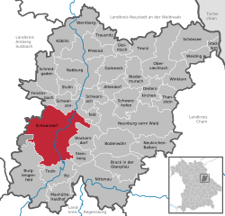
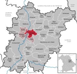
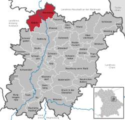
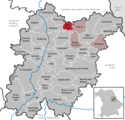
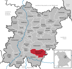
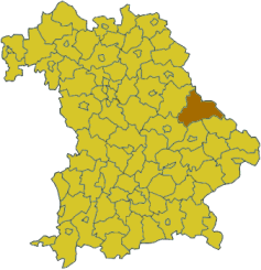
Schwandorf (Landkreis Schwandorf)

- district of Bavaria, Germany
 Hiking in Schwandorf
Schwandorf district, located in Bavaria, Germany, is a great area for hiking enthusiasts looking for scenic routes and beautiful landscapes. The region is characterized by rolling hills, forests, and rivers, providing a mix of terrain that caters to various hiking levels.
Key Highlights for Hiking in Schwandorf District:
-
Nature and Scenery: The district features a variety of ecosystems, from dense woodlands to open fields. The nearby Upper Palatinate Forest Nature Park offers many trails that showcase the natural beauty of the region.
-
Hiking Trails: There are numerous marked trails suitable for different hiking abilities. Some popular trails include:
- The Goldsteig Trail: One of the longest hiking trails in Germany, it passes through the district and offers stunning views of the Bavarian landscape.
- Local Circular Trails: Many villages around Schwandorf have their own circular trails that allow for shorter hikes, perfect for family outings or casual hikers.
-
Cultural and Historical Sites: Hiking in the area also allows you to explore local history and culture. You may encounter quaint villages, historical buildings, and even ancient ruins along the way.
-
Wildlife Observation: The diverse habitats in Schwandorf district support a variety of wildlife, making it an excellent spot for nature lovers and bird watchers.
-
Accessibility: Many hiking routes are easily accessible and can be started from nearby towns or cities, making it convenient for both locals and visitors.
-
Seasonal Considerations: The best time for hiking is typically in late spring through early fall, as the trails are in good condition and the weather is mild. Always check local conditions and trail maps for updates.
-
Safety and Preparation: As with any hiking adventure, make sure to wear appropriate footwear, carry enough water, and have a map or a GPS device. It's also wise to inform someone about your plans before heading out.
Overall, hiking in Schwandorf district is a rewarding experience that combines physical activity with the enjoyment of nature and local culture. Whether you're looking for a leisurely stroll or a more challenging hike, you'll find opportunities that suit your interests.
- Country:

- Capital: Schwandorf
- Licence Plate Code: SAD; ROD; OVI; NEN; NAB; BUL
- Coordinates: 49° 22' 12" N, 12° 15' 0" E


- GPS tracks (wikiloc): [Link]
- AboveSeaLevel: 465 м m
- Area: 1472.88 sq km
- Population: 131260
- Web site: http://www.landkreis-schwandorf.de/
- Wikipedia en: wiki(en)
- Wikipedia: wiki(de)
- Wikidata storage: Wikidata: Q10423
- Wikipedia Commons Category: [Link]
- Freebase ID: [/m/02kpc6]
- GeoNames ID: Alt: [3220859]
- VIAF ID: Alt: [239886562]
- OSM relation ID: [62686]
- GND ID: Alt: [4053719-5]
- archINFORM location ID: [4690]
- Library of Congress authority ID: Alt: [n82229974]
- Quora topic ID: [Schwandorf]
- TGN ID: [7077093]
- Bavarikon ID: [ODB_A00001871]
- NUTS code: [DE239]
- German district key: 09376
Includes regions:


Altendorf
- municipality of Germany
Hiking in Altendorf
Altendorf, located in the Upper Palatinate region of Bavaria, Germany, offers a beautiful setting for hiking enthusiasts. The area is characterized by its rolling hills, dense forests, and picturesque landscapes, making it a great destination for outdoor activities....
- Country:
- Postal Code: 92540
- Local Dialing Code: 0 96 75
- Licence Plate Code: SAD
- Coordinates: 49° 24' 0" N, 12° 17' 0" E
- GPS tracks (wikiloc): [Link]
- AboveSeaLevel: 337 м m
- Area: 23.16 sq km
- Population: 992
- Web site: [Link]


Maxhütte-Haidhof
- municipality of Germany
Hiking in Maxhütte-Haidhof
Maxhütte-Haidhof is a small town located in Bavaria, Germany, and while it may not be as widely known as some other hiking destinations, it offers access to beautiful landscapes and trails in the surrounding areas. Here are some insights to help you enjoy hiking in and around Maxhütte-Haidhof:...
- Country:
- Postal Code: 93142
- Local Dialing Code: 09471
- Licence Plate Code: SAD
- Coordinates: 49° 12' 0" N, 12° 6' 0" E
- GPS tracks (wikiloc): [Link]
- AboveSeaLevel: 407 м m
- Area: 34.71 sq km
- Population: 8893
- Web site: [Link]


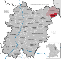
Oberviechtach
- municipality of Germany
Hiking in Oberviechtach
Oberviechtach is a charming town located in Bavaria, Germany, surrounded by beautiful natural landscapes that make it an excellent base for hiking enthusiasts. The region is characterized by rolling hills, forests, and picturesque countryside, offering various trails suitable for different skill levels....
- Country:
- Postal Code: 92526
- Local Dialing Code: 09671
- Coordinates: 49° 27' 30" N, 12° 25' 7" E
- GPS tracks (wikiloc): [Link]
- AboveSeaLevel: 505 м m
- Area: 62.41 sq km
- Population: 4698
- Web site: [Link]
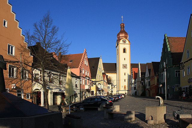
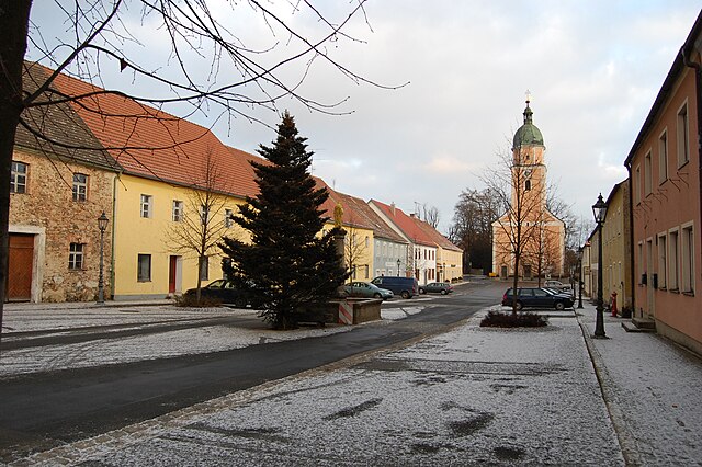
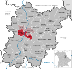
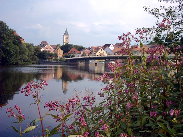
Schwandorf
- town in Bavaria, Germany
Hiking in Schwandorf
Schwandorf, located in Bavaria, Germany, offers a wonderful landscape for hiking enthusiasts. The region is characterized by rolling hills, lush forests, and scenic views of the surrounding countryside. Here are some highlights and tips for hiking in Schwandorf:...
- Country:
- Postal Code: 92421
- Local Dialing Code: 09431
- Licence Plate Code: SAD
- Coordinates: 49° 19' 25" N, 12° 5' 58" E
- GPS tracks (wikiloc): [Link]
- AboveSeaLevel: 355 м m
- Area: 123.76 sq km
- Population: 26109
- Web site: [Link]


Teublitz
- municipality of Germany
Hiking in Teublitz
Teublitz is a small town in Bavaria, Germany, located near the larger city of Schwandorf. While it may not be as widely known for hiking as larger national parks or more prominent hiking regions, it offers scenic trails and beautiful landscapes typical of the Bavarian countryside. Here are some key points about hiking in and around Teublitz:...
- Country:
- Postal Code: 93158
- Local Dialing Code: 09471
- Licence Plate Code: SAD
- Coordinates: 49° 13' 15" N, 12° 5' 7" E
- GPS tracks (wikiloc): [Link]
- AboveSeaLevel: 353 м m
- Area: 38.25 sq km
- Population: 6915
- Web site: [Link]


Pfreimd
- municipality of Germany
Hiking in Pfreimd
Pfreimd is a small town located in Bavaria, Germany, known for its picturesque landscapes and proximity to nature. Hiking in and around Pfreimd offers various trails catering to different skill levels, making it suitable for both beginners and experienced hikers....
- Country:
- Postal Code: 92536
- Local Dialing Code: 09606
- Licence Plate Code: SAD
- Coordinates: 49° 30' 2" N, 12° 11' 54" E
- GPS tracks (wikiloc): [Link]
- AboveSeaLevel: 422 м m
- Area: 51.43 sq km
- Population: 5126
- Web site: [Link]


Neunburg vorm Wald
- municipality of Germany
Hiking in Neunburg vorm Wald
Neunburg vorm Wald is a charming town located in Bavaria, Germany, surrounded by beautiful landscapes that provide excellent hiking opportunities. Here are some aspects to consider when hiking in and around Neunburg vorm Wald:...
- Country:
- Postal Code: 92431
- Local Dialing Code: 09672
- Coordinates: 49° 20' 50" N, 12° 21' 28" E
- GPS tracks (wikiloc): [Link]
- AboveSeaLevel: 456 м m
- Area: 110.16 sq km
- Population: 8222
- Web site: [Link]


Schönsee
- municipality of Germany
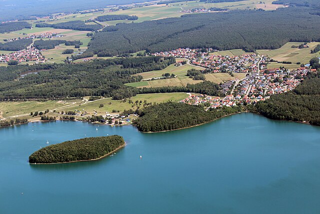
Hiking in Schönsee
Schönsee, located in the Upper Palatinate region of Bavaria, Germany, is a delightful destination for hikers looking to explore picturesque landscapes, serene lakes, and charming villages. Here are some highlights and tips for hiking in Schönsee:...
- Country:
- Postal Code: 92539
- Local Dialing Code: 09674
- Licence Plate Code: SAD
- Coordinates: 49° 31' 0" N, 12° 33' 0" E
- GPS tracks (wikiloc): [Link]
- AboveSeaLevel: 667 м m
- Area: 50.27 sq km
- Population: 2697
- Web site: [Link]


Nittenau
- municipality of Germany
Hiking in Nittenau
Nittenau, located in Bavaria, Germany, is a lovely destination for hiking enthusiasts. Surrounded by beautiful natural landscapes, it offers a variety of trails that showcase the region's scenic beauty and cultural heritage. Here are some highlights about hiking in and around Nittenau:...
- Country:
- Postal Code: 93149
- Local Dialing Code: 09464; 09463; 09436
- Licence Plate Code: SAD
- Coordinates: 49° 12' 36" N, 12° 15' 47" E
- GPS tracks (wikiloc): [Link]
- AboveSeaLevel: 370 м m
- Area: 93.15 sq km
- Population: 8906
- Web site: [Link]


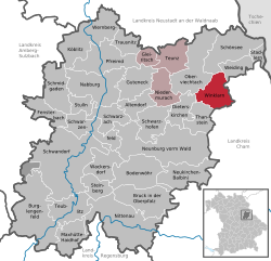
Nabburg
- municipality of Germany
Hiking in Nabburg
Nabburg, located in Bavaria, Germany, offers several opportunities for hiking enthusiasts. The region is characterized by scenic landscapes, historic sites, and a network of trails suitable for various skill levels....
- Country:
- Postal Code: 92507
- Local Dialing Code: 09433
- Coordinates: 49° 27' 15" N, 12° 11' 4" E
- GPS tracks (wikiloc): [Link]
- AboveSeaLevel: 365 м m
- Area: 62.39 sq km
- Population: 6062
- Web site: [Link]


Stulln
- German town
Hiking in Stulln
Stulln, located in Bavaria, Germany, is an area rich in natural beauty and offers a variety of hiking opportunities. The region is characterized by its picturesque landscapes, including dense forests, rolling hills, and serene rivers. When hiking in Stulln, here are some key aspects to consider:...
- Country:
- Postal Code: 92551
- Local Dialing Code: 09435
- Licence Plate Code: SAD
- Coordinates: 49° 25' 0" N, 12° 8' 0" E
- GPS tracks (wikiloc): [Link]
- AboveSeaLevel: 377 м m
- Area: 15.53 sq km
- Population: 1272
- Web site: [Link]


Bodenwöhr
- municipality of Germany
Hiking in Bodenwöhr
Bodenwöhr, located in Bavaria, Germany, offers a range of hiking opportunities amidst picturesque landscapes. The region is characterized by its beautiful forests, lakes, and rolling hills, providing a peaceful setting for outdoor enthusiasts....
- Country:
- Postal Code: 92439
- Local Dialing Code: 0 94 34
- Licence Plate Code: SAD
- Coordinates: 49° 16' 0" N, 12° 19' 0" E
- GPS tracks (wikiloc): [Link]
- AboveSeaLevel: 374 м m
- Area: 51.91 sq km
- Population: 3524
- Web site: [Link]

Schwarzach bei Nabburg
- municipality of Germany
Hiking in Schwarzach bei Nabburg
Schwarzach bei Nabburg, located in Bavaria, Germany, offers scenic hiking opportunities in the picturesque landscape of the Upper Palatinate region. The area is characterized by rolling hills, forests, and charming villages, making it ideal for hikers of all skill levels....
- Country:
- Postal Code: 92548
- Local Dialing Code: 09675
- Licence Plate Code: SAD
- Coordinates: 49° 24' 38" N, 12° 13' 43" E
- GPS tracks (wikiloc): [Link]
- AboveSeaLevel: 374 м m
- Area: 27.37 sq km
- Population: 1372
- Web site: [Link]

Schmidgaden
- municipality of Germany
Hiking in Schmidgaden
Schmidgaden, located in the picturesque region of Bavaria, Germany, offers a captivating hiking experience with its scenic landscapes, lush forests, and charming rural atmosphere. Here are some aspects to consider when planning a hike in this area:...
- Country:
- Postal Code: 92546
- Local Dialing Code: 09435
- Licence Plate Code: SAD
- Coordinates: 49° 25' 0" N, 12° 5' 0" E
- GPS tracks (wikiloc): [Link]
- AboveSeaLevel: 387 м m
- Area: 41.23 sq km
- Population: 2914
- Web site: [Link]


Thanstein
- municipality of Germany
Hiking in Thanstein
Thanstein, located in Bavaria, Germany, offers beautiful hiking opportunities amidst picturesque landscapes and rich natural beauty. The area is characterized by rolling hills, dense forests, and the scenic vistas of the nearby Upper Palatinate region. Here are some key points to consider when hiking in Thanstein:...
- Country:
- Postal Code: 92554
- Local Dialing Code: 09676
- Licence Plate Code: SAD
- Coordinates: 49° 23' 0" N, 12° 28' 0" E
- GPS tracks (wikiloc): [Link]
- AboveSeaLevel: 545 м m
- Area: 27.85 sq km
- Population: 975
- Web site: [Link]


Niedermurach
- municipality of Germany
Hiking in Niedermurach
Niedermurach is a quaint village located in Bavaria, Germany, and offers some charming hiking opportunities for outdoor enthusiasts. The surrounding area features beautiful landscapes, lush forests, and rolling hills, making it ideal for hiking and nature exploration....
- Country:
- Postal Code: 92545
- Local Dialing Code: 09671
- Licence Plate Code: SAD
- Coordinates: 49° 27' 0" N, 12° 22' 0" E
- GPS tracks (wikiloc): [Link]
- AboveSeaLevel: 423 м m
- Area: 29.96 sq km
- Population: 1366
- Web site: [Link]


Stadlern
- municipality of Germany
Hiking in Stadlern
Stadlern is a picturesque village located in the Bavarian Forest region of Germany, known for its stunning natural landscapes and numerous hiking trails. Here’s what you should know about hiking in and around Stadlern:...
- Country:
- Postal Code: 92549
- Local Dialing Code: 09674
- Licence Plate Code: SAD
- Coordinates: 49° 30' 0" N, 12° 37' 0" E
- GPS tracks (wikiloc): [Link]
- AboveSeaLevel: 708 м m
- Area: 10.55 sq km
- Population: 611
- Web site: [Link]


Teunz
- municipality of Germany
Hiking in Teunz
Teunz, a small village in Bavaria, Germany, offers a serene environment for hiking enthusiasts. The surrounding landscapes feature picturesque rolling hills, lush forests, and tranquil meadows, making it ideal for both casual and experienced hikers....
- Country:
- Postal Code: 92552
- Local Dialing Code: 09671
- Licence Plate Code: SAD
- Coordinates: 49° 29' 0" N, 12° 23' 0" E
- GPS tracks (wikiloc): [Link]
- AboveSeaLevel: 448 м m
- Area: 30.74 sq km
- Population: 1734
- Web site: [Link]


Guteneck
- municipality of Germany
Hiking in Guteneck
Guteneck, a small village located in Bavaria, Germany, is nestled within beautiful natural landscapes that are ideal for hiking enthusiasts. While it might not be as widely known as some larger hiking destinations, it offers a number of trails that cater to different skill levels and preferences. Here are some highlights and tips for hiking in the Guteneck area:...
- Country:
- Postal Code: 92543
- Local Dialing Code: 09675; 09433
- Licence Plate Code: SAD
- Coordinates: 49° 27' 0" N, 12° 17' 0" E
- GPS tracks (wikiloc): [Link]
- AboveSeaLevel: 430 м m
- Area: 35.06 sq km
- Population: 914
- Web site: [Link]


Fensterbach
- municipality of Germany
Hiking in Fensterbach
Fensterbach is a charming municipality located in Bavaria, Germany. It's part of the Upper Palatinate region and is surrounded by beautiful nature, making it an excellent destination for hiking enthusiasts. Here are some aspects to consider when hiking in Fensterbach:...
- Country:
- Postal Code: 92269
- Local Dialing Code: 09438
- Licence Plate Code: SAD
- Coordinates: 49° 24' 0" N, 12° 3' 0" E
- GPS tracks (wikiloc): [Link]
- AboveSeaLevel: 390 м m
- Area: 26.79 sq km
- Population: 2138
- Web site: [Link]


Dieterskirchen
- municipality of Germany
Hiking in Dieterskirchen
Dieterskirchen, located in Bavaria, Germany, offers a number of picturesque hiking opportunities that showcase the natural beauty of the region. The area is characterized by rolling hills, dense forests, and charming villages, making it ideal for outdoor enthusiasts....
- Country:
- Postal Code: 92542
- Local Dialing Code: 09671
- Licence Plate Code: SAD
- Coordinates: 49° 25' 0" N, 12° 25' 0" E
- GPS tracks (wikiloc): [Link]
- AboveSeaLevel: 499 м m
- Area: 24.14 sq km
- Population: 995
- Web site: [Link]


Trausnitz
- municipality of Germany
Hiking in Trausnitz
Trausnitz is not commonly known as a hiking destination. However, if you’re referring to the area around Trausnitz Castle (Burg Trausnitz) in Bavaria, Germany, there are some lovely hiking trails nearby that allow for exploration of the beautiful Bavarian landscape....
- Country:
- Postal Code: 92555
- Local Dialing Code: 09655
- Licence Plate Code: SAD
- Coordinates: 49° 31' 0" N, 12° 16' 0" E
- GPS tracks (wikiloc): [Link]
- AboveSeaLevel: 448 м m
- Area: 17.61 sq km
- Population: 979
- Web site: [Link]

Wernberg-Köblitz
- municipality of Germany
Hiking in Wernberg-Köblitz
Wernberg-Köblitz, located in Bavaria, Germany, is a charming town surrounded by beautiful natural landscapes, making it a great destination for hiking enthusiasts. The region is characterized by rolling hills, wooded areas, and picturesque views that offer plenty of opportunities for both leisurely strolls and more challenging hikes....
- Country:
- Postal Code: 92533
- Local Dialing Code: 09604
- Licence Plate Code: SAD
- Coordinates: 49° 32' 0" N, 12° 9' 0" E
- GPS tracks (wikiloc): [Link]
- AboveSeaLevel: 380 м m
- Area: 66.03 sq km
- Population: 5703
- Web site: [Link]


Neukirchen-Balbini
- municipality of Germany
Hiking in Neukirchen-Balbini
Neukirchen-Balbini, located in Bavaria, Germany, offers a range of hiking opportunities that are suitable for various skill levels. The region is known for its picturesque landscapes, including rolling hills, forests, and scenic views, making it a great destination for outdoor enthusiasts....
- Country:
- Postal Code: 92445
- Local Dialing Code: 09465
- Licence Plate Code: SAD
- Coordinates: 49° 30' 0" N, 12° 43' 0" E
- GPS tracks (wikiloc): [Link]
- AboveSeaLevel: 512 м m
- Area: 47.07 sq km
- Population: 1218
- Web site: [Link]


Schwarzhofen
- municipality of Germany
Hiking in Schwarzhofen
Schwarzhofen is a small village in the Bavarian region of Germany, offering a charming and serene setting for outdoor enthusiasts. While it's not as well-known as some larger hiking destinations in the area, it provides access to beautiful landscapes and trails that are perfect for hiking....
- Country:
- Postal Code: 92447
- Local Dialing Code: 09672
- Licence Plate Code: SAD
- Coordinates: 49° 23' 0" N, 12° 21' 0" E
- GPS tracks (wikiloc): [Link]
- AboveSeaLevel: 382 м m
- Area: 36.11 sq km
- Population: 1605
- Web site: [Link]
Winklarn
- municipality of Germany
Hiking in Winklarn
Winklarn, located in Bavaria, Germany, offers a variety of picturesque hiking trails that showcase the beautiful landscapes of the region. The area is characterized by rolling hills, lush meadows, and dense forests, making it ideal for both novice and experienced hikers....
- Country:
- Postal Code: 92559
- Local Dialing Code: 09676
- Licence Plate Code: SAD
- Coordinates: 49° 26' 0" N, 12° 29' 0" E
- GPS tracks (wikiloc): [Link]
- AboveSeaLevel: 516 м m
- Area: 33.71 sq km
- Population: 1417
- Web site: [Link]
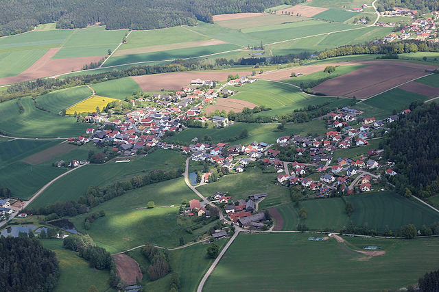
Gleiritsch
- municipality of Germany
Hiking in Gleiritsch
Gleiritsch is an area known for its natural beauty and hiking opportunities. While it might not be as well-known as some of the more prominent hiking destinations, it offers trails that can appeal to both novice and experienced hikers. Here are some general aspects to consider when planning a hiking trip in Gleiritsch:...
- Country:
- Postal Code: 92723
- Local Dialing Code: 09655
- Licence Plate Code: SAD
- Coordinates: 49° 30' 0" N, 12° 20' 0" E
- GPS tracks (wikiloc): [Link]
- AboveSeaLevel: 493 м m
- Area: 10.94 sq km
- Population: 693
- Web site: [Link]

Schwarzenfeld
- municipality of Germany
Hiking in Schwarzenfeld
Schwarzenfeld is a charming area in Bavaria, Germany, known for its natural beauty and outdoor activities, including hiking. Although it may not be as famous as some of the larger hiking destinations in Bavaria, it offers some lovely trails and scenic views....
- Country:
- Postal Code: 92521
- Local Dialing Code: 09435
- Licence Plate Code: SAD
- Coordinates: 49° 23' 0" N, 12° 8' 0" E
- GPS tracks (wikiloc): [Link]
- AboveSeaLevel: 359 м m
- Area: 38.27 sq km
- Population: 5929
- Web site: [Link]

Steinberg am See
- municipality of Germany
Hiking in Steinberg am See
Steinberg am See is a picturesque village nestled in the foothills of the Alps in Bavaria, Germany. It’s surrounded by stunning natural landscapes and offers a range of hiking opportunities for different skill levels. Here are some highlights to consider when planning a hike in this area:...
- Country:
- Postal Code: 92449
- Local Dialing Code: 09431
- Licence Plate Code: SAD
- Coordinates: 49° 16' 33" N, 12° 10' 52" E
- GPS tracks (wikiloc): [Link]
- AboveSeaLevel: 386 м m
- Area: 20.22 sq km
- Population: 1422
- Web site: [Link]

Weiding
- municipality of Germany
Hiking in Weiding
Weiding, located in the Schwandorf district of Bavaria, Germany, offers a lovely backdrop for hiking enthusiasts. The region is characterized by picturesque landscapes, rolling hills, and dense woodlands, making it a great destination for both casual walkers and more experienced hikers....
- Country:
- Postal Code: 92557
- Local Dialing Code: 09674
- Licence Plate Code: SAD
- Coordinates: 49° 29' 0" N, 12° 34' 0" E
- GPS tracks (wikiloc): [Link]
- AboveSeaLevel: 671 м m
- Area: 22.43 sq km
- Population: 655
- Web site: [Link]

Bruck in der Oberpfalz
- municipality of Germany
Hiking in Bruck in der Oberpfalz
Bruck in der Oberpfalz, located in Bavaria, Germany, is surrounded by picturesque landscapes and offers various hiking opportunities. The region is characterized by beautiful natural scenery, including forests, hills, and rivers, making it a great destination for outdoor enthusiasts....
- Country:
- Postal Code: 92436
- Local Dialing Code: 0 94 34
- Licence Plate Code: SAD
- Coordinates: 49° 15' 0" N, 12° 18' 29" E
- GPS tracks (wikiloc): [Link]
- AboveSeaLevel: 368 м m
- Area: 33.09 sq km
- Population: 4037
- Web site: [Link]


Wackersdorf
- municipality of Germany
Hiking in Wackersdorf
Wackersdorf is a charming municipality located in Bavaria, Germany, known for its beautiful landscapes and outdoor recreational opportunities, including hiking. Here are some highlights for hiking in and around Wackersdorf:...
- Country:
- Postal Code: 92442
- Local Dialing Code: 0 94 31
- Licence Plate Code: SAD
- Coordinates: 49° 19' 0" N, 12° 11' 0" E
- GPS tracks (wikiloc): [Link]
- AboveSeaLevel: 422 м m
- Area: 33.56 sq km
- Population: 3896
- Web site: [Link]

Burglengenfeld
- municipality of Germany
Hiking in Burglengenfeld
Burglengenfeld, located in Bavaria, Germany, offers a variety of hiking opportunities for enthusiasts of all levels. The region is characterized by its beautiful landscapes, including forests, rivers, and scenic hills, making it an ideal destination for outdoor activities....
- Country:
- Postal Code: 93133
- Local Dialing Code: 09471
- Coordinates: 49° 12' 22" N, 12° 2' 27" E
- GPS tracks (wikiloc): [Link]
- AboveSeaLevel: 369 м m
- Area: 93.28 sq km
- Population: 10498
- Web site: [Link]
Wolferlohe
- unincorporated area in Germany
Hiking in Wolferlohe
Wolferlohe is a picturesque area in Germany that offers a variety of hiking opportunities, especially for those looking to enjoy nature and explore the countryside. While specific trails can vary and may not be as widely documented as those in larger national parks, here are some general tips and ideas for hiking in this region:...
- Country:
- Coordinates: 49° 18' 0" N, 11° 59' 0" E
- GPS tracks (wikiloc): [Link]
Östlicher Neubäuer Forst
- former unincorporated area in Germany
Hiking in Östlicher Neubäuer Forst
Östlicher Neubäuer Forst is a beautiful forest area in Bavaria, Germany, known for its serene landscapes and diverse wildlife. Here are some highlights and tips for hiking in this region:...
- Country:
- Coordinates: 49° 14' 0" N, 12° 22' 0" E
- GPS tracks (wikiloc): [Link]
Shares border with regions:

Neustadt an der Waldnaab
- district of Bavaria, Germany
Hiking in Neustadt an der Waldnaab
Neustadt an der Waldnaab, located in the Upper Palatinate region of Bavaria, Germany, is known for its picturesque scenery and natural beauty, making it an excellent destination for hiking enthusiasts. Here are some highlights and insights into hiking in this area:...
- Country:
- Capital: Neustadt an der Waldnaab
- Licence Plate Code: VOH; NEW; ESB
- Coordinates: 49° 40' 12" N, 12° 0' 0" E
- GPS tracks (wikiloc): [Link]
- AboveSeaLevel: 450 м m
- Area: 1430.00 sq km
- Population: 94486
- Web site: [Link]
Amberg-Sulzbach
- district of Bavaria, Germany
Hiking in Amberg-Sulzbach
Amberg-Sulzbach, located in Bavaria, Germany, is a picturesque district known for its beautiful landscapes, rich culture, and numerous outdoor activities, including hiking. The area offers a variety of hiking trails that cater to different skill levels, from easy walks suitable for families to more challenging paths for experienced hikers....
- Country:
- Capital: Amberg
- Licence Plate Code: SUL; NAB; ESB; BUL; AS
- Coordinates: 49° 30' 0" N, 11° 45' 0" E
- GPS tracks (wikiloc): [Link]
- AboveSeaLevel: 380 м m
- Area: 1255.00 sq km
- Population: 94617
- Web site: [Link]
Cham
- district of Bavaria, Germany
Hiking in Cham
Cham District, located in the state of Bavaria, Germany, offers a variety of hiking opportunities amid beautiful landscapes, including forests, meadows, and rolling hills. Here are some highlights and tips for hiking in this area:...
- Country:
- Capital: Cham
- Licence Plate Code: WÜM; ROD; KÖZ; CHA
- Coordinates: 49° 15' 0" N, 12° 40' 12" E
- GPS tracks (wikiloc): [Link]
- AboveSeaLevel: 469 м m
- Area: 1510.00 sq km
- Population: 121401
- Web site: [Link]

Neumarkt
- district of Bavaria, Germany
Hiking in Neumarkt
Neumarkt in der Oberpfalz, a district in Bavaria, Germany, is known for its picturesque landscapes and varied hiking opportunities. Set against a backdrop of rolling hills, lush forests, and charming villages, this area is ideal for both casual walkers and seasoned hikers....
- Country:
- Capital: Neumarkt in der Oberpfalz
- Licence Plate Code: PAR; NM
- Coordinates: 49° 15' 0" N, 11° 30' 0" E
- GPS tracks (wikiloc): [Link]
- AboveSeaLevel: 445 м m
- Area: 1344.00 sq km
- Population: 105346
- Web site: [Link]

Regensburg
- district of Bavaria, Germany
Hiking in Regensburg
Regensburg is located in the state of Bavaria, Germany, and it offers a variety of hiking opportunities that showcase the region's natural beauty and historical significance. Here's what you can expect when hiking in and around the Regensburg district:...
- Country:
- Capital: Regensburg
- Licence Plate Code: R
- Coordinates: 49° 4' 48" N, 12° 10' 12" E
- GPS tracks (wikiloc): [Link]
- AboveSeaLevel: 390 м m
- Area: 1396.00 sq km
- Population: 144278
- Web site: [Link]