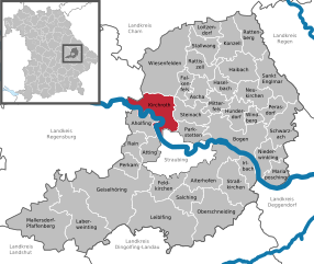
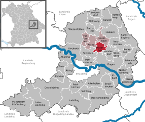
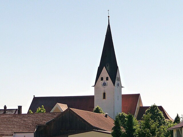
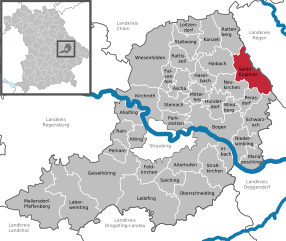
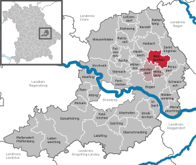
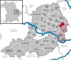
Straubing-Bogen (Landkreis Straubing-Bogen)
.svg)
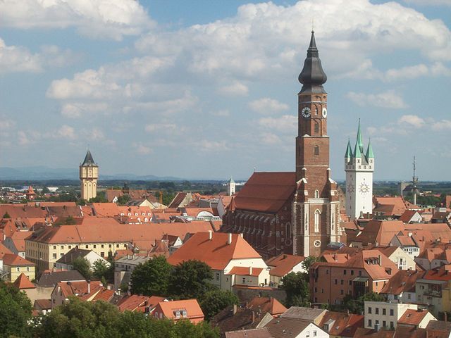
- district of Bavaria, Germany
 Hiking in Straubing-Bogen
Straubing-Bogen is a beautiful district located in Bavaria, Germany, known for its picturesque landscapes and varied terrain, making it a great destination for hiking enthusiasts. Here are some highlights and tips for hiking in the region:
Scenic Trails
-
Lower Bavarian Forest: This area features numerous well-marked hiking trails that wind through lush forests, past rivers, and offer stunning views of the surrounding hills.
-
Donau-Radweg: While primarily a cycling route, many sections are also accessible to hikers. Following the Danube River provides picturesque views and access to charming towns along the way.
-
Bogenberg: This hill offers a popular hiking destination with a panoramic view of the Danube valley. The trail to the top is challenging yet rewarding.
Nature and Wildlife
- The region is home to diverse flora and fauna. Keep an eye out for native birds, deer, and other wildlife as you hike through the various nature reserves and wooded areas.
Cultural Highlights
- As you hike, you may encounter historic sites such as churches, castles, and ruins that give insight into the region’s rich history.
Practical Information
-
Trail Difficulty: Trails in Straubing-Bogen vary from easy family-friendly routes to more challenging hikes. The local tourist information can provide maps indicating trail difficulty levels.
-
Equipment: It's essential to wear suitable hiking boots and bring along water, snacks, and possibly trekking poles, depending on the trail.
-
Weather Considerations: The best time for hiking is typically in spring and early autumn when the weather is mild. However, always check the weather forecast before heading out.
Recommendations
-
Local Resources: Consider visiting local tourist information centers for recommendations on trails and any guided hikes available in the area.
-
Hiking Apps: Utilizing hiking apps can help with navigation and ensuring you don’t miss any scenic viewpoints.
In summary, Straubing-Bogen offers a rich blend of natural beauty and cultural heritage, making it an ideal location for both leisurely and challenging hikes. Enjoy your outdoor adventure!
- Country:

- Capital: Straubing
- Licence Plate Code: MAL; BOG; SR
- Coordinates: 48° 55' 12" N, 12° 34' 48" E


- GPS tracks (wikiloc): [Link]
- AboveSeaLevel: 337 м m
- Area: 1202.24 sq km
- Population: 81062
- Web site: http://www.straubing-bogen.de
- Wikipedia en: wiki(en)
- Wikipedia: wiki(de)
- Wikidata storage: Wikidata: Q10482
- Wikipedia Commons Category: [Link]
- Freebase ID: [/m/02qqfd]
- GeoNames ID: Alt: [3220816]
- VIAF ID: Alt: [246562133]
- OSM relation ID: [62727]
- GND ID: Alt: [4106067-2]
- archINFORM location ID: [2624]
- TGN ID: [7077302]
- Bavarikon ID: [ODB_A00001641]
- NUTS code: [DE22B]
- German district key: 09278
Includes regions:
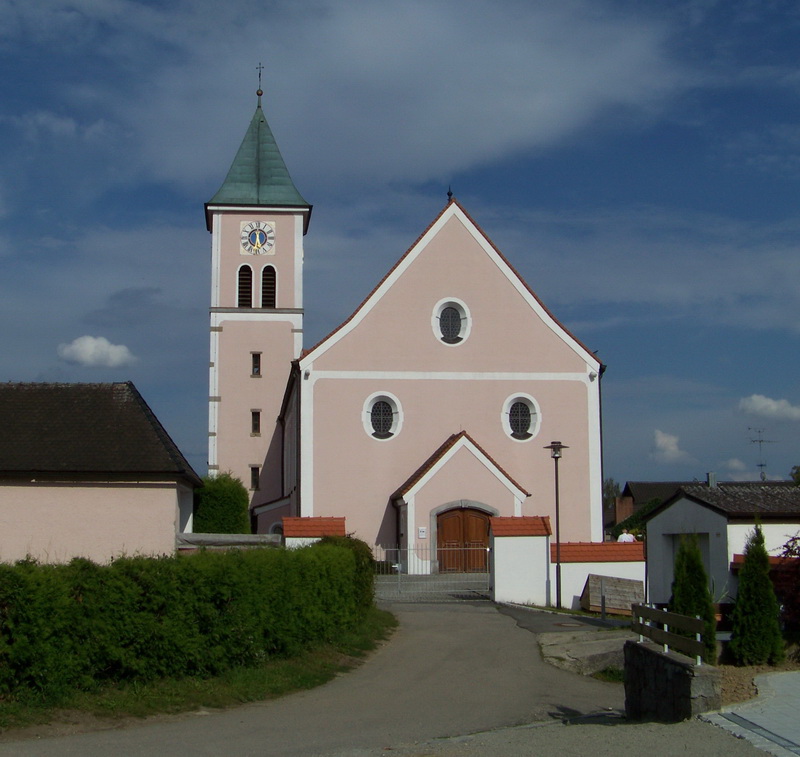
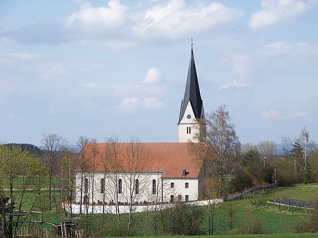
Kirchroth
- German municipality
Hiking in Kirchroth
Kirchroth is a small village in Bavaria, Germany, located near the Danube River. It offers various opportunities for hiking and enjoying the natural beauty of the surrounding landscape. The region is characterized by its picturesque scenery, rolling hills, and lush forests, making it an appealing destination for both novice and experienced hikers....
- Country:
- Postal Code: 94356
- Local Dialing Code: 09428
- Licence Plate Code: SR
- Coordinates: 48° 57' 0" N, 12° 33' 0" E
- GPS tracks (wikiloc): [Link]
- AboveSeaLevel: 325 м m
- Area: 42.82 sq km
- Population: 3104
- Web site: [Link]


Mariaposching
- municipality of Germany
Hiking in Mariaposching
Mariaposching, located in Bavaria, Germany, offers beautiful landscapes and a variety of hiking opportunities suitable for different skill levels. The region is characterized by its rolling hills, scenic meadows, and woodlands, making it a delightful destination for nature lovers and outdoor enthusiasts....
- Country:
- Postal Code: 94553
- Local Dialing Code: 09906
- Licence Plate Code: SR
- Coordinates: 48° 50' 0" N, 12° 48' 0" E
- GPS tracks (wikiloc): [Link]
- AboveSeaLevel: 316 м m
- Area: 19.61 sq km
- Population: 1236
- Web site: [Link]


Parkstetten
- municipality of Germany
Hiking in Parkstetten
Parkstetten is a small municipality located in Bavaria, Germany, known for its scenic landscapes and natural beauty. While it may not be as widely recognized as some larger hiking destinations, the area offers a variety of trails and opportunities for outdoor enthusiasts....
- Country:
- Postal Code: 94365
- Local Dialing Code: 09421
- Licence Plate Code: SR
- Coordinates: 48° 55' 0" N, 12° 36' 0" E
- GPS tracks (wikiloc): [Link]
- AboveSeaLevel: 319 м m
- Area: 19.5 sq km
- Population: 2249
- Web site: [Link]


Aholfing
- municipality of Germany
Hiking in Aholfing
Aholfing is a small yet charming village located in Bavaria, Germany. While it may not be as widely known as some of the larger hiking destinations in the area, it offers ample opportunities for outdoor enthusiasts, particularly those who enjoy hiking in a less crowded environment....
- Country:
- Postal Code: 94345
- Local Dialing Code: 09429
- Licence Plate Code: SR
- Coordinates: 48° 57' 0" N, 12° 28' 0" E
- GPS tracks (wikiloc): [Link]
- AboveSeaLevel: 324 м m
- Area: 21.4 sq km
- Population: 1076
- Web site: [Link]

Mitterfels
- municipality of Germany
Hiking in Mitterfels
Mitterfels is a picturesque village located in Bavaria, Germany, known for its beautiful landscapes and opportunities for hiking. The surrounding area is characterized by rolling hills, forests, and rivers, making it an excellent destination for outdoor enthusiasts....
- Country:
- Postal Code: 94360
- Local Dialing Code: 09961
- Licence Plate Code: SR
- Coordinates: 48° 58' 0" N, 12° 41' 0" E
- GPS tracks (wikiloc): [Link]
- AboveSeaLevel: 407 м m
- Area: 14.23 sq km
- Population: 2047
- Web site: [Link]


Mallersdorf-Pfaffenberg
- municipality of Germany
Hiking in Mallersdorf-Pfaffenberg
Mallersdorf-Pfaffenberg is a picturesque municipality located in Bavaria, Germany, known for its charming landscapes and scenic hiking opportunities. The area is characterized by rolling hills, lush forests, and beautiful meadows, making it an ideal destination for outdoor enthusiasts....
- Country:
- Postal Code: 84066
- Local Dialing Code: 08772
- Coordinates: 48° 46' 0" N, 12° 14' 0" E
- GPS tracks (wikiloc): [Link]
- AboveSeaLevel: 411 м m
- Area: 72.56 sq km
- Population: 6091
- Web site: [Link]

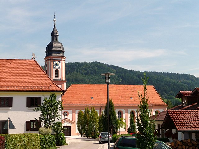
Bogen
- town in Germany
Hiking in Bogen
Bogen is a small town located in Bavaria, Germany, situated near the Danube River and surrounded by scenic landscapes. It offers excellent opportunities for hiking, with trails that cater to different skill levels. Here are some key points about hiking in and around Bogen:...
- Country:
- Postal Code: 94327
- Local Dialing Code: 09422
- Coordinates: 48° 55' 0" N, 12° 41' 0" E
- GPS tracks (wikiloc): [Link]
- AboveSeaLevel: 322 м m
- Area: 49.74 sq km
- Population: 8199
- Web site: [Link]


Haselbach
- human settlement in Germany
Hiking in Haselbach
Haselbach is a picturesque village located in Bavaria, Germany, known for its natural beauty and proximity to various hiking trails. Here are some highlights about hiking in and around Haselbach:...
- Country:
- Postal Code: 94354
- Local Dialing Code: 09961
- Licence Plate Code: SR
- Coordinates: 49° 0' 0" N, 12° 42' 0" E
- GPS tracks (wikiloc): [Link]
- AboveSeaLevel: 428 м m
- Area: 18.43 sq km
- Population: 1222
- Web site: [Link]


Straßkirchen
- municipality in Bavaria, Germany
Hiking in Straßkirchen
Straßkirchen, located in Bavaria, Germany, is surrounded by picturesque landscapes that provide a variety of hiking opportunities. Here are some key points to consider for hiking in and around Straßkirchen:...
- Country:
- Postal Code: 94342
- Local Dialing Code: 09424
- Licence Plate Code: SR
- Coordinates: 48° 50' 0" N, 12° 43' 0" E
- GPS tracks (wikiloc): [Link]
- AboveSeaLevel: 324 м m
- Area: 38.4 sq km
- Population: 3150
- Web site: [Link]


Konzell
- municipality of Germany
Hiking in Konzell
Konzell, located in Bavaria, Germany, is a beautiful area known for its serene natural landscapes and fantastic hiking opportunities. The region offers a mix of lush forests, rolling hills, and picturesque villages, making it an ideal destination for hikers of all levels....
- Country:
- Postal Code: 94357
- Local Dialing Code: 09963
- Licence Plate Code: SR
- Coordinates: 49° 4' 0" N, 12° 43' 0" E
- GPS tracks (wikiloc): [Link]
- AboveSeaLevel: 536 м m
- Area: 26.75 sq km
- Population: 1751
- Web site: [Link]


Aiterhofen
- municipality of Germany
Hiking in Aiterhofen
Aiterhofen is a charming municipality located in Bavaria, Germany, offering several opportunities for hiking enthusiasts. While not as widely known for hiking as larger mountainous regions, there are still beautiful trails and scenic spots to explore....
- Country:
- Postal Code: 94330
- Local Dialing Code: 09421
- Licence Plate Code: SR
- Coordinates: 48° 51' 0" N, 12° 37' 0" E
- GPS tracks (wikiloc): [Link]
- AboveSeaLevel: 331 м m
- Area: 43.11 sq km
- Population: 2749
- Web site: [Link]


Falkenfels
- municipality of Germany
Hiking in Falkenfels
Falkenfels is a small town located in Bavaria, Germany, known for its picturesque landscapes and outdoor recreational opportunities, including hiking. The region surrounding Falkenfels offers a variety of hiking trails that cater to different skill levels, from easy walks to more challenging hikes....
- Country:
- Postal Code: 94350
- Local Dialing Code: 09961
- Licence Plate Code: SR
- Coordinates: 49° 0' 0" N, 12° 36' 0" E
- GPS tracks (wikiloc): [Link]
- AboveSeaLevel: 489 м m
- Area: 11.49 sq km
- Population: 715
- Web site: [Link]


Oberschneiding
- municipality of Germany
Hiking in Oberschneiding
Oberschneiding, located in Bavaria, Germany, offers a charming escape for hiking enthusiasts. Surrounded by beautiful landscapes, you can explore scenic routes that wind through lush fields, rolling hills, and serene woodlands. Here’s what you can expect while hiking in this lovely area:...
- Country:
- Postal Code: 94363
- Local Dialing Code: 09426
- Licence Plate Code: SR
- Coordinates: 48° 47' 45" N, 12° 38' 32" E
- GPS tracks (wikiloc): [Link]
- AboveSeaLevel: 354 м m
- Area: 60.77 sq km
- Population: 2419
- Web site: [Link]

Laberweinting
- municipality of Germany
Hiking in Laberweinting
Laberweinting is located in Bavaria, Germany, and is surrounded by beautiful landscapes that provide excellent opportunities for hiking and outdoor activities. The area features a mix of forests, meadows, and gentle hills, making it ideal for hikers of various skill levels....
- Country:
- Postal Code: 84082
- Local Dialing Code: 09454; 08774; 09423; 08772
- Licence Plate Code: SR
- Coordinates: 48° 48' 0" N, 12° 19' 0" E
- GPS tracks (wikiloc): [Link]
- AboveSeaLevel: 369 м m
- Area: 76.12 sq km
- Population: 3280
- Web site: [Link]


Windberg
- municipality in the district of Straubing-Bogen in Bavaria, Germany
Hiking in Windberg
Windberg, located in Bavaria, Germany, is a picturesque destination for hiking enthusiasts. This charming village is nestled in the heart of the Bavarian Forest, providing a stunning backdrop of natural beauty and diverse landscapes....
- Country:
- Postal Code: 94336
- Local Dialing Code: 09422
- Licence Plate Code: SR
- Coordinates: 48° 57' 0" N, 12° 45' 0" E
- GPS tracks (wikiloc): [Link]
- AboveSeaLevel: 400 м m
- Area: 7.97 sq km
- Population: 884
- Web site: [Link]

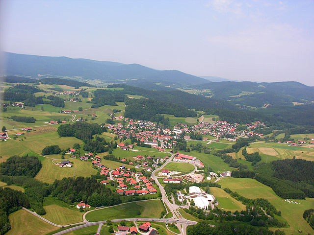
Sankt Englmar
- municipality of Germany
Hiking in Sankt Englmar
Sankt Englmar is a picturesque village located in the Bavarian Forest of Germany, known for its stunning landscapes and outdoor recreational opportunities, including hiking. Here are some key points to consider if you're planning a hiking trip in Sankt Englmar:...
- Country:
- Postal Code: 94379
- Local Dialing Code: 09965
- Licence Plate Code: SR
- Coordinates: 49° 0' 0" N, 12° 49' 0" E
- GPS tracks (wikiloc): [Link]
- AboveSeaLevel: 808 м m
- Area: 36.86 sq km
- Population: 1287
- Web site: [Link]


Steinach
- municipality in Bavaria, Germany
Hiking in Steinach
Steinach, located in Bavaria, Germany, offers a variety of hiking opportunities that cater to different skill levels. Situated near the border with the beautiful Thuringian Forest, the region boasts scenic landscapes, picturesque villages, and a rich cultural heritage....
- Country:
- Postal Code: 94377
- Local Dialing Code: 09428
- Licence Plate Code: SR
- Coordinates: 48° 57' 0" N, 12° 37' 0" E
- GPS tracks (wikiloc): [Link]
- AboveSeaLevel: 348 м m
- Area: 23.15 sq km
- Population: 2073
- Web site: [Link]


Wiesenfelden
- municipality of Germany
Hiking in Wiesenfelden
Wiesenfelden is a picturesque village located in Bavaria, Germany, surrounded by lush forests, rolling hills, and scenic landscapes, making it a great destination for hiking enthusiasts. Here are some aspects to consider if you plan to hike in and around Wiesenfelden:...
- Country:
- Postal Code: 94344
- Local Dialing Code: 09966
- Licence Plate Code: SR
- Coordinates: 49° 2' 0" N, 12° 32' 0" E
- GPS tracks (wikiloc): [Link]
- AboveSeaLevel: 610 м m
- Area: 78.2 sq km
- Population: 3750
- Web site: [Link]


Atting
- municipality of Germany
Hiking in Atting
Atting is a small municipality located in Bavaria, Germany, and while it may not be widely recognized as a major hiking destination, it can serve as a charming starting point for exploring the surrounding Bavarian countryside. Here are some tips and insights about hiking in and around Atting:...
- Country:
- Postal Code: 94348
- Local Dialing Code: 09429
- Licence Plate Code: SR
- Coordinates: 48° 54' 0" N, 12° 29' 0" E
- GPS tracks (wikiloc): [Link]
- AboveSeaLevel: 332 м m
- Area: 14.92 sq km
- Population: 1131
- Web site: [Link]


Geiselhöring
- municipality of Germany
Hiking in Geiselhöring
Geiselhöring, situated in Bavaria, Germany, offers some beautiful opportunities for hiking in a picturesque setting. Although it may not be as famous as some other Bavarian hiking destinations, it has its own charm and scenic landscapes....
- Country:
- Postal Code: 94333
- Local Dialing Code: 09423
- Licence Plate Code: SR
- Coordinates: 48° 49' 33" N, 12° 23' 33" E
- GPS tracks (wikiloc): [Link]
- AboveSeaLevel: 356 м m
- Area: 99.69 sq km
- Population: 5765
- Web site: [Link]


Stallwang
- municipality of Germany
Hiking in Stallwang
Stallwang, located in Bavaria, Germany, offers a variety of hiking opportunities that showcase the beautiful landscapes of the region. The area is characterized by its rolling hills, lush forests, and picturesque countryside, making it a great destination for both experienced hikers and those looking for more leisurely walks....
- Country:
- Postal Code: 94375
- Local Dialing Code: 09964
- Licence Plate Code: SR
- Coordinates: 49° 3' 0" N, 12° 40' 0" E
- GPS tracks (wikiloc): [Link]
- AboveSeaLevel: 492 м m
- Area: 20.59 sq km
- Population: 1326
- Web site: [Link]

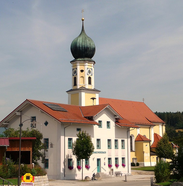
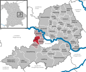
Perkam
- municipality of Germany
Hiking in Perkam
Perkam, a small village in Bavaria, Germany, is surrounded by beautiful landscapes that offer a variety of hiking opportunities. While it may not be as well-known as some larger hiking hotspots, the area boasts serene nature, picturesque views, and a chance to experience the quiet charm of the Bavarian countryside....
- Country:
- Postal Code: 94368
- Local Dialing Code: 09423
- Licence Plate Code: SR
- Coordinates: 48° 51' 0" N, 12° 26' 0" E
- GPS tracks (wikiloc): [Link]
- AboveSeaLevel: 360 м m
- Area: 14.22 sq km
- Population: 1614
- Web site: [Link]


Rattiszell
- municipality of Germany
Hiking in Rattiszell
Rattiszell, located in Bavaria, Germany, offers beautiful landscapes and a variety of hiking opportunities. Surrounding the area are picturesque woods, rolling hills, and fields, making it a lovely spot for outdoor enthusiasts....
- Country:
- Postal Code: 94372
- Local Dialing Code: 09964
- Licence Plate Code: SR
- Coordinates: 49° 2' 0" N, 12° 40' 0" E
- GPS tracks (wikiloc): [Link]
- AboveSeaLevel: 363 м m
- Area: 22.19 sq km
- Population: 1314
- Web site: [Link]


Hunderdorf
- municipality of Germany
Hiking in Hunderdorf
Hunderdorf is a small village located in Bavaria, Germany, surrounded by picturesque landscapes that provide excellent hiking opportunities. The region is characterized by gentle hills, lush forests, and charming farmland, making it a delightful destination for outdoor enthusiasts....
- Country:
- Postal Code: 94336
- Local Dialing Code: 09422
- Licence Plate Code: SR
- Coordinates: 48° 57' 0" N, 12° 44' 0" E
- GPS tracks (wikiloc): [Link]
- AboveSeaLevel: 338 м m
- Area: 22.2 sq km
- Population: 2937
- Web site: [Link]


Salching
- municipality of Germany
Hiking in Salching
Salching is a small village located in Bavaria, Germany, known for its picturesque landscapes and outdoor recreational opportunities. While it may not be as famous as some larger hiking destinations, it offers a number of charming trails that can be enjoyed by hikers of various skill levels. Here are some highlights for hiking in and around Salching:...
- Country:
- Postal Code: 94330
- Local Dialing Code: 09426
- Licence Plate Code: SR
- Coordinates: 48° 49' 0" N, 12° 34' 0" E
- GPS tracks (wikiloc): [Link]
- AboveSeaLevel: 347 м m
- Area: 22 sq km
- Population: 1695
- Web site: [Link]


Niederwinkling
- municipality of Germany
Hiking in Niederwinkling
Niederwinkling is a beautiful area located in Bavaria, Germany, and it offers a variety of hiking opportunities for outdoor enthusiasts. This region is characterized by its lush landscapes, rolling hills, and quaint villages, making it a picturesque destination for nature lovers....
- Country:
- Postal Code: 94559
- Local Dialing Code: 09962
- Licence Plate Code: SR
- Coordinates: 48° 53' 0" N, 12° 48' 0" E
- GPS tracks (wikiloc): [Link]
- AboveSeaLevel: 320 м m
- Area: 25.65 sq km
- Population: 1759
- Web site: [Link]


Loitzendorf
- municipality of Germany
Hiking in Loitzendorf
Loitzendorf is a quaint village located in Germany, which offers various opportunities for outdoor activities, including hiking. While it may not be as well-known as some larger hiking destinations, its charm lies in its scenic countryside, lush landscapes, and peaceful trails. Here are a few highlights if you're considering hiking in Loitzendorf:...
- Country:
- Postal Code: 94359
- Local Dialing Code: 09964
- Licence Plate Code: SR
- Coordinates: 49° 5' 0" N, 12° 39' 0" E
- GPS tracks (wikiloc): [Link]
- AboveSeaLevel: 411 м m
- Area: 12.03 sq km
- Population: 581
- Web site: [Link]


Rattenberg
- municipality of Germany
Hiking in Rattenberg
Rattenberg, located in Bavaria, Germany, is renowned for its charming medieval architecture and beautiful natural surroundings, making it an excellent destination for hiking enthusiasts. The area offers a variety of trails that cater to different skill levels, enabling hikers to explore stunning landscapes, lush forests, and panoramic views of the Bavarian Alps....
- Country:
- Postal Code: 94371
- Local Dialing Code: 09963
- Licence Plate Code: SR
- Coordinates: 49° 5' 15" N, 12° 45' 4" E
- GPS tracks (wikiloc): [Link]
- AboveSeaLevel: 560 м m
- Area: 30.22 sq km
- Population: 1793
- Web site: [Link]


Haibach
- municipality of Germany
Hiking in Haibach
Haibach, located in Lower Bavaria, Germany, is known for its beautiful landscapes and scenic hiking trails. The region offers a mix of rolling hills, forests, and picturesque views that appeal to both casual walkers and experienced hikers....
- Country:
- Postal Code: 94353
- Local Dialing Code: 09965; 09964; 09963; 09961
- Licence Plate Code: SR
- Coordinates: 49° 2' 0" N, 12° 43' 0" E
- GPS tracks (wikiloc): [Link]
- AboveSeaLevel: 449 м m
- Area: 32.38 sq km
- Population: 2084
- Web site: [Link]


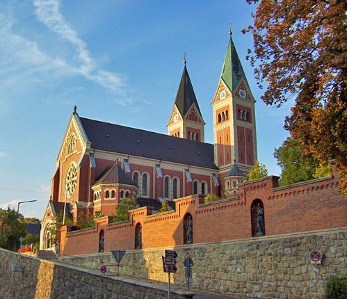
Schwarzach
- municipality of Germany
Hiking in Schwarzach
Schwarzach, located in Lower Bavaria, Germany, is a quaint area known for its beautiful landscapes, lush forests, and scenic trails. Here are some key points about hiking in the area:...
- Country:
- Postal Code: 94374
- Local Dialing Code: 09962
- Licence Plate Code: SR
- Coordinates: 48° 55' 0" N, 12° 49' 0" E
- GPS tracks (wikiloc): [Link]
- AboveSeaLevel: 361 м m
- Area: 33.22 sq km
- Population: 2263
- Web site: [Link]


Feldkirchen
- municipality of Germany
Hiking in Feldkirchen
Feldkirchen, located in Lower Bavaria, offers a charming and picturesque setting for hiking enthusiasts. The region features a mix of lush landscapes, winding trails, and views of the beautiful Bavarian countryside. Here are some key aspects to consider when hiking in Feldkirchen and its surroundings:...
- Country:
- Postal Code: 94351
- Local Dialing Code: 09420
- Licence Plate Code: SR
- Coordinates: 48° 50' 0" N, 12° 32' 0" E
- GPS tracks (wikiloc): [Link]
- AboveSeaLevel: 348 м m
- Area: 22.66 sq km
- Population: 1632
- Web site: [Link]
Neukirchen
- human settlement in Germany
Hiking in Neukirchen
Neukirchen in Lower Bavaria is a charming area that offers a range of hiking opportunities for outdoor enthusiasts. Known for its scenic landscapes, rolling hills, and lush forests, it serves as a great base for exploring the natural beauty of the region. Here are some key points to consider when hiking in Neukirchen:...
- Country:
- Postal Code: 94362
- Local Dialing Code: 09961
- Licence Plate Code: SR
- Coordinates: 48° 59' 0" N, 12° 46' 0" E
- GPS tracks (wikiloc): [Link]
- AboveSeaLevel: 375 м m
- Area: 24.45 sq km
- Population: 1491
- Web site: [Link]


Leiblfing
- municipality of Germany
Hiking in Leiblfing
Leiblfing, a small community in Bavaria, Germany, is surrounded by beautiful landscapes ideal for hiking enthusiasts. While it may not be a widely known hiking destination, the region offers various trails that cater to different skill levels, providing a great way to explore the scenic countryside....
- Country:
- Postal Code: 94339
- Local Dialing Code: 09427
- Licence Plate Code: SR
- Coordinates: 48° 46' 0" N, 12° 31' 0" E
- GPS tracks (wikiloc): [Link]
- AboveSeaLevel: 366 м m
- Area: 78.41 sq km
- Population: 3395
- Web site: [Link]

Ascha
- municipality of Germany
Hiking in Ascha
Ascha is a picturesque town located in Bavaria, Germany, known for its beautiful landscapes and outdoor activities. Hiking in and around Ascha offers a wonderful opportunity to explore the natural beauty of the region, including rolling hills, lush forests, and scenic vistas....
- Country:
- Postal Code: 94347
- Local Dialing Code: 09961
- Licence Plate Code: SR
- Coordinates: 49° 0' 0" N, 12° 38' 0" E
- GPS tracks (wikiloc): [Link]
- AboveSeaLevel: 339 м m
- Area: 19.53 sq km
- Population: 1152
- Web site: [Link]


Irlbach
- municipality of Germany
Hiking in Irlbach
Irlbach, located in Bavaria, Germany, is a picturesque area known for its natural beauty, making it a lovely destination for hiking enthusiasts. While Irlbach may not be as widely recognized as some of the other hiking hotspots in Bavaria, it offers charming trails that can provide a peaceful hiking experience....
- Country:
- Postal Code: 94342
- Local Dialing Code: 09424
- Licence Plate Code: SR
- Coordinates: 48° 51' 0" N, 12° 45' 0" E
- GPS tracks (wikiloc): [Link]
- AboveSeaLevel: 324 м m
- Area: 15.84 sq km
- Population: 1131
- Web site: [Link]

Rain
- municipality in Straubing-Bogen, Lower Bavaria, Germany
Hiking in Rain
Hiking in Rain, located in Lower Bavaria, Germany, offers a wonderful blend of natural beauty, picturesque landscapes, and charming Bavarian culture. Here are some highlights and tips for hiking in the area:...
- Country:
- Postal Code: 94369
- Local Dialing Code: 09429
- Licence Plate Code: SR
- Coordinates: 48° 54' 0" N, 12° 28' 0" E
- GPS tracks (wikiloc): [Link]
- AboveSeaLevel: 330 м m
- Area: 14.29 sq km
- Population: 1720
- Web site: [Link]
Perasdorf
- municipality of Germany
Hiking in Perasdorf
Perasdorf is a small village located in the beautiful region of Lower Austria, known for its serene landscapes and natural beauty. When hiking in this area, you'll have the opportunity to explore scenic trails that showcase rolling hills, lush forests, and picturesque rural scenery....
- Country:
- Postal Code: 94366
- Local Dialing Code: 09962
- Licence Plate Code: SR
- Coordinates: 48° 57' 0" N, 12° 48' 0" E
- GPS tracks (wikiloc): [Link]
- AboveSeaLevel: 503 м m
- Area: 16.04 sq km
- Population: 628
- Web site: [Link]
Shares border with regions:
Cham
- district of Bavaria, Germany
Hiking in Cham
Cham District, located in the state of Bavaria, Germany, offers a variety of hiking opportunities amid beautiful landscapes, including forests, meadows, and rolling hills. Here are some highlights and tips for hiking in this area:...
- Country:
- Capital: Cham
- Licence Plate Code: WÜM; ROD; KÖZ; CHA
- Coordinates: 49° 15' 0" N, 12° 40' 12" E
- GPS tracks (wikiloc): [Link]
- AboveSeaLevel: 469 м m
- Area: 1510.00 sq km
- Population: 121401
- Web site: [Link]

Regensburg
- district of Bavaria, Germany
Hiking in Regensburg
Regensburg is located in the state of Bavaria, Germany, and it offers a variety of hiking opportunities that showcase the region's natural beauty and historical significance. Here's what you can expect when hiking in and around the Regensburg district:...
- Country:
- Capital: Regensburg
- Licence Plate Code: R
- Coordinates: 49° 4' 48" N, 12° 10' 12" E
- GPS tracks (wikiloc): [Link]
- AboveSeaLevel: 390 м m
- Area: 1396.00 sq km
- Population: 144278
- Web site: [Link]

Landshut
- district in Bavaria, Germany
Hiking in Landshut
Landshut district, located in Bavaria, Germany, offers a variety of hiking opportunities that cater to different skill levels and preferences. The landscape is characterized by rolling hills, picturesque villages, and lush forests, providing a beautiful backdrop for outdoor activities....
- Country:
- Capital: Landshut
- Licence Plate Code: LA
- Coordinates: 48° 34' 14" N, 12° 10' 50" E
- GPS tracks (wikiloc): [Link]
- AboveSeaLevel: 383 м m
- Area: 1348 sq km
- Population: 115644
- Web site: [Link]


Dingolfing-Landau
- district in Bavaria, Germany
Hiking in Dingolfing-Landau
Dingolfing-Landau, located in Bavaria, Germany, offers a variety of hiking opportunities for enthusiasts of all levels. The region is known for its picturesque landscapes, charming villages, and diverse flora and fauna. Here are some highlights of hiking in Dingolfing-Landau:...
- Country:
- Capital: Dingolfing
- Licence Plate Code: DGF
- Coordinates: 48° 40' 12" N, 12° 34' 48" E
- GPS tracks (wikiloc): [Link]
- AboveSeaLevel: 372 м m
- Area: 878.00 sq km
- Population: 75517
- Web site: [Link]
Regen district
- district in Bavaria, Germany
Hiking in Regen district
Hiking in the Regen district, located in Bavaria, Germany, offers a stunning blend of natural beauty, cultural attractions, and outdoor adventure. The region is known for its picturesque landscapes, featuring lush forests, rolling hills, and the scenic Danube and Regen rivers. Here are some highlights and tips for hiking in this area:...
- Country:
- Capital: Regen
- Licence Plate Code: REG
- Coordinates: 49° 0' 0" N, 13° 10' 12" E
- GPS tracks (wikiloc): [Link]
- AboveSeaLevel: 686 м m
- Area: 975.00 sq km
- Population: 76135
- Web site: [Link]


Deggendorf
- district in Bavaria, Germany
Hiking in Deggendorf
Deggendorf, located in Bavaria, Germany, is a fantastic region for hiking enthusiasts. Nestled at the edge of the Bavarian Forest National Park and alongside the Danube River, it boasts a variety of landscapes and trails suitable for all skill levels....
- Country:
- Capital: Deggendorf
- Licence Plate Code: DEG
- Coordinates: 48° 49' 48" N, 13° 0' 0" E
- GPS tracks (wikiloc): [Link]
- AboveSeaLevel: 309 м m
- Area: 861.00 sq km
- Population: 115005
- Web site: [Link]
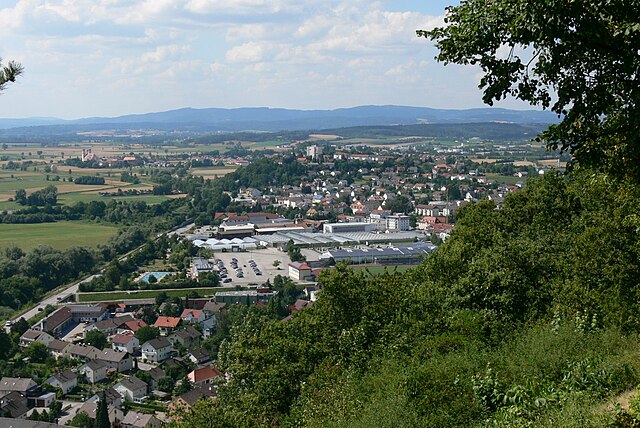
Straubing
- independent city in Lower Bavaria, southern Germany
Hiking in Straubing
Straubing, located in Bavaria, Germany, offers a beautiful setting for hiking enthusiasts. The area is characterized by its stunning natural landscapes, rich history, and charming villages. Here are some highlights of hiking in and around Straubing:...
- Country:
- Postal Code: 94315
- Local Dialing Code: 09421
- Licence Plate Code: SR
- Coordinates: 48° 53' 0" N, 12° 34' 0" E
- GPS tracks (wikiloc): [Link]
- AboveSeaLevel: 326 м m
- Area: 67.58 sq km
- Population: 47586
- Web site: [Link]