Vouzon (Vouzon)

- commune in Loir-et-Cher, France
- Country:

- Postal Code: 41600
- Coordinates: 47° 38' 45" N, 2° 3' 31" E


- GPS tracks (wikiloc): [Link]
- Area: 78.25 sq km
- Population: 1503
- Web site: http://www.vouzon.fr
- Wikipedia en: wiki(en)
- Wikipedia: wiki(fr)
- Wikidata storage: Wikidata: Q1167524
- Wikipedia Commons Category: [Link]
- Freebase ID: [/m/03nw361]
- GeoNames ID: Alt: [2967600]
- SIREN number: [214102964]
- BnF ID: [15259570z]
- VIAF ID: Alt: [257950780]
- MusicBrainz area ID: [f9bc8f89-f0fb-4cf9-b6da-ff1f2c0df9e9]
- INSEE municipality code: 41296
Shares border with regions:

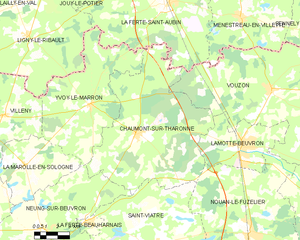
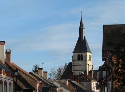
Chaumont-sur-Tharonne
- commune in Loir-et-Cher, France
- Country:
- Postal Code: 41600
- Coordinates: 47° 36' 40" N, 1° 54' 21" E
- GPS tracks (wikiloc): [Link]
- Area: 78.33 sq km
- Population: 1090
- Web site: [Link]

Pierrefitte-sur-Sauldre
- commune in Loir-et-Cher, France
- Country:
- Postal Code: 41300
- Coordinates: 47° 30' 46" N, 2° 9' 3" E
- GPS tracks (wikiloc): [Link]
- Area: 74.96 sq km
- Population: 806
- Web site: [Link]


Nouan-le-Fuzelier
- commune in Loir-et-Cher, France
- Country:
- Postal Code: 41600
- Coordinates: 47° 32' 13" N, 2° 2' 17" E
- GPS tracks (wikiloc): [Link]
- Area: 85.49 sq km
- Population: 2330

Sennely
- commune in Loiret, France
- Country:
- Postal Code: 45240
- Coordinates: 47° 40' 42" N, 2° 8' 57" E
- GPS tracks (wikiloc): [Link]
- Area: 49.32 sq km
- Population: 703
- Web site: [Link]

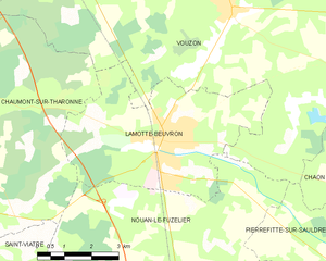
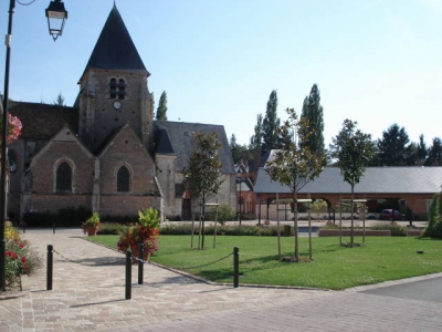
Lamotte-Beuvron
- commune in Loir-et-Cher, France
- Country:
- Postal Code: 41600
- Coordinates: 47° 36' 8" N, 2° 1' 29" E
- GPS tracks (wikiloc): [Link]
- Area: 23.34 sq km
- Population: 4750
- Web site: [Link]

Souvigny-en-Sologne
- commune in Loir-et-Cher, France
- Country:
- Postal Code: 41600
- Coordinates: 47° 38' 41" N, 2° 9' 51" E
- GPS tracks (wikiloc): [Link]
- Area: 41.55 sq km
- Population: 515
- Web site: [Link]


Ménestreau-en-Villette
- commune in Loiret, France
- Country:
- Postal Code: 45240
- Coordinates: 47° 41' 57" N, 2° 1' 20" E
- GPS tracks (wikiloc): [Link]
- Area: 53.62 sq km
- Population: 1471
- Web site: [Link]


La Ferté-Saint-Aubin
- commune in Loiret, France
- Country:
- Postal Code: 45240
- Coordinates: 47° 43' 2" N, 1° 56' 29" E
- GPS tracks (wikiloc): [Link]
- Area: 86.12 sq km
- Population: 7367
- Web site: [Link]


Chaon
- commune in Loir-et-Cher, France
- Country:
- Postal Code: 41600
- Coordinates: 47° 36' 31" N, 2° 10' 21" E
- GPS tracks (wikiloc): [Link]
- Area: 31.85 sq km
- Population: 467