Cormes (Cormes)

- commune in Sarthe, France
- Country:

- Postal Code: 72400
- Coordinates: 48° 10' 12" N, 0° 42' 17" E


- GPS tracks (wikiloc): [Link]
- Area: 19 sq km
- Population: 906
- Web site: http://www.cormes.fr
- Wikipedia en: wiki(en)
- Wikipedia: wiki(fr)
- Wikidata storage: Wikidata: Q305767
- Wikipedia Commons Category: [Link]
- Freebase ID: [/m/03qkzlb]
- GeoNames ID: Alt: [6450951]
- SIREN number: [217200930]
- BnF ID: [15273649c]
- INSEE municipality code: 72093
Shares border with regions:


Ceton
- commune in Orne, France
- Country:
- Postal Code: 61260
- Coordinates: 48° 13' 34" N, 0° 45' 0" E
- GPS tracks (wikiloc): [Link]
- Area: 59.39 sq km
- Population: 1807


Courgenard
- commune in Sarthe, France
- Country:
- Postal Code: 72320
- Coordinates: 48° 9' 6" N, 0° 44' 12" E
- GPS tracks (wikiloc): [Link]
- Area: 11.32 sq km
- Population: 494
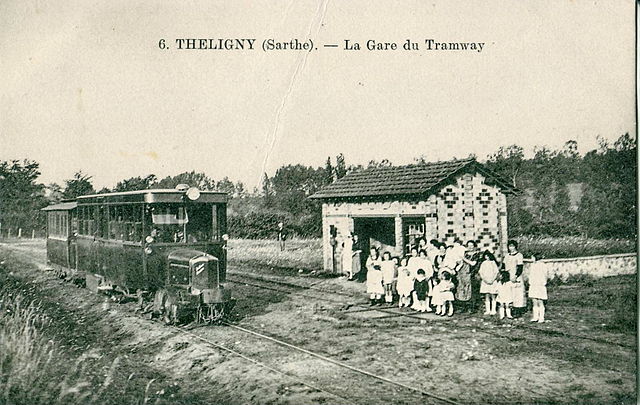

Théligny
- commune in Sarthe, France
- Country:
- Postal Code: 72320
- Coordinates: 48° 10' 31" N, 0° 47' 59" E
- GPS tracks (wikiloc): [Link]
- Area: 14.31 sq km
- Population: 219


Saint-Maixent
- commune in Sarthe, France
- Country:
- Postal Code: 72320
- Coordinates: 48° 5' 22" N, 0° 39' 6" E
- GPS tracks (wikiloc): [Link]
- Area: 22.48 sq km
- Population: 721

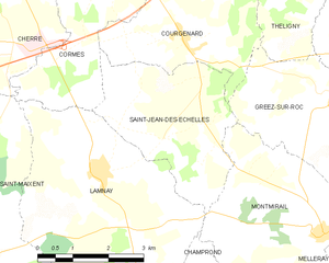
Saint-Jean-des-Échelles
- commune in Sarthe, France
- Country:
- Postal Code: 72320
- Coordinates: 48° 7' 48" N, 0° 42' 48" E
- GPS tracks (wikiloc): [Link]
- Area: 10.64 sq km
- Population: 254


Cherreau
- commune in Sarthe, France
- Country:
- Postal Code: 72400
- Coordinates: 48° 11' 34" N, 0° 40' 58" E
- GPS tracks (wikiloc): [Link]
- Area: 11.64 sq km
- Population: 938


Cherré, Sarthe
- commune in Sarthe, France
- Country:
- Postal Code: 72400
- Coordinates: 48° 10' 21" N, 0° 39' 30" E
- GPS tracks (wikiloc): [Link]
- Area: 18.73 sq km
- Population: 1731
- Web site: [Link]


Lamnay
- commune in Sarthe, France
- Country:
- Postal Code: 72320
- Coordinates: 48° 6' 58" N, 0° 42' 15" E
- GPS tracks (wikiloc): [Link]
- Area: 22.09 sq km
- Population: 962