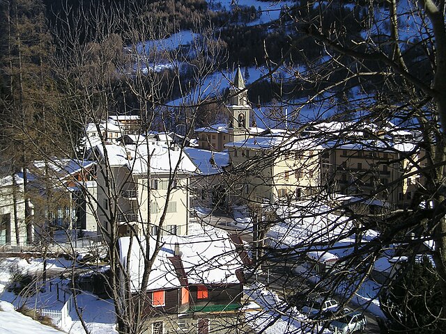
Corteno Golgi (Corteno Golgi)
.svg)
- Italian comune
 Hiking in Corteno Golgi
Corteno Golgi is a charming village located in the Lombardy region of Italy, nestled in the heart of the Central Alps. It's a great destination for hiking enthusiasts, offering a mix of beautiful landscapes, historical sites, and well-marked trails.
Hiking Highlights in Corteno Golgi
-
Scenic Trails: The area is surrounded by stunning natural scenery, including mountainous terrain, forests, and alpine meadows. The trails vary in difficulty, from easy walks suitable for families to more challenging routes for experienced hikers.
-
Stelvio National Park: Proximity to this national park allows hikers to explore diverse ecosystems, with opportunities to see local wildlife and unique flora. Be sure to check for any specific regulations or guidelines when hiking in protected areas.
-
Historical Paths: Some trails in the area lead to historical sites, such as old villages, churches, and remnants from previous centuries. These can enrich your hiking experience with cultural insights.
-
Major Trails:
- Sentiero delle Leggende: This is a popular trail that combines hiking with local legends and stories, offering intriguing insights into the area's culture.
- Rifugio Lago Barbellino: This route leads to a mountain hut near a stunning lake, perfect for resting and enjoying panoramic views.
-
Seasonal Considerations: Summer is ideal for hiking due to milder weather, while spring and fall can offer beautiful colors but might have challenging conditions. Winter hiking is also possible, but proper gear is essential, and it's advisable to check trail accessibility.
-
Local Amenities: Corteno Golgi offers basic amenities, including accommodations and restaurants. It's a good idea to stock up on supplies before heading into more remote areas.
Tips for Hiking in Corteno Golgi
- Start Early: The weather can change quickly in the mountains, so starting your hikes early can help you avoid afternoon storms.
- Stay Hydrated: Carry enough water and snacks to keep your energy up during longer hikes.
- Follow Marked Trails: Stick to marked hiking paths to ensure safety and protect the natural environment.
- Check Weather Conditions: Before heading out, check the local weather forecast and prepare accordingly, especially if you're planning higher elevation hikes.
- Respect Wildlife: Observe animals from a distance and avoid feeding them.
Corteno Golgi offers a wonderful blend of natural beauty and rich culture, making it an excellent spot for a hiking adventure!
- Country:

- Postal Code: 25040
- Local Dialing Code: 0364
- Licence Plate Code: BS
- Coordinates: 46° 10' 1" N, 10° 14' 40" E


- GPS tracks (wikiloc): [Link]
- AboveSeaLevel: 925 м m
- Area: 82.61 sq km
- Population: 1962
- Web site: http://www.comune.corteno-golgi.bs.it
- Wikipedia en: wiki(en)
- Wikipedia: wiki(it)
- Wikidata storage: Wikidata: Q104096
- Wikipedia Commons Gallery: [Link]
- Wikipedia Commons Category: [Link]
- Freebase ID: [/m/0142hr]
- GeoNames ID: Alt: [3177973]
- VIAF ID: Alt: [239263541]
- OSM relation ID: [46856]
- ISTAT ID: 017063
- Italian cadastre code: D064
Shares border with regions:

Edolo
- Italian comune
Hiking in Edolo
Edolo is a charming town located in the Brescia province of Lombardy, Italy, surrounded by the stunning landscapes of the Adamello and Tonale mountains. It's an excellent destination for hiking enthusiasts, offering a variety of trails that cater to different skill levels. Here are some highlights of hiking in the Edolo area:...
- Country:
- Postal Code: 25048
- Local Dialing Code: 0364
- Licence Plate Code: BS
- Coordinates: 46° 10' 44" N, 10° 19' 48" E
- GPS tracks (wikiloc): [Link]
- AboveSeaLevel: 720 м m
- Area: 88.9 sq km
- Population: 4564
- Web site: [Link]

Malonno
- Italian comune
Hiking in Malonno
Malonno, located in the beautiful region of Lombardy, Italy, is known for its stunning landscapes and natural beauty, making it a great destination for hiking enthusiasts. Nestled in the Camonica Valley, this area offers a range of trails that cater to different skill levels, from easy walks to more challenging hikes....
- Country:
- Postal Code: 25040
- Local Dialing Code: 0364
- Licence Plate Code: BS
- Coordinates: 46° 7' 0" N, 10° 19' 0" E
- GPS tracks (wikiloc): [Link]
- AboveSeaLevel: 596 м m
- Area: 31.46 sq km
- Population: 3183
- Web site: [Link]

Paisco Loveno
- Italian comune
Hiking in Paisco Loveno
Paisco Loveno is a picturesque location nestled in the Italian Alps, particularly known for its breathtaking landscapes and diverse hiking trails. Here are some key points to consider if you're planning a hiking trip there:...
- Country:
- Postal Code: 25050
- Local Dialing Code: 0364
- Licence Plate Code: BS
- Coordinates: 46° 4' 48" N, 10° 17' 36" E
- GPS tracks (wikiloc): [Link]
- AboveSeaLevel: 853 м m
- Area: 35.87 sq km
- Population: 190
- Web site: [Link]
Sernio
- Italian comune
Hiking in Sernio
Sernio, located in the Italian region of Lombardy, is a charming destination for hiking enthusiasts. While it may not be as well-known as larger national parks, it offers a variety of trails that can cater to different skill levels, from leisurely walks to more challenging hikes....
- Country:
- Postal Code: 23030
- Local Dialing Code: 0342
- Licence Plate Code: SO
- Coordinates: 46° 13' 0" N, 10° 12' 0" E
- GPS tracks (wikiloc): [Link]
- AboveSeaLevel: 632 м m
- Area: 9.52 sq km
- Population: 474
- Web site: [Link]


Villa di Tirano
- Italian comune
Hiking in Villa di Tirano
Villa di Tirano, located in the Valtellina region of northern Italy, is a beautiful area for hiking enthusiasts. Nestled in the Alps, this small town offers access to stunning landscapes, rich history, and diverse trails suitable for various skill levels....
- Country:
- Postal Code: 23030
- Local Dialing Code: 0342
- Licence Plate Code: SO
- Coordinates: 46° 12' 0" N, 10° 8' 0" E
- GPS tracks (wikiloc): [Link]
- AboveSeaLevel: 406 м m
- Area: 24.74 sq km
- Population: 2978
- Web site: [Link]


Teglio
- Italian comune
Hiking in Teglio
Teglio, a charming town located in the Valtellina valley of northern Italy, is surrounded by stunning alpine landscapes, making it a fantastic destination for hiking enthusiasts. The area is known for its rich natural beauty, with a diverse range of trails suitable for various skill levels, from leisurely strolls to challenging hikes....
- Country:
- Postal Code: 23036
- Local Dialing Code: 0342
- Licence Plate Code: SO
- Coordinates: 46° 10' 0" N, 10° 4' 0" E
- GPS tracks (wikiloc): [Link]
- AboveSeaLevel: 851 м m
- Area: 115.32 sq km
- Population: 4534
- Web site: [Link]


Tirano
- Italian comune
Hiking in Tirano
Tirano, located in the Valtellina region of northern Italy, is a charming town surrounded by stunning Alpine scenery, making it a fantastic base for hiking enthusiasts. The area offers diverse trails that cater to various skill levels, from leisurely walks to challenging hikes....
- Country:
- Postal Code: 23037
- Local Dialing Code: 0342
- Licence Plate Code: SO
- Coordinates: 46° 12' 59" N, 10° 10' 8" E
- GPS tracks (wikiloc): [Link]
- AboveSeaLevel: 441 м m
- Area: 32.37 sq km
- Population: 9050
- Web site: [Link]

Aprica
- Italian comune
Hiking in Aprica
Aprica, located in the Valtellina region of northern Italy, is a fantastic destination for hiking enthusiasts. Surrounded by the stunning landscapes of the Rhaetian Alps, Aprica offers a variety of trails suitable for all skill levels, from casual walkers to experienced trekkers. Here are some highlights of hiking in this beautiful area:...
- Country:
- Postal Code: 23031
- Local Dialing Code: 0342
- Licence Plate Code: SO
- Coordinates: 46° 9' 0" N, 10° 8' 0" E
- GPS tracks (wikiloc): [Link]
- AboveSeaLevel: 1180 м m
- Area: 20.37 sq km
- Population: 1580
- Web site: [Link]