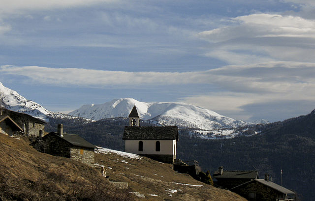
Sernio (Sernio)
.svg)
- Italian comune
 Hiking in Sernio
Sernio, located in the Italian region of Lombardy, is a charming destination for hiking enthusiasts. While it may not be as well-known as larger national parks, it offers a variety of trails that can cater to different skill levels, from leisurely walks to more challenging hikes.
Hiking Trails
-
Local Trails: Sernio features several local trails that wind through picturesque landscapes, including forests, meadows, and stunning viewpoints overlooking the surrounding valleys.
-
Nearby Parks: The nearby Parco Nazionale delle Orobie Bergamasche offers more extensive hiking options. You can access challenging trails that lead to mountain passes and breathtaking vistas.
-
Scenic Routes: Many routes in the area also provide opportunities to discover local flora and fauna, as well as historical sites such as old farms and chapels.
Recommendations
-
Safety Gear: Always wear appropriate hiking footwear, carry enough water, and consider bringing a map or a GPS device.
-
Best Time to Visit: The hiking season generally runs from spring through autumn. Spring offers blooming wildflowers, while autumn provides beautiful foliage.
-
Local Cuisine: After a day's hike, enjoy local cuisine at nearby restaurants, where you can taste traditional dishes and relax.
Skill Level Considerations
- Beginners: Seek out shorter, well-marked trails that can be easily navigated.
- Intermediate/Advanced: Look for more rugged trails, which may include elevation changes and rocky terrain.
Conclusion
Sernio offers a tranquil hiking experience with the added benefit of stunning natural beauty. Whether you’re a seasoned hiker or a beginner, you’ll find a trail that suits your preference while enjoying the serene atmosphere of this lovely corner of Italy.
- Country:

- Postal Code: 23030
- Local Dialing Code: 0342
- Licence Plate Code: SO
- Coordinates: 46° 13' 0" N, 10° 12' 0" E


- GPS tracks (wikiloc): [Link]
- AboveSeaLevel: 632 м m
- Area: 9.52 sq km
- Population: 474
- Web site: http://www.comune.sernio.so.it/
- Wikipedia en: wiki(en)
- Wikipedia: wiki(it)
- Wikidata storage: Wikidata: Q39263
- Wikipedia Commons Category: [Link]
- Freebase ID: [/m/0gj3qc]
- GeoNames ID: Alt: [6542523]
- VIAF ID: Alt: [244798711]
- OSM relation ID: [47006]
- ISTAT ID: 014059
- Italian cadastre code: I636
Shares border with regions:

Corteno Golgi
- Italian comune
Hiking in Corteno Golgi
Corteno Golgi is a charming village located in the Lombardy region of Italy, nestled in the heart of the Central Alps. It's a great destination for hiking enthusiasts, offering a mix of beautiful landscapes, historical sites, and well-marked trails....
- Country:
- Postal Code: 25040
- Local Dialing Code: 0364
- Licence Plate Code: BS
- Coordinates: 46° 10' 1" N, 10° 14' 40" E
- GPS tracks (wikiloc): [Link]
- AboveSeaLevel: 925 м m
- Area: 82.61 sq km
- Population: 1962
- Web site: [Link]

Edolo
- Italian comune
Hiking in Edolo
Edolo is a charming town located in the Brescia province of Lombardy, Italy, surrounded by the stunning landscapes of the Adamello and Tonale mountains. It's an excellent destination for hiking enthusiasts, offering a variety of trails that cater to different skill levels. Here are some highlights of hiking in the Edolo area:...
- Country:
- Postal Code: 25048
- Local Dialing Code: 0364
- Licence Plate Code: BS
- Coordinates: 46° 10' 44" N, 10° 19' 48" E
- GPS tracks (wikiloc): [Link]
- AboveSeaLevel: 720 м m
- Area: 88.9 sq km
- Population: 4564
- Web site: [Link]

Vervio
- Italian comune
Hiking in Vervio
Vervio is a charming village located in the Valtellina region of northern Italy, which offers beautiful hiking opportunities amidst stunning alpine scenery. Here are some key points about hiking in and around Vervio:...
- Country:
- Postal Code: 23030
- Local Dialing Code: 0342
- Licence Plate Code: SO
- Coordinates: 46° 15' 0" N, 10° 14' 0" E
- GPS tracks (wikiloc): [Link]
- AboveSeaLevel: 549 м m
- Area: 12.41 sq km
- Population: 209
- Web site: [Link]


Lovero
- Italian comune
Hiking in Lovero
Lovero is a charming village located in the Valtellina region of northern Italy, offering stunning landscapes and a variety of hiking opportunities. The area is known for its beautiful mountains, lush greenery, and picturesque views that attract outdoor enthusiasts....
- Country:
- Postal Code: 23030
- Local Dialing Code: 0342
- Licence Plate Code: SO
- Coordinates: 46° 14' 0" N, 10° 14' 0" E
- GPS tracks (wikiloc): [Link]
- AboveSeaLevel: 515 м m
- Area: 13.46 sq km
- Population: 657
- Web site: [Link]


Tirano
- Italian comune
Hiking in Tirano
Tirano, located in the Valtellina region of northern Italy, is a charming town surrounded by stunning Alpine scenery, making it a fantastic base for hiking enthusiasts. The area offers diverse trails that cater to various skill levels, from leisurely walks to challenging hikes....
- Country:
- Postal Code: 23037
- Local Dialing Code: 0342
- Licence Plate Code: SO
- Coordinates: 46° 12' 59" N, 10° 10' 8" E
- GPS tracks (wikiloc): [Link]
- AboveSeaLevel: 441 м m
- Area: 32.37 sq km
- Population: 9050
- Web site: [Link]