
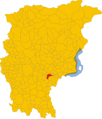
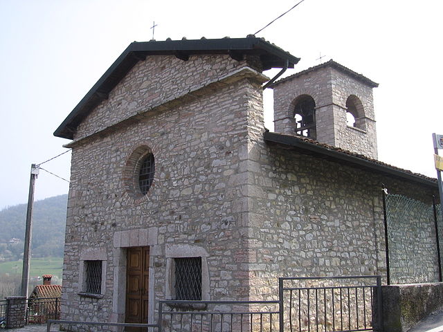
Trescore Balneario (Trescore Balneario)
.svg)
- Italian comune
 Hiking in Trescore Balneario
Trescore Balneario, located in the province of Bergamo in northern Italy, is a charming town known for its thermal baths and scenic landscapes. While it's not as widely recognized for hiking as some other areas in the Italian Alps, it can serve as a great base for exploring nearby trails and natural attractions.
Hiking Opportunities in and Around Trescore Balneario
-
Surrounding Mountains: The nearby mountains, including the Corna Camuzzoni and Monte Misma, offer various hiking trails that cater to different skill levels. You can enjoy panoramic views of the surrounding countryside as you trek through these areas.
-
Lake Endine: Just a short drive from Trescore Balneario, Lake Endine offers several trails around its perimeter. The area is suitable for gentle hikes and is also great for birdwatching and picnicking.
-
Sentiero dei Dossi: This trail starts near Trescore Balneario and leads to beautiful viewpoints. It’s a relatively easy trek and is ideal for families or those looking for a quick hike.
-
Valle Cavallina: This picturesque valley features numerous trails that take you through lush landscapes and charming villages. You can enjoy nature while discovering local flora and fauna.
Tips for Hiking in the Area
-
Seasons: The best time for hiking is typically from late spring to early autumn. Summer can get hot, so plan hikes for early mornings or later in the afternoon.
-
Dress Appropriately: Wear comfortable, moisture-wicking clothing and sturdy hiking boots. Bring layers, as temperatures can vary throughout the day.
-
Stay Hydrated: Always carry enough water, especially when hiking during warmer months.
-
Local Guides: Consider hiring a local hiking guide if you’re unfamiliar with the region. They can provide insights and help you discover hidden trails.
-
Trail Maps: Make sure to have a trail map or use a reliable hiking app on your phone to navigate the paths.
Hiking in and around Trescore Balneario can offer a tranquil escape with stunning views and the charm of the Italian countryside. Enjoy your hike!
- Country:

- Postal Code: 24069
- Local Dialing Code: 035
- Licence Plate Code: BG
- Coordinates: 45° 42' 0" N, 9° 51' 0" E


- GPS tracks (wikiloc): [Link]
- AboveSeaLevel: 271 м m
- Area: 13.51 sq km
- Population: 9814
- Web site: http://www.comune.trescore-balneario.bg.it/
- Wikipedia en: wiki(en)
- Wikipedia: wiki(it)
- Wikidata storage: Wikidata: Q101663
- Wikipedia Commons Gallery: [Link]
- Wikipedia Commons Category: [Link]
- Freebase ID: [/m/0g5y_3]
- GeoNames ID: Alt: [6541708]
- VIAF ID: Alt: [142064643]
- OSM relation ID: [45698]
- Quora topic ID: [Trescore-Balneario]
- UN/LOCODE: [ITZVJ]
- ISTAT ID: 016218
- Italian cadastre code: L388
Shares border with regions:

Carobbio degli Angeli
- Italian comune
Hiking in Carobbio degli Angeli
Carobbio degli Angeli is a quaint municipality located in the province of Bergamo, in the Lombardy region of Italy. While it may not be as well-known for hiking as other areas in Italy, it offers some beautiful natural surroundings and trails that can appeal to outdoor enthusiasts....
- Country:
- Postal Code: 24060
- Local Dialing Code: 035
- Licence Plate Code: BG
- Coordinates: 45° 40' 0" N, 9° 50' 0" E
- GPS tracks (wikiloc): [Link]
- AboveSeaLevel: 232 м m
- Area: 6.82 sq km
- Population: 4700
- Web site: [Link]


Cenate Sopra
- Italian comune
Hiking in Cenate Sopra
Cenate Sopra is a picturesque town located in the province of Bergamo in Lombardy, Italy. It sits at the foothills of the Pre-Alps, making it an attractive base for hikers and nature enthusiasts. The area offers a variety of trails that cater to different skill levels, from leisurely walks to more challenging treks....
- Country:
- Postal Code: 24060
- Local Dialing Code: 035
- Licence Plate Code: BG
- Coordinates: 45° 42' 42" N, 9° 49' 20" E
- GPS tracks (wikiloc): [Link]
- AboveSeaLevel: 330 м m
- Area: 6.97 sq km
- Population: 2571
- Web site: [Link]


Cenate Sotto
- Italian comune
Hiking in Cenate Sotto
Cenate Sotto is a charming town located in the province of Bergamo in Lombardy, Italy. It's surrounded by beautiful landscapes, making it an excellent destination for hiking enthusiasts. Here’s a brief overview of what you can expect when hiking in this area:...
- Country:
- Postal Code: 24069
- Local Dialing Code: 035
- Licence Plate Code: BG
- Coordinates: 45° 42' 0" N, 9° 49' 0" E
- GPS tracks (wikiloc): [Link]
- AboveSeaLevel: 267 м m
- Area: 4.62 sq km
- Population: 3825
- Web site: [Link]

Entratico
- Italian comune
Hiking in Entratico
Entratico is a charming village located in the province of Bergamo, in the Lombardy region of Italy. Surrounded by beautiful landscapes, it offers a variety of hiking opportunities for enthusiasts of all levels. Here’s what you can expect when hiking in Entratico:...
- Country:
- Postal Code: 24060
- Local Dialing Code: 035
- Licence Plate Code: BG
- Coordinates: 45° 43' 0" N, 9° 52' 0" E
- GPS tracks (wikiloc): [Link]
- AboveSeaLevel: 299 м m
- Area: 4.15 sq km
- Population: 1979
- Web site: [Link]


Gandosso
- Italian comune
Hiking in Gandosso
Gandosso is a charming village located in the province of Bergamo, in the Lombardy region of Italy. The area is known for its beautiful landscapes, making it a great destination for hiking enthusiasts....
- Country:
- Postal Code: 24060
- Local Dialing Code: 035
- Licence Plate Code: BG
- Coordinates: 45° 39' 0" N, 9° 54' 0" E
- GPS tracks (wikiloc): [Link]
- AboveSeaLevel: 488 м m
- Area: 3.13 sq km
- Population: 1478
- Web site: [Link]


Gorlago
- Italian comune
Hiking in Gorlago
Gorlago is a picturesque town located in the Lombardy region of northern Italy, near the city of Bergamo. The area around Gorlago offers a variety of hiking opportunities that showcase the stunning landscapes of the Italian countryside, including rolling hills, forests, and panoramic views of the surrounding mountains....
- Country:
- Postal Code: 24060
- Local Dialing Code: 035
- Licence Plate Code: BG
- Coordinates: 45° 40' 0" N, 9° 49' 0" E
- GPS tracks (wikiloc): [Link]
- AboveSeaLevel: 233 м m
- Area: 5.7 sq km
- Population: 5188
- Web site: [Link]


Luzzana
- Italian comune
Hiking in Luzzana
Luzzana is a small town located in the province of Bergamo in the Lombardy region of Italy. While it may not be as well-known as some larger hiking destinations, it offers access to beautiful natural landscapes that are perfect for outdoor enthusiasts....
- Country:
- Postal Code: 24069
- Local Dialing Code: 035
- Licence Plate Code: BG
- Coordinates: 45° 43' 0" N, 9° 53' 0" E
- GPS tracks (wikiloc): [Link]
- AboveSeaLevel: 310 м m
- Area: 3.48 sq km
- Population: 917
- Web site: [Link]


San Paolo d'Argon
- Italian comune
Hiking in San Paolo d'Argon
San Paolo d'Argon, located in the province of Bergamo in northern Italy, offers a variety of hiking opportunities amidst beautiful landscapes. The region is characterized by its rolling hills, vineyards, and scenic views of the surrounding valleys and mountains, including the nearby Orobian Alps....
- Country:
- Postal Code: 24060
- Local Dialing Code: 035
- Licence Plate Code: BG
- Coordinates: 45° 41' 21" N, 9° 48' 11" E
- GPS tracks (wikiloc): [Link]
- AboveSeaLevel: 255 м m
- Area: 5.25 sq km
- Population: 5725
- Web site: [Link]


Zandobbio
- Italian comune
Hiking in Zandobbio
Zandobbio is a charming village located in the province of Bergamo, Italy, nestled in the foothills of the Alps and surrounded by beautiful natural landscapes. Hiking in this region offers a variety of trails that cater to different skill levels, making it an excellent destination for both novice and experienced hikers....
- Country:
- Postal Code: 24060
- Local Dialing Code: 035
- Licence Plate Code: BG
- Coordinates: 45° 41' 18" N, 9° 51' 9" E
- GPS tracks (wikiloc): [Link]
- AboveSeaLevel: 278 м m
- Area: 6.43 sq km
- Population: 2732
- Web site: [Link]


Credaro
- Italian comune
Hiking in Credaro
Credaro, located in the Lombardy region of Italy, is a charming area known for its scenic landscapes and outdoor activities, including hiking. While it may not be one of the most famous hiking destinations in Italy, it offers beautiful trails that cater to various skill levels....
- Country:
- Postal Code: 24060
- Local Dialing Code: 035
- Licence Plate Code: BG
- Coordinates: 45° 40' 0" N, 9° 56' 0" E
- GPS tracks (wikiloc): [Link]
- AboveSeaLevel: 255 м m
- Area: 3.41 sq km
- Population: 3517
- Web site: [Link]


Albino, Lombardy
- Italian comune
Hiking in Albino, Lombardy
Albino, located in the Lombardy region of Italy, is a charming town nestled in the foothills of the Bergamasque Alps. The area offers a variety of hiking opportunities, making it a great destination for outdoor enthusiasts....
- Country:
- Postal Code: 24021
- Local Dialing Code: 035
- Licence Plate Code: BG
- Coordinates: 45° 45' 38" N, 9° 47' 49" E
- GPS tracks (wikiloc): [Link]
- AboveSeaLevel: 342 м m
- Area: 31.81 sq km
- Population: 17903
- Web site: [Link]