Dahlem (Dahlem)
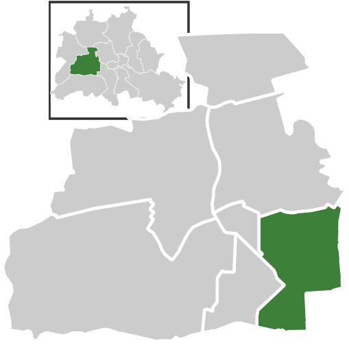
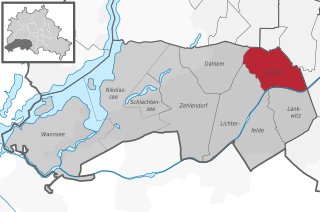
- locality of Berlin
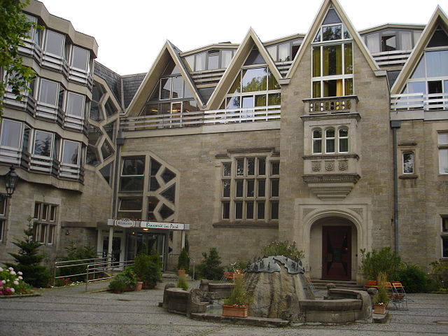
Dahlem, a district in the southwestern part of Berlin, is known for its greenery and is home to several parks and nature reserves that can provide a pleasant hiking experience. Though it may not be as rugged or extensive as hiking in mountainous regions, there are still several opportunities for enjoying nature and walking in this area.
Here are a few highlights of hiking in and around Dahlem:
-
Grunewald Forest: Located to the west of Dahlem, Grunewald is one of the largest urban forests in Berlin. It features a network of trails suitable for hiking, running, and biking. You can explore the various paths that lead to scenic viewpoints, including the famous Teufelsberg, a hill created from WWII debris, which offers panoramic views of the city.
-
Botanical Garden: The Berlin Botanical Garden, located in Dahlem, is not a traditional hiking spot, but it offers beautiful walking paths among its vast collection of plants. It’s a great place to explore nature at a leisurely pace.
-
Wannsee: A short distance from Dahlem is the Wannsee, a beautiful lake surrounded by forest. There are walking paths along the shore and opportunities for recreational activities, including swimming and picnicking.
-
Krumme Lanke: Another nearby lake with surrounding trails, Krumme Lanke is a tranquil spot for hiking and enjoying nature. The area is less crowded and offers a peaceful hiking experience.
-
Nature Paths: Within Dahlem and its vicinity, you will find some smaller nature paths that lead through green areas like parks and residential gardens, providing a more urban yet scenic hiking experience.
For those interested in a more extensive hiking adventure, the surrounding areas of Berlin also have many trails that connect to larger networks, giving you the opportunity to explore beyond Dahlem.
Tips for Hiking in Dahlem:
- Footwear: Wear comfortable hiking shoes, especially if you plan to hike in Grunewald or other forested areas.
- Hydration: Carry plenty of water, especially on warmer days.
- Explore Nature: Take your time to enjoy the flora and fauna; Dahlem is full of lovely parks and wildlife.
- Public Transport: Use Berlin’s extensive public transportation system to access various hiking trails if they are a bit far from Dahlem.
Overall, while Dahlem may not offer high-altitude hiking, it provides a charming urban nature experience ideal for day hikes, leisurely walks, or a quick escape into the green.
- Country:

- Postal Code: 14195; 14169
- Coordinates: 52° 27' 29" N, 13° 17' 15" E


- GPS tracks (wikiloc): [Link]
- AboveSeaLevel: 54 м m
- Area: 8.39 sq km
- Population: 15973
- Wikipedia en: wiki(en)
- Wikipedia: wiki(de)
- Wikidata storage: Wikidata: Q700541
- Wikipedia Commons Gallery: [Link]
- Wikipedia Commons Category: [Link]
- Wikipedia Commons Maps Category: [Link]
- Freebase ID: [/m/027h4sl]
- GeoNames ID: Alt: [2939440]
- VIAF ID: Alt: [141943247]
- OSM relation ID: [55738]
- GND ID: Alt: [4087308-0]
- archINFORM location ID: [43203]
- Library of Congress authority ID: Alt: [n84083881]
- Image Archive, Herder Institute: [Q700541]
Shares border with regions:

Lichterfelde
- locality of Berlin, Germany
Lichterfelde is a district in the southwestern part of Berlin, known for its residential areas, parks, and greenery. While it may not be a traditional hiking destination like larger natural reserves or mountainous regions, there are still opportunities for enjoyable walking and hiking experiences in and around this area....
- Country:

- Postal Code: 14167; 12209; 12207; 12205; 12203
- Coordinates: 52° 26' 0" N, 13° 19' 0" E


- GPS tracks (wikiloc): [Link]
- AboveSeaLevel: 47 м m
- Area: 18.22 sq km
- Population: 81831


Grunewald
- locality of Charlottenburg-Wilmersdorf, Berlin, Germany
Grunewald is a beautiful forested area located on the outskirts of Berlin, Germany. It offers a diverse range of hiking trails and a peaceful escape from the city. Here’s what you need to know about hiking in Grunewald:...
- Country:

- Postal Code: 14193
- Coordinates: 52° 29' 0" N, 13° 16' 0" E


- GPS tracks (wikiloc): [Link]
- AboveSeaLevel: 47 м m
- Area: 22.33 sq km
- Population: 10371


Zehlendorf
- locality of Berlin
Zehlendorf, located in the southwestern part of Berlin, is known for its beautiful natural surroundings, making it a great spot for hiking enthusiasts. Here are some key aspects to consider when planning a hiking trip in this area:...
- Country:

- Postal Code: 14169; 14167; 14165; 14163
- Coordinates: 52° 26' 2" N, 13° 15' 32" E


- GPS tracks (wikiloc): [Link]
- Area: 18.83 sq km
- Population: 58589


Schmargendorf
- locality of Berlin, Germany
Schmargendorf is a charming district in Berlin that offers access to various nature trails and hiking opportunities, particularly within the surrounding areas of the Grunewald forest. While Schmargendorf itself is primarily residential, its proximity to larger green spaces makes it an ideal starting point for outdoor enthusiasts. Here are some highlights for hiking in and around Schmargendorf:...
- Country:

- Postal Code: 14199; 14193
- Coordinates: 52° 28' 38" N, 13° 17' 17" E


- GPS tracks (wikiloc): [Link]
- AboveSeaLevel: 47 м m
- Area: 3.59 sq km
- Population: 21011

Wilmersdorf
- locality of Berlin, Germany
Wilmersdorf is a district in Berlin, Germany, and while it's primarily urban, there are some opportunities for outdoor activities and nature walks in and around the area. Here are a few aspects to consider if you're looking to hike or enjoy nature in Wilmersdorf:...
- Country:

- Postal Code: 14197; 10777; 10719; 10717; 10715; 10713; 10709; 10707
- Coordinates: 52° 29' 0" N, 13° 19' 0" E


- GPS tracks (wikiloc): [Link]
- AboveSeaLevel: 39 м m
- Area: 7.16 sq km
- Population: 98034


Steglitz
- locality of Berlin
Steglitz is a district located in Berlin, Germany, and it offers several opportunities for outdoor activities, including hiking. While Steglitz itself might not have extensive hiking trails like some of the more rural areas surrounding Berlin, there are still some pleasant parks and natural areas where you can enjoy walking and light hiking. Here are a few options:...
- Country:

- Postal Code: 12169; 12167; 12165; 12163; 12161; 12157
- Coordinates: 52° 28' 0" N, 13° 20' 0" E


- GPS tracks (wikiloc): [Link]
- AboveSeaLevel: 51 м m
- Area: 6.79 sq km
- Population: 73463

