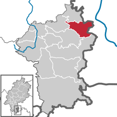
Odenwaldkreis (Odenwaldkreis)


- district in Hesse, Germany
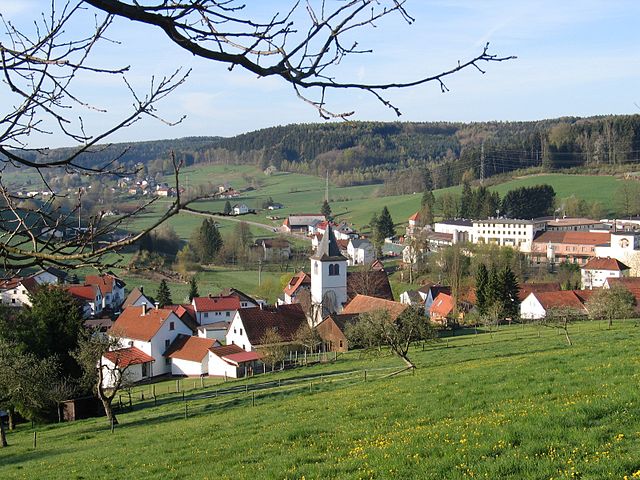
 Hiking in Odenwaldkreis
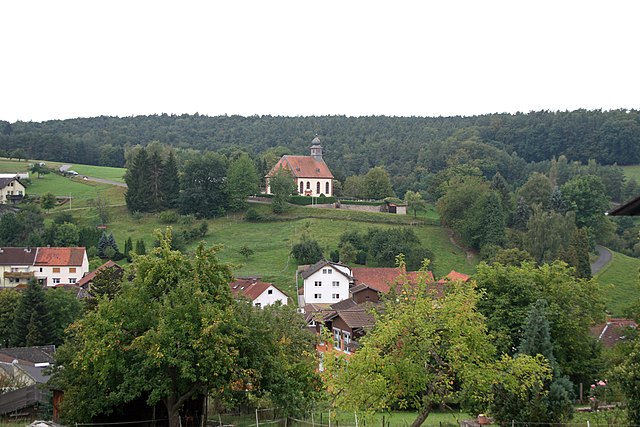
Odenwaldkreis, located in the Odenwald mountain range in Germany, offers a variety of beautiful hiking opportunities. Known for its scenic landscapes, charming villages, and rich cultural heritage, it is a fantastic destination for nature enthusiasts and hikers.
Trails and Routes
-
Odenwaldweg: This is a long-distance trail that runs through the Odenwald region, covering approximately 250 kilometers. It offers hikers stunning views of vineyards, forests, and quaint towns.
-
Premium Hiking Trails: The area is home to several premium hiking trails, recognized for their quality and scenic beauty. Examples include the "Hessischer Bergstrasse" trail, which provides breathtaking views over the Rhine Valley.
-
Short Circular Hikes: There are plenty of shorter, circular routes suitable for families and those looking for a more leisurely hike. These trails often connect local attractions and provide a good mix of nature and culture.
Highlights
- Sabine's Way: A thematic trail linking various points of interest while showcasing local flora and fauna.
- Cultural Sites: Many trails pass by historical buildings, castles, and monuments, allowing hikers to explore the region's rich history.
- Nature Parks: Odenwaldkreis is home to protected areas where you can experience diverse ecosystems, ideal for observing wildlife and enjoying natural beauty.
Hiking Essentials
- Preparation: Always check trail conditions before heading out, and carry a detailed map or GPS device.
- Equipment: Wear sturdy hiking boots, dress in layers, and pack essentials like water, snacks, a first aid kit, and sun protection.
- Navigation: Signage is generally good, but it's wise to have a physical map or an offline digital version, especially in remote areas.
Best Time to Visit
The hiking season in Odenwaldkreis typically runs from spring through autumn (April to October). Each season offers a unique experience: spring brings blooming wildflowers, summer offers lush greenery, autumn provides beautiful foliage, and winter can be great for snowshoeing.
Whether you’re looking for a challenging trek or a peaceful walk through nature, Odenwaldkreis has a variety of trails to explore, making it a rewarding destination for all hiking enthusiasts.
- Country:

- Capital: Erbach
- Licence Plate Code: ERB
- Coordinates: 49° 39' 48" N, 8° 59' 38" E


- GPS tracks (wikiloc): [Link]
- AboveSeaLevel: 233 м m
- Area: 623.96 sq km
- Population: 96648
- Web site: http://www.odenwaldkreis.de/
- Wikipedia en: wiki(en)
- Wikipedia: wiki(de)
- Wikidata storage: Wikidata: Q7919
- Wikipedia Commons Category: [Link]
- Freebase ID: [/m/01cs2g]
- GeoNames ID: Alt: [3220971]
- VIAF ID: Alt: [145539528]
- OSM relation ID: [62596]
- GND ID: Alt: [4043110-1]
- archINFORM location ID: [2543]
- Library of Congress authority ID: Alt: [n89146900]
- TGN ID: [7077064]
- NUTS code: [DE71B]
- German district key: 06437
Includes regions:


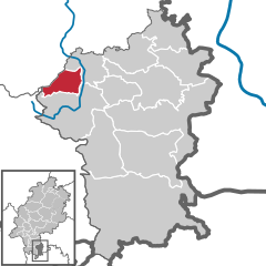
Oberzent
- town in Odenwaldkreis in Hesse, Germany
Hiking in Oberzent
Oberzent is a picturesque municipality located in the Odenwald region of Germany, known for its stunning landscapes and diverse hiking opportunities. Here are some highlights of hiking in Oberzent:...
- Country:
- Postal Code: 64760
- Local Dialing Code: 06068
- Licence Plate Code: ERB
- Coordinates: 49° 34' 0" N, 8° 58' 0" E
- GPS tracks (wikiloc): [Link]
- AboveSeaLevel: 415 м m
- Area: 165.61 sq km
- Population: 10139
- Web site: [Link]


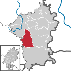
Bad König
- town in Odenwaldkreis in Hesse, Germany
Hiking in Bad König
Bad König, located in the Odenwald region of Germany, is a picturesque destination for hiking enthusiasts. The area is renowned for its lush forests, rolling hills, and scenic landscapes, making it a great spot for outdoor activities....
- Country:
- Postal Code: 64732
- Local Dialing Code: 06063
- Licence Plate Code: ERB
- Coordinates: 49° 44' 28" N, 9° 0' 25" E
- GPS tracks (wikiloc): [Link]
- AboveSeaLevel: 187 м m
- Area: 46.73 sq km
- Population: 9760
- Web site: [Link]

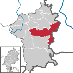
Michelstadt
- town in Odenwaldkreis in Hesse, Germany
Hiking in Michelstadt
Michelstadt is a picturesque town located in the Odenwald region of Germany, known for its beautiful landscapes, charming medieval architecture, and rich natural surroundings. Hiking in and around Michelstadt offers a variety of trails that cater to different skill levels, making it an excellent destination for outdoor enthusiasts....
- Country:
- Postal Code: 64720
- Local Dialing Code: 09372; 06066; 06061
- Licence Plate Code: ERB
- Coordinates: 49° 40' 43" N, 9° 0' 15" E
- GPS tracks (wikiloc): [Link]
- AboveSeaLevel: 206 м m
- Area: 86.97 sq km
- Population: 16642
- Web site: [Link]


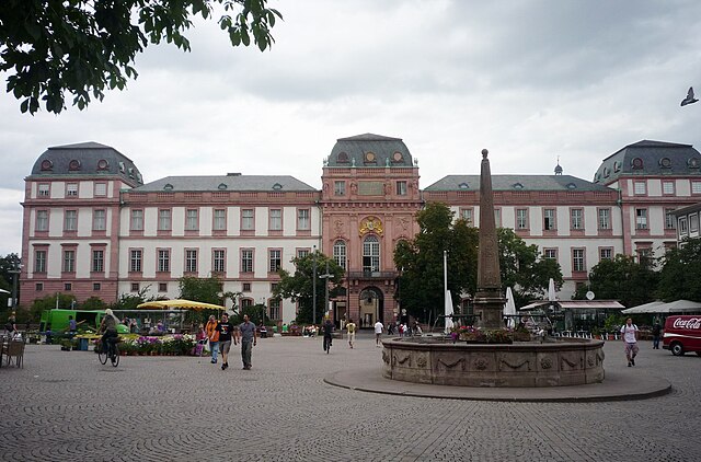
Erbach
- seat of Odenwaldkreis and town in Hesse, Germany
Hiking in Erbach
Erbach im Odenwald is a charming town situated in the Odenwald region of Germany, known for its scenic landscapes, lush forests, and rich history. Hiking in and around Erbach offers a wonderful opportunity to explore nature, as well as cultural sites....
- Country:
- Postal Code: 64711
- Local Dialing Code: 06062
- Licence Plate Code: ERB
- Coordinates: 49° 39' 25" N, 8° 59' 35" E
- GPS tracks (wikiloc): [Link]
- AboveSeaLevel: 250 м m
- Area: 62.67 sq km
- Population: 13630
- Web site: [Link]


Breuberg
- town in Odenwaldkreis in Hesse, Germany
Hiking in Breuberg
Breuberg is a picturesque area located in Hessen, Germany, known for its stunning landscapes and rich history. Hiking in Breuberg offers a combination of beautiful natural scenery, historical sites, and well-maintained trails. Here are some highlights to consider when planning hikes in the Breuberg region:...
- Country:
- Postal Code: 64747
- Local Dialing Code: 06165; 06163
- Licence Plate Code: ERB
- Coordinates: 49° 49' 8" N, 9° 1' 5" E
- GPS tracks (wikiloc): [Link]
- AboveSeaLevel: 152 м m
- Area: 30.76 sq km
- Population: 7387
- Web site: [Link]
Mossautal
- municipality in Odenwaldkreis in Hesse, Germany
Hiking in Mossautal
Mossautal, located in the Odenwald region of Germany, is a fantastic destination for hiking enthusiasts. The area is known for its beautiful landscapes, dense forests, and tranquil surroundings. Here are some key points to consider when hiking in Mossautal:...
- Country:
- Postal Code: 64756
- Local Dialing Code: 06062; 06061
- Licence Plate Code: ERB
- Coordinates: 49° 38' 41" N, 8° 55' 54" E
- GPS tracks (wikiloc): [Link]
- AboveSeaLevel: 327 м m
- Area: 48.50 sq km
- Population: 2419
- Web site: [Link]

Fränkisch-Crumbach
- municipality in Odenwaldkreis in Hesse, Germany
Hiking in Fränkisch-Crumbach
Fränkisch-Crumbach is a picturesque village located in the Odenwald region of Germany, which is known for its beautiful landscapes, rolling hills, and dense forests. Hiking in this area is a fantastic way to explore its natural beauty and enjoy outdoor activities....
- Country:
- Postal Code: 64407
- Local Dialing Code: 06164
- Licence Plate Code: ERB
- Coordinates: 49° 44' 46" N, 8° 51' 31" E
- GPS tracks (wikiloc): [Link]
- AboveSeaLevel: 187 м m
- Area: 16.1 sq km
- Population: 3150
- Web site: [Link]
Lützelbach
- municipality in Odenwaldkreis in Hesse, Germany
Hiking in Lützelbach
Lützelbach is a small town in Hesse, Germany, known for its scenic landscapes and opportunities for outdoor activities, including hiking. The region around Lützelbach features a mix of forests, hills, and valleys, offering a variety of trails for hikers of different skill levels....
- Country:
- Postal Code: 64750
- Local Dialing Code: 09372; 06165; 06066
- Licence Plate Code: ERB
- Coordinates: 49° 47' 17" N, 9° 4' 36" E
- GPS tracks (wikiloc): [Link]
- AboveSeaLevel: 248 м m
- Area: 35.46 sq km
- Population: 6873
- Web site: [Link]


Brombachtal
- municipality in Odenwaldkreis in Hesse, Germany
Hiking in Brombachtal
Brombachtal, a picturesque municipality in Germany's Hesse region, offers a variety of hiking opportunities for both beginners and experienced trekkers. Nestled in the scenic Odenwald Mountains, the area is characterized by lush forests, rolling hills, and charming villages, making it a perfect destination for nature lovers....
- Country:
- Postal Code: 64753
- Local Dialing Code: 06063
- Licence Plate Code: ERB
- Coordinates: 49° 43' 56" N, 8° 57' 26" E
- GPS tracks (wikiloc): [Link]
- AboveSeaLevel: 289 м m
- Area: 20.44 sq km
- Population: 3487
- Web site: [Link]


Höchst im Odenwald
- municipality in Odenwaldkreis in Hesse, Germany
Hiking in Höchst im Odenwald
Höchst im Odenwald is a charming town located in the Odenwald region of Hesse, Germany. This area is known for its picturesque landscapes, dense forests, and rolling hills, making it a fantastic destination for hiking enthusiasts. Here are some key points to consider when hiking in this region:...
- Country:
- Postal Code: 64739
- Local Dialing Code: 06163
- Licence Plate Code: ERB
- Coordinates: 49° 47' 57" N, 8° 59' 39" E
- GPS tracks (wikiloc): [Link]
- AboveSeaLevel: 177 м m
- Area: 30.51 sq km
- Population: 10102
- Web site: [Link]


Brensbach
- municipality in Odenwaldkreis in Hesse, Germany
Hiking in Brensbach
Brensbach is a lovely area located in the Odenwald region of Germany, known for its picturesque landscapes, dense forests, and rolling hills, making it a great destination for hiking enthusiasts. Here are some aspects to consider when hiking in Brensbach:...
- Country:
- Postal Code: 64395
- Local Dialing Code: 06161
- Licence Plate Code: ERB
- Coordinates: 49° 46' 26" N, 8° 53' 4" E
- GPS tracks (wikiloc): [Link]
- AboveSeaLevel: 187 м m
- Area: 23.18 sq km
- Population: 5012
- Web site: [Link]


Reichelsheim
- municipality in Odenwaldkreis in Hesse, Germany
Hiking in Reichelsheim
Reichelsheim, located in the Odenwald region of Germany, offers beautiful hiking opportunities characterized by picturesque landscapes, lush forests, and charming villages. The Odenwald is known for its rolling hills, diverse flora, and rich history, making it an attractive destination for outdoor enthusiasts....
- Country:
- Postal Code: 64385
- Local Dialing Code: 06164
- Licence Plate Code: ERB
- Coordinates: 49° 42' 53" N, 8° 50' 22" E
- GPS tracks (wikiloc): [Link]
- AboveSeaLevel: 211 м m
- Area: 58.21 sq km
- Population: 8550
- Web site: [Link]
Shares border with regions:


Miltenberg
- district in Bavaria, Germany
Hiking in Miltenberg
Miltenberg, located in the Bavaria region of Germany, is a charming town nestled along the Main River and surrounded by picturesque landscapes, making it an excellent destination for hiking enthusiasts. Here are some highlights about hiking in the Miltenberg district:...
- Country:
- Capital: Miltenberg
- Licence Plate Code: MIL
- Coordinates: 49° 45' 0" N, 9° 15' 0" E
- GPS tracks (wikiloc): [Link]
- AboveSeaLevel: 224 м m
- Area: 716.00 sq km
- Population: 114255
- Web site: [Link]

Darmstadt-Dieburg
- district in Hesse, Germany
Hiking in Darmstadt-Dieburg
Darmstadt-Dieburg is a lovely region in Hesse, Germany, known for its scenic landscapes, rich history, and a number of excellent hiking trails. Here are some highlights and tips for hiking in this area:...
- Country:
- Capital: Darmstadt
- Licence Plate Code: DI; DA
- Coordinates: 49° 53' 54" N, 8° 40' 32" E
- GPS tracks (wikiloc): [Link]
- AboveSeaLevel: 203 м m
- Area: 658.51 sq km
- Population: 284413
- Web site: [Link]


Kreis Bergstraße
- district in Hesse, Germany
Hiking in Kreis Bergstraße
Bergstraße is a scenic district located in Hesse, Germany, known for its lush landscapes, vineyards, and rolling hills, making it an excellent destination for hiking enthusiasts. The area is rich in natural beauty and offers a variety of trails that cater to different skill levels, from leisurely walks to more challenging hikes....
- Country:
- Capital: Heppenheim
- Licence Plate Code: HP
- Coordinates: 49° 38' 27" N, 8° 38' 40" E
- GPS tracks (wikiloc): [Link]
- AboveSeaLevel: 252 м m
- Area: 719.54 sq km
- Population: 261695
- Web site: [Link]


Neckar-Odenwald
- district of Baden-Württemberg, Germany
Hiking in Neckar-Odenwald
Neckar-Odenwald-Kreis, located in the state of Baden-Württemberg, Germany, is a fantastic destination for hiking enthusiasts. The region is characterized by its scenic landscapes, which include dense forests, rolling hills, and the beautiful Neckar River valley. Here are some key points to know about hiking in this area:...
- Country:
- Capital: Mosbach
- Licence Plate Code: MOS
- Coordinates: 49° 29' 0" N, 9° 17' 0" E
- GPS tracks (wikiloc): [Link]
- AboveSeaLevel: 416 м m
- Area: 1126.29 sq km
- Population: 141847
- Web site: [Link]


Rhein-Neckar
- district of Naden-Württemberg, Germany
Hiking in Rhein-Neckar
The Rhein-Neckar-Kreis, located in the southwest of Germany, is a fantastic destination for hiking enthusiasts. It's part of the larger Rhein-Neckar Metropolitan Region and boasts diverse landscapes, including rolling hills, dense forests, vineyards, and picturesque villages. Here are some highlights and considerations for hiking in the area:...
- Country:
- Capital: Heidelberg
- Licence Plate Code: HD
- Coordinates: 49° 22' 0" N, 8° 44' 0" E
- GPS tracks (wikiloc): [Link]
- AboveSeaLevel: 390 м m
- Web site: [Link]