Dirol (Dirol)

- commune in Nièvre, France
- Country:

- Postal Code: 58190
- Coordinates: 47° 18' 59" N, 3° 39' 14" E


- GPS tracks (wikiloc): [Link]
- Area: 9.48 sq km
- Population: 118
- Wikipedia en: wiki(en)
- Wikipedia: wiki(fr)
- Wikidata storage: Wikidata: Q739226
- Wikipedia Commons Category: [Link]
- Freebase ID: [/m/03qfcl1]
- GeoNames ID: Alt: [6450019]
- SIREN number: [215800988]
- BnF ID: [15266363m]
- INSEE municipality code: 58098
Shares border with regions:

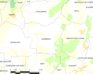
Germenay
- commune in Nièvre, France
- Country:
- Postal Code: 58800
- Coordinates: 47° 16' 56" N, 3° 35' 45" E
- GPS tracks (wikiloc): [Link]
- Area: 12.91 sq km
- Population: 141


Monceaux-le-Comte
- commune in Nièvre, France
- Country:
- Postal Code: 58190
- Coordinates: 47° 19' 45" N, 3° 39' 41" E
- GPS tracks (wikiloc): [Link]
- Area: 3.28 sq km
- Population: 125
Flez-Cuzy
- commune in Nièvre, France
- Country:
- Postal Code: 58190
- Coordinates: 47° 21' 48" N, 3° 37' 23" E
- GPS tracks (wikiloc): [Link]
- AboveSeaLevel: 168 м m
- Area: 5.92 sq km
- Population: 132

Vignol
- commune in Nièvre, France
- Country:
- Postal Code: 58190
- Coordinates: 47° 21' 44" N, 3° 40' 21" E
- GPS tracks (wikiloc): [Link]
- Area: 8.97 sq km
- Population: 65
Saint-Didier
- commune in Nièvre, France
- Country:
- Postal Code: 58190
- Coordinates: 47° 20' 57" N, 3° 37' 16" E
- GPS tracks (wikiloc): [Link]
- Area: 3.51 sq km
- Population: 29

Ruages
- commune in Nièvre, France
- Country:
- Postal Code: 58190
- Coordinates: 47° 19' 0" N, 3° 40' 59" E
- GPS tracks (wikiloc): [Link]
- Area: 10.3 sq km
- Population: 100


Lys
- commune in Nièvre, France
- Country:
- Postal Code: 58190
- Coordinates: 47° 20' 51" N, 3° 36' 2" E
- GPS tracks (wikiloc): [Link]
- Area: 10.67 sq km
- Population: 106

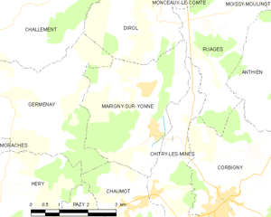
Marigny-sur-Yonne
- commune in Nièvre, France
- Country:
- Postal Code: 58800
- Coordinates: 47° 16' 51" N, 3° 39' 4" E
- GPS tracks (wikiloc): [Link]
- Area: 11.1 sq km
- Population: 200


Challement
- commune in Nièvre, France
- Country:
- Postal Code: 58420
- Coordinates: 47° 18' 53" N, 3° 35' 16" E
- GPS tracks (wikiloc): [Link]
- Area: 9.52 sq km
- Population: 62