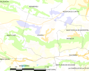
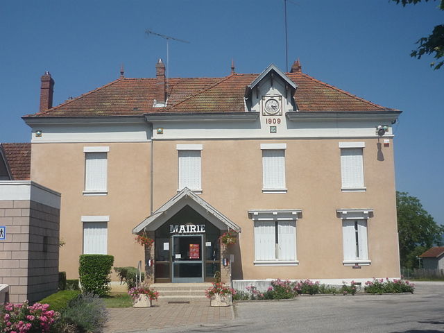
Dolomieu (Dolomieu)

- commune in Isère, France
 Hiking in Dolomieu
Hiking in Dolomieu, Isère can be a wonderful experience, offering stunning landscapes and diverse trails. While Dolomieu is a small town, it is surrounded by natural beauty and is close to the Vercors and Chartreuse mountain ranges, which provide a variety of hiking opportunities.
Key Highlights of Hiking in Dolomieu:
-
Natural Scenery: The region is characterized by beautiful limestone cliffs, rolling hills, and lush forests. You’ll have the chance to enjoy picturesque views and encounter local flora and fauna.
-
Trail Variety: There are trails suitable for hikers of all levels, from easy walks that are family-friendly to more challenging routes for experienced hikers. Trails may lead through valleys, to mountain passes, and alongside rivers.
-
Proximity to Reserves: Dolomieu serves as a great base for exploring nearby natural parks and reserves, including the Vercors Regional Natural Park, which boasts extensive hiking trails, rich biodiversity, and breathtaking scenery.
-
Local Attractions: While hiking, you can also explore local cultural attractions, including charming villages, historical sites, and traditional cuisine in the region.
-
Wildlife: The area is home to diverse wildlife, so keep an eye out for various species of birds, deer, and other animals as you hike.
Tips for Hiking in Dolomieu:
-
Weather Preparedness: The weather can change rapidly in the mountains, so check conditions and dress in layers. Bring rain gear and a good pair of hiking boots.
-
Hydration and Snacks: Carry enough water and snacks, especially on longer hikes, as some trails may be remote.
-
Maps and Navigation: Use a reliable map or GPS device, as well-maintained signage might not be available on all trails.
-
Local Regulations: Always respect local wildlife and plant life. Follow the "Leave No Trace" principles to minimize your impact on the environment.
-
Safety First: If you’re venturing into remote areas, consider hiking with a partner or group, especially if you’re not familiar with the terrain.
Conclusion:
Hiking around Dolomieu offers an excellent opportunity to immerse yourself in the natural beauty of the Isère region, whether you're looking for a leisurely stroll or a challenging trek. It's advisable to do some research on specific trails and conditions before heading out and to always prioritize safety while enjoying the great outdoors!
- Country:

- Postal Code: 38110
- Coordinates: 45° 36' 39" N, 5° 29' 57" E


- GPS tracks (wikiloc): [Link]
- Area: 13.32 sq km
- Population: 3079
- Web site: http://www.dolomieu.fr
- Wikipedia en: wiki(en)
- Wikipedia: wiki(fr)
- Wikidata storage: Wikidata: Q1092573
- Wikipedia Commons Category: [Link]
- Freebase ID: [/m/03nvhrd]
- GeoNames ID: Alt: [6433189]
- SIREN number: [213801483]
- BnF ID: [15257970k]
- VIAF ID: Alt: [144023329]
- INSEE municipality code: 38148
Shares border with regions:


La Chapelle-de-la-Tour
- commune in Isère, France
Hiking in La Chapelle-de-la-Tour
La Chapelle-de-la-Tour is a charming commune located in the Isère department in the Auvergne-Rhône-Alpes region of southeastern France. The area is known for its beautiful landscapes, making it an excellent spot for hiking enthusiasts. Here are some highlights to consider when hiking in and around La Chapelle-de-la-Tour:...
- Country:
- Postal Code: 38110
- Coordinates: 45° 35' 7" N, 5° 27' 47" E
- GPS tracks (wikiloc): [Link]
- Area: 9.04 sq km
- Population: 1757
- Web site: [Link]


Vasselin
- commune in Isère, France
Hiking in Vasselin
Vasselin, a picturesque region in France, offers a variety of hiking opportunities for outdoor enthusiasts. While it's relatively lesser-known compared to some popular hiking destinations, its serene landscapes make it a hidden gem for nature lovers....
- Country:
- Postal Code: 38890
- Coordinates: 45° 37' 51" N, 5° 27' 15" E
- GPS tracks (wikiloc): [Link]
- Area: 3.85 sq km
- Population: 468
- Web site: [Link]

Vignieu
- commune in Isère, France
Hiking in Vignieu
Vignieu is a charming commune located in the Isère department in the Auvergne-Rhône-Alpes region of southeastern France. While it might not be as well-known as some other hiking destinations in France, it offers picturesque landscapes and a range of outdoor activities that can cater to hikers of various skill levels....
- Country:
- Postal Code: 38890
- Coordinates: 45° 37' 41" N, 5° 25' 29" E
- GPS tracks (wikiloc): [Link]
- Area: 9.4 sq km
- Population: 1033
- Web site: [Link]

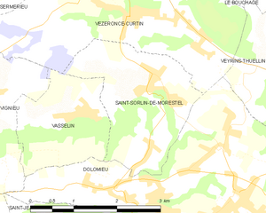
Saint-Sorlin-de-Morestel
- commune in Isère, France
Hiking in Saint-Sorlin-de-Morestel
Saint-Sorlin-de-Morestel is a charming commune located in the Auvergne-Rhône-Alpes region of France. It's known for its picturesque landscapes and a variety of outdoor activities, including hiking. Here are some details about hiking in and around this area:...
- Country:
- Postal Code: 38510
- Coordinates: 45° 38' 14" N, 5° 28' 36" E
- GPS tracks (wikiloc): [Link]
- Area: 5.38 sq km
- Population: 618
- Web site: [Link]


Faverges-de-la-Tour
- commune in Isère, France
Hiking in Faverges-de-la-Tour
Faverges-de-la-Tour, located in the Isère department in the Auvergne-Rhône-Alpes region of France, offers a range of hiking opportunities that showcase the natural beauty of the surrounding area. The region is characterized by its picturesque landscapes, including hills, woodlands, and stunning views of the nearby mountains....
- Country:
- Postal Code: 38110
- Coordinates: 45° 35' 28" N, 5° 31' 25" E
- GPS tracks (wikiloc): [Link]
- Area: 7.67 sq km
- Population: 1330
- Web site: [Link]


Corbelin
- commune in Isère, France
Hiking in Corbelin
Corbelin is a charming village located in the Auvergne-Rhône-Alpes region of France, and it offers a variety of outdoor activities, including hiking. The area is known for its scenic landscapes, wooded hills, and proximity to natural reserves, making it an ideal spot for those who enjoy immersing themselves in nature....
- Country:
- Postal Code: 38630
- Coordinates: 45° 36' 27" N, 5° 32' 41" E
- GPS tracks (wikiloc): [Link]
- Area: 12 sq km
- Population: 2223
- Web site: [Link]


Saint-Jean-de-Soudain
- commune in Isère, France
Hiking in Saint-Jean-de-Soudain
Saint-Jean-de-Soudain is a picturesque village located in the Isère department of the Auvergne-Rhône-Alpes region in southeastern France. It's an excellent base for hikers looking to explore the natural landscapes and mountainous terrain nearby....
- Country:
- Postal Code: 38110
- Coordinates: 45° 34' 21" N, 5° 25' 44" E
- GPS tracks (wikiloc): [Link]
- Area: 7.48 sq km
- Population: 1572
- Web site: [Link]

Vézeronce-Curtin
- commune in Isère, France
Hiking in Vézeronce-Curtin
Vézeronce-Curtin is a charming village located in the Auvergne-Rhône-Alpes region of France, known for its scenic landscapes and proximity to the beautiful natural areas surrounding it, including the Isère river valley. Here are some details about hiking in and around Vézeronce-Curtin:...
- Country:
- Postal Code: 38510
- Coordinates: 45° 39' 2" N, 5° 28' 14" E
- GPS tracks (wikiloc): [Link]
- AboveSeaLevel: 220 м m
- Area: 14.37 sq km
- Population: 2065
- Web site: [Link]

Veyrins-Thuellin
- former commune in Isère, France
Hiking in Veyrins-Thuellin
Veyrins-Thuellin is a picturesque commune located in the Auvergne-Rhône-Alpes region of France. It offers several opportunities for hiking enthusiasts to enjoy the beautiful natural landscapes, rolling hills, and scenic views of the nearby mountains, particularly the Chartreuse and the Massif de Belledonne....
- Country:
- Postal Code: 38630
- Coordinates: 45° 37' 32" N, 5° 32' 21" E
- GPS tracks (wikiloc): [Link]
- AboveSeaLevel: 235 м m
- Area: 11.56 sq km
- Population: 2060
- Web site: [Link]