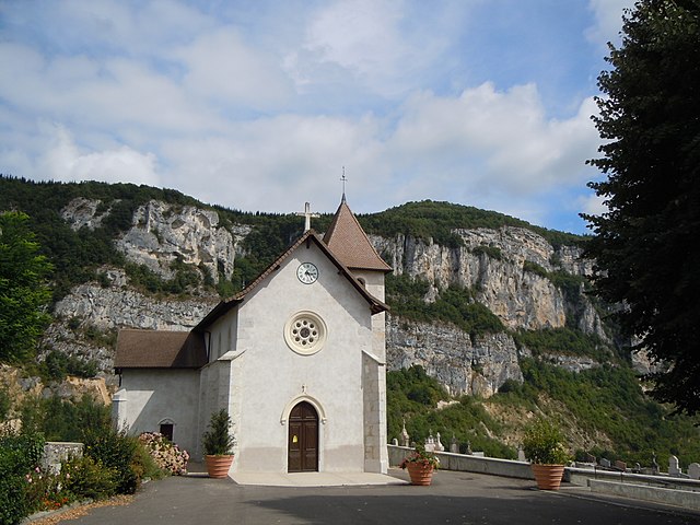
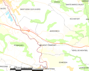
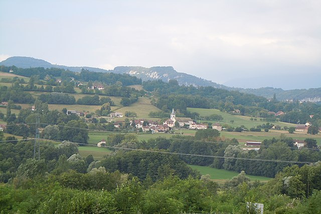
Verel-de-Montbel (Verel-de-Montbel)

- commune in Savoie, France
 Hiking in Verel-de-Montbel
Verel-de-Montbel is a charming commune located in the Auvergne-Rhône-Alpes region of France, nestled at the edge of the Chartreuse Mountains. Hiking in this area offers a wonderful opportunity to explore scenic landscapes, diverse flora, and panoramic views of the surrounding mountains and lakes.
Popular Hiking Trails
-
Montbel Lake: This area surrounding Montbel Lake is popular for leisurely hikes. There are marked trails that allow you to enjoy the serene beauty of the lake, forests, and wildlife. The trails here are suitable for families and provide a good mix of easy to moderate hikes.
-
Chartreuse Mountains: Venture into the Chartreuse Mountains for more challenging hikes. There are numerous trails that lead to breathtaking viewpoints and alpine scenery. The Croix de Chartreuse is a popular hike offering stunning views, but make sure to check the trail conditions and difficulty level before heading out.
-
Historical Trails: Some trails in the region may take you by historical sites, such as ancient monasteries or ruins, offering both a hike and a glimpse into the history of the area.
Tips for Hiking in Verel-de-Montbel
-
Check the Weather: Mountain weather can change rapidly, so it’s important to check the forecast and dress in layers.
-
Stay Hydrated: Always carry enough water, especially on longer hikes.
-
Trail Markings: Many trails in the region are well-marked, but it’s always a good idea to have a map or a navigation app just in case.
-
Footwear: Wear sturdy hiking boots or shoes with good traction, as some trails can be rocky or uneven.
-
Wildlife: Be aware of the local wildlife and practice responsible hiking by not feeding animals and keeping a respectful distance.
Accessibility
Most hiking trails around Verel-de-Montbel are accessible throughout the spring, summer, and early autumn months. However, winter hiking can be possible with specialized gear. Always ensure you are following local guidelines and conditions.
Local Resources
Consider stopping by a local tourist office to pick up maps, trail guides, and get recommendations for current trails and conditions, as well as any local events or guided hikes that may be happening during your visit.
Overall, hiking in Verel-de-Montbel can be a delightful way to connect with nature and experience the natural beauty of the Auvergne-Rhône-Alpes region!
- Country:

- Postal Code: 73330
- Coordinates: 45° 33' 33" N, 5° 43' 49" E


- GPS tracks (wikiloc): [Link]
- Area: 3.74 sq km
- Population: 299
- Wikipedia en: wiki(en)
- Wikipedia: wiki(fr)
- Wikidata storage: Wikidata: Q640017
- Wikipedia Commons Gallery: [Link]
- Wikipedia Commons Category: [Link]
- Freebase ID: [/m/03npgxj]
- Freebase ID: [/m/03npgxj]
- GeoNames ID: Alt: [6614328]
- GeoNames ID: Alt: [6614328]
- SIREN number: [217303098]
- SIREN number: [217303098]
- BnF ID: [152742396]
- BnF ID: [152742396]
- INSEE municipality code: 73309
- INSEE municipality code: 73309
Shares border with regions:


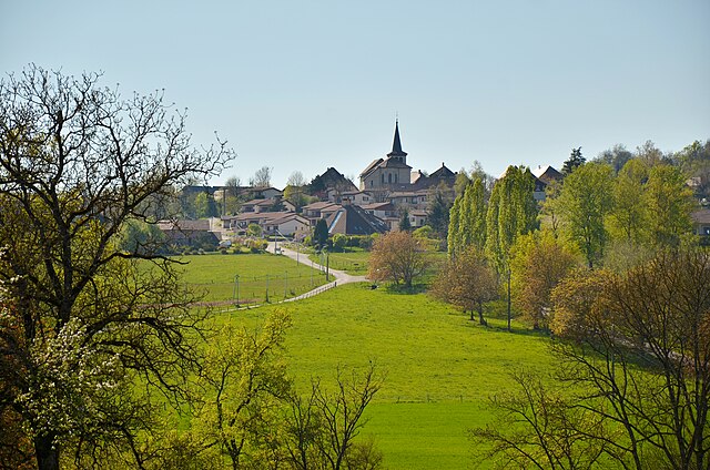
Domessin
- commune in Savoie, France
Hiking in Domessin
Domessin is a quaint commune located in the Savoie department in the Auvergne-Rhône-Alpes region of southeastern France. Nestled at the foot of the Chartreuse Mountains, this area offers a variety of hiking opportunities that cater to different skill levels....
- Country:
- Postal Code: 73330
- Coordinates: 45° 32' 25" N, 5° 42' 33" E
- GPS tracks (wikiloc): [Link]
- Area: 9.83 sq km
- Population: 1839
- Web site: [Link]

Rochefort
- commune in Savoie, France
Hiking in Rochefort
Rochefort is a charming village located in the Savoie region of the French Alps, which is known for its stunning alpine scenery, beautiful landscapes, and fantastic hiking opportunities. Here are some highlights and tips for hiking in and around Rochefort:...
- Country:
- Postal Code: 73240
- Coordinates: 45° 34' 56" N, 5° 43' 20" E
- GPS tracks (wikiloc): [Link]
- Area: 5.6 sq km
- Population: 216

Belmont-Tramonet
- commune in Savoie, France
Hiking in Belmont-Tramonet
Belmont-Tramonet is a picturesque municipality located in the Savoie region of France, nestled in the French Alps. It offers stunning views and a variety of hiking opportunities, making it a great destination for outdoor enthusiasts....
- Country:
- Postal Code: 73330
- Coordinates: 45° 33' 34" N, 5° 40' 46" E
- GPS tracks (wikiloc): [Link]
- Area: 5.46 sq km
- Population: 561

Avressieux
- commune in Savoie, France
Hiking in Avressieux
Avressieux is a charming village located in the Auvergne-Rhône-Alpes region of France, in the department of Savoie. It is situated at the edge of beautiful natural landscapes, making it an appealing destination for hiking enthusiasts....
- Country:
- Postal Code: 73240
- Coordinates: 45° 34' 20" N, 5° 41' 41" E
- GPS tracks (wikiloc): [Link]
- Area: 8.07 sq km
- Population: 517


Ayn, Savoie
- commune in Savoie, France
Hiking in Ayn, Savoie
Ayn, located in the Savoie department of the Auvergne-Rhône-Alpes region in France, is surrounded by stunning natural beauty, making it an excellent destination for hiking enthusiasts. Here are some key points about hiking in and around Ayn:...
- Country:
- Postal Code: 73470
- Coordinates: 45° 34' 21" N, 5° 45' 3" E
- GPS tracks (wikiloc): [Link]
- Area: 7.44 sq km
- Population: 359


La Bridoire
- commune in Savoie, France
Hiking in La Bridoire
La Bridoire is a charming commune located in the Savoie department of the Auvergne-Rhône-Alpes region in southeastern France. It is set in a scenic area that offers a variety of hiking opportunities amidst beautiful landscapes....
- Country:
- Postal Code: 73520
- Coordinates: 45° 31' 34" N, 5° 44' 33" E
- GPS tracks (wikiloc): [Link]
- Area: 6.18 sq km
- Population: 1238

Dullin
- commune in Savoie, France
Hiking in Dullin
Dullin, located in the Auvergne-Rhône-Alpes region of France, is a great destination for hiking enthusiasts. The area offers a variety of trails that cater to different skill levels, from gentle walks through picturesque landscapes to more challenging hikes that provide stunning views of the surrounding Alps....
- Country:
- Postal Code: 73610
- Coordinates: 45° 33' 14" N, 5° 44' 41" E
- GPS tracks (wikiloc): [Link]
- Area: 5.31 sq km
- Population: 409