Emberménil (Emberménil)

- commune in Meurthe-et-Moselle, France
- Country:

- Postal Code: 54370
- Coordinates: 48° 37' 45" N, 6° 41' 45" E


- GPS tracks (wikiloc): [Link]
- Area: 14.39 sq km
- Population: 263
- Wikipedia en: wiki(en)
- Wikipedia: wiki(fr)
- Wikidata storage: Wikidata: Q1385244
- Wikipedia Commons Category: [Link]
- Freebase ID: [/m/03qdgsk]
- Freebase ID: [/m/03qdgsk]
- GeoNames ID: Alt: [6436588]
- GeoNames ID: Alt: [6436588]
- SIREN number: [215401779]
- SIREN number: [215401779]
- BnF ID: [152642468]
- BnF ID: [152642468]
- INSEE municipality code: 54177
- INSEE municipality code: 54177
Shares border with regions:


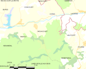
Vaucourt
- commune in Meurthe-et-Moselle, France
- Country:
- Postal Code: 54370
- Coordinates: 48° 40' 10" N, 6° 41' 33" E
- GPS tracks (wikiloc): [Link]
- Area: 6.29 sq km
- Population: 69


Vého
- commune in Meurthe-et-Moselle, France
- Country:
- Postal Code: 54450
- Coordinates: 48° 35' 48" N, 6° 42' 39" E
- GPS tracks (wikiloc): [Link]
- Area: 7.74 sq km
- Population: 97


Laneuveville-aux-Bois
- commune in Meurthe-et-Moselle, France
- Country:
- Postal Code: 54370
- Coordinates: 48° 36' 41" N, 6° 39' 0" E
- GPS tracks (wikiloc): [Link]
- Area: 19.04 sq km
- Population: 314


Xousse
- commune in Meurthe-et-Moselle, France
- Country:
- Postal Code: 54370
- Coordinates: 48° 39' 25" N, 6° 42' 35" E
- GPS tracks (wikiloc): [Link]
- Area: 6.13 sq km
- Population: 124


Lagarde
- commune in Moselle, France
- Country:
- Postal Code: 57810
- Coordinates: 48° 41' 29" N, 6° 42' 18" E
- GPS tracks (wikiloc): [Link]
- Area: 22.26 sq km
- Population: 186


Leintrey
- commune in Meurthe-et-Moselle, France
- Country:
- Postal Code: 54450
- Coordinates: 48° 37' 25" N, 6° 44' 16" E
- GPS tracks (wikiloc): [Link]
- Area: 15.44 sq km
- Population: 136

Mouacourt
- commune in Meurthe-et-Moselle, France
- Country:
- Postal Code: 54370
- Coordinates: 48° 40' 41" N, 6° 37' 36" E
- GPS tracks (wikiloc): [Link]
- Area: 8.5 sq km
- Population: 72


Xures
- commune in Meurthe-et-Moselle, France
- Country:
- Postal Code: 54370
- Coordinates: 48° 41' 22" N, 6° 39' 22" E
- GPS tracks (wikiloc): [Link]
- Area: 6.98 sq km
- Population: 115