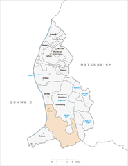
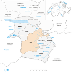
Fläsch (Fläsch)

- municipality in the district of Landquart in the Swiss canton of Graubünden
 Hiking in Fläsch
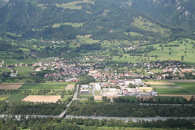
Fläsch is a charming village located in the Bündner Herrschaft region of Switzerland, known for its stunning natural landscapes and excellent hiking opportunities. The area around Fläsch features a mix of vineyards, forests, and panoramic mountain views, making it an ideal destination for both casual walkers and experienced hikers.
Hiking Trails in Fläsch
Here are some popular hiking routes around Fläsch:
-
Fläsch to Malans: This is a relatively easy trail that takes you through picturesque vineyards and offers spectacular views of the Rhine Valley. The trail is well-marked and suitable for families.
-
Gondola Hike to the Grüsch-Danusa Area: You can take a gondola ride from the nearby town of Grüsch to reach higher altitudes. From there, several hiking trails lead into stunning landscapes with breathtaking views of the surrounding mountains.
-
The Wine Trail: Fläsch is situated in the heart of wine country. This trail offers an opportunity to explore the local vineyards and learn about wine production while enjoying beautiful scenic vistas.
-
Hiking through the Rhine Gorge (Grand Canyon of Switzerland): A bit further away from Fläsch, the Rhine Gorge offers more challenging hikes with spectacular rock formations and river views. It's a great day trip if you're looking for more adventurous hiking.
Tips for Hiking in Fläsch
-
Equipment: Depending on the season, be sure to wear appropriate hiking boots and clothing. Consider bringing trekking poles, especially if hiking in more challenging terrain.
-
Weather: Always check the weather conditions before heading out, as the weather in the mountainous areas can change rapidly.
-
Local Guidance: You can also consider joining a guided hike or local tour to learn more about the flora, fauna, and history of the area.
-
Hydration and Snacks: Carry enough water and snacks, especially if you plan on spending a longer time hiking.
-
Respect Nature: Follow the Leave No Trace principles to help preserve the natural beauty of the area.
Overall, hiking in Fläsch provides a wonderful way to explore the Swiss countryside, enjoy nature, and experience the local culture.
- Country:

- Postal Code: 7306
- Local Dialing Code: 081
- Licence Plate Code: GR
- Coordinates: 47° 2' 23" N, 9° 31' 59" E


- GPS tracks (wikiloc): [Link]
- AboveSeaLevel: 528 м m
- Area: 19.94 sq km
- Population: 774
- Web site: http://www.flaesch.ch
- Wikipedia en: wiki(en)
- Wikipedia: wiki(de)
- Wikidata storage: Wikidata: Q65386
- Wikipedia Commons Category: [Link]
- Freebase ID: [/m/026f7w8]
- GeoNames ID: Alt: [2660763]
- VIAF ID: Alt: [236119383]
- OSM relation ID: [1684081]
- archINFORM location ID: [5956]
- HDS ID: [1604]
- Swiss municipality code: [3951]
Shares border with regions:

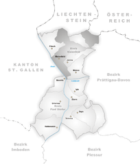
Triesen
- municipality of Liechtenstein
Hiking in Triesen
Triesen, a charming municipality located in Liechtenstein, offers some wonderful hiking opportunities for outdoor enthusiasts. Nestled in the Rhine Valley, surrounded by scenic landscapes and the backdrop of the Alps, Triesen presents a variety of hiking trails suitable for different skill levels....
- Country:

- Postal Code: 9495
- Local Dialing Code: 7002
- Coordinates: 47° 6' 0" N, 9° 31' 0" E
- GPS tracks (wikiloc): [Link]
- AboveSeaLevel: 512 м m
- Area: 26.4 sq km
- Web site: [Link]


Balzers
- municipality of Liechtenstein
Hiking in Balzers
Balzers is a beautiful municipality in Liechtenstein, known for its scenic landscapes, historic sites, and outdoor activities, including hiking. Situated in the Rhine Valley, Balzers offers a range of hiking trails suitable for all skill levels, from leisurely walks to more challenging hikes....
- Country:
- Postal Code: 9496
- Local Dialing Code: 7003
- Coordinates: 47° 4' 0" N, 9° 30' 0" E
- GPS tracks (wikiloc): [Link]
- AboveSeaLevel: 472 м m
- Area: 19.6 sq km
- Population: 4583
- Web site: [Link]
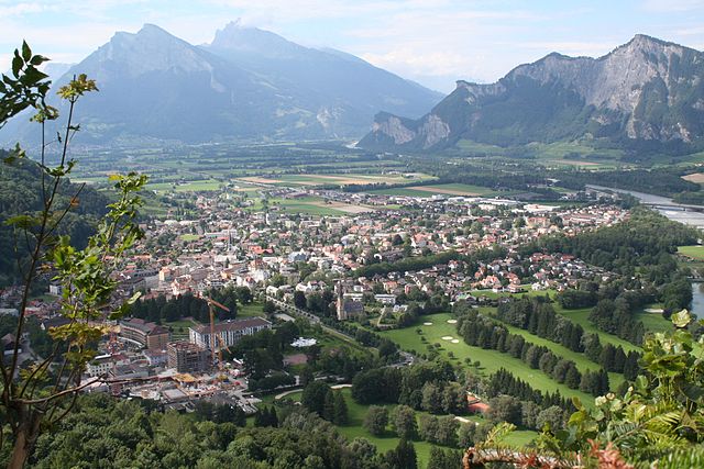
Maienfeld
- municipality in Switzerland
Hiking in Maienfeld
Maienfeld, located in the canton of Graubünden in Switzerland, is a picturesque village famous for its stunning landscapes and wine production, particularly its Bündner wine. The area offers a variety of hiking trails that cater to different skill levels, providing hikers with breathtaking views of the surrounding Alps, charming vineyards, and lush meadows....
- Country:
- Postal Code: 7304
- Local Dialing Code: 081
- Licence Plate Code: GR
- Coordinates: 47° 0' 28" N, 9° 31' 51" E
- GPS tracks (wikiloc): [Link]
- AboveSeaLevel: 1469 м m
- Area: 32.33 sq km
- Population: 2860
- Web site: [Link]


Sargans
- municipality in Switzerland
Hiking in Sargans
Sargans, located in the eastern part of Switzerland, offers a variety of beautiful hiking trails suitable for different skill levels, making it a great destination for outdoor enthusiasts. Nestled in the foothills of the Alps, Sargans provides stunning views of the surrounding mountains and valleys....
- Country:
- Postal Code: 7320
- Local Dialing Code: 081
- Licence Plate Code: SG
- Coordinates: 47° 2' 53" N, 9° 26' 23" E
- GPS tracks (wikiloc): [Link]
- AboveSeaLevel: 483 м m
- Area: 9.48 sq km
- Population: 6118
- Web site: [Link]

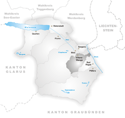
Vilters-Wangs
- municipality in Switzerland
Hiking in Vilters-Wangs
Vilters-Wangs is a beautiful municipality located in the canton of St. Gallen in Switzerland, offering stunning alpine scenery and a range of hiking opportunities. The region is characterized by its picturesque landscapes, lush valleys, and breathtaking mountain views, making it a great destination for hiking enthusiasts of all levels....
- Country:
- Postal Code: 7323
- Local Dialing Code: 081
- Licence Plate Code: SG
- Coordinates: 47° 1' 0" N, 9° 27' 0" E
- GPS tracks (wikiloc): [Link]
- AboveSeaLevel: 499 м m
- Area: 32.70 sq km
- Population: 4820
- Web site: [Link]

Mels
- municipality in Switzerland
Hiking in Mels
Mels is a picturesque village located in the canton of St. Gallen in Switzerland, surrounded by beautiful landscapes and accessible hiking trails. The area offers a variety of hiking routes suitable for different skill levels, from leisurely strolls to more challenging treks. Here are some highlights for hiking in Mels:...
- Country:
- Postal Code: 8887
- Local Dialing Code: 081
- Licence Plate Code: SG
- Coordinates: 47° 2' 59" N, 9° 25' 0" E
- GPS tracks (wikiloc): [Link]
- AboveSeaLevel: 1579 м m
- Area: 140.00 sq km
- Population: 8610
- Web site: [Link]

Bad Ragaz
- municipality in Switzerland
Hiking in Bad Ragaz
Bad Ragaz, located in the Swiss Rhine Valley near the foothills of the Alps, is a fantastic destination for hiking enthusiasts. Known for its thermal baths and wellness resorts, the area also offers beautiful landscapes and a variety of hiking trails suitable for different skill levels. Here are some highlights for hiking in Bad Ragaz:...
- Country:
- Postal Code: 7310
- Local Dialing Code: 081
- Licence Plate Code: SG
- Coordinates: 46° 59' 59" N, 9° 30' 0" E
- GPS tracks (wikiloc): [Link]
- AboveSeaLevel: 516 м m
- Area: 25.37 sq km
- Population: 5923
- Web site: [Link]