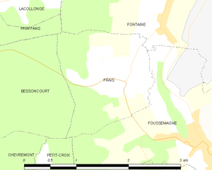
Foussemagne (Foussemagne)

- commune in Territoire de Belfort, France
 Hiking in Foussemagne
Foussemagne is a small commune in the Bourgogne-Franche-Comté region of eastern France. While it may not be as well-known as some larger hiking destinations, it offers charming landscapes and opportunities for those looking to explore the outdoors. Hiking in and around Foussemagne can provide a serene experience in nature, particularly for those seeking to enjoy the tranquility of rural France.
Key Highlights for Hiking in Foussemagne:
-
Scenic Landscapes: The area features rolling hills, forests, and fields, providing diverse scenery that changes with the seasons. It's a great spot for enjoying nature photography.
-
Local Trails: While specific marked trails may not be widely published, local paths and routes can often be found. Exploring through the woods and countryside trails can lead to beautiful vistas and quiet spots.
-
Wildlife Watching: The natural environment around Foussemagne is home to various wildlife. Birdwatching can be particularly rewarding, and you might spot deer or other woodland creatures.
-
Cultural Exploration: In addition to hiking, Foussemagne has historical sites and local culture that can be explored. Consider visiting nearby villages or historical sites to enhance your experience.
-
Accessibility: The region may not offer extensive hiking infrastructure, so being prepared with maps and a good sense of direction can be important.
Preparation Tips:
- Gear: Wear sturdy hiking shoes and weather-appropriate clothing.
- Maps: Use local maps or a GPS app to navigate trails, as well-marked paths may be limited.
- Hydration and Snacks: Carry enough water and snacks, especially if you plan to hike for several hours.
- Local Insights: Check with local tourism offices or hiking groups for recommendations on trails and safety tips.
Nearby Areas:
If you're looking for more established hiking options, consider exploring nearby nature reserves or national parks in the Bourgogne-Franche-Comté region, such as the Jura Mountains, which offer a variety of trails for all skill levels.
Overall, hiking in Foussemagne can provide a peaceful and intimate connection with nature, perfect for those looking to escape the hustle and bustle of city life.
- Country:

- Postal Code: 90150
- Coordinates: 47° 38' 3" N, 7° 0' 21" E


- GPS tracks (wikiloc): [Link]
- Area: 5.1 sq km
- Population: 916
- Web site: http://www.foussemagne.com
- Wikipedia en: wiki(en)
- Wikipedia: wiki(fr)
- Wikidata storage: Wikidata: Q835971
- Wikipedia Commons Category: [Link]
- Freebase ID: [/m/03mh9mg]
- Freebase ID: [/m/03mh9mg]
- Freebase ID: [/m/03mh9mg]
- GeoNames ID: Alt: [6451900]
- GeoNames ID: Alt: [6451900]
- GeoNames ID: Alt: [6451900]
- SIREN number: [219000494]
- SIREN number: [219000494]
- SIREN number: [219000494]
- BnF ID: [152799903]
- BnF ID: [152799903]
- BnF ID: [152799903]
- INSEE municipality code: 90049
- INSEE municipality code: 90049
- INSEE municipality code: 90049
Shares border with regions:


Montreux-Vieux
- commune in Haut-Rhin, France
Hiking in Montreux-Vieux
Montreux-Vieux, located in the Alsace region of France near the border with Switzerland, offers a beautiful natural setting ideal for hiking enthusiasts. Here are some key highlights about hiking in this area:...
- Country:
- Postal Code: 68210
- Coordinates: 47° 37' 11" N, 7° 1' 21" E
- GPS tracks (wikiloc): [Link]
- Area: 4.14 sq km
- Population: 885
- Web site: [Link]


Chavannes-sur-l'Étang
- commune in Haut-Rhin, France
Hiking in Chavannes-sur-l'Étang
Chavannes-sur-l'Étang is a lovely location for hiking enthusiasts situated in the beautiful region of Switzerland, known for its stunning landscapes and outdoor activities. Here are some key points to consider when planning a hike in this area:...
- Country:
- Postal Code: 68210
- Coordinates: 47° 37' 54" N, 7° 1' 28" E
- GPS tracks (wikiloc): [Link]
- Area: 6.04 sq km
- Population: 693

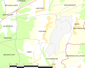
Frais
- commune in Territoire de Belfort, France
Hiking in Frais
Frais is a beautiful natural area located in the French region of Auvergne-Rhône-Alpes, specifically in the northern part of the Chartreuse Mountains. This area is less known to the general public, making it a fantastic destination for hikers looking for peace and stunning scenery....
- Country:
- Postal Code: 90150
- Coordinates: 47° 38' 48" N, 6° 59' 12" E
- GPS tracks (wikiloc): [Link]
- Area: 2.81 sq km
- Population: 212

Fontaine
- commune in Territoire de Belfort, France
Hiking in Fontaine
Fontaine, located in the Territoire de Belfort in the Bourgogne-Franche-Comté region of France, offers a picturesque backdrop for hiking enthusiasts. The area is characterized by its rolling landscapes, lush forests, and proximity to the Vosges Mountains and Jura region, making it an appealing destination for nature lovers....
- Country:
- Postal Code: 90150
- Coordinates: 47° 39' 34" N, 6° 59' 56" E
- GPS tracks (wikiloc): [Link]
- Area: 6.96 sq km
- Population: 611


Petit-Croix
- commune in Territoire de Belfort, France
Hiking in Petit-Croix
Petit-Croix is a picturesque location in the Vosges region of France, often favored by hikers for its beautiful landscapes and diverse trails. Here are some details about hiking in this area:...
- Country:
- Postal Code: 90130
- Coordinates: 47° 36' 49" N, 6° 58' 22" E
- GPS tracks (wikiloc): [Link]
- Area: 3.79 sq km
- Population: 298
- Web site: [Link]


Cunelières
- commune in Territoire de Belfort, France
Hiking in Cunelières
Cunelières is a lesser-known hiking destination that offers a mix of tranquility and stunning natural beauty. While specific trails may vary in difficulty and length, there are several general features to expect when hiking in this area....
- Country:
- Postal Code: 90150
- Coordinates: 47° 37' 33" N, 6° 59' 50" E
- GPS tracks (wikiloc): [Link]
- Area: 2.02 sq km
- Population: 338
- Web site: [Link]