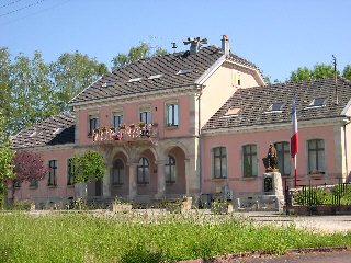
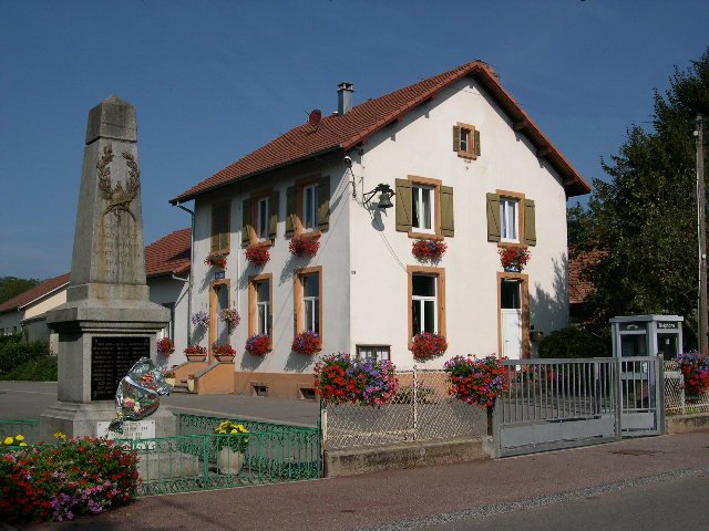
Fontaine (Fontaine)

- commune in Territoire de Belfort, France
 Hiking in Fontaine
Fontaine, located in the Territoire de Belfort in the Bourgogne-Franche-Comté region of France, offers a picturesque backdrop for hiking enthusiasts. The area is characterized by its rolling landscapes, lush forests, and proximity to the Vosges Mountains and Jura region, making it an appealing destination for nature lovers.
Hiking Trails
-
Local Trails: There are several local walking and hiking trails that vary in difficulty, catering to both beginners and experienced hikers. These trails often lead through scenic landscapes, including forests, meadows, and along rivers.
-
Grand Ballon: This is one of the most popular hiking destinations nearby, being the highest point in the Vosges Mountains. It offers breathtaking views and various trails ranging from moderate to challenging.
-
GR5 and GR59: The GR (Grande Randonnée) network includes long-distance hiking routes. The GR5 passes through the Vosges and offers spectacular views as well as a chance to experience diverse flora and fauna. The GR59 is also within reach and connects various local hiking paths.
-
Montessuit: A shorter hike is around Montessuit, providing stunning views of the surrounding countryside and a good opportunity for family hikes.
Tips for Hiking in Fontaine
-
Season: Spring and fall are ideal for hiking due to pleasant weather and beautiful scenery. Summer can be warm but is also a great time to explore, while winter may offer opportunities for snowshoeing in higher elevations.
-
Gear: Wear comfortable hiking boots and bring layers, as temperatures can change throughout the day. A backpack with water, snacks, and a first aid kit is advisable.
-
Local Guides: Consider hiring a local guide or joining a guided group for a more informative experience and to ensure you stay safe on trails that may be less familiar.
-
Respect Nature: Practice Leave No Trace principles by staying on marked trails, not disturbing wildlife, and packing out what you bring in.
Cultural Aspects
While hiking, you may also get the chance to enjoy the cultural heritage of the region. Look out for local historical sites, traditional orchards, and perhaps visit nearby towns for a taste of local cuisine.
Hiking in Fontaine offers not just physical exercise, but also a chance to immerse yourself in the natural beauty and cultural richness of the Territoire de Belfort. Enjoy your adventure!
- Country:

- Postal Code: 90150
- Coordinates: 47° 39' 34" N, 6° 59' 56" E


- GPS tracks (wikiloc): [Link]
- Area: 6.96 sq km
- Population: 611
- Wikipedia en: wiki(en)
- Wikipedia: wiki(fr)
- Wikidata storage: Wikidata: Q836783
- Wikipedia Commons Category: [Link]
- Freebase ID: [/m/03mh9lf]
- Freebase ID: [/m/03mh9lf]
- Freebase ID: [/m/03mh9lf]
- GeoNames ID: Alt: [6613475]
- GeoNames ID: Alt: [6613475]
- GeoNames ID: Alt: [6613475]
- SIREN number: [219000478]
- SIREN number: [219000478]
- SIREN number: [219000478]
- BnF ID: [15279988j]
- BnF ID: [15279988j]
- BnF ID: [15279988j]
- MusicBrainz area ID: [502da363-d6c2-49a7-a1c8-24070fb3eafb]
- MusicBrainz area ID: [502da363-d6c2-49a7-a1c8-24070fb3eafb]
- MusicBrainz area ID: [502da363-d6c2-49a7-a1c8-24070fb3eafb]
- INSEE municipality code: 90047
- INSEE municipality code: 90047
- INSEE municipality code: 90047
Shares border with regions:


Chavannes-sur-l'Étang
- commune in Haut-Rhin, France
Hiking in Chavannes-sur-l'Étang
Chavannes-sur-l'Étang is a lovely location for hiking enthusiasts situated in the beautiful region of Switzerland, known for its stunning landscapes and outdoor activities. Here are some key points to consider when planning a hike in this area:...
- Country:
- Postal Code: 68210
- Coordinates: 47° 37' 54" N, 7° 1' 28" E
- GPS tracks (wikiloc): [Link]
- Area: 6.04 sq km
- Population: 693

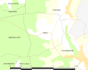
Frais
- commune in Territoire de Belfort, France
Hiking in Frais
Frais is a beautiful natural area located in the French region of Auvergne-Rhône-Alpes, specifically in the northern part of the Chartreuse Mountains. This area is less known to the general public, making it a fantastic destination for hikers looking for peace and stunning scenery....
- Country:
- Postal Code: 90150
- Coordinates: 47° 38' 48" N, 6° 59' 12" E
- GPS tracks (wikiloc): [Link]
- Area: 2.81 sq km
- Population: 212


Reppe
- commune in Territoire de Belfort, France
Hiking in Reppe
Reppe, located in the Territoire de Belfort region in France, offers a variety of hiking opportunities that showcase the natural beauty and landscape of the area. The region is known for its rolling hills, forested areas, and charming villages, making it an attractive destination for outdoor enthusiasts....
- Country:
- Postal Code: 90150
- Coordinates: 47° 39' 42" N, 7° 1' 34" E
- GPS tracks (wikiloc): [Link]
- Area: 3.88 sq km
- Population: 332

Foussemagne
- commune in Territoire de Belfort, France
Hiking in Foussemagne
Foussemagne is a small commune in the Bourgogne-Franche-Comté region of eastern France. While it may not be as well-known as some larger hiking destinations, it offers charming landscapes and opportunities for those looking to explore the outdoors. Hiking in and around Foussemagne can provide a serene experience in nature, particularly for those seeking to enjoy the tranquility of rural France....
- Country:
- Postal Code: 90150
- Coordinates: 47° 38' 3" N, 7° 0' 21" E
- GPS tracks (wikiloc): [Link]
- Area: 5.1 sq km
- Population: 916
- Web site: [Link]
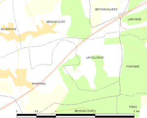
Lacollonge
- commune in Territoire de Belfort, France
Hiking in Lacollonge
Lacollonge is not a widely recognized hiking destination as of my last update, and it seems you might be referring to a lesser-known area. It could also be a misspelling or a specific local area that might not be well-documented in broader hiking resources. However, if you meant "La Collonge" or a similar-sounding area, please specify the location or region to provide you with relevant hiking tips, trails, and advice....
- Country:
- Postal Code: 90150
- Coordinates: 47° 39' 50" N, 6° 57' 36" E
- GPS tracks (wikiloc): [Link]
- Area: 1.92 sq km
- Population: 239


Phaffans
- commune in Territoire de Belfort, France
Hiking in Phaffans
It appears there may be a mix-up with the name "Phaffans," as I couldn't find any specific hiking locations or trails with that exact name. However, if you're referring to a specific region, place, or trail that might be commonly known by another name, please clarify, and I'd be happy to provide information....
- Country:
- Postal Code: 90150
- Coordinates: 47° 39' 37" N, 6° 56' 4" E
- GPS tracks (wikiloc): [Link]
- Area: 3.24 sq km
- Population: 442


Larivière
- commune in Territoire de Belfort, France
Hiking in Larivière
Larivière, located in the Territoire de Belfort region in eastern France, offers a variety of hiking opportunities that showcase the beautiful landscapes of this area. This region is characterized by its rolling hills, dense forests, and scenic views of the surrounding countryside....
- Country:
- Postal Code: 90150
- Coordinates: 47° 40' 35" N, 6° 59' 52" E
- GPS tracks (wikiloc): [Link]
- Area: 4.84 sq km
- Population: 325


Vauthiermont
- commune in Territoire de Belfort, France
Hiking in Vauthiermont
Vauthiermont is a lesser-known but beautiful hiking destination located in the region of the Vosges mountains in northeastern France. The area is ideal for nature lovers and offers a variety of trails suitable for different skill levels. Here are some highlights of hiking in Vauthiermont:...
- Country:
- Postal Code: 90150
- Coordinates: 47° 41' 6" N, 7° 1' 57" E
- GPS tracks (wikiloc): [Link]
- Area: 4.74 sq km
- Population: 227
- Web site: [Link]