
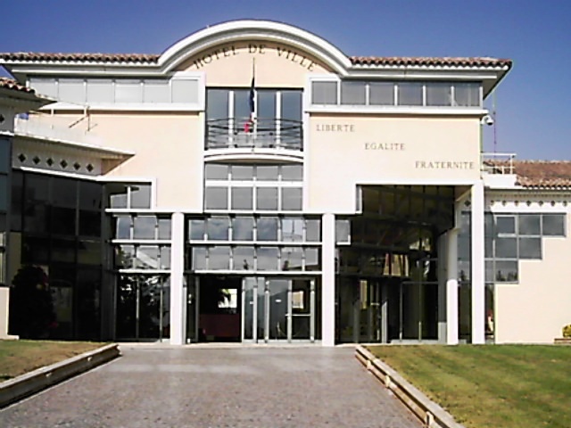
Fréjus (Fréjus)


- commune in Var, France
- Country:

- Postal Code: 83600
- Coordinates: 43° 25' 59" N, 6° 44' 8" E


- GPS tracks (wikiloc): [Link]
- Area: 102.27 sq km
- Population: 52897
- Web site: http://www.ville-frejus.fr
- Wikipedia en: wiki(en)
- Wikipedia: wiki(fr)
- Wikidata storage: Wikidata: Q215155
- Wikipedia Commons Gallery: [Link]
- Wikipedia Commons Category: [Link]
- Wikipedia Commons Maps Category: [Link]
- Freebase ID: [/m/05ng57]
- GeoNames ID: Alt: [3017253]
- SIREN number: [218300614]
- BnF ID: [15277888s]
- VIAF ID: Alt: [244963084]
- GND ID: Alt: [4018400-6]
- archINFORM location ID: [4268]
- MusicBrainz area ID: [1d82c96e-8d64-4503-8dc6-620904a009ac]
- Quora topic ID: [Fréjus]
- Encyclopædia Britannica Online ID: [place/Frejus]
- Gran Enciclopèdia Catalana ID: [0028232]
- EMLO location ID: [e49310c2-2463-49f4-b429-ccd209b8d58a]
- INSEE municipality code: 83061
- US National Archives Identifier: 10045040
Shares border with regions:


Saint-Raphaël
- commune in Var, France
- Country:
- Postal Code: 83700
- Coordinates: 43° 25' 29" N, 6° 46' 4" E
- GPS tracks (wikiloc): [Link]
- Area: 89.59 sq km
- Population: 35296
- Web site: [Link]


Mandelieu-la-Napoule
- commune in Alpes-Maritimes, France
- Country:
- Postal Code: 06210
- Coordinates: 43° 32' 44" N, 6° 56' 15" E
- GPS tracks (wikiloc): [Link]
- AboveSeaLevel: 300 м m
- Area: 31.37 sq km
- Population: 22360
- Web site: [Link]


Roquebrune-sur-Argens
- commune in Var, France
- Country:
- Postal Code: 83520
- Coordinates: 43° 26' 36" N, 6° 38' 16" E
- GPS tracks (wikiloc): [Link]
- Area: 106.1 sq km
- Population: 13195
- Web site: [Link]

Puget-sur-Argens
- commune in Var, France
- Country:
- Postal Code: 83480
- Coordinates: 43° 27' 21" N, 6° 41' 3" E
- GPS tracks (wikiloc): [Link]
- Area: 26.9 sq km
- Population: 7528


Les Adrets-de-l'Estérel
- commune in Var, France
- Country:
- Postal Code: 83600
- Coordinates: 43° 31' 32" N, 6° 48' 51" E
- GPS tracks (wikiloc): [Link]
- Area: 22.26 sq km
- Population: 2741
- Web site: [Link]
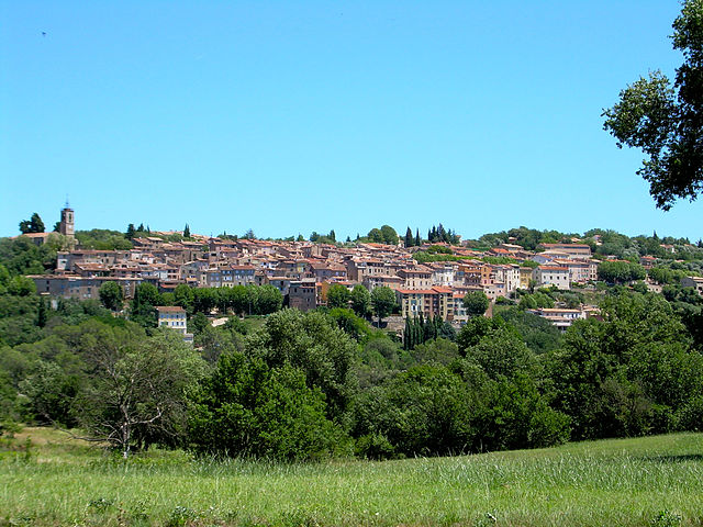

Bagnols-en-Forêt
- commune in Var, France
 Hiking in Bagnols-en-Forêt
Bagnols-en-Forêt is a charming village located in the Var department of the Provence-Alpes-Côte d'Azur region in France. The area around Bagnols-en-Forêt offers a range of hiking opportunities that cater to different skill levels and preferences. Here are some highlights about hiking in this picturesque location:...
- Country:
- Postal Code: 83600
- Coordinates: 43° 32' 16" N, 6° 41' 54" E
- GPS tracks (wikiloc): [Link]
- Area: 42.9 sq km
- Population: 2700
- Web site: [Link]

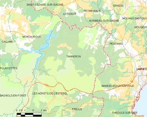
Tanneron
- commune in Var, France
Hiking in Tanneron
Tanneron is a picturesque village located in the Alpes-Maritimes department in the Provence-Alpes-Côte d'Azur region of southeastern France. Known for its stunning natural landscapes, the area offers a variety of hiking opportunities that cater to different experience levels....
- Country:
- Postal Code: 83440
- Coordinates: 43° 35' 26" N, 6° 52' 32" E
- GPS tracks (wikiloc): [Link]
- Area: 52.78 sq km
- Population: 1572