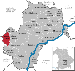
Freising (Landkreis Freising)

- district of Bavaria, Germany
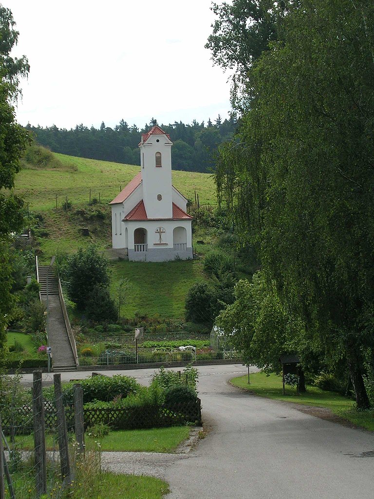
 Hiking in Freising
Freising, located in Bavaria, Germany, offers a variety of hiking opportunities suitable for different skill levels and preferences. The district is known for its picturesque landscapes, including rolling hills, scenic views, and lush forests. Here are some highlights if you’re considering hiking in Freising:
Popular Hiking Areas:
-
Isar River Trails: The banks of the Isar River provide beautiful walking and hiking paths. You can enjoy the peaceful riverside scenery, watch for wildlife, and take in the natural beauty of the area.
-
Erdinger Moos: This large moorland area features unique landscapes with rich biodiversity. Trails here allow you to explore the wetlands and observe various bird species.
-
Forest Trails: There are several forests around Freising, such as the Forstenrieder Park, where you can find well-marked trails that are great for leisurely strolls or more vigorous hikes.
-
The Weihenstephan Hill: Home to the oldest brewery in the world, the hill offers hiking paths with views of the beautiful Bavarian countryside and the chance to combine hiking with a visit to the brewery.
Recommended Hikes:
-
Freising Circular Trail: A lovely loop trail that combines urban and natural settings, giving hikers a taste of local culture and nature.
-
S-Bahn Trails: Many hikers use the nearby S-Bahn (commuter train) to access various starting points for longer hikes or to explore different neighborhoods and villages.
-
Regional Hikes: You can connect to longer regional trails that lead to other cities or natural parks, allowing for a multi-day hiking experience if desired.
Tips for Hiking in Freising:
-
Seasonal Considerations: Spring and autumn are ideal for hiking, with mild weather and vibrant foliage. Summers can be warm, while winter hiking requires proper gear.
-
Trail Markings: Pay attention to the trail signs and maps, which can often be found at the trailheads. Many paths are well-marked, but it's always good to be prepared with a map or a hiking app.
-
Hydration and Supplies: Carry enough water and snacks, especially on longer hikes, and always check the weather forecast to dress appropriately.
-
Local Culture: If you have time, consider visiting local attractions, such as historic churches and the Freising Cathedral, after your hike.
Safety Considerations:
- Always let someone know your hiking plans and expected return times.
- Be aware of your surroundings and watch for possible wildlife encounters.
- Carry a first-aid kit, especially if hiking in more remote areas.
Freising and its surrounding areas offer a lovely blend of nature and culture, making it a great destination for both casual and experienced hikers. Enjoy your adventure!
- Country:

- Capital: Freising
- Licence Plate Code: FS
- Coordinates: 48° 30' 0" N, 11° 49' 48" E


- GPS tracks (wikiloc): [Link]
- AboveSeaLevel: 433 м m
- Area: 800.00 sq km
- Population: 118518
- Web site: http://www.landkreis-freising.de/
- Wikipedia en: wiki(en)
- Wikipedia: wiki(de)
- Wikidata storage: Wikidata: Q10497
- Wikipedia Commons Category: [Link]
- Wikipedia Commons Maps Category: [Link]
- Freebase ID: [/m/01ptzt]
- GeoNames ID: Alt: [3220832]
- VIAF ID: Alt: [312827587]
- OSM relation ID: [62633]
- GND ID: Alt: [4093237-0]
- archINFORM location ID: [2417]
- Library of Congress authority ID: Alt: [n87848046]
- TGN ID: [7077298]
- Historical Gazetteer (GOV) ID: [adm_139178]
- Bavarikon ID: [ODB_A00002348]
- ISNI: Alt: [0000 0004 0493 5727]
- NUTS code: [DE21B]
- Ringgold ID: [232686]
- BabelNet ID: [02211754n]
- German district key: 09178
Includes regions:


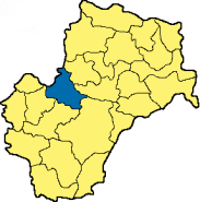
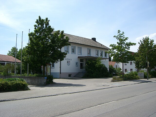
Allershausen
- municipality of Germany
Hiking in Allershausen
Allershausen is a small town located in Bavaria, Germany, and while it may not be as well-known for hiking as larger regions, it still offers some opportunities for outdoor enthusiasts. The area surrounding Allershausen features beautiful landscapes typical of Bavaria, including rolling hills, forests, and farmland....
- Country:
- Postal Code: 85391
- Local Dialing Code: 08166
- Licence Plate Code: FS
- Coordinates: 48° 25' 30" N, 11° 35' 30" E
- GPS tracks (wikiloc): [Link]
- AboveSeaLevel: 442 м m
- Area: 26.56 sq km
- Population: 3466
- Web site: [Link]

Zolling
- municipality of Germany
Hiking in Zolling
Zolling is a small town in Bavaria, Germany, that may not be widely recognized for hiking, but its surrounding landscape offers some beautiful trails and opportunities for outdoor enthusiasts. Here are some things to consider when hiking in and around Zolling:...
- Country:
- Postal Code: 85406
- Local Dialing Code: 08167
- Licence Plate Code: FS
- Coordinates: 48° 27' 0" N, 11° 46' 0" E
- GPS tracks (wikiloc): [Link]
- AboveSeaLevel: 429 м m
- Area: 34.59 sq km
- Population: 3061
- Web site: [Link]


Eching
- municipality in Freising district, Germany
Hiking in Eching
Eching, located in the Freising district of Bavaria, Germany, offers a variety of hiking opportunities for outdoor enthusiasts. The region is characterized by its beautiful landscapes, including fields, forests, rivers, and the nearby Isar River. Here are some key points about hiking in Eching and its surroundings:...
- Country:
- Postal Code: 85716; 85386
- Local Dialing Code: 089; 08165; 08133
- Licence Plate Code: FS
- Coordinates: 48° 18' 0" N, 11° 37' 0" E
- GPS tracks (wikiloc): [Link]
- AboveSeaLevel: 467 м m
- Area: 37.32 sq km
- Population: 13856
- Web site: [Link]


Mauern
- municipality of Germany
Hiking in Mauern
Mauern is a picturesque area that offers a great variety of hiking opportunities, showcasing beautiful landscapes, diverse flora and fauna, and often stunning views. While I don't have specific trails and conditions post-2023, here are some general tips and information to help you enjoy a hiking experience in the Mauern region:...
- Country:
- Postal Code: 85419
- Local Dialing Code: 08764
- Licence Plate Code: FS
- Coordinates: 48° 31' 0" N, 11° 54' 0" E
- GPS tracks (wikiloc): [Link]
- AboveSeaLevel: 435 м m
- Area: 24.14 sq km
- Population: 1942
- Web site: [Link]


Hallbergmoos
- municipality in the district of Freising in Bavaria in Germany
Hiking in Hallbergmoos
Hallbergmoos is a municipality located in Bavaria, Germany, near Munich. While it is not as well-known for hiking as some other regions, it offers several options for outdoor enthusiasts who wish to explore the natural surroundings....
- Country:
- Postal Code: 85396–85399
- Local Dialing Code: 0811
- Licence Plate Code: FS
- Coordinates: 48° 20' 0" N, 11° 45' 0" E
- GPS tracks (wikiloc): [Link]
- AboveSeaLevel: 460 м m
- Area: 35.06 sq km
- Population: 4003
- Web site: [Link]


Neufahrn bei Freising
- municipality in Bavaria, Germany
Hiking in Neufahrn bei Freising
Neufahrn bei Freising is a charming town located in Bavaria, Germany, not far from the city of Munich. While Neufahrn itself is more known for its residential areas and proximity to urban amenities, it offers access to several nearby hiking opportunities that can appeal to both casual walkers and more serious hikers....
- Country:
- Postal Code: 85369–85376
- Local Dialing Code: 08165
- Licence Plate Code: FS
- Coordinates: 48° 18' 57" N, 11° 39' 47" E
- GPS tracks (wikiloc): [Link]
- AboveSeaLevel: 462 м m
- Area: 45.51 sq km
- Population: 14120
- Web site: [Link]


Moosburg an der Isar
- town in Bavaria, Germany
Hiking in Moosburg an der Isar
Moosburg, located in Bavaria, Germany, offers a range of hiking opportunities that highlight the scenic beauty of the region. While it may not be as famous as some of the larger Bavarian towns, it boasts charming landscapes that can be quite enjoyable for hiking enthusiasts....
- Country:
- Postal Code: 85360–85368
- Local Dialing Code: 08761
- Licence Plate Code: FS
- Coordinates: 48° 28' 0" N, 11° 56' 0" E
- GPS tracks (wikiloc): [Link]
- AboveSeaLevel: 421 м m
- Area: 43.85 sq km
- Population: 17847
- Web site: [Link]


Nandlstadt
- municipality of Germany
Hiking in Nandlstadt
Nandlstadt is a small town in Bavaria, Germany, located in the district of Freising. While it might not be as well-known as some of the larger towns and cities in the region, it offers various opportunities for hiking and enjoying nature....
- Country:
- Postal Code: 85405
- Local Dialing Code: 08756
- Licence Plate Code: FS
- Coordinates: 48° 32' 0" N, 11° 48' 0" E
- GPS tracks (wikiloc): [Link]
- AboveSeaLevel: 465 м m
- Area: 34.31 sq km
- Population: 3203
- Web site: [Link]


Paunzhausen
- municipality of Germany
Hiking in Paunzhausen
Paunzhausen is a small town located in Bavaria, Germany, offering a tranquil setting that is ideal for hiking enthusiasts looking for scenic views and peaceful natural surroundings. While it may not be as widely known as larger hiking destinations, the area features picturesque landscapes, farms, and gentle rolling hills typical of the Bavarian countryside....
- Country:
- Postal Code: 85307
- Local Dialing Code: 08444
- Licence Plate Code: FS
- Coordinates: 48° 29' 0" N, 11° 34' 0" E
- GPS tracks (wikiloc): [Link]
- AboveSeaLevel: 515 м m
- Area: 12.73 sq km
- Population: 977
- Web site: [Link]

Kirchdorf an der Amper
- municipality of Germany
Hiking in Kirchdorf an der Amper
Kirchdorf an der Amper is a charming village located in Bavaria, Germany, that offers a serene backdrop for hiking enthusiasts. Nestled near the banks of the Amper River, it's surrounded by picturesque landscapes, including lush meadows, forests, and agricultural fields, making it an ideal spot for outdoor activities....
- Country:
- Postal Code: 85414
- Local Dialing Code: 08166
- Licence Plate Code: FS
- Coordinates: 48° 27' 34" N, 11° 39' 16" E
- GPS tracks (wikiloc): [Link]
- AboveSeaLevel: 441 м m
- Area: 32.988 sq km
- Population: 1817
- Web site: [Link]

Hohenkammer
- municipality of Germany
Hiking in Hohenkammer
Hohenkammer, located in Bavaria, Germany, offers a variety of hiking opportunities set against a picturesque backdrop of lush nature and tranquil countryside. Here are some aspects to consider when hiking in this area:...
- Country:
- Postal Code: 85411
- Local Dialing Code: 08137
- Licence Plate Code: FS
- Coordinates: 48° 25' 0" N, 11° 32' 0" E
- GPS tracks (wikiloc): [Link]
- AboveSeaLevel: 471 м m
- Area: 25.74 sq km
- Population: 1609
- Web site: [Link]
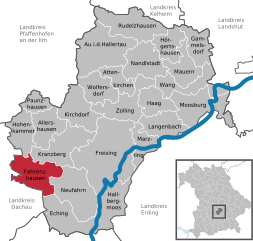
Fahrenzhausen
- municipality of Germany
Hiking in Fahrenzhausen
Fahrenzhausen is a small town located in Bavaria, Germany, not far from Munich. While it may not be as widely known as other hiking destinations, it offers scenic views and access to charming landscapes typical of the Bavarian countryside. Here are some insights into hiking in and around Fahrenzhausen:...
- Country:
- Postal Code: 85777
- Local Dialing Code: 08133
- Licence Plate Code: FS
- Coordinates: 48° 21' 0" N, 11° 33' 0" E
- GPS tracks (wikiloc): [Link]
- AboveSeaLevel: 465 м m
- Area: 37.64 sq km
- Population: 3120
- Web site: [Link]

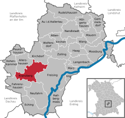
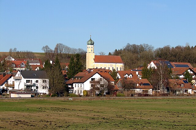
Kranzberg
- municipality of Germany
Hiking in Kranzberg
Kranzberg, located in Bavaria, Germany, offers beautiful landscapes and a variety of hiking opportunities for outdoor enthusiasts. The area is characterized by its lush forests, rolling hills, and stunning views of the surrounding countryside....
- Country:
- Postal Code: 85402
- Local Dialing Code: 08166
- Licence Plate Code: FS
- Coordinates: 48° 24' 0" N, 11° 37' 0" E
- GPS tracks (wikiloc): [Link]
- AboveSeaLevel: 483 м m
- Area: 39.50 sq km
- Population: 4131
- Web site: [Link]


Marzling
- municipality of Germany
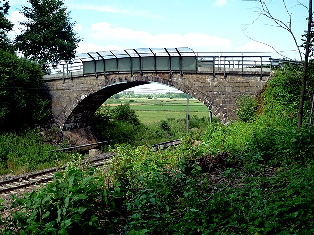
Hiking in Marzling
Marzling is a small municipality in Bavaria, Germany, located about 40 kilometers northeast of Munich. While it may not be as widely known for hiking compared to larger outdoor destinations, it still offers some enjoyable walking and hiking opportunities, especially for those who appreciate scenic rural landscapes and peaceful surroundings....
- Country:
- Postal Code: 85417
- Local Dialing Code: 08161
- Licence Plate Code: FS
- Coordinates: 48° 24' 0" N, 11° 48' 0" E
- GPS tracks (wikiloc): [Link]
- AboveSeaLevel: 443 м m
- Area: 20.50 sq km
- Population: 1871
- Web site: [Link]


Hörgertshausen
- municipality of Germany
Hiking in Hörgertshausen
Hörgertshausen, located in Bavaria, Germany, is a charming area surrounded by natural beauty that offers a variety of hiking opportunities. While it may not be as well-known as some of the larger hiking destinations in the region, it has its own unique allure, including tranquil landscapes, picturesque fields, and scenic trails....
- Country:
- Postal Code: 85413
- Local Dialing Code: 08764
- Licence Plate Code: FS
- Coordinates: 48° 33' 0" N, 11° 52' 0" E
- GPS tracks (wikiloc): [Link]
- AboveSeaLevel: 453 м m
- Area: 21.47 sq km
- Population: 1493
- Web site: [Link]


Rudelzhausen
- municipality of Germany
Hiking in Rudelzhausen
Rudelzhausen is a small village located in Bavaria, Germany, offering a charming environment for hiking enthusiasts. While it may not be as well-known for hiking as other regions in Bavaria, it provides access to beautiful rural landscapes, serene nature, and nearby trails....
- Country:
- Postal Code: 84104
- Local Dialing Code: 08752
- Licence Plate Code: FS
- Coordinates: 48° 35' 0" N, 11° 46' 0" E
- GPS tracks (wikiloc): [Link]
- AboveSeaLevel: 440 м m
- Area: 40.82 sq km
- Population: 2390
- Web site: [Link]


Wang
- municipality in the district of Freising in Bavaria in Germany
Hiking in Wang
Wang, located in Bavaria, Germany, is known for its picturesque landscapes and access to some beautiful hiking trails. Nestled in the foothills of the Alps, this area offers a mix of lush valleys, mountain vistas, and charming rural scenery. Here are some key aspects to consider when planning a hike in Wang:...
- Country:
- Postal Code: 85368
- Local Dialing Code: 08765; 08764; 08761; 08709
- Licence Plate Code: FS
- Coordinates: 48° 30' 0" N, 11° 57' 0" E
- GPS tracks (wikiloc): [Link]
- AboveSeaLevel: 415 м m
- Area: 31.19 sq km
- Population: 1439
- Web site: [Link]

Haag an der Amper
- municipality of Germany
Hiking in Haag an der Amper
Haag an der Amper is a charming town located in Bavaria, Germany, known for its picturesque natural surroundings, making it a great destination for hiking enthusiasts. Here are some key points to consider when planning a hiking trip in this region:...
- Country:
- Postal Code: 85410
- Local Dialing Code: 08167
- Licence Plate Code: FS
- Coordinates: 48° 27' 30" N, 11° 49' 41" E
- GPS tracks (wikiloc): [Link]
- AboveSeaLevel: 440 м m
- Area: 21.71 sq km
- Population: 2003
- Web site: [Link]


Attenkirchen
- municipality of Germany
Hiking in Attenkirchen
Attenkirchen is a charming village located in Bavaria, Germany, and while it may not be as widely known as some of the larger hiking destinations, it offers beautiful scenery and access to nature that can be appealing to hikers looking for a quieter experience....
- Country:
- Postal Code: 85395
- Local Dialing Code: 08168
- Licence Plate Code: FS
- Coordinates: 48° 30' 0" N, 11° 46' 0" E
- GPS tracks (wikiloc): [Link]
- AboveSeaLevel: 510 м m
- Area: 16.16 sq km
- Population: 1485
- Web site: [Link]


Au in der Hallertau
- municipality of Germany
Hiking in Au in der Hallertau
Au in der Hallertau is a picturesque village located in the Hallertau region of Bavaria, Germany, known primarily for its hop growing and beautiful countryside. Hiking in this area can be quite enjoyable, offering scenic landscapes, lush green fields, and charming rural settings....
- Country:
- Postal Code: 84072
- Local Dialing Code: 08752
- Licence Plate Code: FS
- Coordinates: 48° 33' 27" N, 11° 44' 30" E
- GPS tracks (wikiloc): [Link]
- AboveSeaLevel: 452 м m
- Area: 54.99 sq km
- Population: 4137
- Web site: [Link]

Langenbach
- municipality of Germany
Hiking in Langenbach
Langenbach is a picturesque village located in Bavaria, Germany, known for its beautiful landscapes and outdoor activities, including hiking. The surrounding areas feature rolling hills, lush forests, and charming countryside views, making it an excellent spot for nature enthusiasts....
- Country:
- Postal Code: 85416
- Local Dialing Code: 08761
- Licence Plate Code: FS
- Coordinates: 48° 26' 0" N, 11° 51' 0" E
- GPS tracks (wikiloc): [Link]
- AboveSeaLevel: 434 м m
- Area: 26.89 sq km
- Population: 2667
- Web site: [Link]

Gammelsdorf
- municipality of Germany
Hiking in Gammelsdorf
Gammelsdorf is a small locality in Bavaria, Germany, known for its picturesque landscapes and serene natural surroundings. While it may not be a widely recognized hiking destination, the region offers opportunities for outdoor activities, especially for those who enjoy a quieter, more rural hiking experience....
- Country:
- Postal Code: 85408
- Local Dialing Code: 08766
- Licence Plate Code: FS
- Coordinates: 48° 33' 0" N, 11° 57' 0" E
- GPS tracks (wikiloc): [Link]
- AboveSeaLevel: 495 м m
- Area: 21.62 sq km
- Population: 1002
- Web site: [Link]


Wolfersdorf
- municipality of Germany
Hiking in Wolfersdorf
Wolfersdorf, located in the district of Erding in Bavaria, Germany, offers beautiful landscapes and a peaceful environment ideal for hiking enthusiasts. While it may not be as well-known as larger hiking destinations, it provides a quintessential Bavarian experience with scenic trails, charming villages, and natural beauty....
- Country:
- Postal Code: 85395
- Local Dialing Code: 08168
- Licence Plate Code: FS
- Coordinates: 48° 29' 0" N, 11° 43' 0" E
- GPS tracks (wikiloc): [Link]
- AboveSeaLevel: 502 м m
- Area: 26.01 sq km
- Population: 1537
- Web site: [Link]


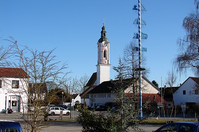
Freising
- town in Bavaria, Germany
Hiking in Freising
Freising, located near Munich in Bavaria, Germany, offers various hiking opportunities that allow you to enjoy the beauty of the surrounding Bavarian countryside. Here are some highlights and tips for hiking in and around Freising:...
- Country:
- Postal Code: 85356; 85354
- Local Dialing Code: 08161
- Licence Plate Code: FS
- Coordinates: 48° 24' 10" N, 11° 44' 56" E
- GPS tracks (wikiloc): [Link]
- AboveSeaLevel: 448 м m
- Area: 88.45 sq km
- Population: 34325
- Web site: [Link]
Shares border with regions:

Kelheim
- district in Bavaria, Germany
Hiking in Kelheim
Kelheim, located in Bavaria, Germany, is a beautiful area for hiking, characterized by its stunning landscapes, historical sites, and natural attractions. Here are some highlights you might consider when planning a hiking trip in Kelheim:...
- Country:
- Capital: Kelheim
- Licence Plate Code: ROL; RID; PAR; MAI; KEH
- Coordinates: 48° 49' 48" N, 11° 49' 48" E
- GPS tracks (wikiloc): [Link]
- AboveSeaLevel: 369 м m
- Area: 1067.00 sq km
- Population: 90040
- Web site: [Link]

Landshut
- district in Bavaria, Germany
Hiking in Landshut
Landshut district, located in Bavaria, Germany, offers a variety of hiking opportunities that cater to different skill levels and preferences. The landscape is characterized by rolling hills, picturesque villages, and lush forests, providing a beautiful backdrop for outdoor activities....
- Country:
- Capital: Landshut
- Licence Plate Code: LA
- Coordinates: 48° 34' 14" N, 12° 10' 50" E
- GPS tracks (wikiloc): [Link]
- AboveSeaLevel: 383 м m
- Area: 1348 sq km
- Population: 115644
- Web site: [Link]

Pfaffenhofen
- district of Bavaria, Germany
Hiking in Pfaffenhofen
Pfaffenhofen is a district in Bavaria, Germany, known for its picturesque landscapes and outdoor recreational opportunities, including hiking. The region features a mix of rolling hills, forests, rivers, and farmland, providing a variety of scenic routes for hikers of all skill levels....
- Country:
- Capital: Pfaffenhofen an der Ilm
- Licence Plate Code: PAF
- Coordinates: 48° 30' 0" N, 11° 30' 0" E
- GPS tracks (wikiloc): [Link]
- AboveSeaLevel: 439 м m
- Area: 760.00 sq km
- Population: 126244
- Web site: [Link]

Dachau
- district of Bavaria, Germany
Hiking in Dachau
Dachau, located just north of Munich in Bavaria, Germany, is a region rich in history and natural beauty, making it a great destination for hiking. Here are some highlights about hiking in the Dachau district:...
- Country:
- Capital: Dachau
- Licence Plate Code: DAH
- Coordinates: 48° 15' 0" N, 11° 25' 12" E
- GPS tracks (wikiloc): [Link]
- AboveSeaLevel: 506 м m
- Area: 579.00 sq km
- Population: 152703
- Web site: [Link]

District of Erding
- district of Bavaria, Germany
Hiking in District of Erding
Erding, located in Bavaria, Germany, offers a variety of hiking opportunities for enthusiasts of all skill levels. This district is characterized by its beautiful landscapes, rolling hills, and picturesque villages, making it a wonderful destination for outdoor activities....
- Country:
- Licence Plate Code: ED
- Coordinates: 48° 19' 48" N, 11° 55' 12" E
- GPS tracks (wikiloc): [Link]
- AboveSeaLevel: 480 м m
- Area: 870.44 sq km
- Population: 89190
- Web site: [Link]

Munich
- district of Bavaria, Germany
Hiking in Munich
Hiking in and around Munich, the capital of Bavaria, offers a wonderful blend of urban landscapes and stunning natural scenery. While Munich itself is a vibrant city with parks and green spaces, many hiking opportunities are just a short distance away in the surrounding region....
- Country:
- Capital: Munich
- Local Dialing Code: 089
- Licence Plate Code: WOR; M; AIB
- Coordinates: 48° 0' 0" N, 11° 40' 12" E
- GPS tracks (wikiloc): [Link]
- AboveSeaLevel: 513 м m
- Area: 52020.58 sq km
- Population: 343405
- Web site: [Link]
Freising
- town in Bavaria, Germany
Hiking in Freising
Freising, located near Munich in Bavaria, Germany, offers various hiking opportunities that allow you to enjoy the beauty of the surrounding Bavarian countryside. Here are some highlights and tips for hiking in and around Freising:...
- Country:
- Postal Code: 85356; 85354
- Local Dialing Code: 08161
- Licence Plate Code: FS
- Coordinates: 48° 24' 10" N, 11° 44' 56" E
- GPS tracks (wikiloc): [Link]
- AboveSeaLevel: 448 м m
- Area: 88.45 sq km
- Population: 34325
- Web site: [Link]