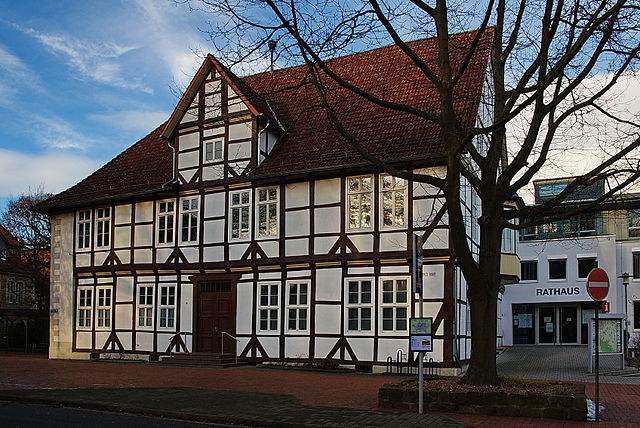
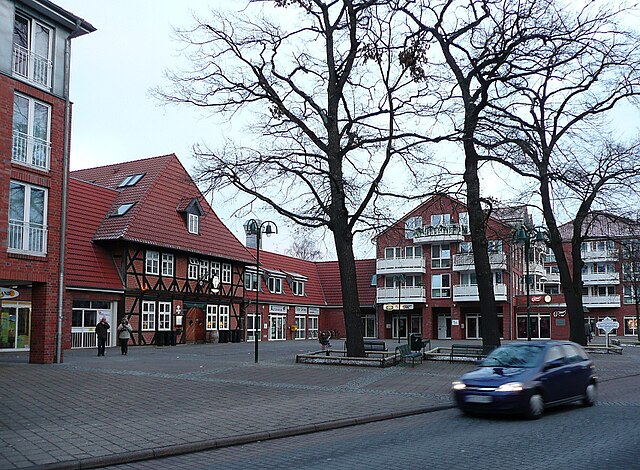
Gehrden (Gehrden)

- district of Hanover, Germany
 Hiking in Gehrden
Gehrden is a charming town located in Lower Saxony, Germany, and is surrounded by beautiful natural landscapes that are ideal for hiking enthusiasts. With its proximity to the foothills of the Harz Mountains and the scenic Burgwald and Deisterhill ranges, Gehrden offers a variety of hiking trails suitable for different skill levels.
Popular Hiking Areas and Trails:
-
Deister Hills: The Deister mountain range features numerous well-marked hiking trails that vary in difficulty. You can enjoy lush forests, wildlife, and stunning views from higher elevations. The trails often lead to lookout points, offering panoramic views of the surrounding countryside.
-
Burgberg (Burgwald): This area is known for its beautiful hiking paths that take you through refreshing woodlands and delightful meadows. Look for trails that lead to the peak of Burgberg, where you can discover historical sites and enjoy the scenery from above.
-
Nature Reserves: The region around Gehrden has several nature reserves, such as the "Naturpark Deister" and "Naturpark Schwalm-Nette," where you can experience diverse ecosystems, flora, and fauna.
Tips for Hiking in Gehrden:
- Trail Maps: Always carry a detailed map of the hiking trails or use a GPS app to navigate. Many trails are well-marked, but it's good to be prepared.
- Weather Preparedness: Check the local weather forecast before heading out. The weather can change quickly in the region, so bring suitable clothing and gear.
- Hydration and Snacks: Bring enough water and energy-boosting snacks to keep you energized throughout your hike.
- Respect Nature: Stick to marked paths, carry out any trash, and be respectful of wildlife and fellow hikers.
Local Amenities:
Gehrden has several local facilities, including shops, cafes, and restaurants, where you can refuel after a day of hiking. Visit local tourist information centers for more recommendations on trails, accommodations, and guided tours.
Whether you're a seasoned hiker or a beginner, Gehrden provides a beautiful setting for enjoyable outdoor activities. Happy hiking!
- Country:

- Postal Code: 30989
- Local Dialing Code: 05137; 05109; 05108
- Licence Plate Code: H
- Coordinates: 52° 18' 42" N, 9° 36' 1" E


- GPS tracks (wikiloc): [Link]
- AboveSeaLevel: 78 м m
- Area: 42.97 sq km
- Population: 14903
- Web site: https://www.gehrden.de/
- Wikipedia en: wiki(en)
- Wikipedia: wiki(de)
- Wikidata storage: Wikidata: Q549864
- Wikipedia Commons Category: [Link]
- Freebase ID: [/m/0cmgry]
- GeoNames ID: Alt: [2922008]
- OSM relation ID: [2012731]
- GND ID: Alt: [4349841-3]
- archINFORM location ID: [10912]
- Library of Congress authority ID: Alt: [n90649478]
- MusicBrainz area ID: [55ceb5f7-c557-4579-9400-7b1a08df364a]
- German municipality key: 03241006
Shares border with regions:

Barsinghausen
- town in Lower Saxony, Germany
Hiking in Barsinghausen
Barsinghausen is a town in Lower Saxony, Germany, that is surrounded by beautiful landscapes, making it an excellent location for hiking enthusiasts. Here are some highlights and details regarding hiking in and around Barsinghausen:...
- Country:
- Postal Code: 30890
- Local Dialing Code: 05108; 05035; 05105
- Licence Plate Code: H
- Coordinates: 52° 18' 0" N, 9° 28' 52" E
- GPS tracks (wikiloc): [Link]
- AboveSeaLevel: 142 м m
- Area: 102.65 sq km
- Population: 33922
- Web site: [Link]

Seelze
- town in the district of Hanover, in Lower Saxony, Germany
Hiking in Seelze
Seelze is a town located in Lower Saxony, Germany, situated just southwest of Hanover. While Seelze itself might not be primarily known as a hiking destination, there are several opportunities for outdoor enthusiasts in and around the area....
- Country:
- Postal Code: 30926
- Local Dialing Code: 05137; 0511; 05031
- Licence Plate Code: H
- Coordinates: 52° 23' 46" N, 9° 35' 53" E
- GPS tracks (wikiloc): [Link]
- AboveSeaLevel: 50 м m
- Area: 54.08 sq km
- Population: 34036
- Web site: [Link]


Hanover
- capital city of the German federated state of Lower Saxony
Hiking in Hanover
Hanover, situated in lower Saxony, Germany, offers a variety of hiking opportunities that cater to different skill levels and preferences. Here are some highlights:...
- Country:
- Postal Code: 30159–30659
- Local Dialing Code: 0511
- Licence Plate Code: H
- Coordinates: 52° 22' 28" N, 9° 44' 19" E
- GPS tracks (wikiloc): [Link]
- AboveSeaLevel: 55 м m
- Area: 204.30 sq km
- Population: 532864
- Web site: [Link]


Ronnenberg
- municipality of Germany
Hiking in Ronnenberg
Ronnenberg, located near the city of Hanover in Lower Saxony, Germany, offers a variety of hiking opportunities for outdoor enthusiasts. The region is characterized by scenic landscapes, lush forests, and rolling hills that provide a pleasant environment for hiking....
- Country:
- Postal Code: 30952
- Local Dialing Code: 0511; 05109; 05108
- Licence Plate Code: H
- Coordinates: 52° 19' 10" N, 9° 39' 20" E
- GPS tracks (wikiloc): [Link]
- AboveSeaLevel: 69 м m
- Area: 37.78 sq km
- Population: 24080
- Web site: [Link]


Wennigsen
- municipality in Lower Saxony, Germany
Hiking in Wennigsen
Wennigsen, located in Lower Saxony, Germany, is surrounded by picturesque landscapes that provide opportunities for various hiking experiences. The region features rolling hills, lush forests, and scenic views, making it ideal for both casual walkers and more experienced hikers....
- Country:
- Postal Code: 30974
- Local Dialing Code: 05109; 05105; 05103
- Licence Plate Code: H
- Coordinates: 52° 16' 27" N, 9° 34' 15" E
- GPS tracks (wikiloc): [Link]
- AboveSeaLevel: 99 м m
- Area: 53.9 sq km
- Population: 14138
- Web site: [Link]