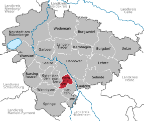
Ronnenberg (Ronnenberg)

- municipality of Germany
 Hiking in Ronnenberg
Ronnenberg, located near the city of Hanover in Lower Saxony, Germany, offers a variety of hiking opportunities for outdoor enthusiasts. The region is characterized by scenic landscapes, lush forests, and rolling hills that provide a pleasant environment for hiking.
Hiking Trails
-
Schaeferweg: This route offers a picturesque journey through forests and fields, making it suitable for both casual and experienced hikers. The trails are well-marked and often lead to beautiful viewpoints.
-
Hannover Region Trails: There are multiple regional trails connecting to Ronnenberg, such as the "Bergbahnweg," where you can enjoy diverse flora and fauna and perhaps spot some wildlife along the way.
-
Ronnenberg Nature Trails: Some local nature trails are designed to educate hikers on the local ecology, making it a perfect choice for families and those interested in learning more about their surroundings.
Features
- Accessibility: The hiking trails around Ronnenberg are generally well-maintained and accessible for a variety of skill levels, from families with children to more experienced hikers.
- Scenic Views: Several trails offer stunning views of the surrounding countryside, particularly during sunrise or sunset.
- Amenities: Depending on the route, you may find resting spots, picnic areas, and sometimes cafes or small eateries in nearby villages for a refreshing break.
Best Time to Hike
- The most favorable times for hiking in Ronnenberg are during the spring and autumn months, when temperatures are mild, and the scenery is particularly beautiful with blooming flowers or colorful fall foliage.
- Summer can also be enjoyable, though be prepared for warmer temperatures, while winter hikes can provide a serene, snowy landscape.
Tips for Hiking in Ronnenberg
- Always check the weather forecast before heading out.
- Wear appropriate footwear and clothing for the terrain and weather conditions.
- Bring enough water and snacks to keep your energy up during your hike.
- Stay on marked trails to protect local ecosystems and for your own safety.
- Consider using a hiking app or map for navigation if you are unfamiliar with the area.
With its beautiful setting and accessible trails, Ronnenberg offers a delightful hiking experience for anyone looking to enjoy the outdoors near Hanover.
- Country:

- Postal Code: 30952
- Local Dialing Code: 0511; 05109; 05108
- Licence Plate Code: H
- Coordinates: 52° 19' 10" N, 9° 39' 20" E


- GPS tracks (wikiloc): [Link]
- AboveSeaLevel: 69 м m
- Area: 37.78 sq km
- Population: 24080
- Web site: https://www.ronnenberg.de/
- Wikipedia en: wiki(en)
- Wikipedia: wiki(de)
- Wikidata storage: Wikidata: Q555643
- Wikipedia Commons Category: [Link]
- Freebase ID: [/m/0cmgwx]
- GeoNames ID: Alt: [2845222]
- VIAF ID: Alt: [239130231]
- OSM relation ID: [2012735]
- GND ID: Alt: [4299958-3]
- archINFORM location ID: [11819]
- German municipality key: 03241014
Shares border with regions:


Hanover
- capital city of the German federated state of Lower Saxony
Hiking in Hanover
Hanover, situated in lower Saxony, Germany, offers a variety of hiking opportunities that cater to different skill levels and preferences. Here are some highlights:...
- Country:
- Postal Code: 30159–30659
- Local Dialing Code: 0511
- Licence Plate Code: H
- Coordinates: 52° 22' 28" N, 9° 44' 19" E
- GPS tracks (wikiloc): [Link]
- AboveSeaLevel: 55 м m
- Area: 204.30 sq km
- Population: 532864
- Web site: [Link]

Hemmingen
- town in Lower Saxony, Germany
Hiking in Hemmingen
Hemming is a great area for hiking, offering various trails suited for different skill levels. Located near the region of Hanover in Germany, Hemmingen has access to both natural landscapes and historical sites....
- Country:
- Postal Code: 30953–30966
- Local Dialing Code: 0511; 05101
- Licence Plate Code: H
- Coordinates: 52° 19' 25" N, 9° 43' 32" E
- GPS tracks (wikiloc): [Link]
- AboveSeaLevel: 56 м m
- Area: 31.65 sq km
- Population: 18923
- Web site: [Link]


Gehrden
- district of Hanover, Germany
Hiking in Gehrden
Gehrden is a charming town located in Lower Saxony, Germany, and is surrounded by beautiful natural landscapes that are ideal for hiking enthusiasts. With its proximity to the foothills of the Harz Mountains and the scenic Burgwald and Deisterhill ranges, Gehrden offers a variety of hiking trails suitable for different skill levels....
- Country:
- Postal Code: 30989
- Local Dialing Code: 05137; 05109; 05108
- Licence Plate Code: H
- Coordinates: 52° 18' 42" N, 9° 36' 1" E
- GPS tracks (wikiloc): [Link]
- AboveSeaLevel: 78 м m
- Area: 42.97 sq km
- Population: 14903
- Web site: [Link]


Wennigsen
- municipality in Lower Saxony, Germany
Hiking in Wennigsen
Wennigsen, located in Lower Saxony, Germany, is surrounded by picturesque landscapes that provide opportunities for various hiking experiences. The region features rolling hills, lush forests, and scenic views, making it ideal for both casual walkers and more experienced hikers....
- Country:
- Postal Code: 30974
- Local Dialing Code: 05109; 05105; 05103
- Licence Plate Code: H
- Coordinates: 52° 16' 27" N, 9° 34' 15" E
- GPS tracks (wikiloc): [Link]
- AboveSeaLevel: 99 м m
- Area: 53.9 sq km
- Population: 14138
- Web site: [Link]


Springe
- municipality of Germany
Hiking in Springe
Springe is located in Lower Saxony, Germany, and is surrounded by beautiful natural landscapes, making it a fantastic destination for hiking enthusiasts. Here are some highlights and tips for hiking in Springe:...
- Country:
- Postal Code: 31832
- Local Dialing Code: 05045; 05044; 05041
- Licence Plate Code: H
- Coordinates: 52° 13' 0" N, 9° 33' 0" E
- GPS tracks (wikiloc): [Link]
- AboveSeaLevel: 107 м m
- Area: 159.78 sq km
- Population: 28918
- Web site: [Link]