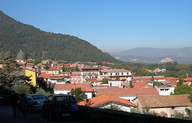
Gorga (Gorga)
.svg)
- Italian comune
 Hiking in Gorga
Gorga, a small town in the province of Rome, Lazio, is surrounded by beautiful natural landscapes, making it an excellent destination for hiking enthusiasts. The area offers a variety of trails that cater to different levels of experience, from leisurely walks to more challenging treks.
Key Highlights for Hiking in Gorga:
-
Natural Beauty: The landscape around Gorga features rolling hills, lush forests, and stunning panoramic views of the surrounding countryside. The biodiversity in the area can be fascinating, with various flora and fauna to observe.
-
Local Trails: There are several hiking trails that you can explore, ranging from easy to moderate difficulty. Popular trails may lead you through scenic woodlands and offer opportunities to discover local wildlife.
-
Cultural Heritage: Hiking in this region also provides a chance to explore the historical aspects of Gorga. You might encounter ancient ruins, churches, and other landmarks that are part of the town's rich history.
-
Accessibility: Gorga is located not far from larger cities like Rome, making it a convenient getaway for those looking to escape urban life and enjoy outdoor activities.
-
Seasonal Considerations: The best times to hike in Gorga are typically during the spring (March to May) and fall (September to November) when temperatures are mild, and the scenery is particularly beautiful. Summer can be quite hot, and winter may bring rain and snow, affecting trail conditions.
-
Safety and Preparation: As with any hiking excursion, it’s essential to be well-prepared. Ensure you have appropriate gear, sufficient water, and snacks, and consider downloading a map or using a hiking app to navigate trails. Be aware of local wildlife and the weather conditions before setting out.
-
Local Guides and Tours: If you're unfamiliar with the area or prefer a guided experience, consider joining local hiking tours. These can provide insights into the natural and cultural heritage of the region that you might miss on your own.
Hiking in Gorga can be a rewarding experience, offering both adventure and a chance to connect with nature and local culture. Whether you're a seasoned hiker or a beginner, there's something to enjoy for everyone in this charming part of Lazio.
- Country:

- Postal Code: 00030
- Local Dialing Code: 06
- Licence Plate Code: RM
- Coordinates: 41° 39' 0" N, 13° 7' 0" E


- GPS tracks (wikiloc): [Link]
- AboveSeaLevel: 766 м m
- Area: 26.19 sq km
- Population: 712
- Web site: http://www.gorga.rm.gov.it/
- Wikipedia en: wiki(en)
- Wikipedia: wiki(it)
- Wikidata storage: Wikidata: Q242698
- Wikipedia Commons Category: [Link]
- Freebase ID: [/m/0gm7c4]
- GeoNames ID: Alt: [6539760]
- VIAF ID: Alt: [236148225]
- OSM relation ID: [41427]
- GND ID: Alt: [7549302-0]
- ISTAT ID: 058045
- Italian cadastre code: E091
Shares border with regions:


Anagni
- Italian comune
Hiking in Anagni
Anagni, located in the province of Frosinone in Italy, is a historic town with a rich cultural heritage and beautiful natural landscapes, making it an excellent destination for hiking enthusiasts. Here are some highlights and tips for hiking in the Anagni area:...
- Country:
- Postal Code: 03012
- Local Dialing Code: 0775
- Licence Plate Code: FR
- Coordinates: 41° 45' 0" N, 13° 9' 0" E
- GPS tracks (wikiloc): [Link]
- AboveSeaLevel: 475 м m
- Area: 112.82 sq km
- Population: 21404
- Web site: [Link]
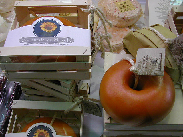

Morolo
- Italian comune
Hiking in Morolo
Morolo, located in the province of Frosinone, Italy, is a charming village that offers beautiful hiking opportunities amidst the stunning landscapes of the Lazio region. While Morolo itself is a small town, its surrounding areas provide access to various nature trails and paths perfect for hiking enthusiasts....
- Country:
- Postal Code: 03017
- Local Dialing Code: 0775
- Licence Plate Code: FR
- Coordinates: 41° 38' 0" N, 13° 12' 0" E
- GPS tracks (wikiloc): [Link]
- AboveSeaLevel: 397 м m
- Area: 26.57 sq km
- Population: 3250
- Web site: [Link]
Sgurgola
- Italian comune
Hiking in Sgurgola
Sgurgola is a charming town situated in the Lazio region of Italy, known for its scenic landscapes and proximity to hiking trails that showcase the natural beauty of the surrounding area. The region boasts a mix of mountainous terrain, rolling hills, and picturesque views which make it a great spot for hikers of all levels....
- Country:
- Postal Code: 03010
- Local Dialing Code: 0775
- Licence Plate Code: FR
- Coordinates: 41° 40' 0" N, 13° 9' 0" E
- GPS tracks (wikiloc): [Link]
- AboveSeaLevel: 386 м m
- Area: 19.22 sq km
- Population: 2651
- Web site: [Link]

Supino
- Italian comune
Hiking in Supino
Supino is a charming town in the province of Frosinone, Italy, located near the Amaseno valley. The surrounding region offers beautiful landscapes that are great for hiking enthusiasts. Here are some highlights and tips for hiking in and around Supino:...
- Country:
- Postal Code: 03019
- Local Dialing Code: 0775
- Licence Plate Code: FR
- Coordinates: 41° 37' 0" N, 13° 14' 0" E
- GPS tracks (wikiloc): [Link]
- AboveSeaLevel: 321 м m
- Area: 35.59 sq km
- Population: 4825
- Web site: [Link]


Carpineto Romano
- Italian comune
Hiking in Carpineto Romano
Carpineto Romano, located in the Lazio region of Italy, is a wonderful destination for hiking enthusiasts. Nestled in the Monti Lepini mountain range, this charming town is surrounded by stunning natural landscapes, making it an ideal spot for various outdoor activities....
- Country:
- Postal Code: 00032
- Local Dialing Code: 06
- Licence Plate Code: ROMA
- Coordinates: 41° 36' 0" N, 13° 5' 0" E
- GPS tracks (wikiloc): [Link]
- AboveSeaLevel: 550 м m
- Area: 86.29 sq km
- Population: 4425
- Web site: [Link]


Gavignano
- Italian comune
Hiking in Gavignano
Gavignano, a charming village in the province of Rome, Italy, offers some beautiful hiking opportunities thanks to its picturesque landscapes and proximity to the Monti Simbruini National Park. Here are some highlights for hiking in and around Gavignano:...
- Country:
- Postal Code: 00030
- Local Dialing Code: 06
- Licence Plate Code: RM
- Coordinates: 41° 42' 0" N, 13° 3' 0" E
- GPS tracks (wikiloc): [Link]
- AboveSeaLevel: 404 м m
- Area: 15.04 sq km
- Population: 1905
- Web site: [Link]
Montelanico
- Italian comune
Hiking in Montelanico
Montelanico is a charming town located in the Lazio region of central Italy, known for its beautiful landscapes and proximity to the Apennine mountains. Hiking in and around Montelanico offers a unique opportunity to explore stunning natural scenery, charming villages, and a rich array of local flora and fauna. Here are some key points to consider when hiking in this area:...
- Country:
- Postal Code: 00030
- Local Dialing Code: 06
- Licence Plate Code: ROMA
- Coordinates: 41° 39' 0" N, 13° 2' 23" E
- GPS tracks (wikiloc): [Link]
- AboveSeaLevel: 297 м m
- Area: 35.14 sq km
- Population: 2125
- Web site: [Link]