Supino (Supino)
.svg)
- Italian comune
 Hiking in Supino
Supino is a charming town in the province of Frosinone, Italy, located near the Amaseno valley. The surrounding region offers beautiful landscapes that are great for hiking enthusiasts. Here are some highlights and tips for hiking in and around Supino:
Trails and Routes
-
Amaseno Valley: This area features gentle hills and beautiful meadows, making it ideal for casual hikes. Several trails wind through the valley, providing stunning views of the surrounding countryside.
-
Monti Ernici: A bit further from Supino, the Monti Ernici mountain range offers more challenging hikes with breathtaking panoramas. Trails here vary in difficulty and can lead to higher altitudes, offering a more strenuous experience for seasoned hikers.
-
Historic Paths: Supino is close to historical sites, and some hiking routes may also lead you through ancient Roman pathways or past old medieval villages, adding a cultural aspect to your hiking experience.
Best Times to Hike
The best times for hiking in this region are typically in spring (April to June) and fall (September to October) when the weather is mild, and the landscapes are vibrant with wildflowers or fall foliage. Summers can be hot, and winter may bring snow to higher elevations.
Safety Tips
- Always wear appropriate footwear, as some trails might be rocky or uneven.
- Bring plenty of water and snacks, especially if you plan to hike for several hours.
- Check the weather forecast before heading out, as conditions can change rapidly in the mountains.
- Consider using hiking apps or maps to navigate the trails effectively.
Regional Highlights
- Rocca di Cave: Close to Supino, this medieval village offers hiking routes with panoramic vistas of the surrounding valleys.
- Cultural Experiences: Explore the local cuisine in Supino after your hike, as the region is known for its delicious rustic dishes and local wines.
Additional Considerations
If you're unfamiliar with the area or hiking in general, consider joining a local hiking group or hiring a guide to enhance your experience and ensure your safety.
Overall, hiking around Supino provides a mix of natural beauty, cultural heritage, and opportunities for exploration suited to various skill levels. Enjoy your adventure!
- Country:

- Postal Code: 03019
- Local Dialing Code: 0775
- Licence Plate Code: FR
- Coordinates: 41° 37' 0" N, 13° 14' 0" E


- GPS tracks (wikiloc): [Link]
- AboveSeaLevel: 321 м m
- Area: 35.59 sq km
- Population: 4825
- Web site: https://www.comune.supino.fr.gov.it/
- Wikipedia en: wiki(en)
- Wikipedia: wiki(it)
- Wikidata storage: Wikidata: Q117395
- Wikipedia Commons Category: [Link]
- Freebase ID: [/m/0gmxvl]
- GeoNames ID: Alt: [6538714]
- VIAF ID: Alt: [132475756]
- OSM relation ID: [41397]
- Library of Congress authority ID: Alt: [n2001029605]
- ISTAT ID: 060076
- Italian cadastre code: L009
Shares border with regions:
Giuliano di Roma
- Italian comune
Hiking in Giuliano di Roma
Giuliano di Roma is a charming town located in the province of Frosinone in Italy's Lazio region. The area surrounding Giuliano di Roma offers a variety of hiking opportunities, characterized by picturesque landscapes, charming countryside, and historical sites....
- Country:
- Postal Code: 03020
- Local Dialing Code: 0775
- Licence Plate Code: FR
- Coordinates: 41° 32' 0" N, 13° 17' 0" E
- GPS tracks (wikiloc): [Link]
- AboveSeaLevel: 363 м m
- Area: 33.54 sq km
- Population: 2417
- Web site: [Link]
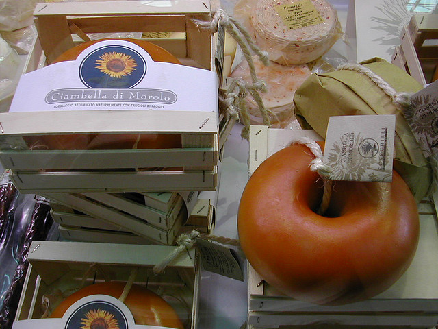

Morolo
- Italian comune
Hiking in Morolo
Morolo, located in the province of Frosinone, Italy, is a charming village that offers beautiful hiking opportunities amidst the stunning landscapes of the Lazio region. While Morolo itself is a small town, its surrounding areas provide access to various nature trails and paths perfect for hiking enthusiasts....
- Country:
- Postal Code: 03017
- Local Dialing Code: 0775
- Licence Plate Code: FR
- Coordinates: 41° 38' 0" N, 13° 12' 0" E
- GPS tracks (wikiloc): [Link]
- AboveSeaLevel: 397 м m
- Area: 26.57 sq km
- Population: 3250
- Web site: [Link]


Patrica
- Italian comune
Hiking in Patrica
Patrica, located in Italy, is known for its picturesque landscapes and hiking opportunities. Nestled within the beautiful region of Lazio, Patrica offers a mix of natural beauty, historical sites, and charming villages, making it a great spot for outdoor enthusiasts....
- Country:
- Postal Code: 03010
- Local Dialing Code: 0775
- Licence Plate Code: FR
- Coordinates: 41° 35' 0" N, 13° 15' 0" E
- GPS tracks (wikiloc): [Link]
- AboveSeaLevel: 450 м m
- Area: 27.31 sq km
- Population: 3161
- Web site: [Link]
Maenza
- Italian comune
Hiking in Maenza
Maenza is a charming town located in the province of Latina, Italy, and is surrounded by beautiful landscapes that offer a variety of hiking opportunities. The region is characterized by its rolling hills, lush vegetation, and stunning views of the surrounding countryside and coastal areas. Here are some key points to consider when hiking in and around Maenza:...
- Country:
- Postal Code: 04010
- Local Dialing Code: 0773
- Licence Plate Code: LT
- Coordinates: 41° 31' 0" N, 13° 11' 0" E
- GPS tracks (wikiloc): [Link]
- AboveSeaLevel: 358 м m
- Area: 42.13 sq km
- Population: 3118
- Web site: [Link]


Frosinone
- Italian comune
Hiking in Frosinone
Frosinone, located in the Lazio region of Italy, offers a variety of hiking opportunities that cater to different skill levels and interests. The region is known for its beautiful landscapes, historical sites, and natural parks. Here are some highlights and tips for hiking in Frosinone:...
- Country:
- Postal Code: 03100
- Local Dialing Code: 0775
- Licence Plate Code: FR
- Coordinates: 41° 38' 0" N, 13° 21' 0" E
- GPS tracks (wikiloc): [Link]
- AboveSeaLevel: 291 м m
- Area: 46.85 sq km
- Population: 46063
- Web site: [Link]


Carpineto Romano
- Italian comune
Hiking in Carpineto Romano
Carpineto Romano, located in the Lazio region of Italy, is a wonderful destination for hiking enthusiasts. Nestled in the Monti Lepini mountain range, this charming town is surrounded by stunning natural landscapes, making it an ideal spot for various outdoor activities....
- Country:
- Postal Code: 00032
- Local Dialing Code: 06
- Licence Plate Code: ROMA
- Coordinates: 41° 36' 0" N, 13° 5' 0" E
- GPS tracks (wikiloc): [Link]
- AboveSeaLevel: 550 м m
- Area: 86.29 sq km
- Population: 4425
- Web site: [Link]
Gorga
- Italian comune
Hiking in Gorga
Gorga, a small town in the province of Rome, Lazio, is surrounded by beautiful natural landscapes, making it an excellent destination for hiking enthusiasts. The area offers a variety of trails that cater to different levels of experience, from leisurely walks to more challenging treks....
- Country:
- Postal Code: 00030
- Local Dialing Code: 06
- Licence Plate Code: RM
- Coordinates: 41° 39' 0" N, 13° 7' 0" E
- GPS tracks (wikiloc): [Link]
- AboveSeaLevel: 766 м m
- Area: 26.19 sq km
- Population: 712
- Web site: [Link]


Ferentino
- town and comune in Italy
Hiking in Ferentino
Ferentino, located in the province of Frosinone in Italy, offers a wonderful setting for hiking enthusiasts. Surrounded by the beautiful landscape of the Lepini Mountains and close to the Amaseno Valley, Ferentino features a variety of trails that cater to different skill levels. Here are some highlights of hiking in this area:...
- Country:
- Postal Code: 03013
- Local Dialing Code: 0775
- Licence Plate Code: FR
- Coordinates: 41° 41' 0" N, 13° 15' 0" E
- GPS tracks (wikiloc): [Link]
- AboveSeaLevel: 393 м m
- Area: 81 sq km
- Population: 20992
- Web site: [Link]