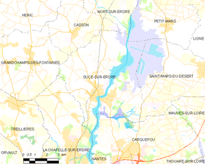
Grandchamps-des-Fontaines (Grandchamps-des-Fontaines)

- commune in Loire-Atlantique, France
- Country:

- Postal Code: 44119
- Coordinates: 47° 21' 54" N, 1° 36' 19" E


- GPS tracks (wikiloc): [Link]
- AboveSeaLevel: 35 м m
- Area: 33.87 sq km
- Population: 5665
- Web site: http://www.grandchampdesfontaines.fr
- Wikipedia en: wiki(en)
- Wikipedia: wiki(fr)
- Wikidata storage: Wikidata: Q658368
- Wikipedia Commons Category: [Link]
- Freebase ID: [/m/03nwc4w]
- Freebase ID: [/m/03nwc4w]
- GeoNames ID: Alt: [6616809]
- GeoNames ID: Alt: [6616809]
- SIREN number: [214400665]
- SIREN number: [214400665]
- BnF ID: [15260235n]
- BnF ID: [15260235n]
- VIAF ID: Alt: [237046749]
- VIAF ID: Alt: [237046749]
- INSEE municipality code: 44066
- INSEE municipality code: 44066
Shares border with regions:


Treillières
- commune in Loire-Atlantique, France
- Country:
- Postal Code: 44119
- Coordinates: 47° 19' 51" N, 1° 37' 36" E
- GPS tracks (wikiloc): [Link]
- Area: 29.05 sq km
- Population: 8734
- Web site: [Link]


Casson
- commune in Loire-Atlantique, France
- Country:
- Postal Code: 44390
- Coordinates: 47° 23' 9" N, 1° 33' 34" E
- GPS tracks (wikiloc): [Link]
- Area: 16.15 sq km
- Population: 2183
- Web site: [Link]


Héric
- commune in Loire-Atlantique, France
- Country:
- Postal Code: 44810
- Coordinates: 47° 24' 45" N, 1° 39' 6" E
- GPS tracks (wikiloc): [Link]
- Area: 73.93 sq km
- Population: 5876
- Web site: [Link]


La Chapelle-sur-Erdre
- commune in Loire-Atlantique, France
- Country:
- Postal Code: 44240
- Coordinates: 47° 17' 56" N, 1° 33' 10" E
- GPS tracks (wikiloc): [Link]
- Area: 33.42 sq km
- Population: 19159
- Web site: [Link]


Notre-Dame-des-Landes
- commune in Loire-Atlantique, France
- Country:
- Postal Code: 44130
- Coordinates: 47° 22' 51" N, 1° 42' 36" E
- GPS tracks (wikiloc): [Link]
- Area: 37.4 sq km
- Population: 2098
- Web site: [Link]

Sucé-sur-Erdre
- commune in Loire-Atlantique, France
- Country:
- Postal Code: 44240
- Coordinates: 47° 20' 0" N, 1° 32' 0" E
- GPS tracks (wikiloc): [Link]
- AboveSeaLevel: 14 м m
- Area: 41.33 sq km
- Population: 6903
- Web site: [Link]