
La Chapelle-sur-Erdre (La Chapelle-sur-Erdre)

- commune in Loire-Atlantique, France
- Country:

- Postal Code: 44240
- Coordinates: 47° 17' 56" N, 1° 33' 10" E


- GPS tracks (wikiloc): [Link]
- Area: 33.42 sq km
- Population: 19159
- Web site: http://www.lachapellesurerdre.fr
- Wikipedia en: wiki(en)
- Wikipedia: wiki(fr)
- Wikidata storage: Wikidata: Q681819
- Wikipedia Commons Category: [Link]
- Freebase ID: [/m/03nwcnw]
- Freebase ID: [/m/03nwcnw]
- GeoNames ID: Alt: [3010237]
- GeoNames ID: Alt: [3010237]
- SIREN number: [214400350]
- SIREN number: [214400350]
- BnF ID: [15260204c]
- BnF ID: [15260204c]
- VIAF ID: Alt: [263320333]
- VIAF ID: Alt: [263320333]
- OSM relation ID: [73554]
- OSM relation ID: [73554]
- WOEID: [597563]
- WOEID: [597563]
- SUDOC authorities ID: [029688558]
- SUDOC authorities ID: [029688558]
- Twitter username: Alt: [lcse44240]
- Twitter username: Alt: [lcse44240]
- INSEE municipality code: 44035
- INSEE municipality code: 44035
Shares border with regions:

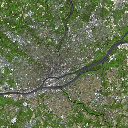
Nantes
- city in Loire-Atlantique, France
- Country:
- Postal Code: 44300; 44200; 44100; 44000
- Coordinates: 47° 13' 2" N, 1° 33' 14" E
- GPS tracks (wikiloc): [Link]
- AboveSeaLevel: 52 м m
- Area: 65.19 sq km
- Population: 303382
- Web site: [Link]


Treillières
- commune in Loire-Atlantique, France
- Country:
- Postal Code: 44119
- Coordinates: 47° 19' 51" N, 1° 37' 36" E
- GPS tracks (wikiloc): [Link]
- Area: 29.05 sq km
- Population: 8734
- Web site: [Link]


Carquefou
- commune in Loire-Atlantique, France
- Country:
- Postal Code: 44470
- Coordinates: 47° 17' 49" N, 1° 29' 34" E
- GPS tracks (wikiloc): [Link]
- Area: 43.42 sq km
- Population: 19411
- Web site: [Link]

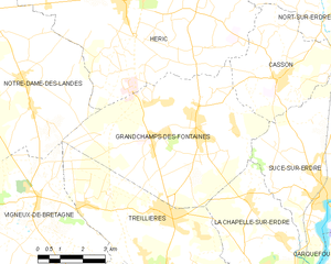
Grandchamps-des-Fontaines
- commune in Loire-Atlantique, France
- Country:
- Postal Code: 44119
- Coordinates: 47° 21' 54" N, 1° 36' 19" E
- GPS tracks (wikiloc): [Link]
- AboveSeaLevel: 35 м m
- Area: 33.87 sq km
- Population: 5665
- Web site: [Link]

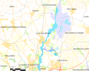
Sucé-sur-Erdre
- commune in Loire-Atlantique, France
- Country:
- Postal Code: 44240
- Coordinates: 47° 20' 0" N, 1° 32' 0" E
- GPS tracks (wikiloc): [Link]
- AboveSeaLevel: 14 м m
- Area: 41.33 sq km
- Population: 6903
- Web site: [Link]