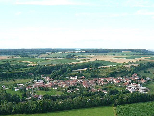
Grimonviller (Grimonviller)
- commune in Meurthe-et-Moselle, France
- Country:

- Postal Code: 54115
- Coordinates: 48° 23' 7" N, 6° 0' 25" E


- GPS tracks (wikiloc): [Link]
- Area: 4.78 sq km
- Population: 97
- Wikipedia en: wiki(en)
- Wikipedia: wiki(fr)
- Wikidata storage: Wikidata: Q585820
- Wikipedia Commons Category: [Link]
- Freebase ID: [/m/03qdhvy]
- GeoNames ID: Alt: [6436641]
- SIREN number: [215402371]
- BnF ID: [152643069]
- INSEE municipality code: 54237
Shares border with regions:
Pulney
- commune in Meurthe-et-Moselle, France
- Country:

- Postal Code: 54115
- Coordinates: 48° 23' 55" N, 6° 2' 1" E


- GPS tracks (wikiloc): [Link]
- Area: 4.4 sq km
- Population: 59


Fécocourt
- commune in Meurthe-et-Moselle, France
- Country:

- Postal Code: 54115
- Coordinates: 48° 24' 16" N, 6° 0' 30" E


- GPS tracks (wikiloc): [Link]
- Area: 7.86 sq km
- Population: 109


Courcelles
- commune in Meurthe-et-Moselle, France
- Country:

- Postal Code: 54930
- Coordinates: 48° 22' 24" N, 6° 2' 16" E


- GPS tracks (wikiloc): [Link]
- AboveSeaLevel: 320 м m
- Area: 4.31 sq km
- Population: 103


Aboncourt, Meurthe-et-Moselle
- commune in Meurthe-et-Moselle, France
- Country:

- Postal Code: 54115
- Coordinates: 48° 21' 29" N, 5° 58' 1" E


- GPS tracks (wikiloc): [Link]
- Area: 6.93 sq km
- Population: 104


Beuvezin
- commune in Meurthe-et-Moselle, France
- Country:

- Postal Code: 54115
- Coordinates: 48° 22' 45" N, 5° 57' 33" E


- GPS tracks (wikiloc): [Link]
- Area: 7.72 sq km
- Population: 99
