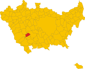
Gudo Visconti (Gudo Visconti)
.svg)
- Italian comune
 Hiking in Gudo Visconti
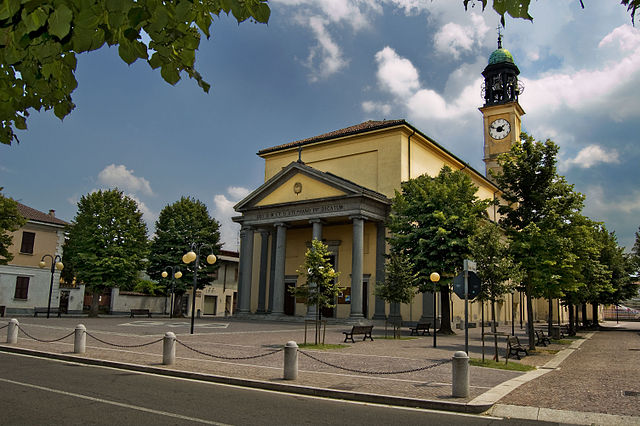
Gudo Visconti is a small municipality in the Lombardy region of Italy, located not far from Milan. While it may not be as well-known as some other hiking destinations in Italy, it offers a peaceful environment and opportunities for outdoor activities in its surrounding areas.
Hiking Opportunities:
-
Local Trails: The countryside around Gudo Visconti features a network of trails that can be explored on foot. These trails often pass through farmlands, woodlands, and along the banks of rivers. You can find routes that are suitable for all levels of hikers.
-
Parco Agricolo Sud Milano: Nearby, the Parco Agricolo Sud Milano is a large agricultural park that includes various hiking paths. It’s a great opportunity to experience nature while staying close to urban areas. This park offers a mix of landscape types, including fields, waterways, and small forests.
-
Naviglio Pavese: The Naviglio Pavese canal runs nearby, and the paths alongside the canal are perfect for leisurely walks or hikes. They provide stunning views and a serene atmosphere, ideal for a relaxing trek.
Tips for Hiking in Gudo Visconti:
- Footwear: Wear comfortable and sturdy hiking boots to handle different terrain types.
- Snacks and Water: Always carry enough water and some snacks, especially if you plan to hike for a significant period.
- Weather Check: Be sure to check the weather forecast before heading out to ensure a safe and enjoyable experience.
- Local Maps: Consider getting a local hiking map or using a hiking app to navigate the trails effectively.
- Respect Nature: Follow Leave No Trace principles to preserve the beauty of the environment.
Additional Activities:
In addition to hiking, you might explore local cultural sites, enjoy local cuisine at nearby restaurants, or take part in agricultural experiences that highlight the region’s farming traditions.
Though Gudo Visconti may not offer extreme hiking adventures, it is ideal for those looking to escape to nature and enjoy a tranquil day outdoors.
- Country:

- Postal Code: 20088
- Local Dialing Code: 02
- Licence Plate Code: MI
- Coordinates: 45° 23' 0" N, 9° 0' 0" E


- GPS tracks (wikiloc): [Link]
- AboveSeaLevel: 116 м m
- Area: 6.1 sq km
- Population: 1658
- Web site: http://www.comune.gudovisconti.mi.it
- Wikipedia en: wiki(en)
- Wikipedia: wiki(it)
- Wikidata storage: Wikidata: Q42494
- Wikipedia Commons Category: [Link]
- Freebase ID: [/m/0gj63n]
- GeoNames ID: Alt: [6542927]
- OSM relation ID: [44824]
- UN/LOCODE: [ITGVS]
- ISTAT ID: 015112
- Italian cadastre code: E258
Shares border with regions:


Gaggiano
- Italian comune
Hiking in Gaggiano
Gaggiano, located in the Lombardy region of Italy, is known for its picturesque landscapes and serene surroundings, making it a lovely destination for hiking. Although it may not be a major hiking destination compared to some of the more famous mountains and valleys in Italy, there are still plenty of opportunities for outdoor activities....
- Country:
- Postal Code: 20083
- Local Dialing Code: 02
- Licence Plate Code: MI
- Coordinates: 45° 24' 17" N, 9° 2' 6" E
- GPS tracks (wikiloc): [Link]
- AboveSeaLevel: 117 м m
- Area: 26.26 sq km
- Population: 9131
- Web site: [Link]

Morimondo
- Italian comune
Hiking in Morimondo
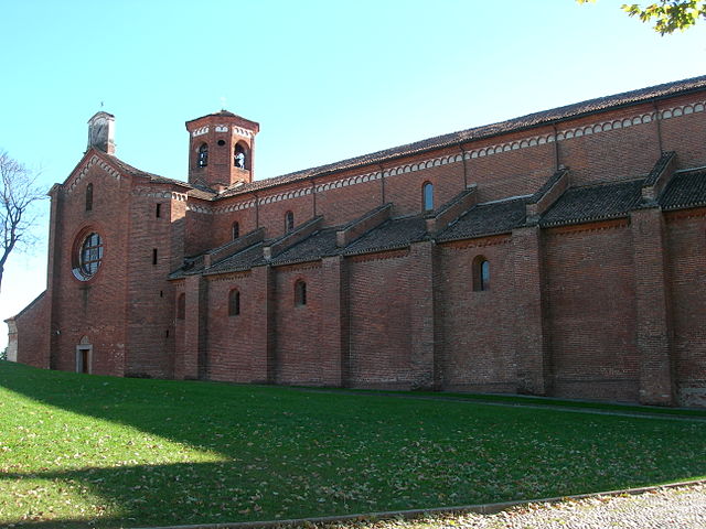
Morimondo is a charming small town located in Lombardy, Italy, known for its historical abbey and serene countryside. While Morimondo is not primarily recognized as a hiking destination, the surrounding area offers beautiful trails that cater to hikers of various skill levels....
- Country:
- Postal Code: 20081
- Local Dialing Code: 02
- Licence Plate Code: MI
- Coordinates: 45° 21' 0" N, 8° 57' 0" E
- GPS tracks (wikiloc): [Link]
- AboveSeaLevel: 109 м m
- Area: 26 sq km
- Population: 1138
- Web site: [Link]

Rosate
- Italian comune
Hiking in Rosate
Rosate is a small town located in the Lombardy region of Italy, not far from Milan. While it may not be known for extensive hiking trails, the surrounding areas offer several opportunities for outdoor activities and nature exploration. Here are some insights and tips for hiking in and around Rosate:...
- Country:
- Postal Code: 20088
- Local Dialing Code: 02
- Licence Plate Code: MI
- Coordinates: 45° 20' 0" N, 9° 1' 0" E
- GPS tracks (wikiloc): [Link]
- AboveSeaLevel: 107 м m
- Area: 18.68 sq km
- Population: 5762
- Web site: [Link]

Vermezzo
- settlement in the italian municipality of Vermezzo con Zelo
Hiking in Vermezzo
Vermezzo is a small town located in the Lombardy region of Italy, known more for its proximity to larger cities like Milan than for extensive hiking networks. However, the surrounding areas offer some opportunities for outdoor activities, including hiking....
- Country:
- Postal Code: 20080
- Local Dialing Code: 02
- Licence Plate Code: MI
- Coordinates: 45° 24' 0" N, 8° 58' 0" E
- GPS tracks (wikiloc): [Link]
- AboveSeaLevel: 111 м m
- Area: 6.31 sq km
- Population: 3931
- Web site: [Link]


Zelo Surrigone
- settlement in the italian municipality of Vermezzo con Zelo
Hiking in Zelo Surrigone
Zelo Surrigone is a small town located in the Lombardy region of Italy, not far from Milan. While it may not be a major tourist destination, it offers access to some beautiful natural surroundings that are perfect for hiking enthusiasts....
- Country:
- Postal Code: 20080
- Local Dialing Code: 02
- Licence Plate Code: MI
- Coordinates: 45° 23' 0" N, 8° 59' 0" E
- GPS tracks (wikiloc): [Link]
- AboveSeaLevel: 113 м m
- Area: 4.43 sq km
- Population: 1842
- Web site: [Link]