Hénaménil (Hénaménil)

- commune in Meurthe-et-Moselle, France
- Country:

- Postal Code: 54370
- Coordinates: 48° 40' 15" N, 6° 33' 31" E


- GPS tracks (wikiloc): [Link]
- Area: 14.21 sq km
- Population: 153
- Wikipedia en: wiki(en)
- Wikipedia: wiki(fr)
- Wikidata storage: Wikidata: Q1064002
- Wikipedia Commons Category: [Link]
- Freebase ID: [/m/03qdj2h]
- Freebase ID: [/m/03qdj2h]
- GeoNames ID: Alt: [6436659]
- GeoNames ID: Alt: [6436659]
- SIREN number: [215402587]
- SIREN number: [215402587]
- BnF ID: [152643278]
- BnF ID: [152643278]
- INSEE municipality code: 54258
- INSEE municipality code: 54258
Shares border with regions:

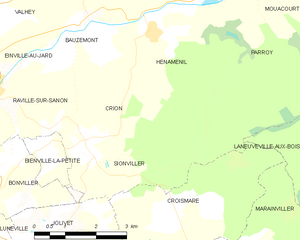
Crion
- commune in Meurthe-et-Moselle, France
- Country:
- Postal Code: 54300
- Coordinates: 48° 38' 24" N, 6° 31' 38" E
- GPS tracks (wikiloc): [Link]
- Area: 8.08 sq km
- Population: 93


Bauzemont
- commune in Meurthe-et-Moselle, France
- Country:
- Postal Code: 54370
- Coordinates: 48° 40' 22" N, 6° 31' 40" E
- GPS tracks (wikiloc): [Link]
- Area: 6.32 sq km
- Population: 149


Laneuveville-aux-Bois
- commune in Meurthe-et-Moselle, France
- Country:
- Postal Code: 54370
- Coordinates: 48° 36' 41" N, 6° 39' 0" E
- GPS tracks (wikiloc): [Link]
- Area: 19.04 sq km
- Population: 314


Bathelémont
- commune in Meurthe-et-Moselle, France
- Country:
- Postal Code: 54370
- Coordinates: 48° 41' 30" N, 6° 31' 30" E
- GPS tracks (wikiloc): [Link]
- Area: 6.6 sq km
- Population: 62


Bures
- commune in Meurthe-et-Moselle, France
- Country:
- Postal Code: 54370
- Coordinates: 48° 41' 39" N, 6° 34' 35" E
- GPS tracks (wikiloc): [Link]
- Area: 5.74 sq km
- Population: 66


Parroy
- commune in Meurthe-et-Moselle, France
- Country:
- Postal Code: 54370
- Coordinates: 48° 40' 57" N, 6° 36' 3" E
- GPS tracks (wikiloc): [Link]
- Area: 17.65 sq km
- Population: 163