canton of Lunéville-Sud (canton de Lunéville-Sud)
- canton of France
- Country:

- Capital: Lunéville
- Coordinates: 48° 35' 20" N, 6° 34' 33" E


- GPS tracks (wikiloc): [Link]
- Wikidata storage: Wikidata: Q1726009
- INSEE canton code: [5418]
Includes regions:

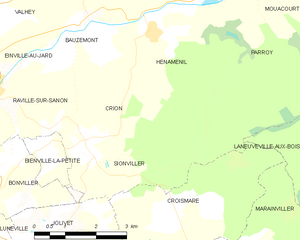
Crion
- commune in Meurthe-et-Moselle, France
- Country:
- Postal Code: 54300
- Coordinates: 48° 38' 24" N, 6° 31' 38" E
- GPS tracks (wikiloc): [Link]
- Area: 8.08 sq km
- Population: 93

Bénaménil
- commune in Meurthe-et-Moselle, France
- Country:
- Postal Code: 54450
- Coordinates: 48° 34' 12" N, 6° 40' 25" E
- GPS tracks (wikiloc): [Link]
- Area: 9.38 sq km
- Population: 577


Laneuveville-aux-Bois
- commune in Meurthe-et-Moselle, France
- Country:
- Postal Code: 54370
- Coordinates: 48° 36' 41" N, 6° 39' 0" E
- GPS tracks (wikiloc): [Link]
- Area: 19.04 sq km
- Population: 314


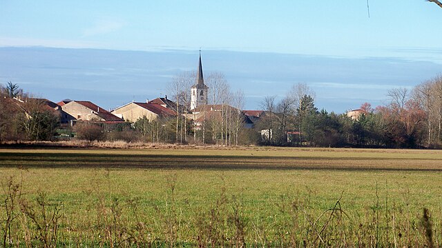
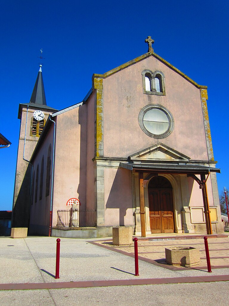
Hénaménil
- commune in Meurthe-et-Moselle, France
- Country:
- Postal Code: 54370
- Coordinates: 48° 40' 15" N, 6° 33' 31" E
- GPS tracks (wikiloc): [Link]
- Area: 14.21 sq km
- Population: 153

Hériménil
- commune in Meurthe-et-Moselle, France
- Country:
- Postal Code: 54300
- Coordinates: 48° 34' 1" N, 6° 29' 59" E
- GPS tracks (wikiloc): [Link]
- Area: 12.48 sq km
- Population: 956


Laronxe
- commune in Meurthe-et-Moselle, France
- Country:
- Postal Code: 54950
- Coordinates: 48° 32' 27" N, 6° 36' 16" E
- GPS tracks (wikiloc): [Link]
- Area: 6.83 sq km
- Population: 373


Thiébauménil
- commune in Meurthe-et-Moselle, France
- Country:
- Postal Code: 54300
- Coordinates: 48° 34' 47" N, 6° 37' 22" E
- GPS tracks (wikiloc): [Link]
- Area: 3.87 sq km
- Population: 385


Moncel-lès-Lunéville
- commune in Meurthe-et-Moselle, France
- Country:
- Postal Code: 54300
- Coordinates: 48° 34' 26" N, 6° 31' 44" E
- GPS tracks (wikiloc): [Link]
- Area: 21.94 sq km
- Population: 634

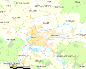
Lunéville
- commune in Meurthe-et-Moselle, France
- Country:
- Postal Code: 54300
- Coordinates: 48° 35' 22" N, 6° 30' 6" E
- GPS tracks (wikiloc): [Link]
- AboveSeaLevel: 230 м m
- Area: 16.34 sq km
- Population: 19020
- Web site: [Link]
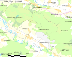
Saint-Clément
- commune in Meurthe-et-Moselle, France
- Country:
- Postal Code: 54950
- Coordinates: 48° 31' 53" N, 6° 36' 9" E
- GPS tracks (wikiloc): [Link]
- Area: 16.47 sq km
- Population: 852

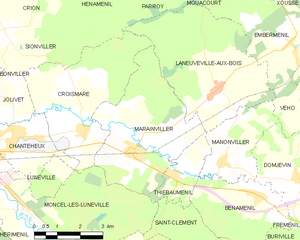
Marainviller
- commune in Meurthe-et-Moselle, France
- Country:
- Postal Code: 54300
- Coordinates: 48° 35' 22" N, 6° 36' 2" E
- GPS tracks (wikiloc): [Link]
- Area: 16.99 sq km
- Population: 659

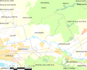
Croismare
- commune in Meurthe-et-Moselle, France
- Country:
- Postal Code: 54300
- Coordinates: 48° 35' 57" N, 6° 34' 14" E
- GPS tracks (wikiloc): [Link]
- Area: 15.7 sq km
- Population: 621


Manonviller
- commune in Meurthe-et-Moselle, France
- Country:
- Postal Code: 54300
- Coordinates: 48° 35' 0" N, 6° 39' 3" E
- GPS tracks (wikiloc): [Link]
- Area: 6.98 sq km
- Population: 171


Jolivet
- commune in Meurthe-et-Moselle, France
- Country:
- Postal Code: 54300
- Coordinates: 48° 36' 20" N, 6° 30' 26" E
- GPS tracks (wikiloc): [Link]
- Area: 7.2 sq km
- Population: 903


Chenevières
- commune in Meurthe-et-Moselle, France
- Country:
- Postal Code: 54122
- Coordinates: 48° 31' 7" N, 6° 37' 51" E
- GPS tracks (wikiloc): [Link]
- Area: 4.54 sq km
- Population: 500


Chanteheux
- commune in Meurthe-et-Moselle, France
- Country:
- Postal Code: 54300
- Coordinates: 48° 36' 0" N, 6° 31' 50" E
- GPS tracks (wikiloc): [Link]
- Area: 5.79 sq km
- Population: 2133