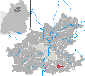
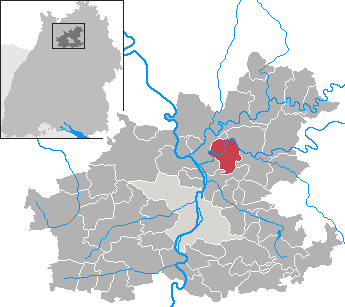
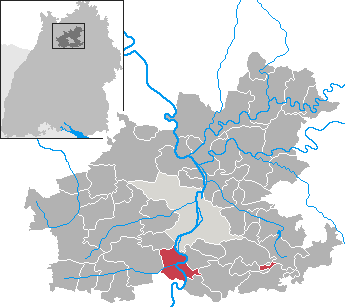
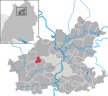
Heilbronn (Landkreis Heilbronn)
.svg)
- district in Germany
 Hiking in Heilbronn
Heilbronn is a district located in the state of Baden-Württemberg, Germany, characterized by its diverse landscapes, rolling vineyards, and a mix of cultural and historical attractions. Here are some highlights of hiking in the Heilbronn district:
Trails and Natural Areas
-
Schwabenweg: This long-distance hiking trail runs through the region, offering scenic views of vineyards, forests, and the picturesque landscape of the Neckar River valley.
-
Heilbronner Hohenweg: A scenic circuit around Heilbronn that leads hikers through vineyards and hilly terrains, providing stunning panorama views of the surrounding countryside.
-
Hiking Areas: The district features various natural reserves and parks such as the Neckar Valley and the Kochertal, where you can find well-marked hiking paths that cater to different skill levels.
-
Swabian Jura: Just a short drive from Heilbronn, you can access the Swabian Jura, which offers rugged terrain and dramatic rock formations, ideal for more challenging hikes.
Points of Interest
-
Vineyards: As Heilbronn is known for its wine production, many hiking trails take you through beautiful vineyards, allowing you to enjoy local wine culture along the way.
-
Cultural Landmarks: Hikes often pass historical sites, including castles, churches, and quaint villages. The combination of nature and culture makes for a rewarding experience.
Practical Information
-
Trail Markings: Trails in the Heilbronn district are typically well-marked with signs, making them easy to navigate. It's advisable to carry a local hiking map or download trail apps for additional guidance.
-
Seasonal Considerations: Spring and autumn are particularly beautiful times to hike, with blooming flowers and colorful foliage. Summers can be hot, while winters may have snow, affecting trail accessibility.
-
Local Tips: Always check local weather conditions before heading out, and stay hydrated. It's also a good idea to wear suitable footwear and carry a small backpack with essentials.
Conclusion
Hiking in the Heilbronn district combines natural beauty with cultural experiences, making it a fantastic destination for outdoor enthusiasts. Whether you’re seeking leisurely walks through vineyards or challenging hikes in the hills, the region offers a variety of options to explore the charming landscapes of Baden-Württemberg.
- Country:

- Capital: Heilbronn
- Licence Plate Code: HN
- Coordinates: 49° 9' 36" N, 9° 15' 0" E


- GPS tracks (wikiloc): [Link]
- AboveSeaLevel: 166 м m
- Area: 1099.93 sq km
- Population: 334388
- Web site: http://www.landkreis-heilbronn.de/
- Wikipedia en: wiki(en)
- Wikipedia: wiki(de)
- Wikidata storage: Wikidata: Q7166
- Wikipedia Commons Category: [Link]
- Freebase ID: [/m/01hcw1]
- GeoNames ID: Alt: [3220743]
- VIAF ID: Alt: [140235735]
- OSM relation ID: [62750]
- GND ID: Alt: [4096102-3]
- archINFORM location ID: [2451]
- Library of Congress authority ID: Alt: [n82043423]
- TGN ID: [7077337]
- ISNI: Alt: [0000 0001 0694 6575]
- NUTS code: [DE118]
- German district key: 08125
Includes regions:

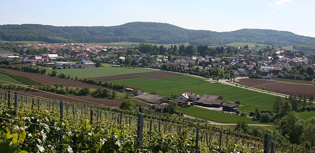
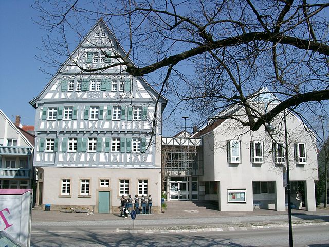
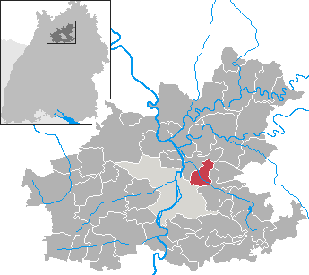
Weinsberg
- town in the German state Baden-Württemberg
Hiking in Weinsberg
Weinsberg, located in the state of Baden-Württemberg, Germany, is a charming town nestled between vineyards and rolling hills. It offers a variety of hiking opportunities for both novice and experienced hikers. Here are some highlights of hiking in the Weinsberg area:...
- Country:
- Postal Code: 74189
- Local Dialing Code: 07134
- Licence Plate Code: HN
- Coordinates: 49° 9' 7" N, 9° 17' 9" E
- GPS tracks (wikiloc): [Link]
- AboveSeaLevel: 219 м m
- Area: 22.22 sq km
- Population: 11615
- Web site: [Link]

Neckarwestheim
- municipality in Germany
Hiking in Neckarwestheim
Neckarwestheim, located in Baden-Württemberg, Germany, offers a variety of hiking opportunities that showcase the beautiful landscape of the region. The area is characterized by its scenic views of the Neckar River, rolling hills, and picturesque vineyards. Here’s a guide to hiking in Neckarwestheim:...
- Country:
- Postal Code: 74382
- Local Dialing Code: 07133
- Licence Plate Code: HN
- Coordinates: 49° 3' 0" N, 9° 11' 0" E
- GPS tracks (wikiloc): [Link]
- AboveSeaLevel: 254 м m
- Area: 13.98 sq km
- Population: 3590
- Web site: [Link]
Jagsthausen
- municipality in Germany
Hiking in Jagsthausen
Jagsthausen is a charming village located in the Baden-Württemberg region of Germany, known for its picturesque landscapes and rich history. It offers a variety of hiking opportunities that are suitable for different experience levels....
- Country:
- Postal Code: 74249
- Local Dialing Code: 07943
- Licence Plate Code: HN
- Coordinates: 49° 18' 0" N, 9° 28' 0" E
- GPS tracks (wikiloc): [Link]
- AboveSeaLevel: 240 м m
- Area: 17.67 sq km
- Population: 1851
- Web site: [Link]


Bad Rappenau
- German town
Hiking in Bad Rappenau
Bad Rappenau is a charming town located in Baden-Württemberg, Germany, surrounded by beautiful nature, making it a wonderful destination for hiking enthusiasts. Here are some key points about hiking in and around Bad Rappenau:...
- Country:
- Postal Code: 74906
- Local Dialing Code: 07266; 06268; 07268; 07066; 07264
- Licence Plate Code: HN
- Coordinates: 49° 14' 20" N, 9° 6' 10" E
- GPS tracks (wikiloc): [Link]
- AboveSeaLevel: 235 м m
- Area: 73.55 sq km
- Population: 20268
- Web site: [Link]

Abstatt
- municipality in Germany
Hiking in Abstatt
Abstatt is a charming village in the state of Baden-Württemberg, Germany, known for its picturesque landscapes and outdoor activities, including hiking. The region is characterized by rolling hills, vineyards, and beautiful forested areas, making it an ideal destination for nature lovers and hiking enthusiasts....
- Country:
- Postal Code: 74232
- Local Dialing Code: 07062
- Licence Plate Code: HN
- Coordinates: 49° 4' 0" N, 9° 18' 0" E
- GPS tracks (wikiloc): [Link]
- AboveSeaLevel: 241 м m
- Area: 9.66 sq km
- Population: 4779
- Web site: [Link]

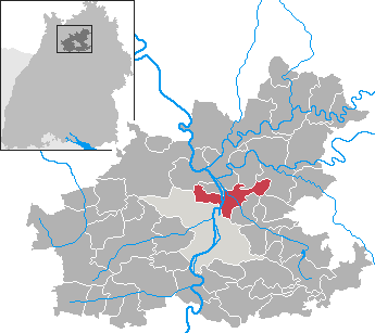
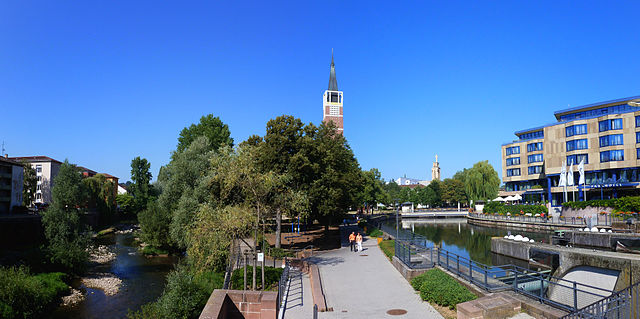
Neckarsulm
- municipality in Germany
Hiking in Neckarsulm
Neckarsulm, located in the Baden-Württemberg region of Germany, is a town that offers a variety of outdoor activities, including hiking. The surrounding area is characterized by beautiful landscapes, vineyards, and scenic routes, making it a great destination for nature enthusiasts....
- Country:
- Postal Code: 74172
- Local Dialing Code: 07132
- Licence Plate Code: HN
- Coordinates: 49° 11' 30" N, 9° 13' 28" E
- GPS tracks (wikiloc): [Link]
- AboveSeaLevel: 162 м m
- Area: 24.94 sq km
- Population: 25798
- Web site: [Link]


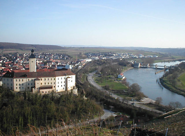
Bad Wimpfen
- municipality in Germany
Hiking in Bad Wimpfen
Bad Wimpfen, located in Germany's Baden-Württemberg region, is a charming town that offers a variety of hiking opportunities. Nestled along the banks of the Neckar River and surrounded by scenic landscapes, it's a great destination for both casual walkers and avid hikers....
- Country:
- Postal Code: 74206
- Local Dialing Code: 07063
- Licence Plate Code: HN
- Coordinates: 49° 13' 50" N, 9° 9' 47" E
- GPS tracks (wikiloc): [Link]
- AboveSeaLevel: 195 м m
- Area: 19.38 sq km
- Population: 6971
- Web site: [Link]


Widdern
- municipality in Germany
Hiking in Widdern
Widdern is a small town located in the state of Baden-Württemberg, Germany, and is known for its picturesque landscapes and scenic trails that are ideal for hiking enthusiasts. The surrounding area features a mix of natural beauty including rolling hills, forests, and agricultural land, providing a serene environment for outdoor activities....
- Country:
- Postal Code: 74259
- Local Dialing Code: 06298
- Licence Plate Code: HN
- Coordinates: 49° 19' 0" N, 9° 25' 0" E
- GPS tracks (wikiloc): [Link]
- AboveSeaLevel: 185 м m
- Area: 25.23 sq km
- Population: 1833
- Web site: [Link]


Bad Friedrichshall
- municipality in Germany
Hiking in Bad Friedrichshall
Bad Friedrichshall is a lovely town in the northern part of Baden-Württemberg, Germany, and it's surrounded by beautiful landscapes that make it a suitable destination for hiking enthusiasts. The region offers a variety of trails that cater to different skill levels, providing opportunities to explore scenic countryside and enjoy the natural beauty of the area....
- Country:
- Postal Code: 74177
- Local Dialing Code: 07136
- Licence Plate Code: HN
- Coordinates: 49° 14' 0" N, 9° 13' 0" E
- GPS tracks (wikiloc): [Link]
- AboveSeaLevel: 167 м m
- Area: 24.70 sq km
- Population: 19244
- Web site: [Link]


Wüstenrot
- municipality in the Mainhardter Forest with about 6,800 inhabitants
Hiking in Wüstenrot
Wüstenrot is a beautiful destination located in the state of Baden-Württemberg, Germany. This area is known for its picturesque landscapes, diverse flora and fauna, and well-maintained hiking trails. Here are some highlights and tips for hiking in Wüstenrot:...
- Country:
- Postal Code: 71543
- Local Dialing Code: 07945
- Licence Plate Code: HN
- Coordinates: 49° 5' 0" N, 9° 28' 0" E
- GPS tracks (wikiloc): [Link]
- AboveSeaLevel: 495 м m
- Area: 30.02 sq km
- Population: 6837
- Web site: [Link]


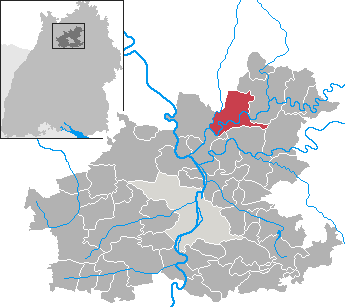
Neuenstadt am Kocher
- municipality in Germany
Hiking in Neuenstadt am Kocher
Neuenstadt am Kocher, located in Baden-Württemberg, Germany, offers picturesque landscapes and a variety of hiking opportunities. Nestled within the scenic Kocher valley, hikers can enjoy beautiful views of the surrounding countryside, lush forests, and quaint villages....
- Country:
- Postal Code: 74196
- Local Dialing Code: 07139
- Licence Plate Code: HN
- Coordinates: 49° 14' 0" N, 9° 20' 0" E
- GPS tracks (wikiloc): [Link]
- AboveSeaLevel: 187 м m
- Area: 41.18 sq km
- Population: 9918
- Web site: [Link]


Untereisesheim
- municipality in Germany
Hiking in Untereisesheim
Untereisesheim, located in the state of Baden-Württemberg, Germany, is a charming area that offers scenic landscapes and opportunities for hiking enthusiasts. While it may not be as widely known for hiking as other regions, it provides beautiful walking trails that can take you through the picturesque countryside, vineyards, and along the nearby rivers....
- Country:
- Postal Code: 74257
- Local Dialing Code: 07132
- Licence Plate Code: HN
- Coordinates: 49° 13' 0" N, 9° 12' 0" E
- GPS tracks (wikiloc): [Link]
- AboveSeaLevel: 161 м m
- Area: 3.67 sq km
- Population: 4129
- Web site: [Link]


Talheim
- municipality in the district Heilbronn, Baden-Württemberg, Germany
Hiking in Talheim
Talheim, located near Heilbronn in Germany, offers some scenic opportunities for hiking, especially for those who enjoy exploring the lush landscapes of the Swabian region. The area is characterized by vineyards, rolling hills, and wooded trails, making it a pleasant destination for outdoor enthusiasts....
- Country:
- Postal Code: 74388
- Local Dialing Code: 07133
- Licence Plate Code: HN
- Coordinates: 49° 5' 0" N, 9° 12' 0" E
- GPS tracks (wikiloc): [Link]
- AboveSeaLevel: 236 м m
- Area: 11.62 sq km
- Population: 4917
- Web site: [Link]

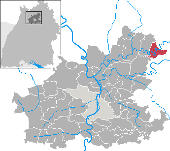
Neudenau
- municipality in Germany
Hiking in Neudenau
Neudenau is a charming town located in the Baden-Württemberg region of Germany. It's surrounded by beautiful landscapes that offer various hiking opportunities for outdoor enthusiasts. The area around Neudenau features scenic trails that go through forests, hills, and along rivers, making it ideal for both casual strolls and more challenging hikes....
- Country:
- Postal Code: 74861
- Local Dialing Code: 06298; 06264
- Licence Plate Code: HN
- Coordinates: 49° 17' 0" N, 9° 16' 0" E
- GPS tracks (wikiloc): [Link]
- AboveSeaLevel: 189 м m
- Area: 32.92 sq km
- Population: 5079
- Web site: [Link]


Offenau
- municipality in Germany
Hiking in Offenau
Offenau is a small town located in the Baden-Württemberg region of Germany, known for its picturesque landscapes and scenic walking trails. While it may not be as famous as some larger hiking destinations, it offers plenty of opportunities for outdoor enthusiasts to explore nature at a leisurely pace....
- Country:
- Postal Code: 74254
- Local Dialing Code: 07136
- Coordinates: 49° 15' 0" N, 9° 10' 0" E
- GPS tracks (wikiloc): [Link]
- AboveSeaLevel: 150 м m
- Area: 5.65 sq km
- Population: 2685
- Web site: [Link]


Möckmühl
- municipality in Germany
Hiking in Möckmühl
Möckmühl is a charming town located in the Baden-Württemberg region of Germany, surrounded by picturesque landscapes that are ideal for hiking enthusiasts. The area is characterized by lush forests, gentle hills, and beautiful meadows, providing a range of trails suitable for different skill levels....
- Country:
- Postal Code: 74219
- Local Dialing Code: 06298
- Licence Plate Code: HN
- Coordinates: 49° 19' 0" N, 9° 21' 0" E
- GPS tracks (wikiloc): [Link]
- AboveSeaLevel: 179 м m
- Area: 49.6 sq km
- Population: 7817
- Web site: [Link]


Roigheim
- municipality in Germany
Hiking in Roigheim
Roigheim is a charming municipality located in the Baden-Württemberg state of Germany, known for its picturesque landscapes and hiking opportunities. While the region is relatively small, it is surrounded by beautiful natural areas that offer a variety of hiking trails suitable for different skill levels....
- Country:
- Postal Code: 74255
- Local Dialing Code: 06298
- Licence Plate Code: HN
- Coordinates: 49° 22' 0" N, 9° 20' 0" E
- GPS tracks (wikiloc): [Link]
- AboveSeaLevel: 220 м m
- Area: 14.01 sq km
- Population: 1391
- Web site: [Link]


Nordheim
- municipality in Germany
Hiking in Nordheim
Nordheim, located in Baden-Württemberg, Germany, is a charming area that offers various opportunities for hiking enthusiasts. While the town itself is small, it is surrounded by beautiful natural landscapes that provide a variety of hiking trails suitable for different skill levels....
- Country:
- Postal Code: 74226
- Local Dialing Code: 07133
- Licence Plate Code: HN
- Coordinates: 49° 7' 0" N, 9° 8' 0" E
- GPS tracks (wikiloc): [Link]
- AboveSeaLevel: 188 м m
- Area: 12.71 sq km
- Population: 8193
- Web site: [Link]

Obersulm
- municipality in Germany
Hiking in Obersulm
Obersulm is a small municipality located in Baden-Württemberg, Germany, known for its beautiful landscapes and outdoor recreational opportunities, including hiking. The area features a mix of vineyards, forests, and rolling hills, providing a scenic backdrop for hikers of all skill levels....
- Country:
- Postal Code: 74182
- Local Dialing Code: 07946; 07134; 07130
- Licence Plate Code: HN
- Coordinates: 49° 8' 0" N, 9° 23' 0" E
- GPS tracks (wikiloc): [Link]
- AboveSeaLevel: 203 м m
- Area: 31.07 sq km
- Population: 13826
- Web site: [Link]


Eppingen
- municipality in Germany
Hiking in Eppingen
Eppingen, located in the northwestern part of Baden-Württemberg, Germany, offers some lovely hiking opportunities that showcase the beautiful landscapes of the region. Here are a few key highlights and tips for hiking in Eppingen:...
- Country:
- Postal Code: 75031
- Local Dialing Code: 07138; 07260; 07262
- Licence Plate Code: HN
- Coordinates: 49° 8' 0" N, 8° 55' 0" E
- GPS tracks (wikiloc): [Link]
- AboveSeaLevel: 199 м m
- Area: 88.59 sq km
- Population: 21094
- Web site: [Link]

Untergruppenbach
- municipality in Germany
Hiking in Untergruppenbach
Untergruppenbach is a charming village located in the Baden-Württemberg region of Germany, surrounded by beautiful landscapes that make it a great spot for hiking enthusiasts. The area boasts a mix of rolling hills, vineyards, and wooded areas, offering a variety of trails for different skill levels....
- Country:
- Postal Code: 74199
- Local Dialing Code: 07131
- Licence Plate Code: HN
- Coordinates: 49° 5' 22" N, 9° 16' 31" E
- GPS tracks (wikiloc): [Link]
- AboveSeaLevel: 276 м m
- Area: 27.27 sq km
- Population: 8122
- Web site: [Link]


Siegelsbach
- municipality in Germany
Hiking in Siegelsbach
Siegelsbach, a small town in Germany, is surrounded by beautiful landscapes that make it a great destination for hiking enthusiasts. The area features a mix of flat terrain and gentle hills, providing trails suitable for hikers of all skill levels. Here are some highlights for hiking in and around Siegelsbach:...
- Country:
- Postal Code: 74936
- Local Dialing Code: 07264
- Licence Plate Code: HN
- Coordinates: 49° 16' 0" N, 9° 5' 0" E
- GPS tracks (wikiloc): [Link]
- AboveSeaLevel: 270 м m
- Area: 7.68 sq km
- Population: 1627
- Web site: [Link]


Eberstadt
- municipality in Germany
Hiking in Eberstadt
Eberstadt, located in the state of Hesse, Germany, is surrounded by scenic landscapes that offer a variety of hiking opportunities. The area is known for its picturesque views, lush green forests, and rolling hills, making it a great destination for both novice and experienced hikers....
- Country:
- Postal Code: 74246
- Local Dialing Code: 07134
- Licence Plate Code: HN
- Coordinates: 49° 11' 0" N, 9° 19' 0" E
- GPS tracks (wikiloc): [Link]
- AboveSeaLevel: 191 м m
- Area: 12.50 sq km
- Population: 3155
- Web site: [Link]


Schwaigern
- municipality in Germany
Hiking in Schwaigern
Schwaigern is a charming town located in the Baden-Württemberg region of Germany, surrounded by picturesque landscapes that make it a great spot for hiking enthusiasts. Here are some key points to consider when hiking in and around Schwaigern:...
- Country:
- Postal Code: 74193
- Local Dialing Code: 07138
- Licence Plate Code: HN
- Coordinates: 49° 8' 0" N, 9° 3' 0" E
- GPS tracks (wikiloc): [Link]
- AboveSeaLevel: 189 м m
- Area: 49.49 sq km
- Population: 11396
- Web site: [Link]


Flein
- municipality in Germany
Hiking in Flein
Flein is a municipality located in the state of Baden-Württemberg, Germany. While it may not be as widely known as some larger hiking destinations, there are still opportunities for hiking and enjoying the natural landscape in and around the area....
- Country:
- Postal Code: 74223
- Local Dialing Code: 07131
- Licence Plate Code: HN
- Coordinates: 49° 6' 0" N, 9° 13' 0" E
- GPS tracks (wikiloc): [Link]
- AboveSeaLevel: 212 м m
- Area: 8.47 sq km
- Population: 7064
- Web site: [Link]

Oedheim
- municipality in Germany
Hiking in Oedheim
Oedheim is a charming town located in Germany, specifically in the state of Baden-Württemberg. It offers a range of outdoor activities, including hiking, primarily due to its scenic landscapes, forested areas, and proximity to the picturesque countryside....
- Country:
- Postal Code: 74229
- Local Dialing Code: 07139; 07136
- Licence Plate Code: HN
- Coordinates: 49° 14' 0" N, 9° 15' 0" E
- GPS tracks (wikiloc): [Link]
- AboveSeaLevel: 166 м m
- Area: 21.26 sq km
- Population: 6414
- Web site: [Link]


Hardthausen am Kocher
- municipality in Germany
Hiking in Hardthausen am Kocher
Hardthausen am Kocher, located in the Baden-Württemberg region of Germany, is a charming area for hiking enthusiasts. Nestled along the Kocher River, the town is surrounded by beautiful landscapes, rolling hills, and lush forests, making it ideal for outdoor activities....
- Country:
- Postal Code: 74249; 74239
- Local Dialing Code: 07139
- Licence Plate Code: HN
- Coordinates: 49° 14' 0" N, 9° 24' 0" E
- GPS tracks (wikiloc): [Link]
- AboveSeaLevel: 182 м m
- Area: 35.55 sq km
- Population: 4094
- Web site: [Link]


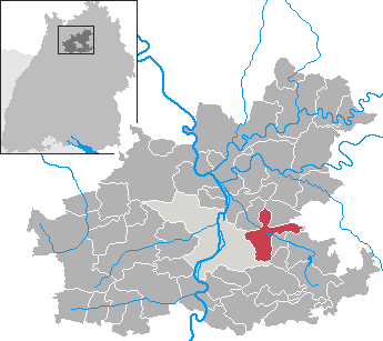
Ellhofen
- municipality in Germany
Hiking in Ellhofen
Ellhofen is a small municipality in Baden-Württemberg, Germany, known for its picturesque landscapes and proximity to nature. While it may not be one of the most widely recognized hiking destinations, the region offers some delightful trails and opportunities for outdoor enthusiasts....
- Country:
- Postal Code: 74248
- Local Dialing Code: 07134
- Licence Plate Code: HN
- Coordinates: 49° 8' 49" N, 9° 19' 17" E
- GPS tracks (wikiloc): [Link]
- AboveSeaLevel: 189 м m
- Area: 5.86 sq km
- Population: 3717
- Web site: [Link]


Gemmingen
- municipality in Germany
Hiking in Gemmingen
Gemmingen, a town located in the district of Heilbronn in Baden-Württemberg, Germany, offers charming landscapes and some hiking opportunities nearby. While it might not be a major hiking destination, it is surrounded by the beautiful countryside that can be explored through various trails....
- Country:
- Postal Code: 75050
- Local Dialing Code: 07267
- Licence Plate Code: HN
- Coordinates: 49° 9' 0" N, 8° 59' 0" E
- GPS tracks (wikiloc): [Link]
- AboveSeaLevel: 212 м m
- Area: 19.08 sq km
- Population: 5158
- Web site: [Link]

Ilsfeld
- municipality in Germany
Hiking in Ilsfeld
Ilsfeld, located in the beautiful region of Baden-Württemberg, Germany, is a charming village surrounded by picturesque landscapes, vineyards, and forests, making it a great destination for hiking enthusiasts. Here are some notable aspects of hiking in Ilsfeld:...
- Country:
- Postal Code: 74360
- Local Dialing Code: 07062
- Licence Plate Code: HN
- Coordinates: 49° 3' 0" N, 9° 15' 0" E
- GPS tracks (wikiloc): [Link]
- AboveSeaLevel: 230 м m
- Area: 26.51 sq km
- Population: 9419
- Web site: [Link]


Ittlingen
- municipality in Germany
Hiking in Ittlingen
Ittlingen is a small town located in the Baden-Württemberg region of Germany, known for its charming landscapes and natural beauty. If you are considering hiking in this area, here's what you can expect:...
- Country:
- Postal Code: 74930
- Local Dialing Code: 07266
- Licence Plate Code: HN
- Coordinates: 49° 11' 0" N, 8° 56' 0" E
- GPS tracks (wikiloc): [Link]
- AboveSeaLevel: 181 м m
- Area: 14.11 sq km
- Population: 2433
- Web site: [Link]


Leingarten
- municipality in Germany
Hiking in Leingarten
Leingarten, located in the Baden-Württemberg region of Germany, offers a variety of scenic hiking opportunities. This area is characterized by its picturesque vineyards, rolling hills, and lush landscapes, making it a great destination for outdoor enthusiasts....
- Country:
- Postal Code: 74211
- Local Dialing Code: 07131
- Licence Plate Code: HN
- Coordinates: 49° 9' 0" N, 9° 7' 0" E
- GPS tracks (wikiloc): [Link]
- AboveSeaLevel: 168 м m
- Area: 23.48 sq km
- Population: 11606
- Web site: [Link]


Löwenstein
- municipality in Germany
Hiking in Löwenstein
Löwenstein is a picturesque area located in the state of Baden-Württemberg, Germany. It’s known for its scenic landscapes, hiking trails, and charming small-town atmosphere. Here are some highlights and tips for hiking in Löwenstein:...
- Country:
- Postal Code: 74245
- Local Dialing Code: 07130
- Licence Plate Code: HN
- Coordinates: 49° 6' 0" N, 9° 23' 0" E
- GPS tracks (wikiloc): [Link]
- AboveSeaLevel: 385 м m
- Area: 23.46 sq km
- Population: 3356
- Web site: [Link]
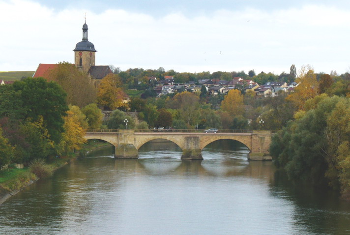
Lauffen am Neckar
- municipality in Germany
Hiking in Lauffen am Neckar
Lauffen am Neckar is a charming town in the Baden-Württemberg region of Germany, located on the banks of the Neckar River. It's an ideal starting point for various hiking adventures, offering picturesque landscapes, vineyards, and scenic views....
- Country:
- Postal Code: 74348
- Local Dialing Code: 07133
- Licence Plate Code: HN
- Coordinates: 49° 4' 35" N, 9° 9' 24" E
- GPS tracks (wikiloc): [Link]
- AboveSeaLevel: 175 м m
- Area: 22.64 sq km
- Population: 10931
- Web site: [Link]

Lehrensteinsfeld
- municipality in Germany
Hiking in Lehrensteinsfeld
Lehrensteinsfeld is a small town in Baden-Württemberg, Germany, surrounded by beautiful natural landscapes that offer various hiking opportunities. The area is part of the scenic landscapes typical of the Swabian region, characterized by rolling hills, vineyards, and forested areas....
- Country:
- Postal Code: 74251
- Local Dialing Code: 07134
- Licence Plate Code: HN
- Coordinates: 49° 7' 43" N, 9° 19' 30" E
- GPS tracks (wikiloc): [Link]
- AboveSeaLevel: 220 м m
- Area: 6.22 sq km
- Population: 2281
- Web site: [Link]


Pfaffenhofen
- municipality in Germany
Hiking in Pfaffenhofen
Pfaffenhofen is a charming municipality in Baden-Württemberg, Germany, located in the picturesque Rems-Murr District. While it may not be as widely known as some larger hiking destinations, the region around Pfaffenhofen offers a variety of hiking opportunities that showcase the natural beauty and serene landscapes of southwest Germany....
- Country:
- Postal Code: 74397
- Local Dialing Code: 07046
- Licence Plate Code: HN
- Coordinates: 49° 3' 52" N, 8° 58' 35" E
- GPS tracks (wikiloc): [Link]
- AboveSeaLevel: 207 м m
- Area: 12.04 sq km
- Population: 2401
- Web site: [Link]


Brackenheim
- town in the district of Heilbronn, Baden-Württemberg, Germany
Hiking in Brackenheim
Brackenheim, located in the state of Baden-Württemberg, Germany, offers a scenic backdrop for hiking enthusiasts. The region is characterized by picturesque vineyards, rolling hills, and beautiful landscapes, making it a delightful spot for outdoor activities....
- Country:
- Postal Code: 74336
- Local Dialing Code: 07135
- Licence Plate Code: HN
- Coordinates: 49° 5' 0" N, 9° 4' 0" E
- GPS tracks (wikiloc): [Link]
- AboveSeaLevel: 202 м m
- Area: 45.75 sq km
- Population: 15220
- Web site: [Link]
Gundelsheim
- town in Germany
Hiking in Gundelsheim
Gundelsheim, located in the Baden-Württemberg region of Germany, offers an array of hiking opportunities that cater to various skill levels and preferences. The town is situated near the Neckar River, surrounded by picturesque landscapes, vineyards, and historical sites. Here are some key aspects to consider when hiking in Gundelsheim:...
- Country:
- Postal Code: 74831
- Local Dialing Code: 07136; 06265; 06269
- Licence Plate Code: HN
- Coordinates: 49° 17' 0" N, 9° 10' 0" E
- GPS tracks (wikiloc): [Link]
- AboveSeaLevel: 154 м m
- Area: 38.45 sq km
- Population: 7324
- Web site: [Link]

Langenbrettach
- municipality in Germany
Hiking in Langenbrettach
Langenbrettach is a small district located in Baden-Württemberg, Germany, and is situated near the cities of Heilbronn and Neckarsulm. The region around Langenbrettach offers beautiful landscapes typical of the Swabian region, with rolling hills, forests, and vineyards. Here are some highlights for hiking in and around Langenbrettach:...
- Country:
- Postal Code: 74243
- Local Dialing Code: 07946; 07139
- Licence Plate Code: HN
- Coordinates: 49° 14' 0" N, 9° 23' 0" E
- GPS tracks (wikiloc): [Link]
- AboveSeaLevel: 194 м m
- Area: 23.97 sq km
- Population: 3791
- Web site: [Link]

Güglingen
- municipality in Germany
Hiking in Güglingen
Güglingen, located in the state of Baden-Württemberg, Germany, offers a delightful blend of scenic beauty, charming landscapes, and historical sites for hikers and nature enthusiasts. Here are some key points about hiking in the region:...
- Country:
- Postal Code: 74363
- Local Dialing Code: 07135
- Licence Plate Code: HN
- Coordinates: 49° 4' 0" N, 9° 0' 0" E
- GPS tracks (wikiloc): [Link]
- AboveSeaLevel: 206 м m
- Area: 16.27 sq km
- Population: 6089
- Web site: [Link]


Zaberfeld
- municipality in Germany
Hiking in Zaberfeld
Zaberfeld is a charming village in the Baden-Württemberg region of Germany, situated in the beautiful landscape of the Swabian Jura. It's an excellent starting point for hiking enthusiasts looking to explore both natural beauty and cultural sites....
- Country:
- Postal Code: 74374
- Local Dialing Code: 07046
- Licence Plate Code: HN
- Coordinates: 49° 3' 0" N, 8° 56' 0" E
- GPS tracks (wikiloc): [Link]
- AboveSeaLevel: 228 м m
- Area: 22.18 sq km
- Population: 3903
- Web site: [Link]


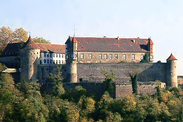
Beilstein
- town in Württemberg, Germany
Hiking in Beilstein
Beilstein, a picturesque village in Württemberg, Germany, is often referred to as the "Sleeping Beauty of the Mosel." Nestled along the banks of the river Mosel, it offers a stunning landscape characterized by rolling hills, vineyards, and charming old buildings. Hiking in and around Beilstein can be a rewarding experience for both beginners and seasoned hikers....
- Country:
- Postal Code: 71543; 71717
- Local Dialing Code: 07130; 07062
- Licence Plate Code: HN
- Coordinates: 49° 2' 0" N, 9° 19' 0" E
- GPS tracks (wikiloc): [Link]
- AboveSeaLevel: 257 м m
- Area: 25.25 sq km
- Population: 6161
- Web site: [Link]


Kirchardt
- municipality in Germany
Hiking in Kirchardt
Kirchardt, located in the state of Baden-Württemberg, Germany, is surrounded by beautiful natural landscapes that offer various hiking opportunities. Here’s an overview to help you explore the hiking options in and around Kirchardt:...
- Country:
- Postal Code: 74912
- Local Dialing Code: 07266
- Licence Plate Code: HN
- Coordinates: 49° 12' 0" N, 8° 59' 0" E
- GPS tracks (wikiloc): [Link]
- AboveSeaLevel: 227 м m
- Area: 21.5 sq km
- Population: 5634
- Web site: [Link]


Cleebronn
- municipality in Germany
Hiking in Cleebronn
Cleebronn is a charming town located in the Baden-Württemberg region of Germany, surrounded by beautiful natural landscapes that are perfect for hiking enthusiasts. The area is known for its scenic trails, vineyards, and the picturesque backdrop of the Swabian Jura....
- Country:
- Postal Code: 74389
- Local Dialing Code: 07135
- Licence Plate Code: HN
- Coordinates: 49° 3' 0" N, 9° 2' 0" E
- GPS tracks (wikiloc): [Link]
- AboveSeaLevel: 236 м m
- Area: 2858 sq km
- Population: 2858
- Web site: [Link]

Massenbachhausen
- municipality in Germany
Hiking in Massenbachhausen
Massenbachhausen is a small municipality in Baden-Württemberg, Germany, located in the Kraichgau region, known for its picturesque landscapes, rolling hills, and vineyards. While it's not a major hiking destination, there are certainly opportunities for enjoyable outdoor activities in and around the area....
- Country:
- Postal Code: 74252
- Local Dialing Code: 07138
- Licence Plate Code: HN
- Coordinates: 49° 11' 0" N, 9° 3' 0" E
- GPS tracks (wikiloc): [Link]
- AboveSeaLevel: 209 м m
- Area: 8.76 sq km
- Population: 3487
- Web site: [Link]

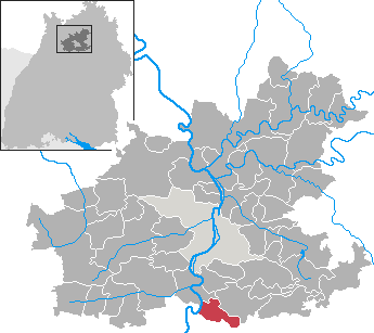
Erlenbach
- municipality in Germany
Hiking in Erlenbach
Erlenbach, located in Baden-Württemberg, Germany, is a charming area that offers various hiking opportunities amidst picturesque landscapes. The region is characterized by rolling hills, forests, and vineyards, making it a delightful destination for both casual walkers and more serious hikers....
- Country:
- Postal Code: 74235
- Local Dialing Code: 07132
- Licence Plate Code: HN
- Coordinates: 49° 10' 12" N, 9° 16' 10" E
- GPS tracks (wikiloc): [Link]
- AboveSeaLevel: 552 м m
- Area: 12.73 sq km
- Population: 4926
- Web site: [Link]
Shares border with regions:

Enz
- district of Baden-Württemberg, Germany
Hiking in Enz
Enzkreis, located in Baden-Württemberg, Germany, is a wonderful area for hiking enthusiasts, offering a mix of picturesque landscapes, historic towns, and diverse trail options. Here’s an overview of some aspects to consider when hiking in this region:...
- Country:
- Capital: Pforzheim
- Licence Plate Code: PF
- Coordinates: 48° 54' 0" N, 8° 45' 0" E
- GPS tracks (wikiloc): [Link]
- AboveSeaLevel: 298 м m
- Area: 573.69 sq km
- Web site: [Link]


Ludwigsburg
- district in Baden-Württemberg, Germany
Hiking in Ludwigsburg
Ludwigsburg is a district located in the state of Baden-Württemberg, Germany, and is known for its picturesque landscapes and rich cultural heritage. While the area itself may not be as prominent as some of the larger mountain ranges in Germany, it offers several beautiful hiking opportunities that cater to different skill levels....
- Country:
- Capital: Ludwigsburg
- Licence Plate Code: LB
- Coordinates: 48° 54' 0" N, 9° 12' 0" E
- GPS tracks (wikiloc): [Link]
- AboveSeaLevel: 266 м m
- Area: 686.83 sq km
- Population: 534074
- Web site: [Link]