Herbéviller (Herbéviller)

- commune in Meurthe-et-Moselle, France
- Country:

- Postal Code: 54450
- Coordinates: 48° 33' 25" N, 6° 45' 13" E


- GPS tracks (wikiloc): [Link]
- Area: 8.12 sq km
- Population: 228
- Wikipedia en: wiki(en)
- Wikipedia: wiki(fr)
- Wikidata storage: Wikidata: Q1102598
- Wikipedia Commons Category: [Link]
- Freebase ID: [/m/03qdj2v]
- Freebase ID: [/m/03qdj2v]
- GeoNames ID: Alt: [6436660]
- GeoNames ID: Alt: [6436660]
- SIREN number: [215402595]
- SIREN number: [215402595]
- BnF ID: [15264328m]
- BnF ID: [15264328m]
- archINFORM location ID: [5185]
- archINFORM location ID: [5185]
- PACTOLS thesaurus ID: [pcrtc7EtLcUdsQ]
- PACTOLS thesaurus ID: [pcrtc7EtLcUdsQ]
- Global Anabaptist Mennonite Encyclopedia Online ID: [Herbéviller (Lorraine, France)]
- Global Anabaptist Mennonite Encyclopedia Online ID: [Herbéviller (Lorraine, France)]
- INSEE municipality code: 54259
- INSEE municipality code: 54259
Shares border with regions:


Mignéville
- commune in Meurthe-et-Moselle, France
- Country:
- Postal Code: 54540
- Coordinates: 48° 31' 58" N, 6° 46' 46" E
- GPS tracks (wikiloc): [Link]
- Area: 6.44 sq km
- Population: 193


Pettonville
- commune in Meurthe-et-Moselle, France
- Country:
- Postal Code: 54120
- Coordinates: 48° 31' 44" N, 6° 44' 31" E
- GPS tracks (wikiloc): [Link]
- Area: 2.92 sq km
- Population: 65


Saint-Martin
- commune in Meurthe-et-Moselle, France
- Country:
- Postal Code: 54450
- Coordinates: 48° 34' 5" N, 6° 45' 10" E
- GPS tracks (wikiloc): [Link]
- AboveSeaLevel: 240 м m
- Area: 4.87 sq km
- Population: 61


Ogéviller
- commune in Meurthe-et-Moselle, France
- Country:
- Postal Code: 54450
- Coordinates: 48° 32' 49" N, 6° 43' 32" E
- GPS tracks (wikiloc): [Link]
- Area: 3.54 sq km
- Population: 287


Réclonville
- commune in Meurthe-et-Moselle, France
- Country:
- Postal Code: 54450
- Coordinates: 48° 32' 26" N, 6° 43' 41" E
- GPS tracks (wikiloc): [Link]
- Area: 2.96 sq km
- Population: 73


Fréménil
- commune in Meurthe-et-Moselle, France
- Country:
- Postal Code: 54450
- Coordinates: 48° 33' 55" N, 6° 42' 46" E
- GPS tracks (wikiloc): [Link]
- Area: 3.04 sq km
- Population: 226

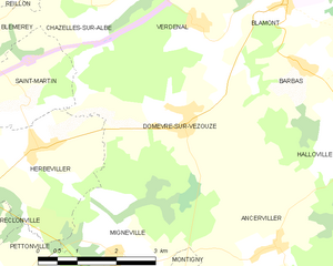
Domèvre-sur-Vezouze
- commune in Meurthe-et-Moselle, France
- Country:
- Postal Code: 54450
- Coordinates: 48° 33' 41" N, 6° 48' 22" E
- GPS tracks (wikiloc): [Link]
- Area: 14.78 sq km
- Population: 289