
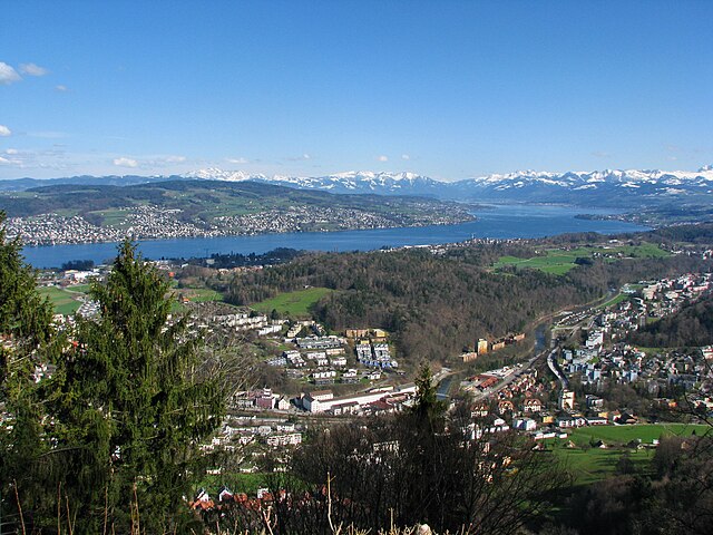
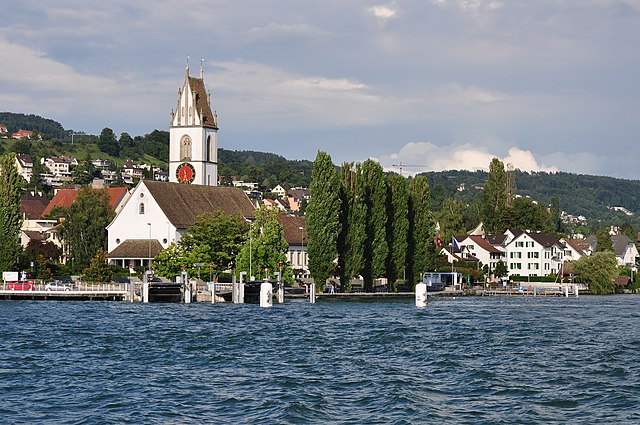
Horgen (Horgen)

- municipality in the canton of Zürich, Switzerland
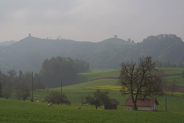
 Hiking in Horgen
Horgen, located on the southern shore of Lake Zurich in Switzerland, offers a variety of hiking opportunities suited for different skill levels and interests. Here are some highlights:
1. Scenic Trails:
-
Horgen to Uetikon am See: This is a lovely lakeside walk that allows you to take in picturesque views of Lake Zurich and the surrounding mountains. The trail is relatively flat, making it suitable for families and beginners.
-
Zug Ridge (Zugerberg): For a more challenging hike, you can head towards the Zug Ridge. The trail offers panoramic views of the Zurich region and is great for those looking for a workout with beautiful scenery.
2. Forest Trails:
- Horgenberg Forest: There are numerous trails weaving through the forests, providing a serene experience where you can enjoy the tranquility of nature. These paths are less crowded and perfect for peaceful walks.
3. Cultural Hikes:
- Hiking through Historical Sites: Some trails may lead past historical sites and quaint villages, allowing hikers to experience the local culture and history. Make sure to look for informational signs about landmarks along the way.
4. Recommendations:
-
Best Time to Hike: The best times for hiking in Horgen are in spring and autumn when the weather is generally mild. Summer can be hot but is also popular, while winter offers opportunities for snowshoeing in the surrounding areas.
-
Gear: Depending on the trails, it’s essential to wear good hiking shoes and bring plenty of water. If you're hiking in winter, consider waterproof and warm clothing.
5. Accessibility:
-
Public Transport: Horgen is well-connected by public transport, making it easy to reach trailheads without needing a car.
-
Trail Markings: The trails are typically well-marked with signs indicating the direction and difficulty level, which makes navigation straightforward even for less experienced hikers.
Conclusion:
Horgen is a beautiful starting point for hiking adventures with its blend of scenic and cultural offerings. Whether you are looking for a gentle lakeside stroll or a challenging mountain hike, you’ll find suitable options in this picturesque Swiss town. Always check local trail maps and weather conditions before setting out for your hike!
- Country:

- Postal Code: 8810
- Local Dialing Code: 044; 043
- Licence Plate Code: ZH
- Coordinates: 47° 15' 39" N, 8° 35' 51" E


- GPS tracks (wikiloc): [Link]
- AboveSeaLevel: 415 м m
- Area: 30.75 sq km
- Population: 22476
- Web site: http://www.horgen.ch
- Wikipedia en: wiki(en)
- Wikipedia: wiki(de)
- Wikidata storage: Wikidata: Q68286
- Wikipedia Commons Category: [Link]
- Freebase ID: [/m/03g0d9]
- GeoNames ID: Alt: [2660305]
- VIAF ID: Alt: [158334875]
- OSM relation ID: [1682144]
- GND ID: Alt: [4095642-8]
- archINFORM location ID: [4427]
- Library of Congress authority ID: Alt: [n85030694]
- MusicBrainz area ID: [57697a89-a468-44ef-8499-8a6a1871e503]
- HDS ID: [96]
- Swiss municipality code: [0295]
- US National Archives Identifier: 10037798
Shares border with regions:


Hausen am Albis
- municipality in Switzerland
Hiking in Hausen am Albis
Hausen am Albis is a picturesque village located in the Canton of Zurich, Switzerland. It is surrounded by beautiful landscapes, making it an ideal destination for hiking enthusiasts. Here’s a guide to hiking in this charming area:...
- Country:
- Postal Code: 8915
- Local Dialing Code: 044; 043
- Licence Plate Code: ZH
- Coordinates: 47° 14' 41" N, 8° 32' 4" E
- GPS tracks (wikiloc): [Link]
- AboveSeaLevel: 611 м m
- Area: 13.64 sq km
- Population: 3646
- Web site: [Link]

Langnau am Albis
- municipality in Switzerland
Hiking in Langnau am Albis
Langnau am Albis, located in the canton of Zurich, Switzerland, is a beautiful area for hiking, offering a mix of scenic landscapes, forests, and panoramic views of the surrounding Alps and Lake Zurich. Here are some highlights and tips for hiking in this region:...
- Country:
- Postal Code: 8135
- Local Dialing Code: 01
- Licence Plate Code: ZH
- Coordinates: 47° 17' 22" N, 8° 32' 29" E
- GPS tracks (wikiloc): [Link]
- AboveSeaLevel: 468 м m
- Area: 8.66 sq km
- Population: 7500
- Web site: [Link]
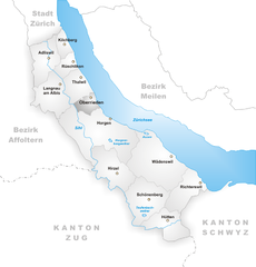
Oberrieden
- municipality in the canton of Zurich, Switzerland
Hiking in Oberrieden
Oberrieden, a picturesque municipality in the canton of Zurich, Switzerland, offers a wonderful backdrop for hiking enthusiasts. The area is characterized by its scenic landscapes, which include rolling hills, lush forests, and stunning views of Lake Zurich and the Swiss Alps....
- Country:
- Postal Code: 8942
- Local Dialing Code: 043; 044
- Licence Plate Code: ZH
- Coordinates: 47° 16' 40" N, 8° 34' 41" E
- GPS tracks (wikiloc): [Link]
- AboveSeaLevel: 460 м m
- Area: 2.76 sq km
- Population: 5090
- Web site: [Link]
Neuheim
- municipality in Switzerland
Hiking in Neuheim
Neuheim, located in the Canton of Zug in Switzerland, offers a variety of beautiful hiking opportunities that showcase the stunning landscapes of the region. The area is characterized by rolling hills, lush forests, and panoramic views of the surrounding mountains and Lake Zug. Here’s a brief overview of what you can expect when hiking in Neuheim:...
- Country:
- Postal Code: 6345
- Local Dialing Code: 041
- Licence Plate Code: ZG
- Coordinates: 47° 12' 24" N, 8° 34' 40" E
- GPS tracks (wikiloc): [Link]
- AboveSeaLevel: 666 м m
- Area: 7.9 sq km
- Population: 2245
- Web site: [Link]

Menzingen
- municipality in Switzerland
Hiking in Menzingen
Menzingen is a charming municipality located in the Canton of Zug, Switzerland. It is surrounded by beautiful nature and rolling hills, making it an ideal location for hiking enthusiasts. Here are some highlights and tips for hiking in Menzingen:...
- Country:
- Postal Code: 6313
- Local Dialing Code: 041
- Licence Plate Code: ZG
- Coordinates: 47° 10' 12" N, 8° 36' 11" E
- GPS tracks (wikiloc): [Link]
- AboveSeaLevel: 801 м m
- Area: 27.50 sq km
- Population: 4499
- Web site: [Link]

Hirzel
- Village in Switzerland
Hiking in Hirzel
Hirzel is a picturesque village located in the Zurich region of Switzerland, nestled amidst beautiful landscapes that are perfect for hiking enthusiasts. The area is characterized by rolling hills, lush forests, and stunning views of the surrounding Alps and Lake Zurich, making it an ideal destination for both casual walkers and experienced hikers....
- Country:
- Postal Code: 8816
- Local Dialing Code: 01
- Licence Plate Code: ZH
- Coordinates: 47° 13' 1" N, 8° 36' 37" E
- GPS tracks (wikiloc): [Link]
- AboveSeaLevel: 678 м m
- Area: 9.68 sq km
- Population: 2158
- Web site: [Link]

Meilen
- municipality in the canton of Zürich, Switzerland
Hiking in Meilen
Meilen, located on the shores of Lake Zurich in Switzerland, is a picturesque village that offers a range of hiking trails suitable for different skill levels. Here are some highlights and tips for hiking in the Meilen area:...
- Country:
- Postal Code: 8706
- Local Dialing Code: 01
- Licence Plate Code: ZH
- Coordinates: 47° 16' 13" N, 8° 38' 28" E
- GPS tracks (wikiloc): [Link]
- AboveSeaLevel: 420 м m
- Area: 11.93 sq km
- Population: 13999
- Web site: [Link]


Thalwil
- municipality in the canton of Zürich, Switzerland
Hiking in Thalwil
Thalwil, located in the canton of Zurich, Switzerland, is a beautiful area that offers a wonderful range of hiking opportunities. Nestled along the shores of Lake Zurich and surrounded by rolling hills and lush forests, Thalwil is an excellent starting point for both easy walks and more challenging hikes....
- Country:
- Postal Code: 8800
- Local Dialing Code: 044
- Licence Plate Code: ZH
- Coordinates: 47° 17' 43" N, 8° 33' 53" E
- GPS tracks (wikiloc): [Link]
- AboveSeaLevel: 468 м m
- Area: 5.53 sq km
- Population: 17784
- Web site: [Link]


Wädenswil
- municipality in the canton of Zürich, Switzerland
Hiking in Wädenswil
Wädenswil, located on the shores of Lake Zurich in Switzerland, offers beautiful hiking trails that suit various skill levels and provide stunning views of both the lake and the surrounding mountains. Here are some highlights and popular trails in and around Wädenswil:...
- Country:
- Postal Code: 8833
- Local Dialing Code: 044; 043
- Licence Plate Code: ZH
- Coordinates: 47° 13' 30" N, 8° 39' 7" E
- GPS tracks (wikiloc): [Link]
- AboveSeaLevel: 597 м m
- Area: 17.37 sq km
- Population: 21716
- Web site: [Link]