Saint-Just-en-Bas (Saint-Just-en-Bas)

- commune in Loire, France
- Country:

- Postal Code: 42136
- Coordinates: 45° 43' 51" N, 3° 52' 50" E


- GPS tracks (wikiloc): [Link]
- Area: 20.95 sq km
- Population: 291
- Wikipedia en: wiki(en)
- Wikipedia: wiki(fr)
- Wikidata storage: Wikidata: Q1105976
- Wikipedia Commons Category: [Link]
- Freebase ID: [/m/03nw8sr]
- Freebase ID: [/m/03nw8sr]
- GeoNames ID: Alt: [6434283]
- GeoNames ID: Alt: [6434283]
- SIREN number: [214202475]
- SIREN number: [214202475]
- BnF ID: [152598149]
- BnF ID: [152598149]
- INSEE municipality code: 42247
- INSEE municipality code: 42247
Shares border with regions:
La Valla-sur-Rochefort
- commune in Loire, France
- Country:
- Postal Code: 42111
- Coordinates: 45° 45' 33" N, 3° 51' 8" E
- GPS tracks (wikiloc): [Link]
- AboveSeaLevel: 830 м m
- Area: 8.98 sq km
- Population: 109
Saint-Didier-sur-Rochefort
- commune in Loire, France
- Country:
- Postal Code: 42111
- Coordinates: 45° 47' 36" N, 3° 50' 42" E
- GPS tracks (wikiloc): [Link]
- Area: 22.75 sq km
- Population: 405


Saint-Georges-en-Couzan
- commune in Loire, France
- Country:
- Postal Code: 42990
- Coordinates: 45° 42' 5" N, 3° 55' 52" E
- GPS tracks (wikiloc): [Link]
- Area: 23.64 sq km
- Population: 443


Palogneux
- commune in Loire, France
- Country:
- Postal Code: 42990
- Coordinates: 45° 44' 38" N, 3° 55' 12" E
- GPS tracks (wikiloc): [Link]
- Area: 7.01 sq km
- Population: 78

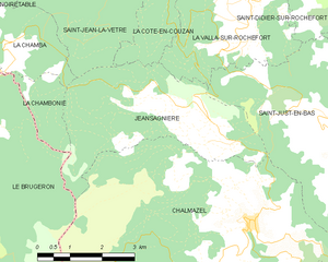
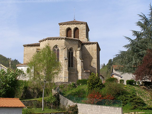
Jeansagnière
- former commune in Loire, France
- Country:
- Postal Code: 42920
- Coordinates: 45° 43' 59" N, 3° 50' 9" E
- GPS tracks (wikiloc): [Link]
- Area: 14.01 sq km
- Population: 83

Saint-Laurent-Rochefort
- commune in Loire, France
- Country:
- Postal Code: 42130
- Coordinates: 45° 46' 24" N, 3° 55' 24" E
- GPS tracks (wikiloc): [Link]
- Area: 15.6 sq km
- Population: 242
- Web site: [Link]