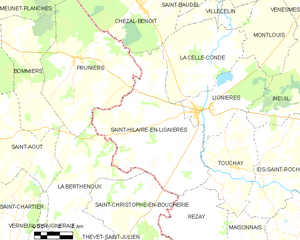
La Celle-Condé (La Celle-Condé)

- commune in Cher, France
- Country:

- Postal Code: 18160
- Coordinates: 46° 47' 38" N, 2° 11' 4" E


- GPS tracks (wikiloc): [Link]
- Area: 30.94 sq km
- Population: 209
- Wikipedia en: wiki(en)
- Wikipedia: wiki(fr)
- Wikidata storage: Wikidata: Q1159020
- Wikipedia Commons Category: [Link]
- Freebase ID: [/m/03mfcb4]
- GeoNames ID: Alt: [6456747]
- SIREN number: [211800438]
- BnF ID: [15249389m]
- PACTOLS thesaurus ID: [pcrt3kX5HzdTBf]
- INSEE municipality code: 18043
Shares border with regions:


Chezal-Benoît
- commune in Cher, France
- Country:
- Postal Code: 18160
- Coordinates: 46° 49' 37" N, 2° 6' 51" E
- GPS tracks (wikiloc): [Link]
- Area: 46.46 sq km
- Population: 867
Saint-Hilaire-en-Lignières
- commune in Cher, France
- Country:
- Postal Code: 18160
- Coordinates: 46° 43' 34" N, 2° 10' 25" E
- GPS tracks (wikiloc): [Link]
- Area: 53.78 sq km
- Population: 515


Montlouis
- commune in Cher, France
- Country:
- Postal Code: 18160
- Coordinates: 46° 48' 51" N, 2° 14' 25" E
- GPS tracks (wikiloc): [Link]
- Area: 18.98 sq km
- Population: 110


Villecelin
- commune in Cher, France
- Country:
- Postal Code: 18160
- Coordinates: 46° 49' 34" N, 2° 10' 54" E
- GPS tracks (wikiloc): [Link]
- Area: 9.39 sq km
- Population: 99


Lignières
- commune in Cher, France
- Country:
- Postal Code: 18160
- Coordinates: 46° 45' 7" N, 2° 10' 34" E
- GPS tracks (wikiloc): [Link]
- Area: 21.88 sq km
- Population: 1378