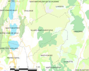
La Morte (La Morte)

- commune in Isère, France
 Hiking in La Morte
La Morte, located in the French Alps, is a lesser-known but breathtaking area for hiking enthusiasts. It is characterized by its stunning landscapes, including rugged mountains, lush valleys, and pristine lakes. Here are some key points to consider when hiking in La Morte:
Hiking Trails:
- Variety of Trails: La Morte offers trails for different skill levels, from easy walks suitable for families to more challenging treks for experienced hikers.
- Scenic Views: Many trails provide stunning views of the surrounding peaks and valleys, ideal for photographers and nature lovers.
- Wildlife Observation: The area is home to diverse flora and fauna, making it possible to spot different wildlife during your hikes.
Best Time to Hike:
- Summer (June to September): This is the most popular season for hiking in La Morte. The weather is generally warm, and the trails are accessible.
- Autumn (October): Early autumn can also be beautiful, with changing foliage, but be aware of changing weather conditions.
Preparation:
- Gear: Wear proper hiking gear, including sturdy hiking boots, weather-appropriate clothing, and a good backpack.
- Navigation: Familiarize yourself with hiking maps or use a GPS device, as some trails may not be well-marked.
- Hydration and Nutrition: Always carry enough water and snacks to keep your energy up during your hikes.
Safety Tips:
- Weather Awareness: The weather in the Alps can change rapidly, so check forecasts and be prepared for sudden changes.
- Companion Hiking: It’s always safer to hike with a partner or a group, especially in remote areas.
- Emergency Kit: Carry a small first-aid kit and know basic first-aid procedures in case of minor injuries.
Local Enjoyments:
- Cultural Sites: Apart from hiking, enjoy exploring local villages, trying regional cuisine, and immersing yourself in the culture.
- Accommodations: There are various lodging options ranging from camping sites to hotels, catering to different preferences and budgets.
Hiking in La Morte can be a rewarding experience, allowing you to connect with nature and enjoy the tranquility of the Alps. Always respect the environmental guidelines and leave no trace to preserve the beauty of this stunning region.
- Country:

- Postal Code: 38350
- Coordinates: 45° 1' 47" N, 5° 51' 22" E


- GPS tracks (wikiloc): [Link]
- Area: 19.45 sq km
- Population: 133
- Web site: http://www.mairielamorte.fr
- Wikipedia en: wiki(en)
- Wikipedia: wiki(fr)
- Wikidata storage: Wikidata: Q1094582
- Wikipedia Commons Category: [Link]
- Freebase ID: [/m/03nvkcn]
- GeoNames ID: Alt: [3008069]
- SIREN number: [213802648]
- BnF ID: [15258076d]
- VIAF ID: Alt: [124427218]
- Library of Congress authority ID: Alt: [n87136281]
- INSEE municipality code: 38264
Shares border with regions:


Lavaldens
- commune in Isère, France
Hiking in Lavaldens
Lavaldens is a beautiful destination for hiking enthusiasts, located in the stunning region of the Italian Alps, specifically within the Province of Trento. The area is known for its picturesque landscapes, charming villages, and a variety of trails suitable for different levels of hikers. Here are some key points to consider when hiking in Lavaldens:...
- Country:
- Postal Code: 38350
- Coordinates: 44° 58' 58" N, 5° 53' 15" E
- GPS tracks (wikiloc): [Link]
- Area: 41.4 sq km
- Population: 163

Villard-Saint-Christophe
- commune in Isère, France
Hiking in Villard-Saint-Christophe
Villard-Saint-Christophe is a picturesque village located in the Isère department of the Auvergne-Rhône-Alpes region in France. It offers a variety of hiking opportunities that showcase the stunning natural scenery of the region, including mountains, lakes, and lush forests....
- Country:
- Postal Code: 38119
- Coordinates: 44° 58' 44" N, 5° 48' 21" E
- GPS tracks (wikiloc): [Link]
- Area: 14.22 sq km
- Population: 408


Saint-Barthélemy-de-Séchilienne
- commune in Isère, France
Hiking in Saint-Barthélemy-de-Séchilienne
Saint-Barthélemy-de-Séchilienne is a charming commune situated in the Isère department of the Auvergne-Rhône-Alpes region in southeastern France. Nestled in the foothills of the French Alps, this area offers beautiful scenery and a range of hiking opportunities for outdoor enthusiasts. Here's what you can expect when hiking in this region:...
- Country:
- Postal Code: 38220
- Coordinates: 45° 2' 39" N, 5° 49' 34" E
- GPS tracks (wikiloc): [Link]
- AboveSeaLevel: 450 м m
- Area: 12.1 sq km
- Population: 454


Cholonge
- commune in Isère, France
Hiking in Cholonge
Cholonge is known for its picturesque landscapes and diverse hiking opportunities. Nestled in a natural setting, it offers trails that cater to various skill levels, from beginners to experienced hikers. Here are some highlights you might find while hiking in Cholonge:...
- Country:
- Postal Code: 38220
- Coordinates: 45° 0' 15" N, 5° 47' 48" E
- GPS tracks (wikiloc): [Link]
- Area: 8.92 sq km
- Population: 323


Livet-et-Gavet
- commune in Isère, France
Hiking in Livet-et-Gavet
Livet-et-Gavet, located in the Auvergne-Rhône-Alpes region of France, is a picturesque destination for hiking enthusiasts. This area is characterized by its stunning natural landscapes, including lush forests, rivers, and mountainous terrain. Here are some highlights and tips for hiking in Livet-et-Gavet:...
- Country:
- Postal Code: 38220
- Coordinates: 45° 5' 28" N, 5° 54' 9" E
- GPS tracks (wikiloc): [Link]
- Area: 46.54 sq km
- Population: 1296
- Web site: [Link]