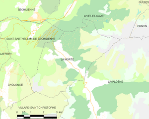
Saint-Barthélemy-de-Séchilienne (Saint-Barthélemy-de-Séchilienne)
- commune in Isère, France
 Hiking in Saint-Barthélemy-de-Séchilienne
Saint-Barthélemy-de-Séchilienne is a charming commune situated in the Isère department of the Auvergne-Rhône-Alpes region in southeastern France. Nestled in the foothills of the French Alps, this area offers beautiful scenery and a range of hiking opportunities for outdoor enthusiasts. Here's what you can expect when hiking in this region:
Scenic Trails
- Mountain Views: The hiking trails typically feature breathtaking views of the surrounding mountains, including the nearby Oisans Massif and Belledonne range.
- Lush Landscapes: The area is known for its rich biodiversity, with forests, meadows, and alpine flora. Hikers can enjoy the sight and sounds of nature, including the potential to spot local wildlife.
Trail Variety
- Easy to Moderate Hikes: There are trails suitable for all levels of hikers, including family-friendly options. Depending on your experience, you can choose trails that range from easy walks to more moderate hikes.
- Guided Tours: Some local companies may offer guided hikes, which can provide valuable insights into the region's history and ecology.
Seasonal Considerations
- Summer Hiking: The best time for hiking is typically from late spring to early autumn when the weather is mild, and the trails are well-maintained.
- Winter Activities: In winter, some trails may be suitable for snowshoeing or cross-country skiing, offering a different experience of the stunning winter landscapes.
Essential Tips
- Preparation: Always check the weather conditions before your hike. Make sure to wear appropriate footwear and clothing, and carry enough water and snacks.
- Maps and Signage: While many trails are well-marked, it's advisable to carry a map or use a hiking app on your phone to navigate.
- Check Local Regulations: Follow any local guidelines regarding wildlife and environmental conservation to help preserve the beauty of the area.
Conclusion
Hiking in Saint-Barthélemy-de-Séchilienne can be a rewarding experience for nature lovers and those looking to explore the stunning landscapes of the French Alps. Whether you're a novice hiker or an experienced trekker, the area's trails offer something for everyone. Enjoy your adventure!
- Country:

- Postal Code: 38220
- Coordinates: 45° 2' 39" N, 5° 49' 34" E


- GPS tracks (wikiloc): [Link]
- AboveSeaLevel: 450 м m
- Area: 12.1 sq km
- Population: 454
- Wikipedia en: wiki(en)
- Wikipedia: wiki(fr)
- Wikidata storage: Wikidata: Q1154620
- Wikipedia Commons Category: [Link]
- Freebase ID: [/m/03nvj1q]
- SIREN number: [213803646]
- BnF ID: [15258175b]
- VIAF ID: Alt: [316738452]
- PACTOLS thesaurus ID: [pcrtSbR0Ec0vnw]
- INSEE municipality code: 38364
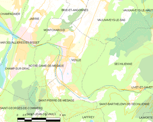
Shares border with regions:


La Morte
- commune in Isère, France
La Morte, located in the French Alps, is a lesser-known but breathtaking area for hiking enthusiasts. It is characterized by its stunning landscapes, including rugged mountains, lush valleys, and pristine lakes. Here are some key points to consider when hiking in La Morte:...
- Country:

- Postal Code: 38350
- Coordinates: 45° 1' 47" N, 5° 51' 22" E


- GPS tracks (wikiloc): [Link]
- Area: 19.45 sq km
- Population: 133
- Web site: [Link]


Saint-Pierre-de-Mésage
- commune in Isère, France
 Hiking in Saint-Pierre-de-Mésage
Saint-Pierre-de-Mésage is a charming town located in the Isère department of the Auvergne-Rhône-Alpes region in southeastern France. It is nestled at the foothills of the French Alps, making it a fantastic destination for hiking enthusiasts....
- Country:

- Postal Code: 38220
- Coordinates: 45° 3' 7" N, 5° 45' 52" E


- GPS tracks (wikiloc): [Link]
- Area: 7.03 sq km
- Population: 757
- Web site: [Link]


Séchilienne
- commune in Isère, France
Séchilienne is a charming village located in the Isère department of the Auvergne-Rhône-Alpes region in southeastern France. Nestled in the mountains, it offers beautiful hiking opportunities with stunning views of the surrounding landscapes....
- Country:

- Postal Code: 38220
- Coordinates: 45° 3' 17" N, 5° 50' 6" E


- GPS tracks (wikiloc): [Link]
- Area: 21.47 sq km
- Population: 1021


Cholonge
- commune in Isère, France
Cholonge is known for its picturesque landscapes and diverse hiking opportunities. Nestled in a natural setting, it offers trails that cater to various skill levels, from beginners to experienced hikers. Here are some highlights you might find while hiking in Cholonge:...
- Country:

- Postal Code: 38220
- Coordinates: 45° 0' 15" N, 5° 47' 48" E


- GPS tracks (wikiloc): [Link]
- Area: 8.92 sq km
- Population: 323


Vizille
- commune in Isère, France
Vizille, located in the Isère department of southeastern France, is a lovely area known for its picturesque landscapes, rich history, and access to the stunning scenery of the French Alps. Hiking in and around Vizille offers various trails that cater to different skill levels, from leisurely walks to more challenging hikes....
- Country:

- Postal Code: 38220
- Coordinates: 45° 4' 42" N, 5° 46' 19" E


- GPS tracks (wikiloc): [Link]
- Area: 10.51 sq km
- Population: 7468
- Web site: [Link]


Laffrey
- commune in Isère, France
Laffrey is a beautiful area located near Grenoble in the French Alps, offering stunning natural landscapes and a variety of hiking opportunities. Here are some details to help enhance your hiking experience in Laffrey:...
- Country:

- Postal Code: 38220
- Coordinates: 45° 1' 29" N, 5° 46' 25" E


- GPS tracks (wikiloc): [Link]
- Area: 6.72 sq km
- Population: 429
- Web site: [Link]


Livet-et-Gavet
- commune in Isère, France
Livet-et-Gavet, located in the Auvergne-Rhône-Alpes region of France, is a picturesque destination for hiking enthusiasts. This area is characterized by its stunning natural landscapes, including lush forests, rivers, and mountainous terrain. Here are some highlights and tips for hiking in Livet-et-Gavet:...
- Country:

- Postal Code: 38220
- Coordinates: 45° 5' 28" N, 5° 54' 9" E


- GPS tracks (wikiloc): [Link]
- Area: 46.54 sq km
- Population: 1296
- Web site: [Link]
