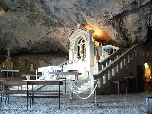
Mazaugues (Mazaugues)

- commune in Var, France
 Hiking in Mazaugues
Mazaugues is a charming village located in the Var department of the Provence-Alpes-Côte d'Azur region in southeastern France. It is surrounded by beautiful landscapes, making it a great destination for hiking enthusiasts. Here are some highlights about hiking in and around Mazaugues:
Scenic Trails
-
Local Trails: The area around Mazaugues features several well-marked hiking trails that range from easy walks for beginners to more challenging routes for experienced hikers. These trails often lead through picturesque forests, vineyards, and fields.
-
Montagne Sainte-Victoire: A short drive from Mazaugues, the iconic Montagne Sainte-Victoire is a must-visit for hikers. Numerous trails wind through this stunning mountain, offering breathtaking views and the chance to explore diverse flora and fauna.
-
Gorges Du Verdon: Although a bit further afield (about a 2-hour drive), the Gorges du Verdon is another fantastic hiking destination. Known as Europe’s Grand Canyon, it has numerous trails with spectacular views along the gorge.
Flora and Fauna
The region is rich in biodiversity, so hikers may encounter various plant species and wildlife. Make sure to keep an eye out for local flora such as lavender fields, wild herbs, and diverse bird species.
Best Times to Hike
The best times for hiking in Mazaugues are in spring (April to June) and autumn (September to November) when the weather is mild, and the landscapes are particularly beautiful. Summer can be quite hot, while winter may bring cooler temperatures and occasional snow at higher elevations.
Preparation Tips
- Weather Conditions: Always check the weather forecast before heading out and dress in layers to accommodate changing temperatures.
- Hydration: Bring plenty of water, especially during warmer months.
- Navigation: Familiarize yourself with the trail maps, or use a hiking app for navigation.
- Safety: Let someone know your hiking plans and expected return time.
Local Amenities
While Mazaugues is a small village, it offers some local shops and cafés where you can grab supplies or enjoy a meal after your hike. Exploring the village itself can also add to the experience, with its quaint architecture and a glimpse of Provençal life.
Overall, hiking in Mazaugues provides a delightful combination of natural beauty, tranquil landscapes, and cultural experiences, perfect for outdoor lovers looking to explore the charm of Provence.
- Country:

- Postal Code: 83136
- Coordinates: 43° 20' 51" N, 5° 55' 19" E


- GPS tracks (wikiloc): [Link]
- Area: 53.79 sq km
- Population: 887
- Wikipedia en: wiki(en)
- Wikipedia: wiki(fr)
- Wikidata storage: Wikidata: Q1350351
- Wikipedia Commons Category: [Link]
- Freebase ID: [/m/03w9ks4]
- GeoNames ID: Alt: [2994894]
- SIREN number: [218300762]
- BnF ID: [15277903v]
- PACTOLS thesaurus ID: [pcrtrlx8WB0ETx]
- WOEID: [610720]
- INSEE municipality code: 83076
Shares border with regions:

Plan-d'Aups-Sainte-Baume
- commune in Var, France
Hiking in Plan-d'Aups-Sainte-Baume
Plan-d'Aups-Sainte-Baume is a beautiful destination for hiking enthusiasts, located in the Var department of the Provence-Alpes-Côte d'Azur region of southeastern France. Nestled at the foot of the Sainte-Baume mountain range, this area offers a range of trails that vary in difficulty and scenery....
- Country:
- Postal Code: 83640
- Coordinates: 43° 19' 48" N, 5° 43' 3" E
- GPS tracks (wikiloc): [Link]
- AboveSeaLevel: 700 м m
- Area: 24.91 sq km
- Population: 2067


Rougiers
- commune in Var, France
Hiking in Rougiers
Rougiers is a small commune located in the Var department in the Provence-Alpes-Côte d'Azur region of southeastern France. It is surrounded by beautiful natural landscapes, making it an excellent spot for hiking enthusiasts. Here's a guide to hiking in the Rougiers area:...
- Country:
- Postal Code: 83170
- Coordinates: 43° 23' 33" N, 5° 51' 4" E
- GPS tracks (wikiloc): [Link]
- Area: 20.53 sq km
- Population: 1623

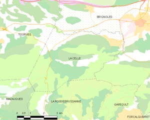
La Celle
- commune in Var, France
Hiking in La Celle
La Celle, a charming village nestled in the Var department of Provence-Alpes-Côte d'Azur, offers beautiful hiking opportunities amidst stunning natural scenery. The region is characterized by its picturesque landscapes, rolling hills, vineyards, and historical sites. Here are some highlights and tips for hiking in and around La Celle:...
- Country:
- Postal Code: 83170
- Coordinates: 43° 23' 39" N, 6° 2' 26" E
- GPS tracks (wikiloc): [Link]
- Area: 21 sq km
- Population: 1433


Signes
- commune in Var, France
Hiking in Signes
Signes is a charming village located in the Var department of the Provence-Alpes-Côte d'Azur region in southeastern France. It offers a variety of hiking opportunities, showcasing the region's stunning natural landscapes, rich flora, and diverse fauna....
- Country:
- Postal Code: 83870
- Coordinates: 43° 17' 29" N, 5° 51' 46" E
- GPS tracks (wikiloc): [Link]
- Area: 133.1 sq km
- Population: 2779


La Roquebrussanne
- commune in Var, France
Hiking in La Roquebrussanne
La Roquebrussanne, a charming village located in the Var department of the Provence-Alpes-Côte d'Azur region in southeastern France, is surrounded by picturesque landscapes that are perfect for hiking enthusiasts. The area features a variety of trails that cater to different skill levels, offering opportunities to explore beautiful natural scenery, including forests, hills, and vineyards....
- Country:
- Postal Code: 83136
- Coordinates: 43° 20' 25" N, 5° 58' 35" E
- GPS tracks (wikiloc): [Link]
- Area: 37.05 sq km
- Population: 2540

Tourves
- commune in Var, France
Hiking in Tourves
Tourves is a charming commune located in the Var department of the Provence-Alpes-Côte d'Azur region in southeastern France. It is surrounded by stunning landscapes, including rolling hills, vineyards, and picturesque countryside, making it an ideal spot for hiking enthusiasts....
- Country:
- Postal Code: 83170
- Coordinates: 43° 24' 29" N, 5° 55' 26" E
- GPS tracks (wikiloc): [Link]
- Area: 65.62 sq km
- Population: 4973