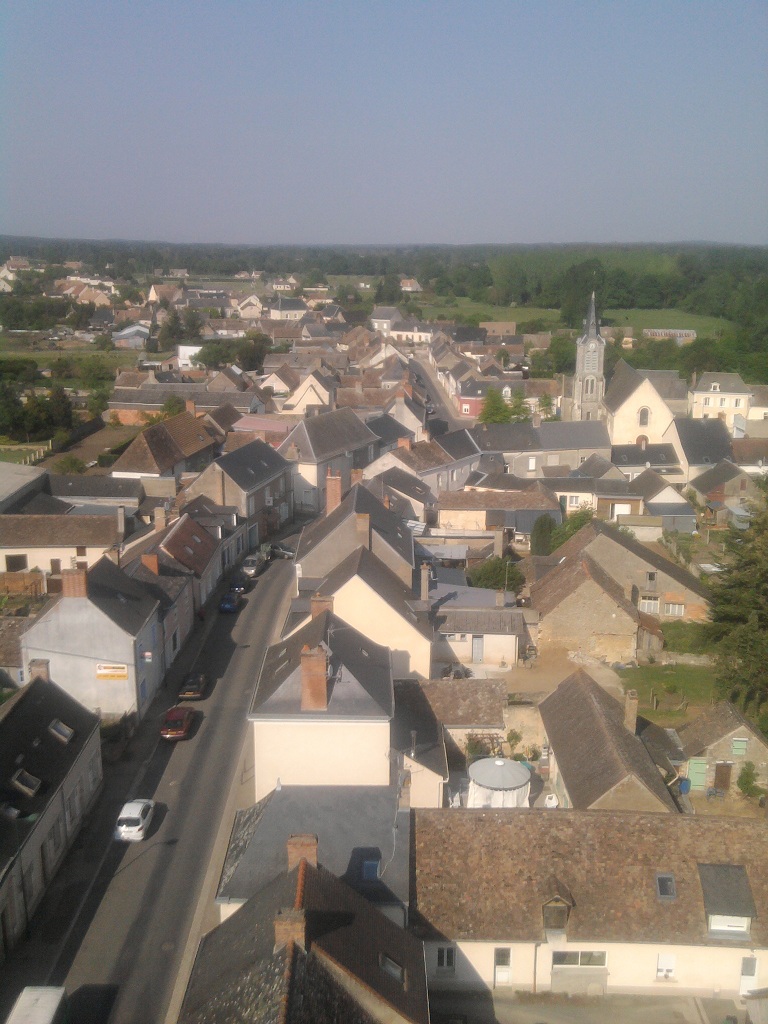
%20(cropped).JPG)
La Suze-sur-Sarthe (La Suze-sur-Sarthe)

- commune in Sarthe, France
- Country:

- Postal Code: 72210
- Coordinates: 47° 53' 23" N, 0° 1' 31" E


- GPS tracks (wikiloc): [Link]
- AboveSeaLevel: 76 м m
- Area: 21.4 sq km
- Population: 4460
- Web site: http://www.lasuze.fr/
- Wikipedia en: wiki(en)
- Wikipedia: wiki(fr)
- Wikidata storage: Wikidata: Q903827
- Wikipedia Commons Category: [Link]
- Freebase ID: [/m/03qkzwm]
- GeoNames ID: Alt: [6456410]
- SIREN number: [217203462]
- BnF ID: [152738984]
- VIAF ID: Alt: [300750812]
- INSEE municipality code: 72346
Shares border with regions:

Mézeray
- commune in Sarthe, France
- Country:
- Postal Code: 72270
- Coordinates: 47° 49' 34" N, 0° 1' 6" E
- GPS tracks (wikiloc): [Link]
- Area: 32.95 sq km
- Population: 1905
- Web site: [Link]


Roézé-sur-Sarthe
- commune in Sarthe, France
- Country:
- Postal Code: 72210
- Coordinates: 47° 53' 45" N, 0° 4' 1" E
- GPS tracks (wikiloc): [Link]
- Area: 26.46 sq km
- Population: 2631


Cérans-Foulletourte
- commune in Sarthe, France
- Country:
- Postal Code: 72330
- Coordinates: 47° 49' 38" N, 0° 4' 35" E
- GPS tracks (wikiloc): [Link]
- AboveSeaLevel: 64 м m
- Area: 32.52 sq km
- Population: 3384
- Web site: [Link]


Chemiré-le-Gaudin
- commune in Sarthe, France
- Country:
- Postal Code: 72210
- Coordinates: 47° 55' 42" N, 0° 0' 54" E
- GPS tracks (wikiloc): [Link]
- Area: 22.79 sq km
- Population: 958

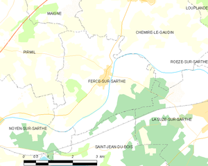
Fercé-sur-Sarthe
- commune in Sarthe, France
- Country:
- Postal Code: 72430
- Coordinates: 47° 54' 4" N, 0° 1' 54" E
- GPS tracks (wikiloc): [Link]
- Area: 12.11 sq km
- Population: 583
- Web site: [Link]


Saint-Jean-du-Bois
- commune in Sarthe, France
- Country:
- Postal Code: 72430
- Coordinates: 47° 52' 20" N, 0° 2' 24" E
- GPS tracks (wikiloc): [Link]
- Area: 14.62 sq km
- Population: 636