Chemiré-le-Gaudin (Chemiré-le-Gaudin)

- commune in Sarthe, France
- Country:

- Postal Code: 72210
- Coordinates: 47° 55' 42" N, 0° 0' 54" E


- GPS tracks (wikiloc): [Link]
- Area: 22.79 sq km
- Population: 958
- Wikipedia en: wiki(en)
- Wikipedia: wiki(fr)
- Wikidata storage: Wikidata: Q430393
- Wikipedia Commons Category: [Link]
- Freebase ID: [/m/03qj0hq]
- GeoNames ID: Alt: [6450939]
- SIREN number: [217200757]
- BnF ID: [15273632n]
- INSEE municipality code: 72075
Shares border with regions:


Roézé-sur-Sarthe
- commune in Sarthe, France
- Country:
- Postal Code: 72210
- Coordinates: 47° 53' 45" N, 0° 4' 1" E
- GPS tracks (wikiloc): [Link]
- Area: 26.46 sq km
- Population: 2631


Souligné-Flacé
- commune in Sarthe, France
- Country:
- Postal Code: 72210
- Coordinates: 47° 58' 27" N, 0° 0' 54" E
- GPS tracks (wikiloc): [Link]
- Area: 16.49 sq km
- Population: 692

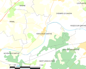
Fercé-sur-Sarthe
- commune in Sarthe, France
- Country:
- Postal Code: 72430
- Coordinates: 47° 54' 4" N, 0° 1' 54" E
- GPS tracks (wikiloc): [Link]
- Area: 12.11 sq km
- Population: 583
- Web site: [Link]

Maigné
- commune in Sarthe, France
- Country:
- Postal Code: 72210
- Coordinates: 47° 56' 16" N, 0° 3' 17" E
- GPS tracks (wikiloc): [Link]
- Area: 11.5 sq km
- Population: 345


Crannes-en-Champagne
- commune in Sarthe, France
- Country:
- Postal Code: 72540
- Coordinates: 47° 58' 51" N, 0° 3' 7" E
- GPS tracks (wikiloc): [Link]
- Area: 11.97 sq km
- Population: 352


La Suze-sur-Sarthe
- commune in Sarthe, France
- Country:
- Postal Code: 72210
- Coordinates: 47° 53' 23" N, 0° 1' 31" E
- GPS tracks (wikiloc): [Link]
- AboveSeaLevel: 76 м m
- Area: 21.4 sq km
- Population: 4460
- Web site: [Link]


Louplande
- commune in Sarthe, France
- Country:
- Postal Code: 72210
- Coordinates: 47° 56' 36" N, 0° 2' 30" E
- GPS tracks (wikiloc): [Link]
- Area: 18.47 sq km
- Population: 1472
- Web site: [Link]