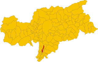
Laives (Laives)
.svg)
- Italian comune
 Hiking in Laives
Laives (or Leifers in German) is a small town located in the South Tyrol region of northern Italy. It's situated near the city of Bolzano, making it a great base for hikers interested in exploring the stunning scenery of the Dolomites and the surrounding alpine landscape.
Hiking Trails and Areas:
-
Dolomites: The Dolomites, a UNESCO World Heritage site, offer breathtaking views and a variety of hiking trails suitable for different skill levels. Many trails are accessible from Laives or nearby Bolzano.
-
Nature Parks: The surrounding nature parks, such as the Fanes-Sennes-Braies Nature Park and the Sciliar-Catinaccio Nature Park, have numerous trails that vary in difficulty and length.
-
Local Trails: There are also local trails around Laives that wind through vineyards, forests, and along the Adige River. These paths are usually well-marked and are perfect for leisurely walks or more challenging hikes.
Tips for Hiking in Laives:
- Weather Awareness: Before heading out, check the weather conditions. The mountain weather can change rapidly, so be prepared with suitable clothing and gear.
- Trail Maps: It’s advisable to carry a trail map or use a hiking app. Local tourist offices can provide maps and details on trail conditions.
- Hydration and Snacks: Always bring enough water and some snacks. Many hiking trails may not have access to food and water sources.
- Footwear: Comfortable, durable hiking shoes are essential, especially on rocky or uneven terrain.
- Respect Nature: Stay on marked trails, take your litter with you, and be mindful of wildlife.
Additional Activities:
In addition to hiking, the area offers opportunities for biking, exploring local culture, and enjoying wine tastings in the nearby vineyards. The proximity to Bolzano also allows for vibrant cultural experiences, including visiting museums and local markets.
Overall, Laives serves as a peaceful and picturesque starting point for embracing the natural beauty and outdoor adventures that South Tyrol has to offer.
- Country:

- Postal Code: 39055
- Local Dialing Code: 0471
- Licence Plate Code: BZ
- Coordinates: 46° 25' 39" N, 11° 20' 26" E


- GPS tracks (wikiloc): [Link]
- AboveSeaLevel: 258 м m
- Area: 24.11 sq km
- Population: 17954
- Web site: http://www.comune.laives.bz.it
- Wikipedia en: wiki(en)
- Wikipedia: wiki(it)
- Wikidata storage: Wikidata: Q244607
- Wikipedia Commons Gallery: [Link]
- Wikipedia Commons Category: [Link]
- Freebase ID: [/m/0g9gw6]
- GeoNames ID: Alt: [6535956]
- BnF ID: [13741936b]
- VIAF ID: Alt: [124331324]
- OSM relation ID: [47187]
- GND ID: Alt: [4111248-9]
- UN/LOCODE: [ITLVE]
- ISTAT ID: 021040
- Italian cadastre code: E421
Shares border with regions:
Bronzolo
- Italian comune
Hiking in Bronzolo
Bronzolo, or Bronzolo in Italian, is a charming village located in South Tyrol, Italy. Nestled near the Adige River and surrounded by beautiful rolling hills and vineyards, it offers a fantastic experience for hiking enthusiasts. Here are some highlights about hiking in the Bronzolo area:...
- Country:
- Postal Code: 39051
- Local Dialing Code: 0471
- Licence Plate Code: BZ
- Coordinates: 46° 24' 0" N, 11° 19' 0" E
- GPS tracks (wikiloc): [Link]
- AboveSeaLevel: 263 м m
- Area: 7.54 sq km
- Population: 2798
- Web site: [Link]


Deutschnofen
- Italian comune
Hiking in Deutschnofen
Deutschnofen, known as "Naz-Sciaves" in Italian, is a charming village located in the South Tyrol region of northern Italy. Nestled in the stunning Dolomites, it offers a variety of hiking opportunities for enthusiasts of all levels. Here are some highlights of hiking in this beautiful area:...
- Country:
- Postal Code: 39050
- Local Dialing Code: 0471
- Licence Plate Code: BZ
- Coordinates: 46° 24' 51" N, 11° 25' 31" E
- GPS tracks (wikiloc): [Link]
- AboveSeaLevel: 1357 м m
- Area: 112.49 sq km
- Population: 3917
- Web site: [Link]

Vadena
- Italian comune
Hiking in Vadena
Vadena, located in the South Tyrol region of northern Italy, is a lesser-known but beautiful area that offers a variety of hiking opportunities. Here’s an overview of what to expect when hiking in this region:...
- Country:
- Postal Code: 39051
- Local Dialing Code: 0471
- Licence Plate Code: BZ
- Coordinates: 46° 25' 0" N, 11° 18' 0" E
- GPS tracks (wikiloc): [Link]
- AboveSeaLevel: 243 м m
- Area: 15.22 sq km
- Population: 1015
- Web site: [Link]


Bolzano
- Italian comune in South Tyrol
Hiking in Bolzano
Bolzano, located in the northern part of Italy in the South Tyrol region, offers stunning hiking opportunities amidst the picturesque backdrop of the Dolomites and surrounding mountains. Here are some highlights and tips for hiking in Bolzano:...
- Country:
- Postal Code: 39100
- Local Dialing Code: 0471
- Licence Plate Code: BZ
- Coordinates: 46° 30' 0" N, 11° 21' 0" E
- GPS tracks (wikiloc): [Link]
- AboveSeaLevel: 232 м m
- Area: 52.29 sq km
- Population: 106951
- Web site: [Link]