
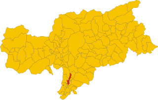
Bolzano (Bolzano)

.svg)
- Italian comune in South Tyrol
 Hiking in Bolzano
Bolzano, located in the northern part of Italy in the South Tyrol region, offers stunning hiking opportunities amidst the picturesque backdrop of the Dolomites and surrounding mountains. Here are some highlights and tips for hiking in Bolzano:
Trails and Routes
-
Renon Plateau (Ritten): Easily accessible by a cable car from Bolzano, the Renon Plateau features several scenic hiking trails. The famous Earth Pyramids of Ritten offer a unique geological phenomenon that can be explored on various marked paths.
-
The Dolomites: The nearby Dolomites boast a network of hiking trails for all skill levels. Trails such as the Seceda to Col Raiser route provide breathtaking views and allow hikers to experience the stunning landscapes and rich biodiversity.
-
Terlano: Just a short distance from Bolzano, Terlano has numerous well-marked trails that are ideal for leisurely walks or more challenging hikes. The Terlano Vineyards offer wine enthusiasts an opportunity to combine their hobby with hiking.
-
Val Sarentino (Sarin Valley): This valley is less touristy and offers pristine nature. There are plenty of hiking trails weaving through the valley and up into the mountains, providing options for both casual hikers and serious trekkers.
Practical Information
-
Best Season: The best time for hiking in Bolzano is from late spring to early autumn (May to October). Summer offers warm temperatures, while early autumn provides beautiful fall colors.
-
Weather Considerations: The weather can change rapidly in the mountains, so it's essential to check forecasts before heading out. Always carry rain gear, and be prepared for cooler temperatures at higher elevations.
-
Equipment: Wear sturdy hiking boots and bring along plenty of water, snacks, and sun protection. A map or GPS device is helpful since some paths may not be well marked.
-
Guided Tours: For those unfamiliar with the area or seeking a more educational experience, consider joining guided hiking tours, where local experts can provide insights into the flora, fauna, and history of the region.
-
Local Cuisine: Don’t miss the chance to enjoy local South Tyrolean cuisine after your hikes. Local dishes, including speck, canederli (bread dumplings), and strudel, are well worth trying.
Safety Tips
- Always inform someone about your hiking plans.
- Stick to marked trails and respect local wildlife and nature.
- Be cautious of altitude sickness if hiking at higher elevations.
In summary, Bolzano is a gateway to some of the most beautiful hiking in the Alps, catering to all levels of hikers with its stunning landscapes, diverse trails, and rich cultural experiences. Enjoy your hiking adventure!
- Country:

- Postal Code: 39100
- Local Dialing Code: 0471
- Licence Plate Code: BZ
- Coordinates: 46° 30' 0" N, 11° 21' 0" E


- GPS tracks (wikiloc): [Link]
- AboveSeaLevel: 232 м m
- Area: 52.29 sq km
- Population: 106951
- Web site: http://www.comune.bolzano.it
- Wikipedia en: wiki(en)
- Wikipedia: wiki(it)
- Wikidata storage: Wikidata: Q6526
- Wikipedia Commons Gallery: [Link]
- Wikipedia Commons Category: [Link]
- Freebase ID: [/m/01b3xv]
- GeoNames ID: Alt: [6535953]
- VIAF ID: Alt: [312796306]
- OSM relation ID: [47207]
- GND ID: Alt: [4007901-6]
- archINFORM location ID: [881]
- Library of Congress authority ID: Alt: [n80001313]
- MusicBrainz area ID: [eb173fb0-4c4f-4971-9f8a-185b700f4544]
- Quora topic ID: [Bolzano-Italy]
- UN/LOCODE: [ITBZO]
- Encyclopædia Britannica Online ID: [place/Bolzano-Italy]
- Encyclopædia Universalis ID: [bolzano]
- HDS ID: [8992]
- Facebook Places ID: [109939089035498]
- Great Russian Encyclopedia Online ID: [1876521]
- Digital Atlas of the Roman Empire ID: [23497]
- NKCR AUT ID: [ge134077]
- National Library of Israel ID: [000977863]
- YSO ID: [112667]
- Klexikon article ID: [Bozen]
- Global Anabaptist Mennonite Encyclopedia Online ID: [Bozen (Trentino-Alto Adige, Italy)]
- Lexicon istoric retic ID: [153]
- ISTAT ID: 021008
- Italian cadastre code: A952
Includes regions:
Europa-Neustift
- frazione of Italy
Hiking in Europa-Neustift
Europa-Novacella, located in South Tyrol, Italy, is a beautiful area that offers a variety of hiking opportunities. Known for its stunning landscapes, wineries, and cultural heritage, it provides hikers with a unique experience that combines nature and local traditions....
- Country:
- Postal Code: 39100
- Local Dialing Code: 0471
- Coordinates: 46° 29' 33" N, 11° 20' 16" E
- GPS tracks (wikiloc): [Link]
- AboveSeaLevel: 254 м m
- Web site: [Link]

Gries-San Quirino
- frazione of Italy
Hiking in Gries-San Quirino
Gries-San Quirino, located in the Trentino-Alto Adige region of northern Italy, is a beautiful area known for its stunning landscapes, diverse ecosystems, and a variety of hiking opportunities. Here’s an overview of what you can expect when hiking in this area:...
- Country:
- Postal Code: 39100
- Local Dialing Code: 0471
- Coordinates: 46° 30' 1" N, 11° 20' 20" E
- GPS tracks (wikiloc): [Link]
- AboveSeaLevel: 246 м m
- Web site: [Link]
Zentrum-Bozner Boden-Rentsch
- frazione of Italy
Hiking in Zentrum-Bozner Boden-Rentsch
Centro-Piani-Rencio is a beautiful area located in the Dolomites of northern Italy, known for its stunning landscapes, diverse hiking trails, and rich biodiversity. This region offers a variety of hiking experiences suitable for different skill levels, from easy walks to challenging hikes....
- Country:
- Postal Code: 39100
- Local Dialing Code: 0471
- Coordinates: 46° 30' 1" N, 11° 21' 39" E
- GPS tracks (wikiloc): [Link]
- AboveSeaLevel: 262 м m
- Web site: [Link]

Oberau-Haslach
- human settlement in Italy
Hiking in Oberau-Haslach
Oltrisarco-Aslago, located in the South Tyrol region of Italy, offers a beautiful backdrop for hiking enthusiasts. The area is characterized by gentle hills, lush landscapes, and stunning views of the surrounding mountains. Here’s an overview of what you can expect when hiking in Oltrisarco-Aslago:...
- Country:
- Postal Code: 39100
- Local Dialing Code: 0471
- Coordinates: 46° 29' 2" N, 11° 20' 37" E
- GPS tracks (wikiloc): [Link]
- AboveSeaLevel: 247 м m
- Web site: [Link]
Don Bosco
- frazione of Italy
Hiking in Don Bosco
Hiking in Don Bosco, a neighborhood in Bolzano (Bolzen), Italy, offers picturesque trails and a delightful experience in the South Tyrol region, which is known for its stunning Alpine scenery. Based at the foothills of the Dolomites, Bolzano provides access to several hiking opportunities suitable for different skill levels....
- Country:
- Postal Code: 39100
- Local Dialing Code: 0471
- Coordinates: 46° 29' 20" N, 11° 19' 30" E
- GPS tracks (wikiloc): [Link]
- AboveSeaLevel: 246 м m
- Web site: [Link]
Shares border with regions:


Laives
- Italian comune
Hiking in Laives
Laives (or Leifers in German) is a small town located in the South Tyrol region of northern Italy. It's situated near the city of Bolzano, making it a great base for hikers interested in exploring the stunning scenery of the Dolomites and the surrounding alpine landscape....
- Country:
- Postal Code: 39055
- Local Dialing Code: 0471
- Licence Plate Code: BZ
- Coordinates: 46° 25' 39" N, 11° 20' 26" E
- GPS tracks (wikiloc): [Link]
- AboveSeaLevel: 258 м m
- Area: 24.11 sq km
- Population: 17954
- Web site: [Link]


Eppan an der Weinstraße
- Italian comune
Hiking in Eppan an der Weinstraße
Eppan an der Weinstraße, located in the South Tyrol region of northern Italy, is a beautiful destination for hiking enthusiasts. Nestled amidst vineyards and rolling hills, this area offers a variety of trails suitable for all levels of hikers, from easy walks to more challenging treks. Here are some highlights of hiking in Eppan:...
- Country:
- Postal Code: 39050; 39057
- Local Dialing Code: 0471
- Licence Plate Code: BZ
- Coordinates: 46° 27' 0" N, 11° 16' 0" E
- GPS tracks (wikiloc): [Link]
- AboveSeaLevel: 239 м m
- Area: 59.45 sq km
- Population: 14941
- Web site: [Link]


Cornedo all’Isarco (Karneid)
- Italian comune
Hiking in Cornedo all’Isarco (Karneid)
Karneid, located in South Tyrol, Italy, offers beautiful hiking opportunities amidst stunning mountain landscapes. The region is known for its diverse trails that range from easy walks to challenging treks, making it suitable for hikers of all skill levels....
- Country:
- Postal Code: 39053
- Local Dialing Code: 0471
- Licence Plate Code: BZ
- Coordinates: 46° 30' 0" N, 11° 24' 0" E
- GPS tracks (wikiloc): [Link]
- AboveSeaLevel: 510 м m
- Area: 40.61 sq km
- Population: 3391
- Web site: [Link]


Deutschnofen
- Italian comune
Hiking in Deutschnofen
Deutschnofen, known as "Naz-Sciaves" in Italian, is a charming village located in the South Tyrol region of northern Italy. Nestled in the stunning Dolomites, it offers a variety of hiking opportunities for enthusiasts of all levels. Here are some highlights of hiking in this beautiful area:...
- Country:
- Postal Code: 39050
- Local Dialing Code: 0471
- Licence Plate Code: BZ
- Coordinates: 46° 24' 51" N, 11° 25' 31" E
- GPS tracks (wikiloc): [Link]
- AboveSeaLevel: 1357 м m
- Area: 112.49 sq km
- Population: 3917
- Web site: [Link]


Ritten
- Italian comune
Hiking in Ritten
Ritten, also known as Renon, is a picturesque area located in South Tyrol, Italy, just outside of Bolzano. It offers a fantastic hiking experience with its stunning landscapes, diverse trails, and panoramic views of the Dolomites. Here are some highlights and tips for hiking in Ritten:...
- Country:
- Postal Code: 39054
- Local Dialing Code: 0471
- Licence Plate Code: BZ
- Coordinates: 46° 32' 29" N, 11° 27' 26" E
- GPS tracks (wikiloc): [Link]
- AboveSeaLevel: 1154 м m
- Area: 111.36 sq km
- Population: 7892
- Web site: [Link]


Jenesien
- Italian comune
Hiking in Jenesien
Jenesien, or San Genesio in Italian, is a lovely village located on the southern slopes of the Alps, just above the city of Bolzano in South Tyrol, Italy. It's known for its stunning views, rich history, and a plethora of hiking trails that cater to all skill levels. Here are some key highlights and tips if you're considering hiking in Jenesien:...
- Country:
- Postal Code: 39050
- Local Dialing Code: 0471
- Licence Plate Code: BZ
- Coordinates: 46° 32' 5" N, 11° 19' 47" E
- GPS tracks (wikiloc): [Link]
- AboveSeaLevel: 1000 м m
- Area: 68.84 sq km
- Population: 3045
- Web site: [Link]

Terlan
- Italian comune
Hiking in Terlan
Terlan, located in South Tyrol, Italy, is a beautiful destination for hiking enthusiasts. Nestled at the foothills of the Alps and surrounded by vineyards and rolling hills, Terlan offers a variety of trails suitable for all levels, from leisurely walks to challenging mountain hikes....
- Country:
- Postal Code: 39018
- Local Dialing Code: 0471
- Licence Plate Code: BZ
- Coordinates: 46° 31' 56" N, 11° 14' 49" E
- GPS tracks (wikiloc): [Link]
- AboveSeaLevel: 250 м m
- Area: 18.57 sq km
- Population: 4391
- Web site: [Link]

Vadena
- Italian comune
Hiking in Vadena
Vadena, located in the South Tyrol region of northern Italy, is a lesser-known but beautiful area that offers a variety of hiking opportunities. Here’s an overview of what to expect when hiking in this region:...
- Country:
- Postal Code: 39051
- Local Dialing Code: 0471
- Licence Plate Code: BZ
- Coordinates: 46° 25' 0" N, 11° 18' 0" E
- GPS tracks (wikiloc): [Link]
- AboveSeaLevel: 243 м m
- Area: 15.22 sq km
- Population: 1015
- Web site: [Link]