Lapoutroie (Lapoutroie)

- commune in Haut-Rhin, France
- Country:

- Postal Code: 68650
- Coordinates: 48° 9' 9" N, 7° 10' 10" E


- GPS tracks (wikiloc): [Link]
- Area: 21.12 sq km
- Population: 1894
- Web site: http://www.lapoutroie.fr
- Wikipedia en: wiki(en)
- Wikipedia: wiki(fr)
- Wikidata storage: Wikidata: Q122984
- Wikipedia Commons Category: [Link]
- Freebase ID: [/m/03nst5f]
- Freebase ID: [/m/03nst5f]
- GeoNames ID: Alt: [3007160]
- GeoNames ID: Alt: [3007160]
- SIREN number: [216801753]
- SIREN number: [216801753]
- BnF ID: [15271877p]
- BnF ID: [15271877p]
- VIAF ID: Alt: [129081139]
- VIAF ID: Alt: [129081139]
- GND ID: Alt: [4211609-0]
- GND ID: Alt: [4211609-0]
- Library of Congress authority ID: Alt: [n85322514]
- Library of Congress authority ID: Alt: [n85322514]
- WOEID: [601445]
- WOEID: [601445]
- INSEE municipality code: 68175
- INSEE municipality code: 68175
Shares border with regions:


Labaroche
- commune in Haut-Rhin, France
- Country:
- Postal Code: 68910
- Coordinates: 48° 6' 36" N, 7° 11' 35" E
- GPS tracks (wikiloc): [Link]
- Area: 13.44 sq km
- Population: 2219
- Web site: [Link]


Orbey
- commune in Haut-Rhin, France
- Country:
- Postal Code: 68370
- Coordinates: 48° 7' 35" N, 7° 9' 39" E
- GPS tracks (wikiloc): [Link]
- AboveSeaLevel: 500 м m
- Area: 46.02 sq km
- Population: 3576
- Web site: [Link]

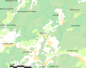
Fréland
- commune in Haut-Rhin, France
- Country:
- Postal Code: 68240
- Coordinates: 48° 10' 16" N, 7° 11' 38" E
- GPS tracks (wikiloc): [Link]
- Area: 19.74 sq km
- Population: 1367


Sainte-Marie-aux-Mines
- commune in Haut-Rhin, France
- Country:
- Postal Code: 68160
- Coordinates: 48° 14' 48" N, 7° 11' 2" E
- GPS tracks (wikiloc): [Link]
- Area: 45.23 sq km
- Population: 5136
- Web site: [Link]


Le Bonhomme
- commune in Haut-Rhin, France
- Country:
- Postal Code: 68650
- Coordinates: 48° 10' 21" N, 7° 6' 48" E
- GPS tracks (wikiloc): [Link]
- Area: 21.98 sq km
- Population: 780


Kaysersberg
- former commune in Haut-Rhin, France
- Country:
- Postal Code: 68240
- Coordinates: 48° 8' 21" N, 7° 15' 39" E
- GPS tracks (wikiloc): [Link]
- AboveSeaLevel: 240 м m
- Area: 24.82 sq km
- Population: 2703
- Web site: [Link]