Laverdines (Laverdines)

- commune in Cher, France
- Country:

- Postal Code: 18800
- Coordinates: 47° 1' 50" N, 2° 47' 53" E


- GPS tracks (wikiloc): [Link]
- Area: 9.89 sq km
- Population: 48
- Wikipedia en: wiki(en)
- Wikipedia: wiki(fr)
- Wikidata storage: Wikidata: Q1423226
- Wikipedia Commons Category: [Link]
- Freebase ID: [/m/03mfd2d]
- GeoNames ID: Alt: [6428202]
- SIREN number: [211801238]
- BnF ID: [152494698]
- INSEE municipality code: 18123
Shares border with regions:


Bengy-sur-Craon
- commune in Cher, France
- Country:
- Postal Code: 18520
- Coordinates: 47° 0' 1" N, 2° 44' 52" E
- GPS tracks (wikiloc): [Link]
- Area: 35.24 sq km
- Population: 673

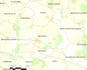
Nérondes
- commune in Cher, France
- Country:
- Postal Code: 18350
- Coordinates: 46° 59' 51" N, 2° 49' 10" E
- GPS tracks (wikiloc): [Link]
- Area: 34 sq km
- Population: 1526
- Web site: [Link]


Saligny-le-Vif
- commune in Cher, France
- Country:
- Postal Code: 18800
- Coordinates: 47° 2' 44" N, 2° 45' 59" E
- GPS tracks (wikiloc): [Link]
- Area: 15.29 sq km
- Population: 188
Villequiers
- commune in Cher, France
- Country:
- Postal Code: 18800
- Coordinates: 47° 4' 10" N, 2° 48' 18" E
- GPS tracks (wikiloc): [Link]
- Area: 29.49 sq km
- Population: 486
- Web site: [Link]


Chassy
- commune in Cher, France
- Country:
- Postal Code: 18800
- Coordinates: 47° 2' 31" N, 2° 50' 10" E
- GPS tracks (wikiloc): [Link]
- Area: 17.76 sq km
- Population: 250