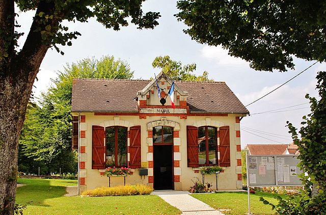
Villequiers (Villequiers)

- commune in Cher, France
- Country:

- Postal Code: 18800
- Coordinates: 47° 4' 10" N, 2° 48' 18" E


- GPS tracks (wikiloc): [Link]
- Area: 29.49 sq km
- Population: 486
- Web site: http://www.villequiers.fr
- Wikipedia en: wiki(en)
- Wikipedia: wiki(fr)
- Wikidata storage: Wikidata: Q634971
- Wikipedia Commons Category: [Link]
- Freebase ID: [/m/03mffmp]
- GeoNames ID: Alt: [6428336]
- SIREN number: [211802863]
- BnF ID: [15249632g]
- VIAF ID: Alt: [240515718]
- INSEE municipality code: 18286
Shares border with regions:


Baugy
- commune in Cher, France
- Country:
- Postal Code: 18800
- Coordinates: 47° 4' 53" N, 2° 43' 39" E
- GPS tracks (wikiloc): [Link]
- Area: 22.6 sq km
- Population: 1492


Couy
- commune in Cher, France
- Country:
- Postal Code: 18140
- Coordinates: 47° 7' 2" N, 2° 49' 32" E
- GPS tracks (wikiloc): [Link]
- Area: 18.36 sq km
- Population: 355


Saligny-le-Vif
- commune in Cher, France
- Country:
- Postal Code: 18800
- Coordinates: 47° 2' 44" N, 2° 45' 59" E
- GPS tracks (wikiloc): [Link]
- Area: 15.29 sq km
- Population: 188


Mornay-Berry
- commune in Cher, France
- Country:
- Postal Code: 18350
- Coordinates: 47° 2' 56" N, 2° 52' 16" E
- GPS tracks (wikiloc): [Link]
- Area: 9.15 sq km
- Population: 188
Laverdines
- commune in Cher, France
- Country:
- Postal Code: 18800
- Coordinates: 47° 1' 50" N, 2° 47' 53" E
- GPS tracks (wikiloc): [Link]
- Area: 9.89 sq km
- Population: 48


Gron
- commune in Cher, France
- Country:
- Postal Code: 18800
- Coordinates: 47° 7' 17" N, 2° 44' 28" E
- GPS tracks (wikiloc): [Link]
- Area: 26.22 sq km
- Population: 482
- Web site: [Link]


Chassy
- commune in Cher, France
- Country:
- Postal Code: 18800
- Coordinates: 47° 2' 31" N, 2° 50' 10" E
- GPS tracks (wikiloc): [Link]
- Area: 17.76 sq km
- Population: 250

Garigny
- commune in Cher, France
- Country:
- Postal Code: 18140
- Coordinates: 47° 5' 13" N, 2° 53' 16" E
- GPS tracks (wikiloc): [Link]
- Area: 19.66 sq km
- Population: 260