Lindau (Landkreis Lindau)
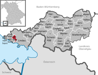
- rural district in Bavaria, Germany
Lindau, located in southern Germany on the shores of Lake Constance (Bodensee), offers a beautiful setting for hiking enthusiasts. The district encompasses a variety of natural landscapes, including picturesque lake views, rolling hills, lush forests, and charming villages. Here are some highlights for hiking in Lindau:
Hiking Trails
-
Lake Constance Trail (Bodensee-Rundweg): This is a scenic trail that encircles the entire Lake Constance, with sections passing through Lindau. It provides stunning views of the lake and the Alps, as well as opportunities to explore quaint lakeside towns.
-
Pfahlbauten Trail: Near the village of Wasserburg, this trail allows hikers to experience the region's prehistoric stilt-house dwellings, combined with views of the lake.
-
Lindauer Leuchtturm (Lindau Lighthouse): There are short hikes around the island town of Lindau that offer views of the famous lighthouse. Walking through the historic old town can also combine light hiking with cultural exploration.
-
The Bregenz Forest (Bregenzerwald): Just a short distance from Lindau, this region offers numerous hiking trails ranging from easy walks to more challenging hikes, all surrounded by lush forest and mountain scenery.
Tips for Hiking in Lindau
-
Seasonal Considerations: Spring and summer are ideal for hiking, but autumn also offers beautiful foliage. Winter hikes can be enjoyable, especially if you venture to higher elevations for snow-covered landscapes.
-
Equipment: Ensure you wear proper hiking footwear and bring along a map or GPS, as some trails may not be well-marked.
-
Stay Hydrated: Bring enough water, especially on longer hikes, as some trails may not have accessible sources of drinking water.
-
Trail Conditions: Always check trail conditions before heading out, as weather and maintenance can affect accessibility.
Nearby Attractions
-
Mainau Island: Known as the Flower Island, this botanical wonder is accessible by boat from Lindau and offers beautiful gardens and walking paths.
-
Bregenz, Austria: Just across the border, this city is known for its cultural festivals and offers additional hiking opportunities in the surrounding mountains.
In summary, Lindau is a delightful destination for hikers, with its combination of natural beauty and cultural attractions providing an enriching outdoor experience.
- Country:

- Capital: Lindau
- Licence Plate Code: LI
- Coordinates: 47° 36' 0" N, 9° 51' 36" E


- GPS tracks (wikiloc): [Link]
- AboveSeaLevel: 496 м m
- Area: 323.00 sq km
- Population: 69522
- Web site: http://www.landkreis-lindau.de/
- Wikipedia en: wiki(en)
- Wikipedia: wiki(de)
- Wikidata storage: Wikidata: Q10401
- Wikipedia Commons Category: [Link]
- Freebase ID: [/m/020gxc]
- GeoNames ID: Alt: [3220885]
- VIAF ID: Alt: [136124265]
- OSM relation ID: [62672]
- GND ID: Alt: [4035780-6]
- archINFORM location ID: [3832]
- Library of Congress authority ID: Alt: [n86038157]
- TGN ID: [7077086]
- Historical Gazetteer (GOV) ID: [adm_139776]
- Bavarikon ID: [ODB_A00000703]
- NUTS code: [DE27A]
- German district key: 09776
Includes regions:
Lindau
- town in Bavaria, Germany
Lindau, located on Lake Constance (Bodensee) in Bavaria, Germany, is a picturesque town known for its stunning views, charming architecture, and access to beautiful hiking trails. Here are some key points about hiking in and around Lindau:...
- Country:

- Postal Code: 88131
- Local Dialing Code: 08382
- Licence Plate Code: LI
- Coordinates: 47° 32' 45" N, 9° 41' 2" E


- GPS tracks (wikiloc): [Link]
- AboveSeaLevel: 401 м m
- Area: 33.18 sq km
- Population: 25249
- Web site: [Link]


Oberreute
- municipality of Germany
Oberreute is a charming village located in Bavaria, Germany, near the border with Austria, known for its picturesque landscapes and opportunities for outdoor activities, including hiking. The area features beautiful rolling hills, lush forests, and stunning views of the Alps, making it an excellent destination for both novice and experienced hikers....
- Country:

- Postal Code: 88179
- Local Dialing Code: 08387
- Licence Plate Code: LI
- Coordinates: 47° 34' 0" N, 9° 56' 0" E


- GPS tracks (wikiloc): [Link]
- AboveSeaLevel: 827 м m
- Area: 13.49 sq km
- Population: 1641
- Web site: [Link]


Opfenbach
- municipality of Germany
Opfenbach is a charming village located in Bavaria, Germany, near the border with Austria. It offers a variety of hiking opportunities that cater to different skill levels and preferences. Here are some highlights about hiking in and around Opfenbach:...
- Country:

- Postal Code: 88145
- Local Dialing Code: 08385
- Licence Plate Code: LI
- Coordinates: 47° 37' 0" N, 9° 49' 0" E


- GPS tracks (wikiloc): [Link]
- AboveSeaLevel: 597 м m
- Area: 16.79 sq km
- Population: 1952
- Web site: [Link]


Stiefenhofen
- municipality of Germany
Stiefenhofen, located in the Allgäu region of Bavaria, Germany, offers beautiful hiking opportunities amidst stunning natural scenery. Nestled at the foot of the Alps, this area features rolling hills, lush meadows, and picturesque views of the surrounding mountains. Here are some key highlights for hiking in Stiefenhofen:...
- Country:

- Postal Code: 88167
- Local Dialing Code: 08383
- Licence Plate Code: LI
- Coordinates: 47° 36' 0" N, 10° 0' 0" E


- GPS tracks (wikiloc): [Link]
- AboveSeaLevel: 805 м m
- Area: 28.96 sq km
- Population: 1498
- Web site: [Link]


Scheidegg
- municipality in Bavaria, Germany
Scheidegg, located in Bavaria, Germany, is a picturesque destination for hiking enthusiasts. Nestled near the Allgäu Alps and close to the shores of Lake Constance, it offers a variety of trails that cater to different skill levels, making it accessible for both beginners and experienced hikers....
- Country:

- Postal Code: 88175
- Local Dialing Code: 08381
- Licence Plate Code: LI
- Coordinates: 47° 34' 56" N, 9° 50' 56" E


- GPS tracks (wikiloc): [Link]
- AboveSeaLevel: 805 м m
- Area: 27.36 sq km
- Population: 4230
- Web site: [Link]


Sigmarszell
- municipality of Germany
Sigmarszell, located in the southern part of Germany near the border with Austria, is an ideal destination for hiking enthusiasts. The region encompasses scenic landscapes, including rolling hills, lush forests, and offers views of the nearby Alps. Here’s an overview of what you can expect when hiking in Sigmarszell:...
- Country:

- Postal Code: 88138
- Local Dialing Code: 08389; 08388; 08382
- Licence Plate Code: LI
- Coordinates: 47° 35' 22" N, 9° 45' 44" E


- GPS tracks (wikiloc): [Link]
- AboveSeaLevel: 482 м m
- Area: 16.01 sq km
- Population: 2215
- Web site: [Link]


Hergensweiler
- municipality of Germany
Hergensweiler is a quaint village located in the southern region of Germany, near Lake Constance and the Swiss border. The surrounding area is known for its beautiful natural landscapes, making it a great destination for hiking enthusiasts. Here are some highlights about hiking in and around Hergensweiler:...
- Country:

- Postal Code: 88138
- Local Dialing Code: 08388
- Licence Plate Code: LI
- Coordinates: 47° 37' 0" N, 9° 46' 0" E


- GPS tracks (wikiloc): [Link]
- AboveSeaLevel: 520 м m
- Area: 12.09 sq km
- Population: 1391
- Web site: [Link]


Maierhöfen
- municipality of Germany
Maierhöfen is a charming village located in the Allgäu region of Bavaria, Germany, nestled between the rolling hills and scenic landscapes that are characteristic of this part of the Bavarian Alps. Hiking in and around Maierhöfen offers a range of trails suitable for various skill levels, making it an excellent destination for outdoor enthusiasts....
- Country:

- Postal Code: 88167
- Local Dialing Code: 08383
- Licence Plate Code: LI
- Coordinates: 47° 38' 0" N, 10° 3' 0" E


- GPS tracks (wikiloc): [Link]
- AboveSeaLevel: 741 м m
- Area: 17.50 sq km
- Population: 1580
- Web site: [Link]


Hergatz
- municipality of Germany
Hergatz is a small town located in Bavaria, Germany, and is surrounded by beautiful natural landscapes making it a lovely spot for hiking enthusiasts. Here are some key points about hiking in and around Hergatz:...
- Country:

- Postal Code: 88145
- Local Dialing Code: 08385
- Licence Plate Code: LI
- Coordinates: 47° 39' 0" N, 9° 50' 0" E


- GPS tracks (wikiloc): [Link]
- AboveSeaLevel: 600 м m
- Area: 18.81 sq km
- Population: 2158
- Web site: [Link]


Nonnenhorn
- municipality of Germany
Nonnenhorn is a charming village located on the shores of Lake Constance (Bodensee) in Germany, within the state of Baden-Württemberg. The area is known for its beautiful landscapes, wine culture, and outdoor activities, making it an excellent destination for hikers....
- Country:

- Postal Code: 88149
- Local Dialing Code: 08382
- Licence Plate Code: LI
- Coordinates: 47° 34' 31" N, 9° 36' 37" E


- GPS tracks (wikiloc): [Link]
- AboveSeaLevel: 404 м m
- Area: 1.96 sq km
- Population: 1450
- Web site: [Link]


Wasserburg am Bodensee
- municipality in Germany
 Hiking in Wasserburg am Bodensee
Wasserburg am Bodensee is a picturesque village located on the shores of Lake Constance (Bodensee) in southern Germany. It's an excellent destination for hiking enthusiasts, offering a variety of trails with stunning views of the lake, surrounding hills, and the Alps in the background. Here are some highlights for hiking in Wasserburg am Bodensee:...
- Country:

- Postal Code: 88142
- Local Dialing Code: 08382
- Licence Plate Code: LI
- Coordinates: 47° 34' 1" N, 9° 37' 34" E


- GPS tracks (wikiloc): [Link]
- AboveSeaLevel: 393 м m
- Area: 6.34 sq km
- Population: 2693
- Web site: [Link]


Röthenbach
- municipality of Germany
Röthenbach (Allgäu) is a charming village located in the beautiful Allgäu region of Bavaria, Germany. It's known for its stunning landscapes, rolling hills, and proximity to the Alps, making it an excellent location for hiking enthusiasts. Here are some highlights about hiking in this area:...
- Country:

- Postal Code: 88167
- Local Dialing Code: 08384
- Licence Plate Code: LI
- Coordinates: 47° 37' 0" N, 9° 59' 0" E


- GPS tracks (wikiloc): [Link]
- AboveSeaLevel: 657 м m
- Area: 14.96 sq km
- Population: 1567
- Web site: [Link]


Weiler-Simmerberg
- municipality of Germany
Weiler-Simmerberg is a charming village in the Allgäu region of Bavaria, Germany, surrounded by picturesque landscapes that make it an excellent destination for hiking enthusiasts. The area features a variety of trails that cater to different skill levels, offering stunning views of the Alps, lush forests, and serene meadows....
- Country:

- Postal Code: 88171
- Local Dialing Code: 08387; 08384
- Licence Plate Code: LI
- Coordinates: 47° 35' 0" N, 9° 56' 0" E


- GPS tracks (wikiloc): [Link]
- AboveSeaLevel: 632 м m
- Area: 31.30 sq km
- Population: 5137
- Web site: [Link]


Lindenberg im Allgäu
- municipality of Germany
 Hiking in Lindenberg im Allgäu
Lindenberg im Allgäu is a charming town located in the beautiful Allgäu region of Bavaria, Germany. It's well-known for its picturesque landscapes, rolling hills, and proximity to the Alps, making it a great destination for hiking enthusiasts....
- Country:

- Postal Code: 88161
- Local Dialing Code: 08381
- Licence Plate Code: LI
- Coordinates: 47° 36' 11" N, 9° 53' 10" E


- GPS tracks (wikiloc): [Link]
- AboveSeaLevel: 786 м m
- Area: 11.85 sq km
- Population: 10075
- Web site: [Link]


Grünenbach
- municipality of Germany
Grünenbach, located in the Allgäu region of southern Germany, offers a variety of hiking opportunities for outdoor enthusiasts. The area is known for its picturesque landscapes, including rolling hills, lush meadows, forests, and stunning views of the surrounding mountains....
- Country:

- Postal Code: 88167
- Local Dialing Code: 08383
- Licence Plate Code: LI
- Coordinates: 47° 37' 0" N, 10° 1' 0" E


- GPS tracks (wikiloc): [Link]
- AboveSeaLevel: 718 м m
- Area: 25.12 sq km
- Population: 1124
- Web site: [Link]


Gestratz
- municipality of Germany
Gestratz is a charming village located in Bavaria, Germany, nestled in the foothills of the Alps. It offers a lovely environment for hiking enthusiasts, with a variety of trails that cater to different skill levels and preferences. Here are some highlights of what you can expect when hiking in and around Gestratz:...
- Country:

- Postal Code: 88167
- Local Dialing Code: 08383
- Licence Plate Code: LI
- Coordinates: 47° 39' 0" N, 9° 59' 0" E


- GPS tracks (wikiloc): [Link]
- AboveSeaLevel: 629 м m
- Area: 15.07 sq km
- Population: 1028
- Web site: [Link]


Bodolz
- municipality of Germany
Bodolz is a charming community located in the state of Bavaria, Germany, near the shores of Lake Constance (Bodensee). While it may not be as widely known for hiking as some larger regions, it offers several beautiful routes and nearby areas that are perfect for outdoor enthusiasts....
- Country:

- Postal Code: 88131
- Local Dialing Code: 08382
- Licence Plate Code: LI
- Coordinates: 47° 34' 20" N, 9° 39' 40" E


- GPS tracks (wikiloc): [Link]
- AboveSeaLevel: 429 м m
- Area: 3.03 sq km
- Population: 2460
- Web site: [Link]


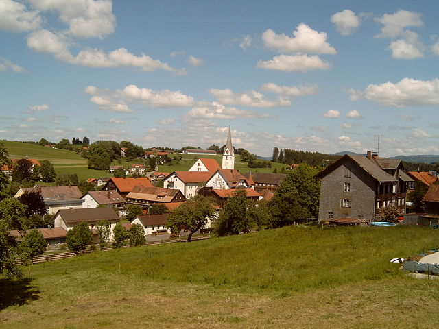
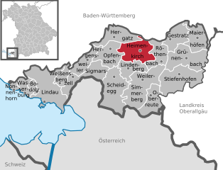
Heimenkirch
- municipality of Germany
Heimenkirch is a charming village located in the Allgäu region of Bavaria, Germany, surrounded by beautiful landscapes perfect for hiking and outdoor activities. Here’s an overview of what you can expect when hiking in and around Heimenkirch:...
- Country:

- Postal Code: 88178
- Local Dialing Code: 08381
- Licence Plate Code: LI
- Coordinates: 47° 37' 0" N, 9° 55' 0" E


- GPS tracks (wikiloc): [Link]
- AboveSeaLevel: 668 м m
- Area: 21.24 sq km
- Population: 3093
- Web site: [Link]

Weißensberg
- municipality of Germany
Weißensberg is a picturesque village located in the southern part of Germany, near Lake Constance. While it may not be as widely known as some other hiking destinations, it offers plenty of opportunities for outdoor enthusiasts. Here are some highlights and tips for hiking in and around Weißensberg:...
- Country:

- Postal Code: 88138
- Local Dialing Code: 08389
- Licence Plate Code: LI
- Coordinates: 47° 34' 0" N, 9° 43' 0" E


- GPS tracks (wikiloc): [Link]
- AboveSeaLevel: 502 м m
- Area: 7.84 sq km
- Population: 1965
- Web site: [Link]
Shares border with regions:


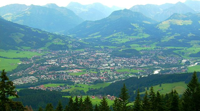
Oberallgäu
- district in Bavaria, Germany
Oberallgäu, located in Bavaria, Germany, is a stunning region known for its breathtaking landscapes, rolling hills, and majestic Alps. It offers a wide range of hiking opportunities suitable for all levels of experience, from leisurely walks to challenging mountain ascents. Here are some highlights and tips for hiking in Oberallgäu:...
- Country:

- Capital: Sonthofen
- Licence Plate Code: OA
- Coordinates: 47° 34' 48" N, 10° 15' 0" E


- GPS tracks (wikiloc): [Link]
- AboveSeaLevel: 711 м m
- Area: 1528.00 sq km
- Population: 128665
- Web site: [Link]

Bregenz District
- district in Austria
Bregenz District, located in the western part of Austria in the state of Vorarlberg, offers a variety of stunning hiking opportunities, thanks to its diverse landscapes that include lakes, mountains, and picturesque villages. Here are some highlights and tips for hiking in this beautiful region:...
- Country:

- Capital: Bregenz
- Licence Plate Code: B
- Coordinates: 47° 24' 0" N, 10° 0' 0" E


- GPS tracks (wikiloc): [Link]
- AboveSeaLevel: 771 м m
- Area: 863.34 sq km
- Population: 131350
- Web site: [Link]


Landkreis Ravensburg
- district of Baden-Württemberg, Germany
 Hiking in Landkreis Ravensburg
Ravensburg district, located in the state of Baden-Württemberg in Germany, offers a diverse range of hiking opportunities for both casual walkers and experienced hikers. The region is characterized by its beautiful landscapes, rolling hills, and picturesque villages. Here are some highlights and tips for hiking in Ravensburg:...
- Country:

- Capital: Ravensburg
- Licence Plate Code: RV
- Coordinates: 47° 49' 12" N, 9° 48' 0" E


- GPS tracks (wikiloc): [Link]
- AboveSeaLevel: 698 м m
- Area: 1631.81 sq km
- Population: 272425
- Web site: [Link]


Bodenseekreis
- district of Baden-Württemberg, Germany
Bodenseekreis, located in the Baden-Württemberg region of Germany, is known for its stunning landscapes, charming towns, and proximity to Lake Constance (Bodensee). Hiking in this area can be a delightful experience due to its varied terrain, beautiful views, and a range of trails suitable for different skill levels. Here are some highlights and tips for hiking in Bodenseekreis:...
- Country:

- Capital: Friedrichshafen
- Licence Plate Code: FN
- Coordinates: 47° 44' 0" N, 9° 23' 0" E


- GPS tracks (wikiloc): [Link]
- AboveSeaLevel: 490 м m
- Area: 664.64 sq km
- Population: 205843
- Web site: [Link]
