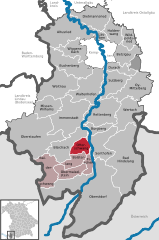
Oberallgäu (Landkreis Oberallgäu)

- district in Bavaria, Germany
 Hiking in Oberallgäu
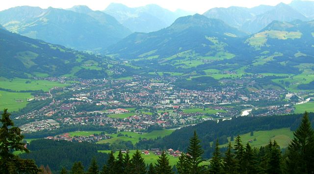
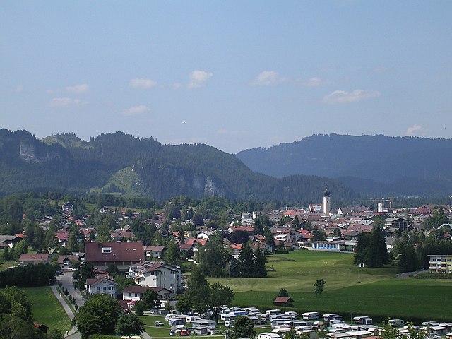
Oberallgäu, located in Bavaria, Germany, is a stunning region known for its breathtaking landscapes, rolling hills, and majestic Alps. It offers a wide range of hiking opportunities suitable for all levels of experience, from leisurely walks to challenging mountain ascents. Here are some highlights and tips for hiking in Oberallgäu:
Hiking Trails
-
Allgäu Alps: These mountains provide numerous routes that showcase dramatic scenery, including rugged peaks, lush valleys, and alpine lakes. Popular trails include:
- Nebelhorn: This hike offers panoramic views of the Alps and is accessible via a cable car. The area features several marked trails with varying difficulty.
- Fellhorn-Kanzelwand: This is a popular hiking region that connects Germany and Austria, with scenic paths that cater to families and experienced hikers alike.
-
Nature Reserves: Oberallgäu is home to various nature reserves that feature well-maintained paths. The Buchenberger Moos and Riedberger Horn are excellent spots for experiencing local flora and fauna.
-
Lake Hikes: The region includes beautiful mountain lakes like Schwarzenbachsee and Waldersee, featuring easy walking trails that provide stunning views and opportunities for picnicking.
-
The “Isny Allgäu” Trail: This long-distance trail takes you through picturesque villages, meadows, and alongside rivers, providing an authentic taste of Bavarian culture.
Best Times to Hike
- Summer (June to September): The best time for most hikes, with mild weather and fully accessible trails.
- Autumn (October): Offers beautiful fall foliage, but check local conditions as some trails may close or require equipment due to early snow.
Safety Tips
- Weather: Conditions in the mountains can change rapidly. Always check the weather forecast before heading out and be prepared for sudden changes.
- Trail Difficulty: Be sure to assess your fitness level and choose trails that match your experience. Maps and signage are usually good, but carrying a compass or GPS is wise.
- Wildlife: Respect local wildlife and adhere to guidelines to minimize your impact on the environment.
Essentials for Hiking
- Footwear: Sturdy, comfortable hiking boots are crucial.
- Clothing: Dress in layers; temperatures can vary significantly at different elevations.
- Supplies: Bring water, snacks, a first-aid kit, and a map of the area.
- Local Guides: If you’re inexperienced or want to explore more remote areas, consider hiring a local guide.
Cultural Considerations
- Local Cuisine: Don't miss out on trying Allgäu specialties like cheese, butter, and traditional dishes post-hike in local huts or restaurants.
- Regional Events: Check for local festivals or markets that may coincide with your visit to enrich your hiking experience.
Oberallgäu offers a perfect blend of natural beauty and rich culture, making it an ideal destination for hikers looking to experience the majesty of the Alps. Always prepare properly and respect the environment to ensure an enjoyable hike!
- Country:

- Capital: Sonthofen
- Licence Plate Code: OA
- Coordinates: 47° 34' 48" N, 10° 15' 0" E


- GPS tracks (wikiloc): [Link]
- AboveSeaLevel: 711 м m
- Area: 1528.00 sq km
- Population: 128665
- Web site: http://www.oberallgaeu.de/
- Wikipedia en: wiki(en)
- Wikipedia: wiki(de)
- Wikidata storage: Wikidata: Q10402
- Wikipedia Commons Category: [Link]
- Freebase ID: [/m/026wbf]
- GeoNames ID: Alt: [2861443]
- VIAF ID: Alt: [147763362]
- OSM relation ID: [62415]
- GND ID: Alt: [4042875-8]
- archINFORM location ID: [2541]
- Library of Congress authority ID: Alt: [n82010185]
- TGN ID: [7127326]
- Bavarikon ID: [ODB_A00000867]
- ISNI: Alt: [0000 0004 0565 4361]
- NUTS code: [DE27E]
- German district key: 09780
Includes regions:


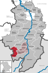
Oberstaufen
- municipality of Germany
Hiking in Oberstaufen
Oberstaufen, located in the Allgäu region of Bavaria, Germany, is a popular destination for hiking enthusiasts. The area is known for its stunning alpine scenery, lush meadows, and picturesque trails that cater to various levels of hiking experience. Here are some highlights and tips for hiking in Oberstaufen:...
- Country:
- Postal Code: 87534
- Local Dialing Code: 08386
- Licence Plate Code: OA
- Coordinates: 47° 33' 16" N, 10° 1' 16" E
- GPS tracks (wikiloc): [Link]
- AboveSeaLevel: 791 м m
- Area: 125.84 sq km
- Population: 7547
- Web site: [Link]
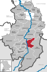
Sonthofen
- town in Germany
Hiking in Sonthofen
Sonthofen, located in Bavaria, Germany, is a fantastic destination for hikers and outdoor enthusiasts. Nestled in the beautiful Allgäu Alps, it offers a range of hiking trails that cater to different skill levels, from leisurely walks to challenging mountain hikes. Here are some highlights of hiking in and around Sonthofen:...
- Country:
- Postal Code: 87527
- Local Dialing Code: 08321
- Licence Plate Code: OA
- Coordinates: 47° 30' 51" N, 10° 16' 54" E
- GPS tracks (wikiloc): [Link]
- AboveSeaLevel: 746 м m
- Area: 20.982 sq km
- Population: 20025
- Web site: [Link]


Kempter Wald
- unincorporated area in Germany
Hiking in Kempter Wald
Kempter Wald is a beautiful forested area located in the Allgäu region of Bavaria, Germany. It’s known for its lush scenery, diverse wildlife, and a variety of hiking trails, making it an ideal destination for both novice and experienced hikers. Here are some key points to consider for hiking in this area:...
- Country:
- Coordinates: 47° 43' 13" N, 10° 26' 25" E
- GPS tracks (wikiloc): [Link]


Bolsterlang
- municipality of Germany
Hiking in Bolsterlang
Bolsterlang is a charming village located in Bavaria, Germany, nestled in the Allgäu region, which is renowned for its stunning natural beauty. This area offers plenty of opportunities for hiking enthusiasts, ranging from easy strolls to more challenging trails. Here are some highlights about hiking in Bolsterlang:...
- Country:
- Postal Code: 87538
- Local Dialing Code: 08326
- Licence Plate Code: OA
- Coordinates: 47° 28' 0" N, 10° 14' 0" E
- GPS tracks (wikiloc): [Link]
- AboveSeaLevel: 893 м m
- Area: 20.37 sq km
- Population: 1069
- Web site: [Link]


Lauben
- municipality of Germany
Hiking in Lauben
Lauben is a charming village in Bavaria, Germany, known for its picturesque landscapes and proximity to various hiking trails. Whether you're a seasoned hiker or a beginner, Lauben offers plenty of options for outdoor adventures. Here are some highlights and tips for hiking in the area:...
- Country:
- Postal Code: 87493
- Local Dialing Code: 08374
- Licence Plate Code: OA
- Coordinates: 47° 47' 0" N, 10° 18' 0" E
- GPS tracks (wikiloc): [Link]
- AboveSeaLevel: 675 м m
- Area: 8.41 sq km
- Population: 2757
- Web site: [Link]


Oberstdorf
- municipality of Bavaria, Germany
Hiking in Oberstdorf
Oberstdorf, located in the Allgäu region of Bavaria, Germany, is a stunning destination for hiking enthusiasts. Nestled within the majestic Bavarian Alps, it offers a variety of trails that cater to different skill levels, from leisurely walks to challenging mountain hikes....
- Country:
- Postal Code: 87561
- Local Dialing Code: 08322
- Licence Plate Code: OA
- Coordinates: 47° 24' 35" N, 10° 16' 45" E
- GPS tracks (wikiloc): [Link]
- AboveSeaLevel: 813 м m
- Area: 230 sq km
- Population: 9638
- Web site: [Link]


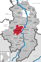
Altusried
- municipality of Germany
Hiking in Altusried
Altusried is a picturesque village located in the Allgäu region of Bavaria, Germany. It offers a range of hiking opportunities, making it a great destination for outdoor enthusiasts. Here are some key aspects to consider when hiking in Altusried:...
- Country:
- Postal Code: 87452
- Local Dialing Code: 08373
- Licence Plate Code: OA
- Coordinates: 47° 48' 0" N, 10° 13' 0" E
- GPS tracks (wikiloc): [Link]
- AboveSeaLevel: 723 м m
- Area: 91.68 sq km
- Population: 7552
- Web site: [Link]

Immenstadt
- municipality of Germany
Hiking in Immenstadt
Immenstadt, located in the Allgäu region of Bavaria, Germany, offers a fantastic range of hiking opportunities set against a backdrop of stunning natural beauty. The area is known for its picturesque landscapes, including rolling hills, lush forests, alpine meadows, and impressive mountain views....
- Country:
- Postal Code: 87509
- Local Dialing Code: 08379; 08325; 08320; 08323
- Licence Plate Code: OA
- Coordinates: 47° 34' 0" N, 10° 13' 0" E
- GPS tracks (wikiloc): [Link]
- AboveSeaLevel: 821 м m
- Area: 81 sq km
- Population: 14191
- Web site: [Link]


Blaichach
- municipality of Germany
Hiking in Blaichach
Blaichach, located in Bavaria, Germany, offers a variety of beautiful hiking opportunities for outdoor enthusiasts. Nestled in the Allgäu region, the area is known for its stunning landscapes, including lush meadows, rolling hills, and mountain views. Here are some key highlights about hiking in Blaichach:...
- Country:
- Postal Code: 87544
- Local Dialing Code: 08323; 08321
- Licence Plate Code: OA
- Coordinates: 47° 32' 0" N, 10° 16' 0" E
- GPS tracks (wikiloc): [Link]
- AboveSeaLevel: 729 м m
- Area: 50.11 sq km
- Population: 5751
- Web site: [Link]


Wildpoldsried
- municipality of Germany
Hiking in Wildpoldsried
Wildpoldsried is a picturesque village located in Bavaria, Germany, known for its stunning landscapes and commitment to sustainability. Hiking in this region offers a perfect blend of natural beauty, serene countryside, and the chance to explore local culture....
- Country:
- Postal Code: 87499
- Local Dialing Code: 08304
- Licence Plate Code: OA
- Coordinates: 47° 46' 0" N, 10° 24' 0" E
- GPS tracks (wikiloc): [Link]
- AboveSeaLevel: 724 м m
- Area: 21.35 sq km
- Population: 1917
- Web site: [Link]


Bad Hindelang
- municipality of Germany
Hiking in Bad Hindelang
Bad Hindelang is a charming village situated in the Bavarian Alps of Germany and is known for its stunning landscapes and outdoor activities, making it a fantastic destination for hiking enthusiasts. Here’s what you can expect when hiking in Bad Hindelang:...
- Country:
- Postal Code: 87541
- Local Dialing Code: 08324
- Licence Plate Code: OA
- Coordinates: 47° 30' 19" N, 10° 22' 10" E
- GPS tracks (wikiloc): [Link]
- AboveSeaLevel: 825 м m
- Area: 137.02 sq km
- Population: 4648
- Web site: [Link]

Balderschwang
- municipality of Germany
Hiking in Balderschwang
Balderschwang is a beautiful hiking destination located in the Bavarian Alps of Germany, known for its picturesque landscapes and diverse trails. The region is particularly popular for both summer hiking and winter sports, but during the warmer months, it becomes a hiker's paradise....
- Country:
- Postal Code: 87538
- Local Dialing Code: 08328
- Licence Plate Code: OA
- Coordinates: 47° 28' 0" N, 10° 6' 0" E
- GPS tracks (wikiloc): [Link]
- AboveSeaLevel: 1044 м m
- Area: 41.56 sq km
- Population: 327
- Web site: [Link]


Oy-Mittelberg
- municipality of Germany
Hiking in Oy-Mittelberg
Oy-Mittelberg, located in Bavaria, Germany, is a picturesque destination ideal for hiking enthusiasts. Nestled in the Allgäu region, it offers stunning views of the surrounding mountains, lush green valleys, and a variety of trails suitable for all levels of hikers....
- Country:
- Postal Code: 87466
- Local Dialing Code: 08366
- Licence Plate Code: OA
- Coordinates: 47° 38' 0" N, 10° 26' 0" E
- GPS tracks (wikiloc): [Link]
- AboveSeaLevel: 929 м m
- Area: 60.24 sq km
- Population: 3516
- Web site: [Link]


Obermaiselstein
- municipality of Germany
Hiking in Obermaiselstein
Obermaiselstein is a charming village located in the Allgäu region of Bavaria, Germany, known for its stunning natural landscapes and excellent hiking opportunities. Here are some highlights about hiking in this area:...
- Country:
- Postal Code: 87538
- Local Dialing Code: 08326
- Licence Plate Code: OA
- Coordinates: 47° 26' 44" N, 10° 14' 28" E
- GPS tracks (wikiloc): [Link]
- AboveSeaLevel: 859 м m
- Area: 25.02 sq km
- Population: 823
- Web site: [Link]


Dietmannsried
- municipality of Germany
Hiking in Dietmannsried
Dietmannsried is a charming town located in Bavaria, Germany, known for its beautiful landscapes and outdoor activities, including hiking. Here are some highlights and tips for hiking in and around Dietmannsried:...
- Country:
- Postal Code: 87463
- Local Dialing Code: 08374
- Licence Plate Code: OA
- Coordinates: 47° 47' 0" N, 10° 16' 0" E
- GPS tracks (wikiloc): [Link]
- AboveSeaLevel: 682 м m
- Area: 53.67 sq km
- Population: 6067
- Web site: [Link]


Burgberg im Allgäu
- municipality of Germany
Hiking in Burgberg im Allgäu
Burgberg im Allgäu is a picturesque village located in the mesmerizing Allgäu region of Bavaria, Germany. It’s a fantastic destination for hikers, offering a range of trails suitable for all skill levels, from leisurely walks to challenging mountain hikes. Here are some highlights of hiking in this area:...
- Country:
- Postal Code: 87545
- Local Dialing Code: 08321
- Licence Plate Code: OA
- Coordinates: 47° 32' 0" N, 10° 17' 0" E
- GPS tracks (wikiloc): [Link]
- AboveSeaLevel: 744 м m
- Area: 15.99 sq km
- Population: 2608
- Web site: [Link]


Rettenberg
- municipality of Germany
Hiking in Rettenberg
Rettenberg, located in the Allgäu region of Bavaria, Germany, is a fantastic destination for hiking enthusiasts. The area is known for its beautiful landscapes, including rolling hills, lush forests, and stunning views of the Alps....
- Country:
- Postal Code: 87549
- Local Dialing Code: 08327
- Licence Plate Code: OA
- Coordinates: 47° 35' 0" N, 10° 18' 0" E
- GPS tracks (wikiloc): [Link]
- AboveSeaLevel: 807 м m
- Area: 60.08 sq km
- Population: 4391
- Web site: [Link]


Buchenberg
- municipality of Germany
Hiking in Buchenberg
Buchenberg, located in the scenic Allgäu region of Germany, offers a variety of hiking opportunities suitable for different skill levels. Here are some highlights of hiking in Buchenberg:...
- Country:
- Postal Code: 87474
- Local Dialing Code: 08378; 08370; 07569
- Licence Plate Code: OA
- Coordinates: 47° 42' 0" N, 10° 13' 0" E
- GPS tracks (wikiloc): [Link]
- AboveSeaLevel: 893 м m
- Area: 58.11 sq km
- Population: 4110
- Web site: [Link]


Missen-Wilhams
- municipality of Germany
Hiking in Missen-Wilhams
Missen-Wilhams is a picturesque village located in the Allgäu region of Bavaria, Germany. It is surrounded by stunning landscapes that make it a great destination for hiking enthusiasts of all levels. Here are some highlights and tips for hiking in this area:...
- Country:
- Postal Code: 87547
- Local Dialing Code: 08320
- Licence Plate Code: OA
- Coordinates: 47° 36' 0" N, 10° 7' 0" E
- GPS tracks (wikiloc): [Link]
- AboveSeaLevel: 860 м m
- Area: 34.96 sq km
- Population: 1447
- Web site: [Link]

Fischen
- municipality of Germany
Hiking in Fischen
Fischen, located in the Allgäu region of Bavaria, Germany, is a lovely destination for hiking enthusiasts. This quaint village offers stunning natural scenery, including the beautiful backdrop of the Alps, lush meadows, and clear streams. Here are some highlights about hiking in and around Fischen:...
- Country:
- Postal Code: 87538
- Local Dialing Code: 08326
- Licence Plate Code: OA
- Coordinates: 47° 27' 0" N, 10° 16' 0" E
- GPS tracks (wikiloc): [Link]
- AboveSeaLevel: 766 м m
- Area: 13.60 sq km
- Population: 3131
- Web site: [Link]

Waltenhofen
- municipality of Germany
Hiking in Waltenhofen
Waltenhofen, located in the Allgäu region of Bavaria, Germany, offers beautiful hiking opportunities that attract outdoor enthusiasts from near and far. The area is rich in natural beauty, with stunning landscapes, lush forests, and panoramic views of the surrounding mountains....
- Country:
- Postal Code: 87448
- Local Dialing Code: 08303
- Licence Plate Code: OA
- Coordinates: 47° 39' 52" N, 10° 18' 25" E
- GPS tracks (wikiloc): [Link]
- AboveSeaLevel: 722 м m
- Area: 59.82 sq km
- Population: 9117
- Web site: [Link]


Wiggensbach
- municipality of Germany
Hiking in Wiggensbach
Wiggensbach is a charming municipality located in Bavaria, Germany, nestled near the Allgäu region. This area is known for its beautiful landscapes, rolling hills, and lush forests, making it an excellent destination for hiking enthusiasts. Here are some highlights of hiking in the Wiggensbach area:...
- Country:
- Postal Code: 87487
- Local Dialing Code: 08370
- Licence Plate Code: OA
- Coordinates: 47° 44' 45" N, 10° 13' 55" E
- GPS tracks (wikiloc): [Link]
- AboveSeaLevel: 857 м m
- Area: 31.83 sq km
- Population: 3468
- Web site: [Link]

Betzigau
- municipality of Germany
Hiking in Betzigau
Betzigau is a charming village located in the Allgäu region of Bavaria, Germany. It's surrounded by stunning landscapes, including rolling hills, lush forests, and scenic meadows, making it an excellent base for hiking enthusiasts....
- Country:
- Postal Code: 87488
- Local Dialing Code: 0831
- Licence Plate Code: OA
- Coordinates: 47° 44' 0" N, 10° 23' 0" E
- GPS tracks (wikiloc): [Link]
- AboveSeaLevel: 737 м m
- Area: 29.27 sq km
- Population: 2280
- Web site: [Link]


Wertach
- municipality of Germany
Hiking in Wertach
Wertach is a picturesque village located in the Allgäu region of Bavaria, Germany, surrounded by stunning alpine scenery. Hiking in and around Wertach offers a range of trails suitable for various skill levels, making it a fantastic destination for both beginners and experienced hikers....
- Country:
- Postal Code: 87497
- Local Dialing Code: 08365
- Licence Plate Code: OA
- Coordinates: 47° 36' 0" N, 10° 24' 0" E
- GPS tracks (wikiloc): [Link]
- AboveSeaLevel: 915 м m
- Area: 45.63 sq km
- Population: 2409
- Web site: [Link]


Weitnau
- municipality of Germany
Hiking in Weitnau
Weitnau, located in the Allgäu region of Bavaria, Germany, offers a beautiful setting for hiking enthusiasts. Surrounded by the picturesque Allgäu Alps, it's a great destination for both beginners and experienced hikers. Here are some highlights and tips for hiking in Weitnau:...
- Country:
- Postal Code: 87480
- Local Dialing Code: 08375
- Licence Plate Code: OA
- Coordinates: 47° 39' 0" N, 10° 8' 0" E
- GPS tracks (wikiloc): [Link]
- AboveSeaLevel: 797 м m
- Area: 65.19 sq km
- Population: 3873
- Web site: [Link]


Sulzberg
- municipality of Germany
Hiking in Sulzberg
Sulzberg, located in Oberallgäu, Bavaria, is a beautiful destination for hiking enthusiasts. Nestled within the picturesque Allgäu region, it offers a mix of serene landscapes, rolling hills, and stunning views of the Alps....
- Country:
- Postal Code: 87477
- Local Dialing Code: 08376
- Licence Plate Code: OA
- Coordinates: 47° 40' 0" N, 10° 20' 59" E
- GPS tracks (wikiloc): [Link]
- AboveSeaLevel: 711 м m
- Area: 41.00 sq km
- Population: 4834
- Web site: [Link]

Haldenwang
- municipality of Germany in the district of Oberallgäu
Hiking in Haldenwang
Haldenwang is a charming village located in the Oberallgäu district of Bavaria, Germany. This area is known for its stunning natural landscapes, making it a great destination for hiking enthusiasts. Here are some highlights to consider for hiking in and around Haldenwang:...
- Country:
- Postal Code: 87490
- Local Dialing Code: 08374
- Licence Plate Code: OA
- Coordinates: 47° 48' 0" N, 10° 21' 0" E
- GPS tracks (wikiloc): [Link]
- AboveSeaLevel: 766 м m
- Area: 26.69 sq km
- Population: 2726
- Web site: [Link]


Durach
- municipality of Germany
Hiking in Durach
Durach, located in the Allgäu region of Bavaria, Germany, is surrounded by beautiful landscapes and offers a variety of hiking opportunities. With its picturesque hills, dense forests, and stunning views of the Alps, it is an excellent destination for outdoor enthusiasts. Here are some key points about hiking in Durach:...
- Country:
- Postal Code: 87471
- Local Dialing Code: 0831
- Licence Plate Code: OA
- Coordinates: 47° 42' 0" N, 10° 20' 0" E
- GPS tracks (wikiloc): [Link]
- AboveSeaLevel: 714 м m
- Area: 20.74 sq km
- Population: 5316
- Web site: [Link]

Ofterschwang
- municipality of Germany
Hiking in Ofterschwang
Ofterschwang is a picturesque village located in the Bavarian Alps of Germany, near Oberstdorf and the famous skiing area of the Allgäu region. The area is well known for its stunning natural landscapes, making it a popular destination for hikers during the warmer months....
- Country:
- Postal Code: 87527
- Local Dialing Code: 08321
- Licence Plate Code: OA
- Coordinates: 47° 29' 45" N, 10° 14' 12" E
- GPS tracks (wikiloc): [Link]
- AboveSeaLevel: 864 м m
- Area: 19.54 sq km
- Population: 2042
- Web site: [Link]
Shares border with regions:
Lindau
- rural district in Bavaria, Germany
Hiking in Lindau
Lindau, located in southern Germany on the shores of Lake Constance (Bodensee), offers a beautiful setting for hiking enthusiasts. The district encompasses a variety of natural landscapes, including picturesque lake views, rolling hills, lush forests, and charming villages. Here are some highlights for hiking in Lindau:...
- Country:
- Capital: Lindau
- Licence Plate Code: LI
- Coordinates: 47° 36' 0" N, 9° 51' 36" E
- GPS tracks (wikiloc): [Link]
- AboveSeaLevel: 496 м m
- Area: 323.00 sq km
- Population: 69522
- Web site: [Link]

Ostallgäu
- district in Bavaria, Germany
Hiking in Ostallgäu
Ostallgäu is a picturesque region in Bavaria, Germany, known for its stunning landscapes dominated by the Alps, rolling hills, and charming villages. It's an excellent destination for hiking, offering a variety of trails suitable for different skill levels, from beginner to advanced. Here are some key highlights of hiking in Ostallgäu:...
- Country:
- Capital: Marktoberdorf
- Licence Plate Code: OAL; MOD; FÜS
- Coordinates: 47° 45' 0" N, 10° 34' 48" E
- GPS tracks (wikiloc): [Link]
- AboveSeaLevel: 724 м m
- Area: 1395.00 sq km
- Population: 114547
- Web site: [Link]

Unterallgäu
- district in Bavaria, Germany
Hiking in Unterallgäu
Unterallgäu is a beautiful region in Bavaria, Germany, known for its picturesque landscapes, charming villages, and extensive hiking trails. Located in the Allgäu, it's characterized by rolling hills, lush meadows, and stunning views of the Alpine foothills. Here are some highlights if you're considering hiking in Unterallgäu:...
- Country:
- Capital: Mindelheim
- Licence Plate Code: MN
- Coordinates: 48° 0' 0" N, 10° 30' 0" E
- GPS tracks (wikiloc): [Link]
- Area: 1230.24 sq km
- Population: 115770
- Web site: [Link]

Kempten
- town in Bavaria, Germany
Hiking in Kempten
Kempten, located in the Allgäu region of Bavaria, Germany, offers a variety of hiking options that cater to different skill levels and preferences. The picturesque surroundings, featuring the beautiful Allgäu Alps, lush meadows, and pristine rivers, make it an appealing destination for outdoor enthusiasts....
- Country:
- Postal Code: 87437; 87439; 87435
- Local Dialing Code: 0831
- Licence Plate Code: KE
- Coordinates: 47° 44' 0" N, 10° 19' 0" E
- GPS tracks (wikiloc): [Link]
- AboveSeaLevel: 674 м m
- Area: 63.29 sq km
- Population: 65624
- Web site: [Link]

Bregenz District
- district in Austria
Hiking in Bregenz District
Bregenz District, located in the western part of Austria in the state of Vorarlberg, offers a variety of stunning hiking opportunities, thanks to its diverse landscapes that include lakes, mountains, and picturesque villages. Here are some highlights and tips for hiking in this beautiful region:...
- Country:

- Capital: Bregenz
- Licence Plate Code: B
- Coordinates: 47° 24' 0" N, 10° 0' 0" E
- GPS tracks (wikiloc): [Link]
- AboveSeaLevel: 771 м m
- Area: 863.34 sq km
- Population: 131350
- Web site: [Link]


Landkreis Ravensburg
- district of Baden-Württemberg, Germany
Hiking in Landkreis Ravensburg
Ravensburg district, located in the state of Baden-Württemberg in Germany, offers a diverse range of hiking opportunities for both casual walkers and experienced hikers. The region is characterized by its beautiful landscapes, rolling hills, and picturesque villages. Here are some highlights and tips for hiking in Ravensburg:...
- Country:
- Capital: Ravensburg
- Licence Plate Code: RV
- Coordinates: 47° 49' 12" N, 9° 48' 0" E
- GPS tracks (wikiloc): [Link]
- AboveSeaLevel: 698 м m
- Area: 1631.81 sq km
- Population: 272425
- Web site: [Link]
Reutte District
- district of Austria
Hiking in Reutte District
The Reutte District, located in the Tyrol region of Austria, is known for its stunning natural landscapes, charming villages, and a variety of hiking trails suitable for all levels of hikers. Here are some key aspects of hiking in this area:...
- Country:
- Capital: Reutte
- Licence Plate Code: RE
- Coordinates: 47° 24' 0" N, 10° 30' 0" E
- GPS tracks (wikiloc): [Link]
- AboveSeaLevel: 1222 м m
- Area: 1236.82 sq km
- Population: 32023
- Web site: [Link]