
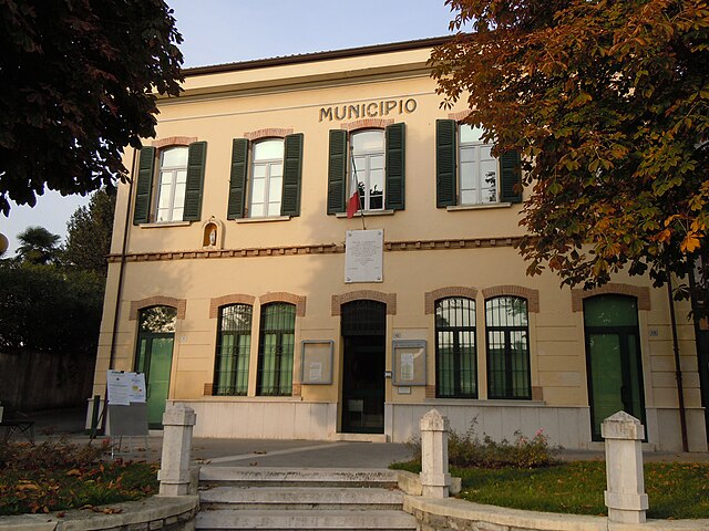
Padenghe sul Garda (Padenghe sul Garda)
.svg)
- Italian comune
 Hiking in Padenghe sul Garda
Padenghe sul Garda, located on the southwestern shore of Lake Garda in Italy, offers a beautiful backdrop for hiking enthusiasts. The area is characterized by its stunning lake views, rolling hills, olive groves, and vineyards. Here’s what you can expect when hiking in and around Padenghe sul Garda:
Trails and Routes
-
Civic Trail (Sentiero Civico):
- This scenic trail runs along the lakeshore and is suitable for hikers of all levels. You'll enjoy extensive views of Lake Garda and the surrounding landscape.
- The trail connects various towns along the lake, allowing for flexible hiking options.
-
Monte Croce:
- A popular hiking destination near Padenghe. The trek up offers breathtaking views of the lake and the hills beyond.
- The route can be challenging, so ensure you’re adequately prepared with good hiking gear and perhaps some experience.
-
Custer Park (Parco Custer):
- This area features several woodland trails and the chance to explore nature more intimately. It’s a great environment for families and beginners.
-
Wine and Olive Oil Trails:
- Many local vineyards and olive oil producers offer trails that provide both hiking and tasting experiences. You can hike through the vineyards and then enjoy local produce at the end of the trail.
Best Time to Hike
- Spring (March to May): Ideal for mild temperatures and blooming landscapes.
- Autumn (September to November): Great for enjoying the vibrant colors of changing leaves and the harvest season.
Tips for Hiking in Padenghe sul Garda
- Footwear: Wear sturdy hiking shoes, as some trails can be rocky or uneven.
- Water and Snacks: Carry plenty of water and snacks to keep your energy up, especially on longer hikes.
- Weather: Check the weather forecast before heading out, as conditions can change quickly in mountainous areas.
- Maps and Guides: Consider getting a map or a guidebook for detailed trails, as some routes may not be well-marked.
Local Attractions
After a day of hiking, you can explore Padenghe sul Garda's historical sites, such as the medieval castle or the charming old town. Enjoy local cuisine in one of the many restaurants, or relax by the lake.
Conclusion
Hiking in Padenghe sul Garda is a wonderful way to experience the natural beauty of the region while also enjoying the cultural and culinary delights it offers. Whether you're a seasoned hiker or a casual walker, there are trails to suit every level of experience.
- Country:

- Postal Code: 25080
- Local Dialing Code: 030
- Licence Plate Code: BS
- Coordinates: 45° 30' 30" N, 10° 30' 59" E


- GPS tracks (wikiloc): [Link]
- AboveSeaLevel: 127 м m
- Area: 26.81 sq km
- Population: 4629
- Web site: http://www.comune.padenghesulgarda.bs.it/
- Wikipedia en: wiki(en)
- Wikipedia: wiki(it)
- Wikidata storage: Wikidata: Q111339
- Wikipedia Commons Category: [Link]
- Freebase ID: [/m/0453l2]
- GeoNames ID: Alt: [6541498]
- VIAF ID: Alt: [242752275]
- OSM relation ID: [45168]
- UN/LOCODE: [ITPHU]
- ISTAT ID: 017129
- Italian cadastre code: G213
Shares border with regions:
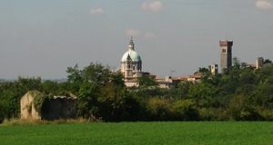
Calvagese della Riviera
- Italian comune
Hiking in Calvagese della Riviera
Calvagese della Riviera, located in the province of Brescia in Northern Italy, offers various hiking opportunities that allow you to explore its picturesque landscapes and natural beauty. Here are some key points to consider when hiking in this area:...
- Country:
- Postal Code: 25080
- Local Dialing Code: 030
- Licence Plate Code: BS
- Coordinates: 45° 32' 3" N, 10° 26' 33" E
- GPS tracks (wikiloc): [Link]
- AboveSeaLevel: 225 м m
- Area: 11.74 sq km
- Population: 3566
- Web site: [Link]

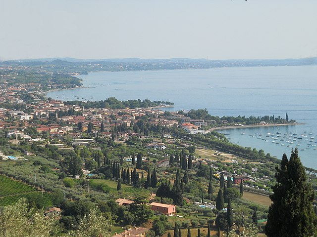
Desenzano del Garda
- Italian comune
Hiking in Desenzano del Garda
Desenzano del Garda, located on the southern shore of Lake Garda in Italy, offers a beautiful landscape for hiking enthusiasts. The area is characterized by a mix of rolling hills, vineyards, olive groves, and stunning lake views, making it a fantastic destination for outdoor activities....
- Country:
- Postal Code: 25015
- Local Dialing Code: 030
- Licence Plate Code: BS
- Coordinates: 45° 28' 8" N, 10° 32' 6" E
- GPS tracks (wikiloc): [Link]
- AboveSeaLevel: 96 м m
- Area: 59.26 sq km
- Population: 28982
- Web site: [Link]
Lonato del Garda
- Italian comune
Hiking in Lonato del Garda
Lonato del Garda, located in the Lombardy region of northern Italy, is a beautiful area that offers various hiking opportunities, particularly due to its proximity to Lake Garda and the surrounding hills. Here are some key points to consider if you're planning a hiking trip in this region:...
- Country:
- Postal Code: 25017
- Local Dialing Code: 030
- Licence Plate Code: BS
- Coordinates: 45° 27' 39" N, 10° 28' 38" E
- GPS tracks (wikiloc): [Link]
- AboveSeaLevel: 170 м m
- Area: 68.2 sq km
- Population: 16506
- Web site: [Link]

Moniga del Garda
- Italian comune
Hiking in Moniga del Garda
Moniga del Garda is a charming town located on the western shore of Lake Garda in Italy. It offers beautiful scenery, lovely views of the lake, and a pleasant Mediterranean climate, making it a great destination for hiking enthusiasts. Here are some details about hiking in the area:...
- Country:
- Postal Code: 25080
- Local Dialing Code: 0365
- Licence Plate Code: BS
- Coordinates: 45° 31' 37" N, 10° 32' 20" E
- GPS tracks (wikiloc): [Link]
- AboveSeaLevel: 125 м m
- Area: 14.65 sq km
- Population: 2575
- Web site: [Link]

Sirmione
- Italian comune
Hiking in Sirmione
Sirmione, a charming town located on the southern shore of Lake Garda in Italy, is known for its stunning scenery, historical sites, and relaxed atmosphere. While Sirmione itself is not primarily known for extensive hiking trails, there are several beautiful walks and nearby hiking opportunities that you can explore....
- Country:
- Postal Code: 25019
- Local Dialing Code: 030
- Licence Plate Code: BS
- Coordinates: 45° 28' 10" N, 10° 36' 22" E
- GPS tracks (wikiloc): [Link]
- AboveSeaLevel: 68 м m
- Area: 26.25 sq km
- Population: 8243
- Web site: [Link]

Soiano del Lago
- Italian comune
Hiking in Soiano del Lago
Soiano del Lago, located in the Lombardy region of Italy, near Lake Garda, offers a variety of hiking opportunities that showcase the area's stunning natural beauty and cultural heritage. The region is characterized by its rolling hills, olive groves, and panoramic views of the lake, making it a picturesque destination for hikers of all levels....
- Country:
- Postal Code: 25080
- Local Dialing Code: 0365
- Licence Plate Code: BS
- Coordinates: 45° 31' 40" N, 10° 30' 46" E
- GPS tracks (wikiloc): [Link]
- AboveSeaLevel: 196 м m
- Area: 5.77 sq km
- Population: 1919
- Web site: [Link]

Bardolino
- Italian comune
Hiking in Bardolino
Bardolino is a picturesque town located on the eastern shore of Lake Garda in Italy. The area is known for its beautiful landscapes, scenic views, and vineyard-covered hills, making it a great destination for hikers. Here are some highlights to consider when hiking in Bardolino:...
- Country:
- Postal Code: 37011
- Local Dialing Code: 045
- Licence Plate Code: VR
- Coordinates: 45° 33' 6" N, 10° 43' 17" E
- GPS tracks (wikiloc): [Link]
- AboveSeaLevel: 65 м m
- Area: 57.33 sq km
- Population: 7147
- Web site: [Link]


Lazise
- Italian comune
Hiking in Lazise
Lazise is a charming town located on the eastern shore of Lake Garda in Italy. Known for its beautiful landscapes, historical sites, and Mediterranean climate, it offers a variety of hiking opportunities for outdoor enthusiasts....
- Country:
- Postal Code: 37017
- Local Dialing Code: 045
- Licence Plate Code: VR
- Coordinates: 45° 30' 19" N, 10° 43' 57" E
- GPS tracks (wikiloc): [Link]
- AboveSeaLevel: 76 м m
- Area: 63.15 sq km
- Population: 6958
- Web site: [Link]