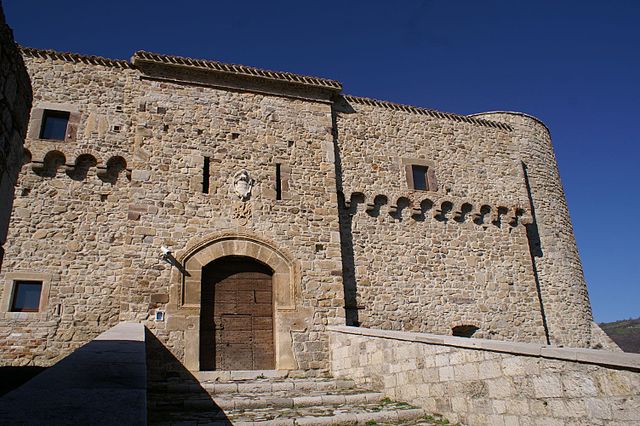
Lucito (Lucito)
.svg)
- Italian comune
 Hiking in Lucito
Lucito is a small town located in the Molise region of Italy. While it may not be as well-known for hiking as other Italian destinations, the surrounding landscapes offer beautiful opportunities for outdoor activities, including hiking.
Hiking Opportunities in and around Lucito:
-
Scenic Trails: The area around Lucito has several scenic trails that provide a mix of nature and culture. You can find paths that take you through vineyards, olive groves, and rolling hills with stunning views of the Molise countryside.
-
Monte Patalecchia: This nearby mountain is accessible from Lucito and offers trails for hikers of varying experience levels. The views from the summit are rewarding, especially during clear days when you can see far into the landscape.
-
Local Nature Reserves: Consider exploring nearby nature reserves or parks. The region is known for its biodiversity, including various flora and fauna, making it a great place for both hiking and birdwatching.
-
Cultural Routes: Some trails may lead you to historical sites, including ancient ruins and local churches. This combination of hiking and cultural exploration can enrich your experience.
Preparation Tips:
- Footwear: Sturdy hiking boots are recommended, as trails can sometimes be uneven or rocky.
- Water and Snacks: Always carry enough water and some snacks, especially during longer hikes.
- Maps and Navigation: Familiarize yourself with trail maps and consider using a GPS device or hiking app for navigation, as some trails may not be well marked.
- Weather Check: The weather can change rapidly, so check forecasts before heading out and be prepared for sudden changes.
Best Time to Hike:
The ideal months for hiking in Lucito are spring (April to June) and fall (September to October), when the temperatures are milder and the scenery is beautiful with blooming flowers or autumn leaves.
In summary, while Lucito may not be on everyone's hiking radar, it offers unique experiences for those who seek a quieter, more rural Italian hiking adventure. Enjoy your outdoor exploration!
- Country:

- Postal Code: 86030
- Local Dialing Code: 0874
- Licence Plate Code: CB
- Coordinates: 41° 44' 0" N, 14° 41' 0" E


- GPS tracks (wikiloc): [Link]
- AboveSeaLevel: 480 м m
- Area: 31.56 sq km
- Population: 666
- Web site: http://www.comune.lucito.cb.it/hh/index.php?jvs=0&acc=1
- Wikipedia en: wiki(en)
- Wikipedia: wiki(it)
- Wikidata storage: Wikidata: Q176292
- Wikipedia Commons Category: [Link]
- Freebase ID: [/m/0gnp40]
- GeoNames ID: Alt: [6538906]
- VIAF ID: Alt: [237519656]
- OSM relation ID: [41505]
- TGN ID: [1045146]
- ISTAT ID: 070033
- Italian cadastre code: E722
Shares border with regions:
Castelbottaccio
- Italian comune
Hiking in Castelbottaccio
Castelbottaccio is a charming village located in the Molise region of Italy. It offers a unique hiking experience for those looking to explore the natural beauty and cultural heritage of the area. Here are some highlights and tips for hiking in and around Castelbottaccio:...
- Country:
- Postal Code: 86030
- Local Dialing Code: 0874
- Licence Plate Code: CB
- Coordinates: 41° 45' 0" N, 14° 42' 0" E
- GPS tracks (wikiloc): [Link]
- AboveSeaLevel: 618 м m
- Area: 11.22 sq km
- Population: 274
- Web site: [Link]


Castellino del Biferno
- Italian comune
Hiking in Castellino del Biferno
Castellino del Biferno is a quaint little town located in the Molise region of Italy. While it's not as well-known as some of Italy's more famous hiking destinations, it offers some beautiful landscapes and opportunities for outdoor enthusiasts. Here are a few aspects to consider if you're planning to hike in or around Castellino del Biferno:...
- Country:
- Postal Code: 86020
- Local Dialing Code: 0874
- Licence Plate Code: CB
- Coordinates: 41° 42' 0" N, 14° 44' 0" E
- GPS tracks (wikiloc): [Link]
- AboveSeaLevel: 450 м m
- Area: 15.54 sq km
- Population: 556
- Web site: [Link]

Civitacampomarano
- Italian comune
Hiking in Civitacampomarano
Civitacampomarano is a charming village located in the Molise region of Italy, known for its stunning landscapes, rich history, and traditional architecture. Hiking in and around Civitacampomarano provides a unique opportunity to explore the natural beauty and cultural heritage of this lesser-known area of Italy....
- Country:
- Postal Code: 86030
- Local Dialing Code: 0874
- Licence Plate Code: CB
- Coordinates: 41° 47' 0" N, 14° 41' 0" E
- GPS tracks (wikiloc): [Link]
- AboveSeaLevel: 520 м m
- Area: 38.89 sq km
- Population: 385
- Web site: [Link]


Limosano
- Italian comune
Hiking in Limosano
Limosano is a picturesque village in the Molise region of Italy, known for its beautiful landscapes and rich history. Hiking in and around Limosano offers a unique opportunity to explore the natural beauty of central Italy, combined with cultural experiences....
- Country:
- Postal Code: 86022
- Local Dialing Code: 0874
- Licence Plate Code: CB
- Coordinates: 41° 41' 0" N, 14° 37' 0" E
- GPS tracks (wikiloc): [Link]
- AboveSeaLevel: 687 м m
- Area: 28.27 sq km
- Population: 744
- Web site: [Link]
Morrone del Sannio
- Italian comune
Hiking in Morrone del Sannio
Morrone del Sannio is a picturesque area located in the Molise region of Italy, known for its stunning landscapes and rich natural beauty. It offers a variety of hiking opportunities that cater to different skill levels, from leisurely walks to challenging trails. Here are some highlights of hiking in Morrone del Sannio:...
- Country:
- Postal Code: 86040
- Local Dialing Code: 0874
- Licence Plate Code: CB
- Coordinates: 41° 42' 41" N, 14° 46' 46" E
- GPS tracks (wikiloc): [Link]
- AboveSeaLevel: 827 м m
- Area: 45.84 sq km
- Population: 576
- Web site: [Link]


Petrella Tifernina
- Italian comune
Hiking in Petrella Tifernina
Petrella Tifernina is a charming village located in the Molise region of Italy, which is known for its beautiful natural landscapes, rustic charm, and historical sites. Hiking in and around Petrella Tifernina offers a unique opportunity to explore picturesque trails that showcase the region's stunning scenery, rolling hills, and traditional rural architecture....
- Country:
- Postal Code: 86024
- Local Dialing Code: 0874
- Licence Plate Code: CB
- Coordinates: 41° 41' 0" N, 14° 42' 0" E
- GPS tracks (wikiloc): [Link]
- AboveSeaLevel: 651 м m
- Area: 26.52 sq km
- Population: 1131
- Web site: [Link]


Sant'Angelo Limosano
- Italian comune
Hiking in Sant'Angelo Limosano
Sant'Angelo Limosano, a picturesque village in the Molise region of Italy, offers a unique hiking experience characterized by its scenic landscapes, historical sites, and charming rural atmosphere. Here are some highlights of hiking in and around Sant'Angelo Limosano:...
- Country:
- Postal Code: 86020
- Local Dialing Code: 0874
- Licence Plate Code: CB
- Coordinates: 41° 42' 0" N, 14° 36' 0" E
- GPS tracks (wikiloc): [Link]
- AboveSeaLevel: 900 м m
- Area: 16.87 sq km
- Population: 347
- Web site: [Link]


Trivento
- Italian comune
Hiking in Trivento
Trivento is a charming town located in the Molise region of Italy, known for its beautiful landscapes and rich history. Hiking in and around Trivento can offer a unique experience, featuring a mix of natural beauty, cultural heritage, and a chance to explore the surrounding countryside....
- Country:
- Postal Code: 86029
- Local Dialing Code: 0874
- Licence Plate Code: CB
- Coordinates: 41° 46' 0" N, 14° 33' 0" E
- GPS tracks (wikiloc): [Link]
- AboveSeaLevel: 599 м m
- Area: 73 sq km
- Population: 4663
- Web site: [Link]