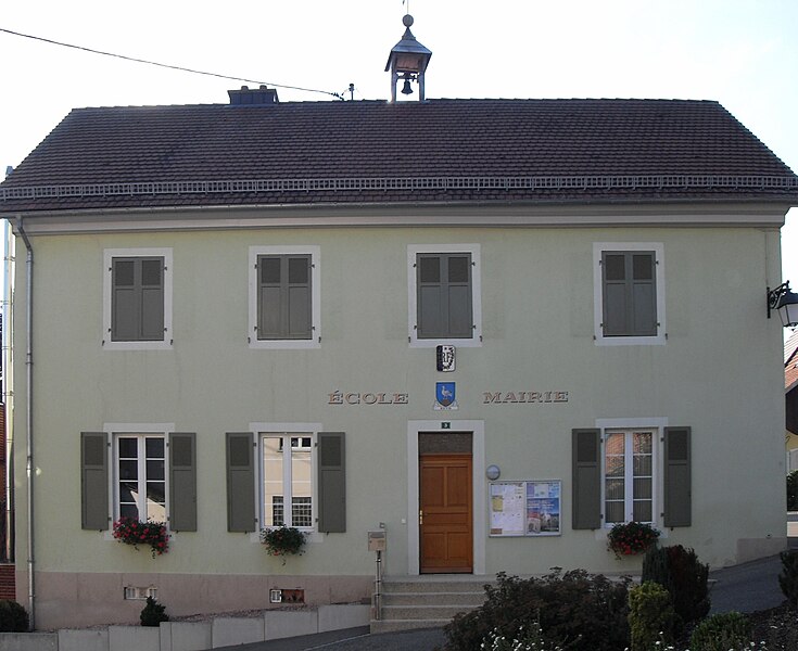
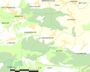
Lutter (Lutter)
- commune in Haut-Rhin, France
Lutter, located in the Haut-Rhin department in the Alsace region of France, offers a variety of hiking opportunities for outdoor enthusiasts. The region is characterized by its picturesque landscapes, rolling hills, vineyards, and charming villages, making it an attractive destination for both casual walkers and seasoned hikers.
Hiking Opportunities in Lutter:
-
Scenic Trails: There are several marked hiking trails in and around Lutter that showcase the natural beauty of the Alsace region. Look for paths that take you through forests, vineyards, and past historic sites.
-
Wine Routes: As part of the Alsace Wine Route, hiking in this region often allows you to experience the beautiful vineyards and sometimes includes stops at local wineries. This can be a delightful addition to your hike.
-
Accessibility: Many trails in the area are well-maintained and suitable for varying skill levels. Whether you're looking for a short stroll or a more challenging hike, there are paths available for all.
-
Cultural Highlights: The region is rich in history, with opportunities to explore old houses, churches, and historical monuments along your hiking route.
-
Nearby Natural Parks: The Parc Naturel Régional des Ballons des Vosges is nearby. This park offers extensive hiking options, including higher elevation trails with stunning views and more rugged terrain.
Practical Tips:
-
Maps and Markers: Make sure to carry a detailed map or use a GPS-enabled hiking app. Trail markers are usually well indicated, but it's good to have a backup just in case.
-
Local Weather: The weather can change quickly, especially in mountainous areas, so check the forecast before your hike and be prepared for variations in temperature and possible rain.
-
Packing Essentials: Bring water, snacks, proper footwear, and a first-aid kit. Depending on the length and difficulty of your hike, consider bringing additional layers for warmth.
-
Respect Nature: Practice Leave No Trace principles to keep the environment pristine. Stay on marked trails and avoid disturbing wildlife.
Overall, hiking in Lutter provides a fantastic opportunity to enjoy the natural beauty and cultural richness of the Alsace region. Whether you are looking for a leisurely day out or an adventurous challenge, you’re likely to find a trail that suits your needs!
- Country:

- Postal Code: 68480
- Coordinates: 47° 27' 58" N, 7° 22' 52" E


- GPS tracks (wikiloc): [Link]
- Area: 8.46 sq km
- Population: 277
- Wikipedia en: wiki(en)
- Wikipedia: wiki(fr)
- Wikidata storage: Wikidata: Q124120
- Wikipedia Commons Category: [Link]
- Freebase ID: [/m/03nstc8]
- Freebase ID: [/m/03nstc8]
- Freebase ID: [/m/03nstc8]
- GeoNames ID: Alt: [6441518]
- GeoNames ID: Alt: [6441518]
- GeoNames ID: Alt: [6441518]
- SIREN number: [216801944]
- SIREN number: [216801944]
- SIREN number: [216801944]
- BnF ID: [15271896z]
- BnF ID: [15271896z]
- BnF ID: [15271896z]
- INSEE municipality code: 68194
- INSEE municipality code: 68194
- INSEE municipality code: 68194
Shares border with regions:


Kiffis
- commune in Haut-Rhin, France
Kiffis doesn't appear to be widely recognized as a prominent hiking destination, so it's possible that you may be referring to a less-known area or a local name. If Kiffis is a specific location you're interested in, it would be helpful to know its geographic context or features....
- Country:

- Postal Code: 68480
- Coordinates: 47° 26' 25" N, 7° 21' 25" E


- GPS tracks (wikiloc): [Link]
- Area: 6.55 sq km
- Population: 248


Oltingue
- commune in Haut-Rhin, France
Oltingue is a small commune located in the Haut-Rhin department of eastern France, near the border with Switzerland. Hiking in this area can be quite rewarding, as it offers beautiful landscapes and the chance to experience the unique flora and fauna of the region....
- Country:

- Postal Code: 68480
- Coordinates: 47° 29' 29" N, 7° 23' 30" E


- GPS tracks (wikiloc): [Link]
- Area: 13.42 sq km
- Population: 721
- Web site: [Link]


Raedersdorf
- commune in Haut-Rhin, France
Raedersdorf is a small village located in the Alsace region of France, not far from the German border. It offers a serene environment perfect for hiking enthusiasts who want to explore the scenic beauty of the area. Here are some details and tips for hiking in and around Raedersdorf:...
- Country:

- Postal Code: 68480
- Coordinates: 47° 28' 30" N, 7° 22' 0" E


- GPS tracks (wikiloc): [Link]
- Area: 7.39 sq km
- Population: 506


Wolschwiller
- commune in Haut-Rhin, France
Wolschwiller is a charming village located in the Alsace region of France, near the border with Switzerland. The area is known for its beautiful natural scenery, making it a delightful destination for hikers. Here are some key points about hiking in and around Wolschwiller:...
- Country:

- Postal Code: 68480
- Coordinates: 47° 27' 41" N, 7° 24' 29" E


- GPS tracks (wikiloc): [Link]
- Area: 10.14 sq km
- Population: 469

